")


Weathering Types

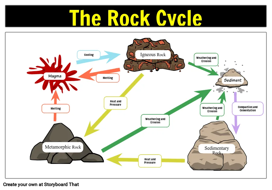
Weathering is the combination of processes that breaking down of rocks, soil and minerals, eventually transforming into sediment. On the other hand, disintegration or alteration of the rock surface in its natural or original position through physical, chemical and biological processes induced or modified by wind, water and climate.

Weathering involves physical, chemical, and biological processes that act separately or more often together to cause fragmentation and decay of rock material. Physical decomposition causes mechanical disintegration of the rock and therefore depends on the application of force. Weathering involves breaking up the rock into the forming minerals or particles without disturbing the forming minerals. The main sources of physical Weathering are the expansion and contraction of heat, the erosion of overlapping materials, the release of pressure on the rock, alternatively the freezing and thawing of water, the dissolution of water between the cracks and cracks in the rock, the growth of plants and organisms in the rock. Organisms in the rock. Rock exchange usually involves chemical deterioration in which the mineral composition in the rock is altered, rearranged or redistributed. Rock minerals are subjected to solution, carbonation, hydration and oxidation with circulating water. These effects on the Weathering of minerals are added to the effects of living organisms and plants as nutrient extraction to rocks.
After the rock breaks, the remaining materials cause soil with organic materials. The mineral content of the soil is determined by the parent material; therefore, a soil derived from a single rock type may often be lacking in one or more minerals required for good fertility, whereas a ventilated soil from a mixture of rock types (such as glacial, aeolian or alluvial deposits) generally makes more fertile soils. In addition, most of the Earth’s landforms and landscapes are the result of decomposition processes associated with erosion and re-accumulation.
Explain the disintegration or dissolution of rocks and minerals on the Earth’s surface. Water, ice, acids, salts, plants, animals and changes in temperature are all weather conditions.
After a rock is shredded, a process called erosion removes rock and mineral fragments. No rock on earth can resist erosion.
Weathering and erosion constantly changes the rocky landscape of the Earth. Wear abrades exposed surfaces over time. Exposure time generally contributes to how vulnerable a rock is to weather conditions. Rocks buried under other rocks, such as lava, are less susceptible to wear and erosion than rocks exposed to wind and water.
It is the first step in soil production in weather conditions as it smooths hard, sharp rock surfaces. Small pieces of worn minerals mix with plants, animal remains, fungi, bacteria and other organisms. A single type of weathered rock generally produces infertile soil, the weathered materials from the rock collection are richer in mineral diversity and contribute to more fertile soil. Soil types associated with the weathered rock mixture include untouched and alluvial deposits until icing.

Physical weathering or Mechanical weathering
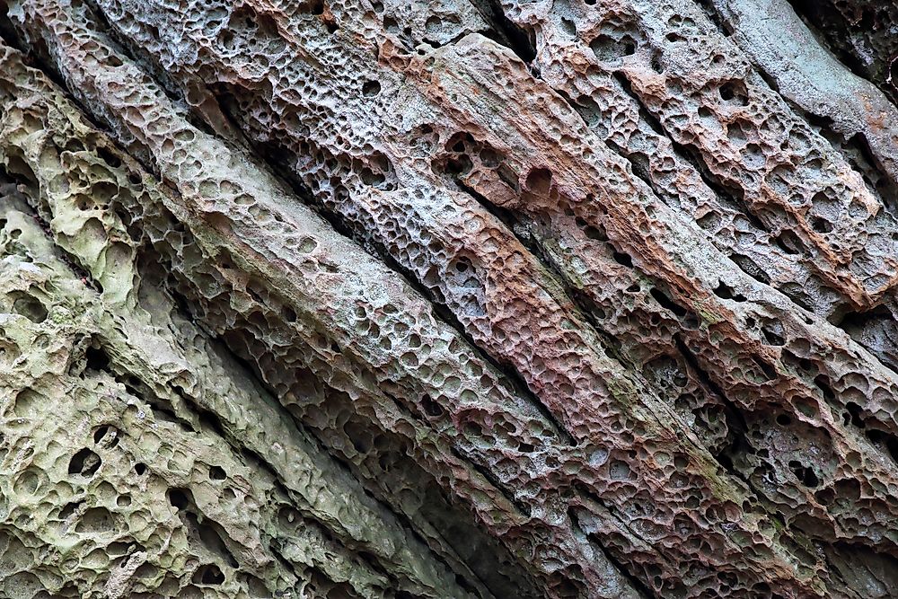
Physical weathering, also called mechanical weathering or disaggregation, is a class of processes that cause rocks to break up without chemical change. The primary process in physical weathering is abrasion (the process by which clips and other particles are reduced in size). Temperature, pressure, freezing and so on. Physical weathering may occur for reasons. For example, cracks resulting from physical weathering will increase the surface area exposed to the chemical effect, thereby increasing the rate of disintegration.
Frost wedging: Freezing water blows pipes and breaks bottles; because water expands when the walls of the container freeze and push. The same phenomenon occurs on the rock. When stuck water in a joint freezes, it forces the joint to open and may cause the joint to grow. These freezing wedges allow the blocks to be freed from solid bedrock.
Salt wedging: In arid climates, dissolved salt in groundwater precipitates and grows as crystals in open pore spaces in rocks. This process, called salt wedging, pushes apart the surrounding grains and weakens the rock so that when exposed to wind and rain, the rock disintegrates into separate grains. The same phenomenon happens along the coast, where salt spray percolates into rock and then dries.
Root wedging: Have you ever noticed how the roots of an old tree can break up a sidewalk? As roots grow, they apply pressure to their surroundings, and can push joints open in a process known as root wedging
Thermal expansion: When the heat of an intense forest fire bakes a rock, the outer layer of the rock expands. On cooling, the layer contracts. This change creates forces in the rock sufficient to make the outer part of the rock break off in sheet-like pieces. Recent research suggests that the intense heat of the Sun’s rays sweeping across dark rocks in a desert may cause the rocks to fracture into thin slices.
Animal attack: Animal life also contributes to physical weathering: burrowing creatures, from earthworms to gophers, push open cracks and move rock fragments. And in the past century, humans have become perhaps the most energetic agent of physical weathering on the planet. When we excavate quarries, foundations, mines, or roadbeds by digging and blasting, we shatter and displace rock that might otherwise have remained intact for millions of years more.
Chemical weathering
Chemical weathering changes the composition of rocks, often transforming them when water interacts with minerals to create various chemical reactions. Chemical weathering is a gradual and ongoing process as the mineralogy of the rock adjusts to the near surface environment. New or secondary minerals develop from the original minerals of the rock. In this the processes of oxidation and hydrolysis are most important. Chemical weathering is enhanced by such geological agents as the presence of water and oxygen, as well as by such biological agents as the acids produced by microbial and plant-root metabolism.
The process of mountain block uplift is important in exposing new rock strata to the atmosphere and moisture, enabling important chemical weathering to occur; significant release occurs of Ca2+ and other ions into surface waters.
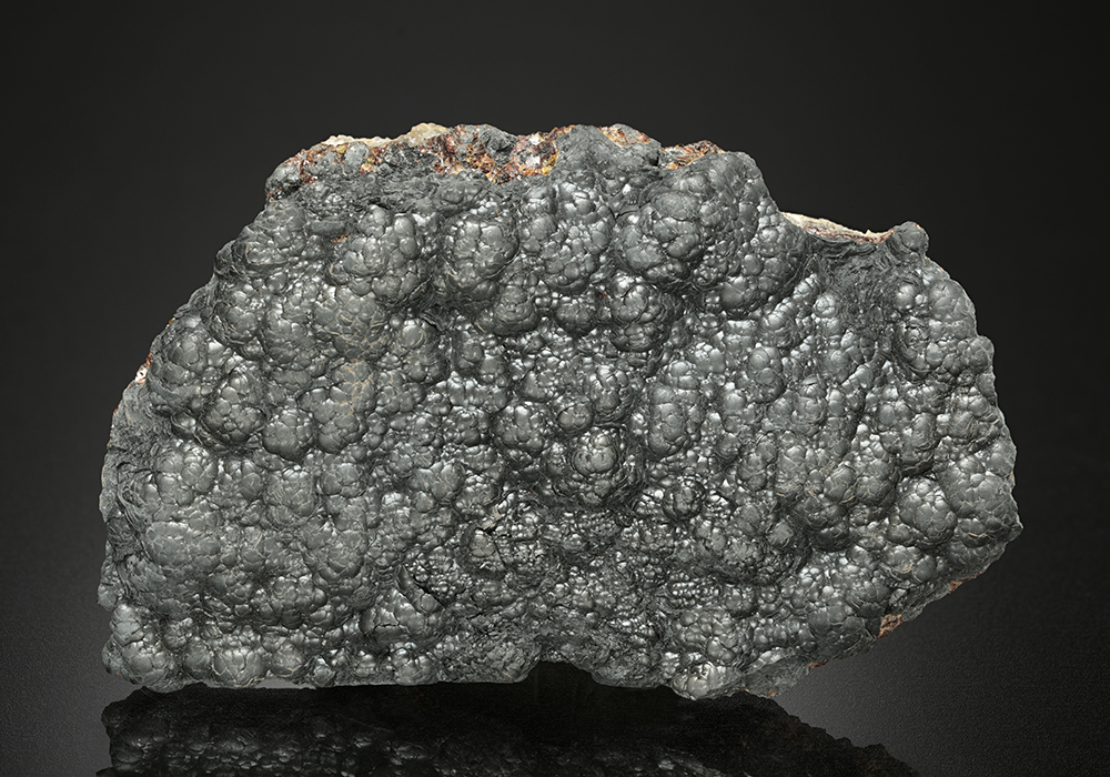
Dissolution: Chemical weathering during which minerals dissolve into water is called dissolution. Dissolution primarily affects salts and carbonate minerals (Fig. B.6a, b), but even quartz dissolves slightly.
Hydrolysis: During hydrolysis, water chemically reacts with minerals and breaks them down (lysis means loosen in Greek) to form other minerals. For example, hydrolysis reactions in feldspar produce clay.
Oxidation: Oxidation reactions in rocks transform ironbearing minerals (such as biotite and pyrite) into a rustybrown mixture of various iron-oxide and iron-hydroxide minerals. In effect, iron-bearing rocks can “rust.”
Hydration: the absorption of water into the crystal structure of minerals, causes some minerals, such as certain types of clay, to expand. Such expansion weakens rock.
Organic or Biological Weathering
A number of plants and animals may create chemical weathering through release of acidic compounds, i.e. the effect of moss growing on roofs is classed as weathering. Mineral weathering can also be initiated or accelerated by soil microorganisms. Lichens on rocks are thought to increase chemical weathering rates.

Some plants and animals can cause chemical weathering through the release of acidic compounds, ie, classification of algae grown on the roof as degradation. Mineral weathering can also be initiated or accelerated by soil microorganisms. It is thought that lichens on the rocks increase the chemical weathering rates.
The most common forms of biological weathering are the release of chelating compounds (ie, organic acids, siderophores) and acidifying molecules (ie, protons, organic acids) to break down aluminum and iron-containing compounds in soils beneath plants. The decomposition of the remains of dead plants in the soil can form organic acids which, when dissolved in water, cause chemical weather conditions. Excessive release of chelating compounds can easily affect the surrounding rocks and soils and lead to soils podsolization.
Factors affecting weathering
Weathering is affected by several factors, including climate, rock type, and natural agents. Here’s a brief discussion of each of these factors:
- Climate: The climate of a particular area can greatly influence the type and rate of weathering that occurs. In regions with high rainfall and high humidity, chemical weathering is more common, as water reacts with minerals in rocks to create new compounds. In contrast, areas with extreme temperature changes, such as those that experience freeze-thaw cycles, experience mechanical weathering due to the expansion and contraction of water in rocks. Additionally, areas with strong winds can cause abrasion and wear on exposed rock surfaces.
- Rock type: The type of rock being weathered is also an important factor. Some rocks, such as granite and basalt, are more resistant to weathering due to their dense and hard composition. In contrast, sedimentary rocks, such as sandstone and limestone, are often more susceptible to weathering due to their porous nature and the presence of minerals that can dissolve in water. Additionally, rocks that contain iron and other minerals that are prone to oxidation are more susceptible to chemical weathering.
- Natural agents: Natural agents such as water, wind, and living organisms can greatly influence the rate and type of weathering that occurs. Water can cause both mechanical and chemical weathering, as it can freeze and thaw in rocks, and it can also dissolve minerals over time. Wind can cause abrasion and wear on exposed rock surfaces, while living organisms such as plant roots and burrowing animals can physically break down rocks and minerals.
Effects of weathering on the landscape
Weathering has a significant impact on the landscape over time. Here are some effects of weathering on the landscape:
- Formation of soil: Weathering plays a major role in the formation of soil. As rocks and minerals are broken down by natural agents and chemical reactions, they form smaller particles that mix with organic matter to create soil. Over time, the accumulation of soil can support the growth of vegetation, leading to the development of complex ecosystems.
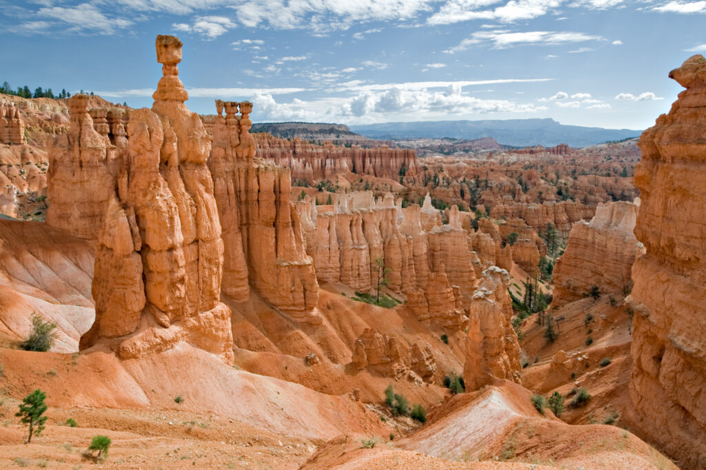
- Erosion: Weathering can contribute to erosion, which is the process of removing soil and rock from one location to another through natural agents such as water and wind. As rocks and minerals are weathered, they can become loose and easily transported by these agents, leading to the formation of features such as canyons, valleys, and riverbeds.
- Sedimentation: Weathering can also contribute to sedimentation, which is the process of depositing sediment in a new location. As weathered material is transported by natural agents, it can settle and accumulate in a new area. This can lead to the formation of sedimentary rocks over time.
- Formation of caves: Chemical weathering can dissolve rocks and minerals over time, leading to the formation of caves and other underground features. In limestone areas, for example, the dissolution of calcium carbonate by acidic water can lead to the formation of complex cave systems.
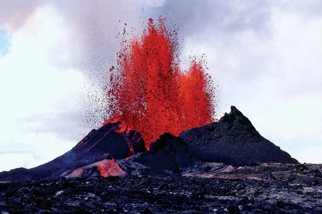
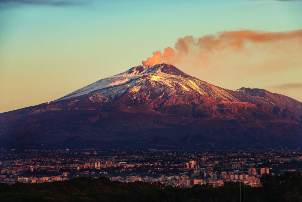
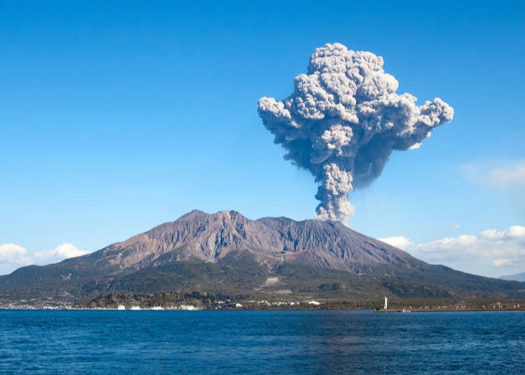
- Formation of mountains: Weathering can contribute to the formation of mountains over long periods of time. As rocks are weathered and eroded, the resulting sediments can accumulate and be compressed, leading to the formation of new rock formations and the uplift of land masses.
Overall, weathering is an important natural process that contributes to the shaping and evolution of the Earth’s landscape over time.
Human impact on weathering
Human activities can have a significant impact on weathering processes. Here are some ways in which human activities can affect weathering:
- Land use changes: Human activities such as deforestation, urbanization, and agriculture can alter the natural landscape and affect the rate and type of weathering that occurs. For example, deforestation can lead to increased soil erosion and decreased plant cover, leading to increased chemical weathering of rocks and soil.
- Mining and excavation: Mining and excavation activities can remove large quantities of rocks and minerals, leading to significant changes in the local geology and weathering patterns. These activities can also increase the exposure of rocks and minerals to natural agents such as water and air, leading to accelerated weathering.
- Industrial activities: Industrial activities such as fossil fuel combustion and manufacturing can release pollutants into the air and water, which can react with rocks and minerals and contribute to chemical weathering. Additionally, the construction of buildings and infrastructure can alter the local landscape and affect the natural processes of weathering and erosion.
- Climate change: Human activities such as the burning of fossil fuels and deforestation can contribute to global climate change, which can alter the temperature and precipitation patterns in a given area. These changes can affect the type and rate of weathering that occurs, as well as other natural processes such as erosion and sedimentation.
In summary, human activities can have both direct and indirect impacts on weathering processes, and can alter the natural landscape and ecosystem dynamics over time. Understanding and minimizing these impacts is important for preserving natural resources and maintaining healthy ecosystems.
Practical applications of weathering
Weathering processes have several practical applications across a range of fields. Here are some examples:
- Agriculture: Weathering plays a critical role in the formation of soil, which is essential for agriculture. Understanding weathering processes can help farmers optimize their soil management practices, such as selecting the appropriate fertilizers and irrigation methods based on the type of soil and weather conditions.
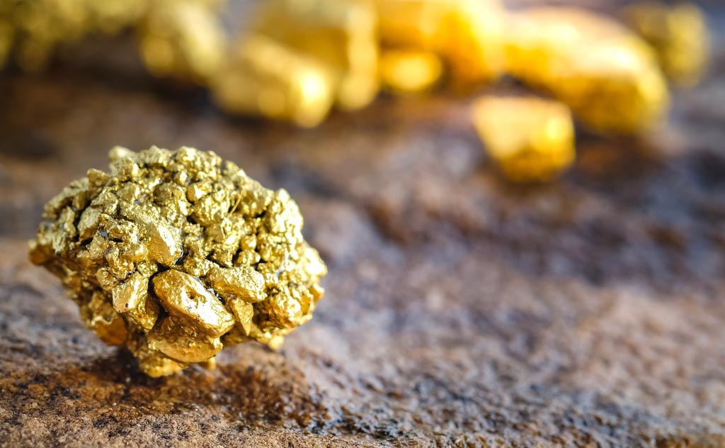
- Geology and mining: Weathering patterns and rates can be used to identify the types and locations of valuable minerals and ores. By understanding the weathering characteristics of different rock formations, geologists and miners can optimize their exploration and extraction efforts.
- Civil engineering and construction: Understanding the weathering characteristics of different types of rock and soil is important for construction projects such as building foundations, tunnels, and bridges. Engineers need to consider the potential impacts of weathering processes such as erosion and subsidence on the long-term stability and safety of these structures.
- Environmental science: Weathering processes play an important role in the natural carbon cycle and can affect climate change. Understanding the processes and rates of weathering can help researchers better model and predict the impacts of climate change on the Earth’s systems and inform strategies for mitigating these impacts.
- Cultural heritage preservation: Weathering processes can cause damage to cultural heritage sites such as monuments and sculptures. Understanding the weathering characteristics of different materials and environmental conditions can help conservators develop effective preservation and restoration strategies.
Overall, understanding weathering processes is important for a range of practical applications across fields such as agriculture, geology, construction, environmental science, and cultural heritage preservation.
Weathering research: Methods and current trends
Weathering research is a broad and interdisciplinary field that involves the study of physical, chemical, and biological processes that transform rocks and minerals over time. Here are some methods and current trends in weathering research:
- Laboratory experiments: Researchers use laboratory experiments to study the chemical and physical weathering processes that occur under controlled conditions. These experiments can help identify the mechanisms and rates of weathering reactions and provide insights into the factors that influence these processes.
- Field observations: Field observations involve the direct measurement and monitoring of weathering processes in natural environments. Researchers use field observations to study the effects of climate, geology, and vegetation on weathering patterns and rates over time.
- Modeling: Modeling involves the use of mathematical and computer-based models to simulate weathering processes and predict their impacts under different scenarios. Modeling can help researchers better understand the complex interactions between different environmental factors and inform management and conservation strategies.
- Emerging techniques: Advances in analytical techniques such as X-ray diffraction, scanning electron microscopy, and laser ablation inductively coupled plasma mass spectrometry have enabled researchers to study weathering processes at the micro- and nanoscale. These techniques allow researchers to identify and characterize the mineralogy and chemistry of rocks and minerals and provide insights into the mechanisms and rates of weathering reactions.
- Interdisciplinary approaches: Weathering research is increasingly becoming more interdisciplinary, with researchers from different fields such as geology, chemistry, biology, and environmental science collaborating to study weathering processes and their impacts on the Earth’s systems. This approach allows for a more holistic understanding of weathering processes and their interactions with other environmental factors.
Overall, weathering research involves a range of methods and approaches aimed at understanding the complex and dynamic processes that transform rocks and minerals over time. Ongoing research in this field is critical for understanding and managing the impacts of weathering on the Earth’s systems and developing strategies for mitigating these impacts.
Summary of key points and future directions in weathering research.
Key points in weathering research include:
- Weathering processes are complex and dynamic and involve physical, chemical, and biological processes that transform rocks and minerals over time.
- Factors such as climate, rock type, and natural agents influence the rates and patterns of weathering.
- Weathering can have significant impacts on the landscape, including the formation of soil, the release of nutrients, and the erosion of rock formations.
- Human activities such as pollution, deforestation, and mining can accelerate or modify weathering processes.
Future directions in weathering research may include:
- Developing a better understanding of the microscale and nanoscale processes that drive weathering reactions.
- Studying the impacts of climate change on weathering processes and the carbon cycle.
- Investigating the interactions between different environmental factors, such as climate, vegetation, and soil properties, on weathering rates and patterns.
- Developing more effective strategies for managing and mitigating the impacts of weathering on natural and cultural systems.
- Improving our understanding of the role of weathering in the formation and evolution of planets, including the early Earth and Mars.
Overall, weathering research is an interdisciplinary field with significant implications for a range of scientific and practical applications. Ongoing research in this field is critical for understanding and managing the impacts of weathering on the Earth’s systems and developing strategies for mitigating these impacts.
Weathering FAQ
Q: What is weathering?
A: Weathering is the process by which rocks and minerals are broken down into smaller particles due to exposure to the atmosphere, water, and other natural agents.
Q: What are the three types of weathering?
A: The three types of weathering are mechanical weathering, chemical weathering, and biological weathering.
Q: What is mechanical weathering?
A: Mechanical weathering occurs when rocks and minerals are broken down into smaller pieces through physical processes.
Q: What is chemical weathering?
A: Chemical weathering occurs when rocks and minerals are broken down through chemical reactions.
Q: What is biological weathering?
A: Biological weathering occurs when rocks and minerals are broken down through the action of living organisms.
Q: How do these types of weathering work together?
A: All three types of weathering can work together to break down rocks and minerals into smaller particles, which can then be transported and deposited by natural agents such as wind and water.
Q: Why is weathering important?
A: The process of weathering is an important part of the natural rock cycle, and it plays a crucial role in shaping the Earth’s landscape over time.
Q: What are some examples of mechanical weathering?
A: Examples of mechanical weathering include freeze-thaw cycles, exfoliation due to pressure release, abrasion due to wind or water, and the formation of talus slopes.
Q: What are some examples of chemical weathering?
A: Examples of chemical weathering include the dissolution of limestone by carbonic acid, the oxidation of iron in rocks to form rust, and the leaching of minerals by acid rain.
Q: What are some examples of biological weathering?
A: Examples of biological weathering include the breakdown of rocks and minerals by plant roots, the burrowing of animals into rocks, and the action of microorganisms in soil.
Q: How long does weathering take?
A: The amount of time it takes for weathering to occur depends on factors such as the type of rock or mineral, the climate and environment, and the strength and duration of the natural agents causing weathering. Some rocks may weather quickly in certain conditions, while others may take thousands or even millions of years to weather.
Q: What are the effects of weathering on the Earth’s landscape?
A: Weathering plays a major role in shaping the Earth’s landscape over time. It can create features such as canyons, caves, and mountains, and it can also break down rocks and minerals into smaller particles that contribute to the formation of soil and the cycling of nutrients in ecosystems. Weathering can also contribute to erosion and sedimentation, which can have both positive and negative effects on the environment.
References
- White, A. F., & Brantley, S. L. (2016). The effect of time on the weathering of silicate minerals: why do weathering rates differ in the laboratory and field?. Chemical Geology, 420, 1-16.
- Lalonde, K., Konhauser, K. O., & Reimer, C. W. (2012). The last billion years of Earth history: A bio-inorganic sedimentary record of coupled climate, sedimentation, and evolution. Earth-Science Reviews, 108(1-2), 47-75.
- Brantley, S. L., & Lebedeva, M. I. (2011). Learning to read the chemistry of silicate rocks: Weathering geothermometers and geospeedometers. Earth-Science Reviews, 106(1-2), 92-111.
- Navarrete-López, M., & Martínez-Montoya, J. F. (2017). The role of weathering in the formation and evolution of planets. Planetary and Space Science, 138, 1-10.
- Gabet, E. J., & Mudd, S. M. (2010). Bedrock and soil controls on alpine treeline ecotone position. Journal of Geophysical Research: Earth Surface, 115(F4).
- Foster, C., & Rosenzweig, C. (2003). Assessing the vulnerability of human settlements to extreme weather events: a conceptual framework. Environment and Urbanization, 15(2), 123-135.


")