")


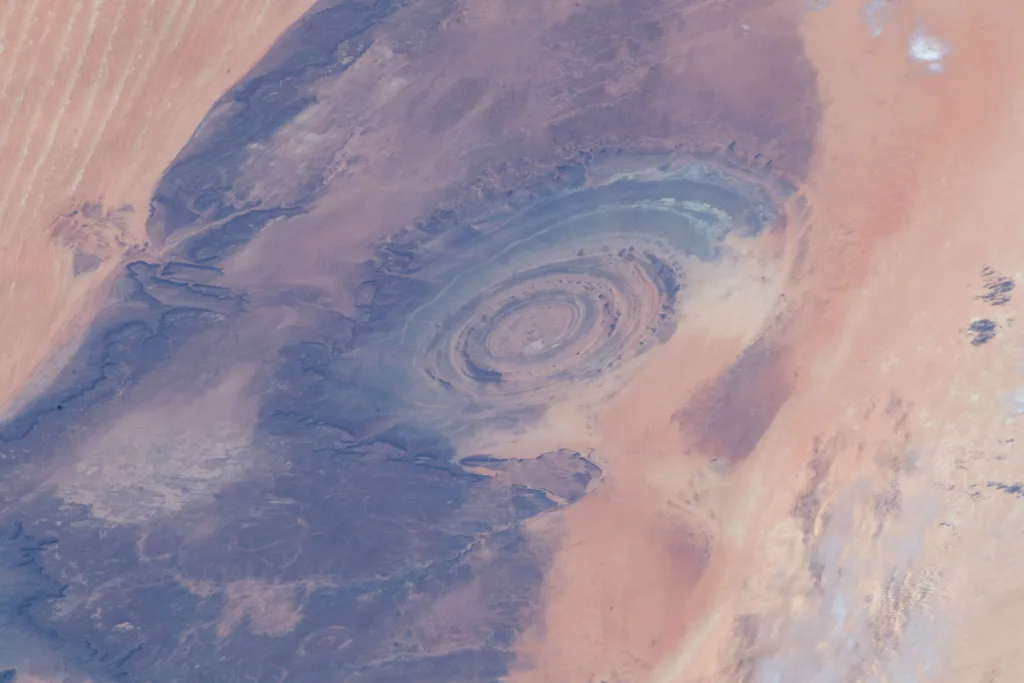
Eye Of The Sahara or Richat Structure

A Mysterious Circle in the Sands
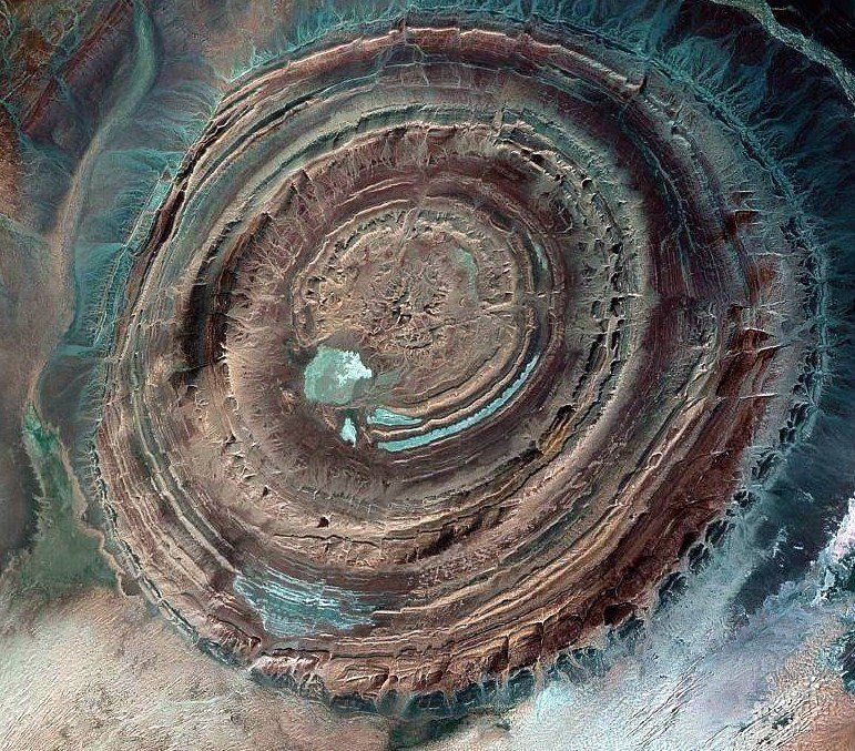
In the endless beige expanse of the Sahara Desert, a perfect circle breaks the monotony — a series of rings, vast enough to be seen from space.
Locally known as the Richat Structure, and globally as the Eye of the Sahara, this formation has fascinated geologists, astronauts, and travelers alike.
It stretches nearly 50 kilometers (30 miles) across, resembling a gigantic bull’s-eye carved into the surface of the Earth.
From space, its concentric layers of brown, gold, and violet sandstone spiral outward like an ancient fossil of the planet itself.
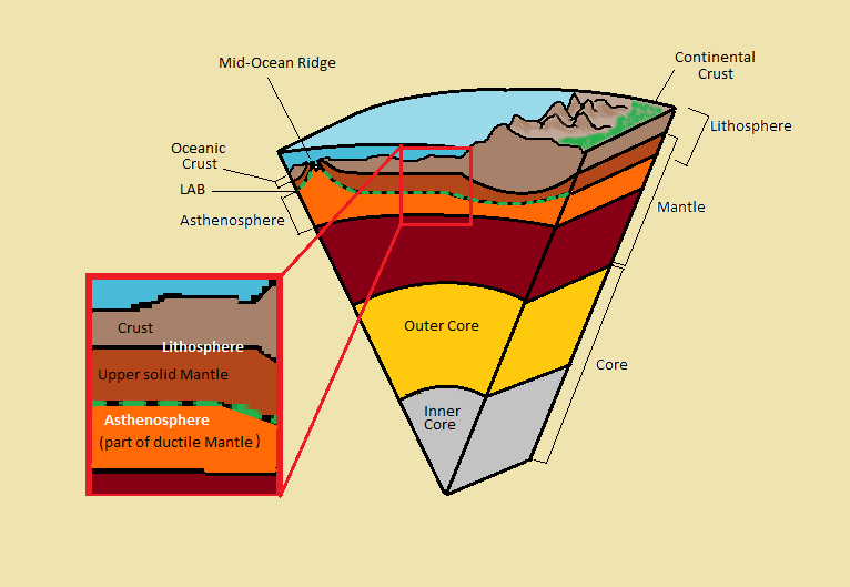
Location and Geography
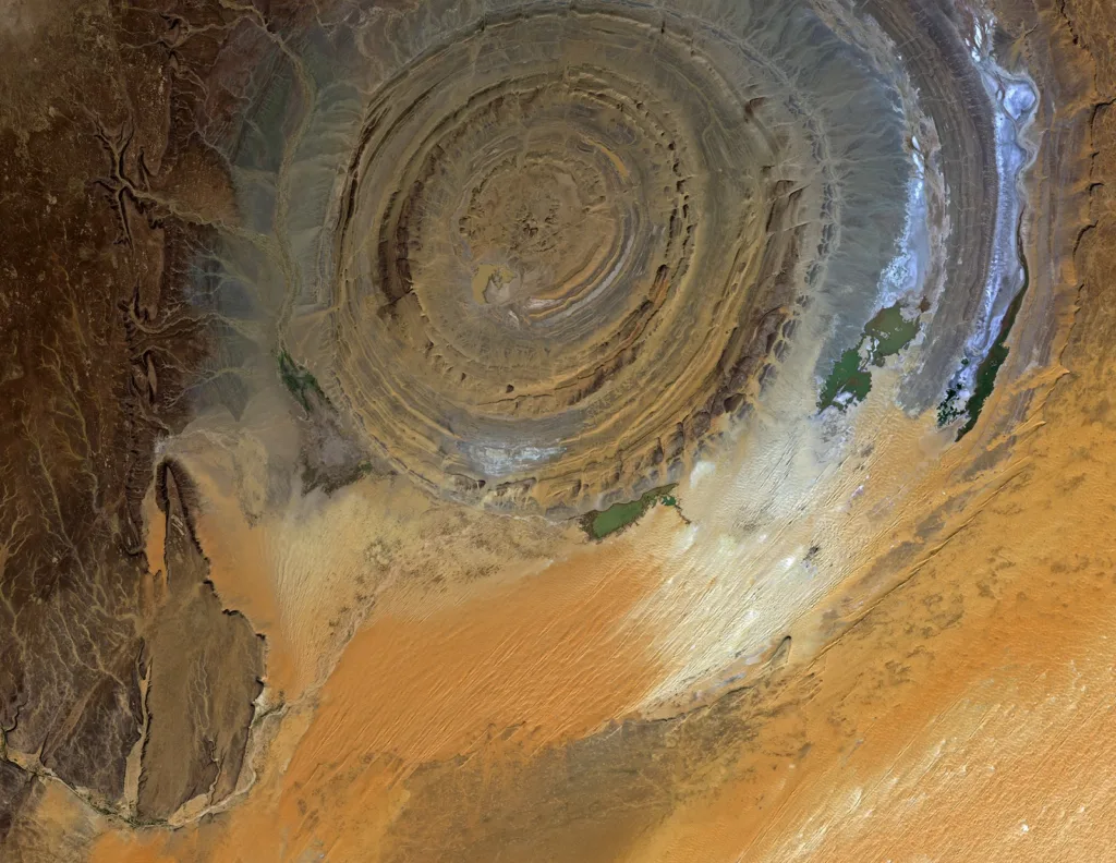
The Eye of the Sahara sits on the Adrar Plateau in central Mauritania, near the small town of Ouadane.
Coordinates: 21°07′N, 11°22′W — an otherwise desolate part of northwestern Africa.
The area is arid, wind-sculpted, and eerily silent. From the ground, you might not even notice the formation — its rings are so broad and subtle that only from the air does their symmetry reveal itself.
Discovery from Space
Although local people had known about the formation for centuries, the Eye of the Sahara gained international attention only in the 1960s, during the era of early space missions.
Astronauts aboard NASA’s Gemini 4 mission spotted the structure while orbiting Earth and were amazed by its circular symmetry.
At first, scientists believed it was a meteorite impact crater.
Its perfect geometry and massive scale seemed to suggest a violent cosmic origin.
But later studies proved otherwise: no traces of shocked quartz, melted rock, or impact debris were ever found.
The Eye, it turned out, was a creation of Earth itself.
Geological Formation – Not an Impact, But Uplift and Erosion
The Richat Structure is a geological dome, not a crater.
Millions of years ago, deep beneath the African crust, molten rock pushed upward, warping the layers of sedimentary rock above it into a dome shape — much like a bubble rising through thick syrup.
Over time, wind and water erosion stripped away the softer layers, leaving behind the harder rocks in concentric rings.
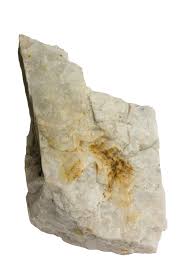
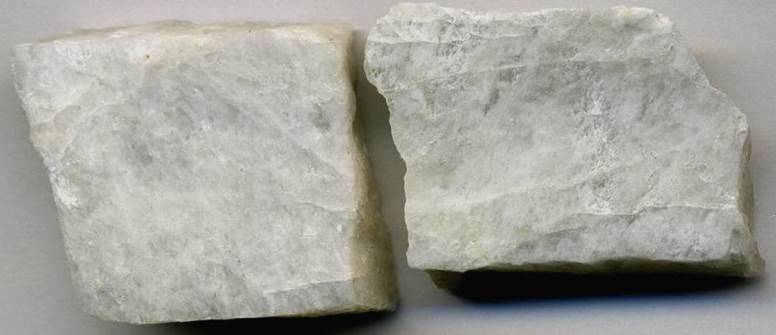
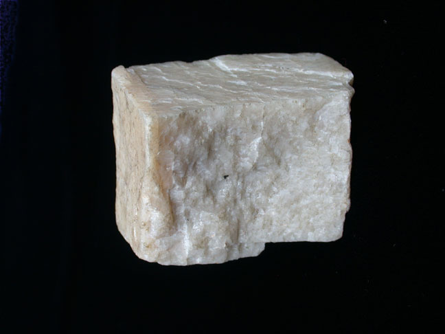
These alternating layers of limestone, quartzite, and sandstone eroded at different speeds, forming the distinct circular pattern seen today.
At its center, ancient igneous rocks reveal evidence of volcanic activity dating back nearly 100 million years.
The Concentric Rings – A Timeline of Earth’s History
Each ring of the Eye tells a different story in geological time.
The outermost rings consist of Ordovician sandstone (over 480 million years old), while the inner core exposes Proterozoic rocks, among the oldest in Africa.
It’s as if nature peeled back the layers of the planet like an onion, exposing its ancient core.
To geologists, walking across the Richat Structure is like stepping through chapters of Earth’s history — from the shallow seas of the Paleozoic era to the volcanic upheavals of the Mesozoic.
Myths, Legends, and the “Atlantis” Theory

The Eye of the Sahara hasn’t only attracted scientists — it has also captured the imagination of storytellers.
Some have claimed it could be the lost city of Atlantis described by Plato — a circular city surrounded by rings of land and water.
Supporters of this theory point to the Eye’s shape, its proximity to ancient riverbeds, and geological evidence of past flooding.
While no archaeological proof supports the Atlantis claim, the theory continues to spark curiosity and tourism.
For many, the Richat Structure remains both a scientific marvel and a place of mystery — a desert spiral that blurs the line between myth and geology.
Scientific Research and Findings

Over the decades, the Eye of the Sahara has been thoroughly studied by geological teams from around the world.
Field expeditions have uncovered igneous dikes, breccia deposits, and hydrothermal minerals, confirming that the formation resulted from internal uplift rather than external impact.
Satellite imagery and radar mapping have revealed fractures radiating outward — signs of deep crustal stress.
No traces of shock-metamorphic minerals (like those found in meteorite craters) have been discovered, effectively ruling out an extraterrestrial origin.
Erosion and the Power of Time

The Sahara Desert, though seemingly lifeless, is one of Earth’s most powerful sculptors.
Over millions of years, wind-blown sand has shaved down mountain ridges, polished rocks smooth, and carved valleys invisible from ground level.
The Eye’s circular pattern is the desert’s artwork — carved not by human hands but by endless wind, sun, and time.
Even today, erosion continues to reshape the structure, slowly softening its rings like waves eroding the edges of a fossil.
Visiting the Eye of the Sahara
Traveling to the Eye of the Sahara is not simple, but it’s unforgettable.
The nearest town, Ouadane, lies about 40 kilometers away, reachable by rugged desert roads.
Guided expeditions take travelers across the sand dunes and plateaus to view the formation from high ground.
From above — whether by drone or small aircraft — the view is breathtaking: a massive spiral of stone fading into the golden desert.
? Best Time to Visit: Between November and March, when temperatures are moderate and skies are clear.
? What to Bring: Sunglasses, water, GPS, and a sense of awe.
Importance to Earth Science
Beyond its beauty, the Eye of the Sahara is a natural classroom.
It helps scientists understand:
- How uplifted domes evolve under erosion,
- How desert weathering sculpts large-scale features,
- And how plate tectonics influence sedimentary basins.
In many ways, the Richat Structure is a living fossil — a cross-section of the Earth’s crust visible without drilling, offering a glimpse into processes normally hidden deep underground.
Summary – Earth’s Fingerprint in the Desert
The Eye of the Sahara is both a masterpiece of geology and a symbol of time’s quiet persistence.
Born from fire beneath the crust and shaped by the relentless hand of erosion, it stands as a reminder that Earth itself is the greatest artist.
Whether seen from the ground or from space, it remains hypnotic — a spiral in the sand that connects science, mystery, and imagination.
FAQs – The Eye of the Sahara (Richat Structure)
1. What is the Eye of the Sahara?
A massive circular geological dome formation in Mauritania, officially known as the Richat Structure.
2. How large is it?
It spans about 50 km (30 miles) in diameter.
3. Is it a meteorite crater?
No. Studies show it formed through uplift and erosion, not impact.
4. Why is it circular?
Different rock layers eroded at varying rates, creating concentric rings.
5. Can tourists visit it?
Yes. It’s accessible via Ouadane with local guides and 4×4 vehicles, though remote.