")


Geodes

Geodes are fascinating geological formations that captivate the attention of both scientists and collectors alike. These unique structures are found in various regions around the world and are known for their hollow interiors lined with beautiful crystals. Geodes are formed through a combination of geological processes that occur over long periods of time.
The word “geode” is derived from the Greek word “geoides,” which means “earthlike.” Geodes are spherical or oblong-shaped rocks that appear unremarkable from the outside. However, when they are cracked open or cut, they reveal a breathtaking display of minerals and crystals within.
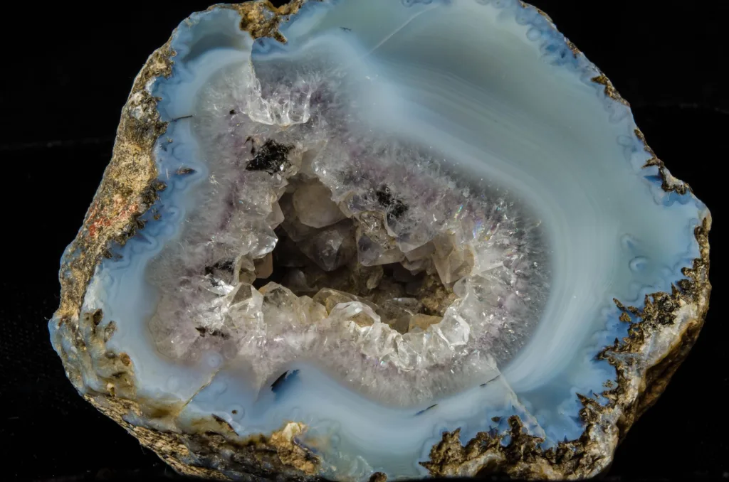
The formation of geodes begins with volcanic or sedimentary activity. In volcanic regions, geodes are often formed from the gas bubbles in lava flows. As the lava cools and hardens, these gas bubbles become cavities within the rock. Over time, mineral-rich groundwater seeps into these cavities, carrying dissolved minerals such as quartz, amethyst, calcite, or agate. As the water evaporates, the minerals are left behind, gradually lining the interior of the geode with crystals.
In sedimentary environments, geodes are formed through a different process. They typically originate in ancient limestone or shale beds. As water flows through these porous rocks, it carries minerals in solution. When the water enters a cavity or an empty space, such as a pre-existing animal burrow or a hollowed-out tree trunk, it can deposit the dissolved minerals, forming crystals inside the cavity. Over time, these crystals grow and develop into the characteristic interior of a geode.
The type of minerals found inside a geode depends on the specific geological conditions of its formation. Some geodes are filled with a single type of crystal, such as quartz or amethyst, while others exhibit a variety of minerals, creating a stunning array of colors and textures.
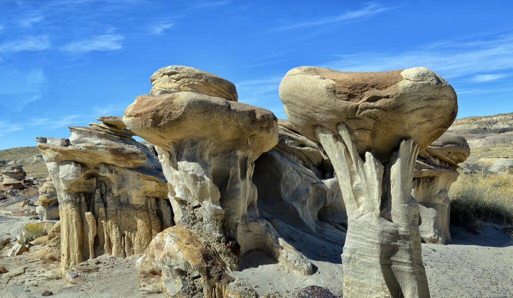
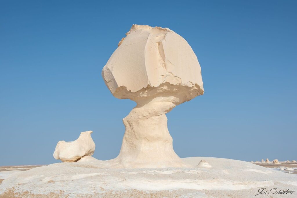
Geodes can be found in numerous locations worldwide, including regions with volcanic activity, limestone deposits, or areas that have experienced geological upheavals. Notable geode-producing regions include Brazil, Mexico, Uruguay, Morocco, and the United States, among others.
Geodes have captivated humans for centuries. They are not only admired for their beauty but also valued by collectors and used in jewelry making. Additionally, geodes provide valuable insights into the geological history of a particular area and offer a glimpse into the processes that shape our planet.
In summary, geodes are geological marvels that house breathtaking crystal formations within seemingly ordinary-looking rocks. Their formation involves a combination of volcanic or sedimentary processes, resulting in cavities that become lined with minerals over time. Geodes are cherished for their aesthetic appeal, scientific significance, and cultural value.
Geode Formation
Geode formation is a complex process that involves the interplay of various geological factors over extended periods of time. Geodes are typically formed in two main types of geological environments: volcanic and sedimentary. Let’s explore the formation of geodes in each of these environments:
- Volcanic Geode Formation: Volcanic geodes are formed in regions with volcanic activity, where molten lava flows onto the Earth’s surface. The process of volcanic geode formation can be summarized as follows:a. During a volcanic eruption, lava emerges from the Earth’s mantle and reaches the surface. As the lava flows, it cools and solidifies, forming volcanic rocks such as basalt or rhyolite.b. Within the lava flow, there are often gas bubbles or vesicles. These vesicles form when gases, such as water vapor, carbon dioxide, or sulfur dioxide, dissolved in the molten lava come out of solution as the lava rapidly cools and solidifies.c. As the lava continues to cool, a solid outer layer forms around the gas bubbles, creating a hardened rock shell.d. Over time, mineral-rich groundwater, often carrying dissolved minerals like quartz, calcite, amethyst, or agate, percolates through cracks and pores in the volcanic rock.e. The mineral-laden groundwater enters the gas-filled vesicles and slowly deposits minerals on the inner walls of the vesicles.f. As the minerals crystallize, they gradually fill the cavity, forming the characteristic crystal-lined hollow space within the geode.
- Sedimentary Geode Formation: Sedimentary geodes are formed within sedimentary rocks, such as limestone, shale, or dolomite. The process of sedimentary geode formation can be summarized as follows:a. In a sedimentary environment, water percolates through porous rocks, carrying dissolved minerals in solution.b. When the water encounters a cavity or void within the sedimentary rock, such as an animal burrow, tree root mold, or concretionary nodule, it slows down or accumulates, allowing the minerals to precipitate and deposit within the cavity.c. Over time, the minerals continue to crystallize and grow within the cavity, gradually filling the space and forming a crystalline interior.d. As the surrounding sedimentary rock erodes or weathers away through natural processes, the geodes are exposed and can be found either on the surface or through excavation.
It’s important to note that the specific minerals found inside geodes vary depending on the geological conditions and the availability of dissolved minerals in the infiltrating groundwater. This results in a wide range of geode types, each characterized by its unique crystal formations and colors.
The formation of geodes is a slow and gradual process that can span thousands or even millions of years. It requires the right combination of geological factors, including volcanic activity, sedimentation, groundwater flow, and mineral saturation, to create these captivating natural wonders.
Geode Varieties
Geodes come in a variety of types, each distinguished by their unique crystal formations, mineral compositions, and geological origins. Here are some notable varieties of geodes:
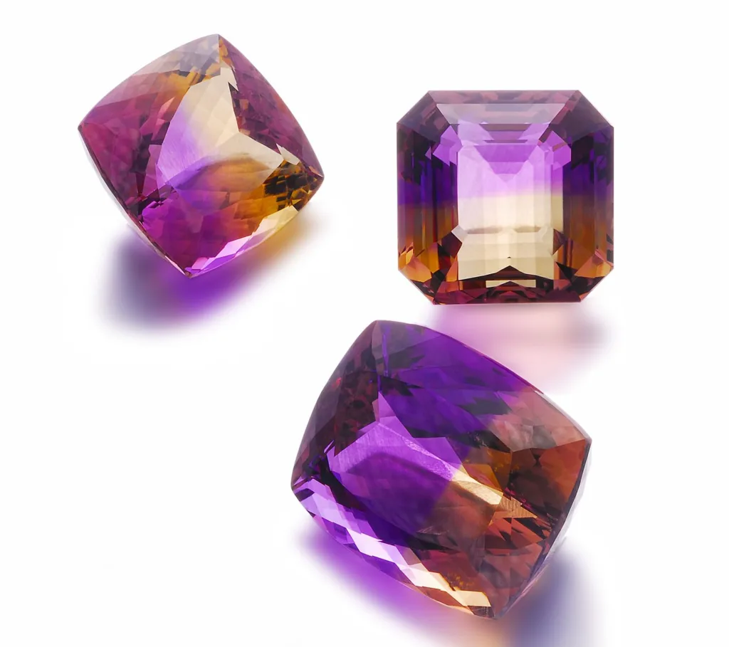
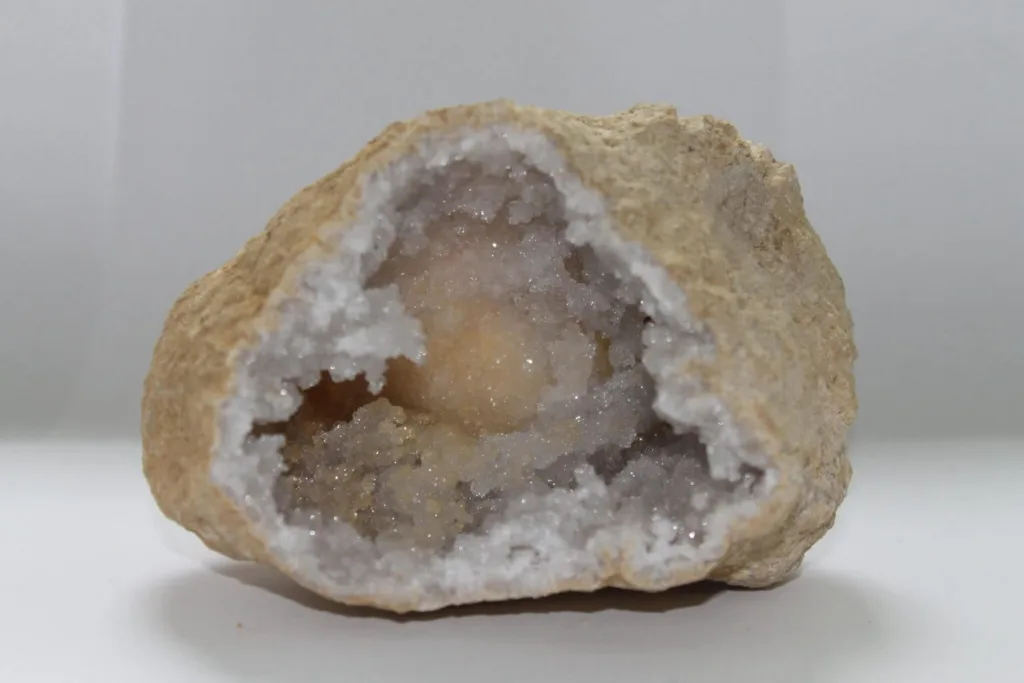
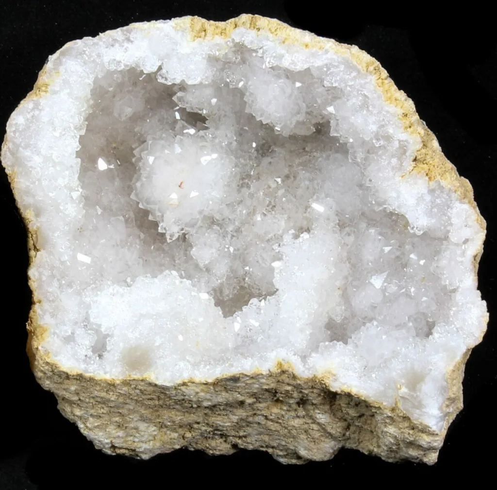
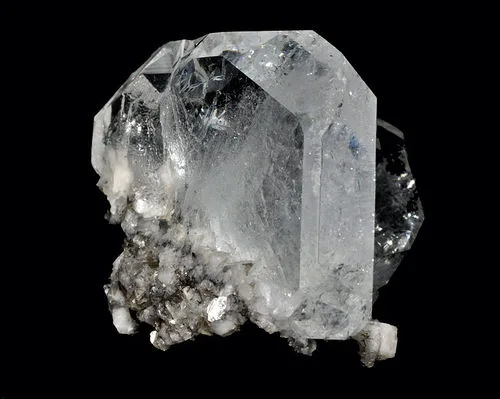
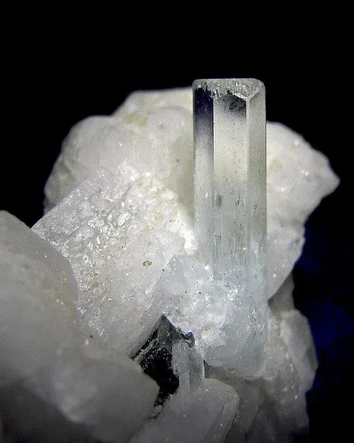
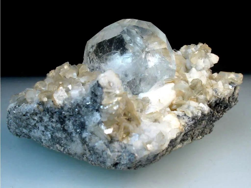
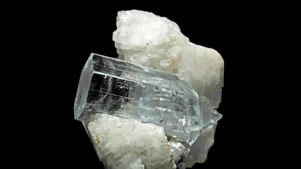
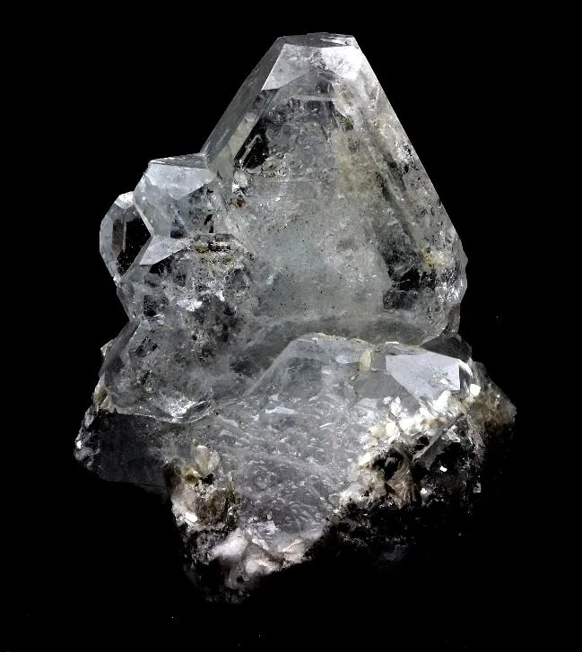
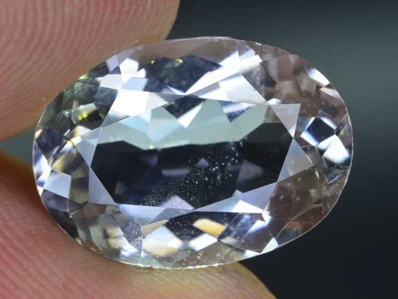
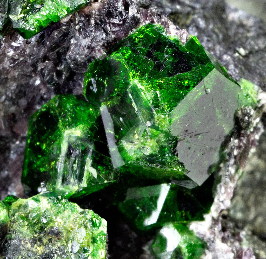
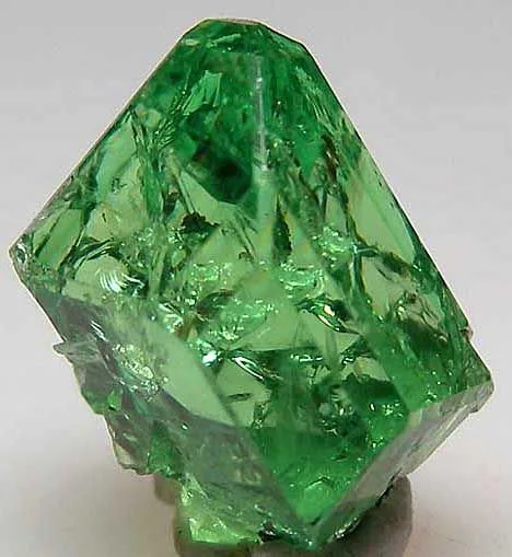
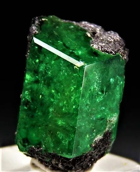
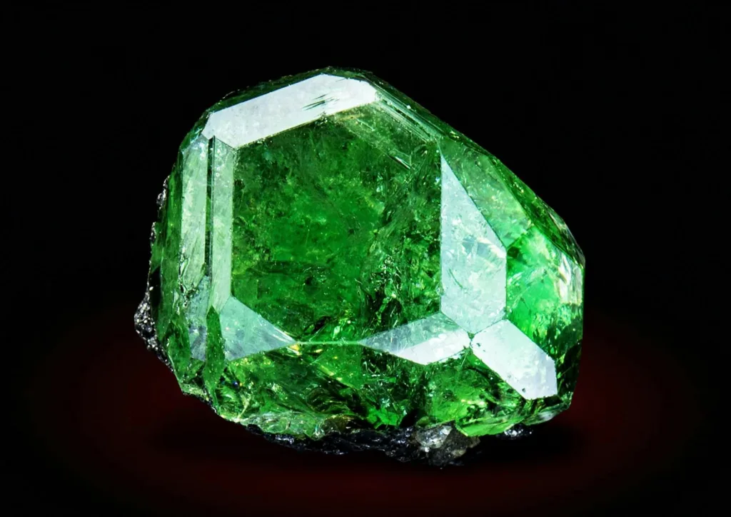
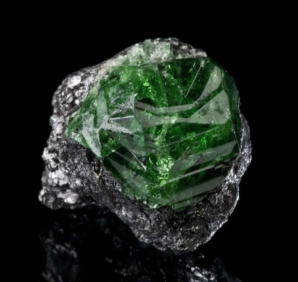
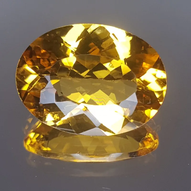
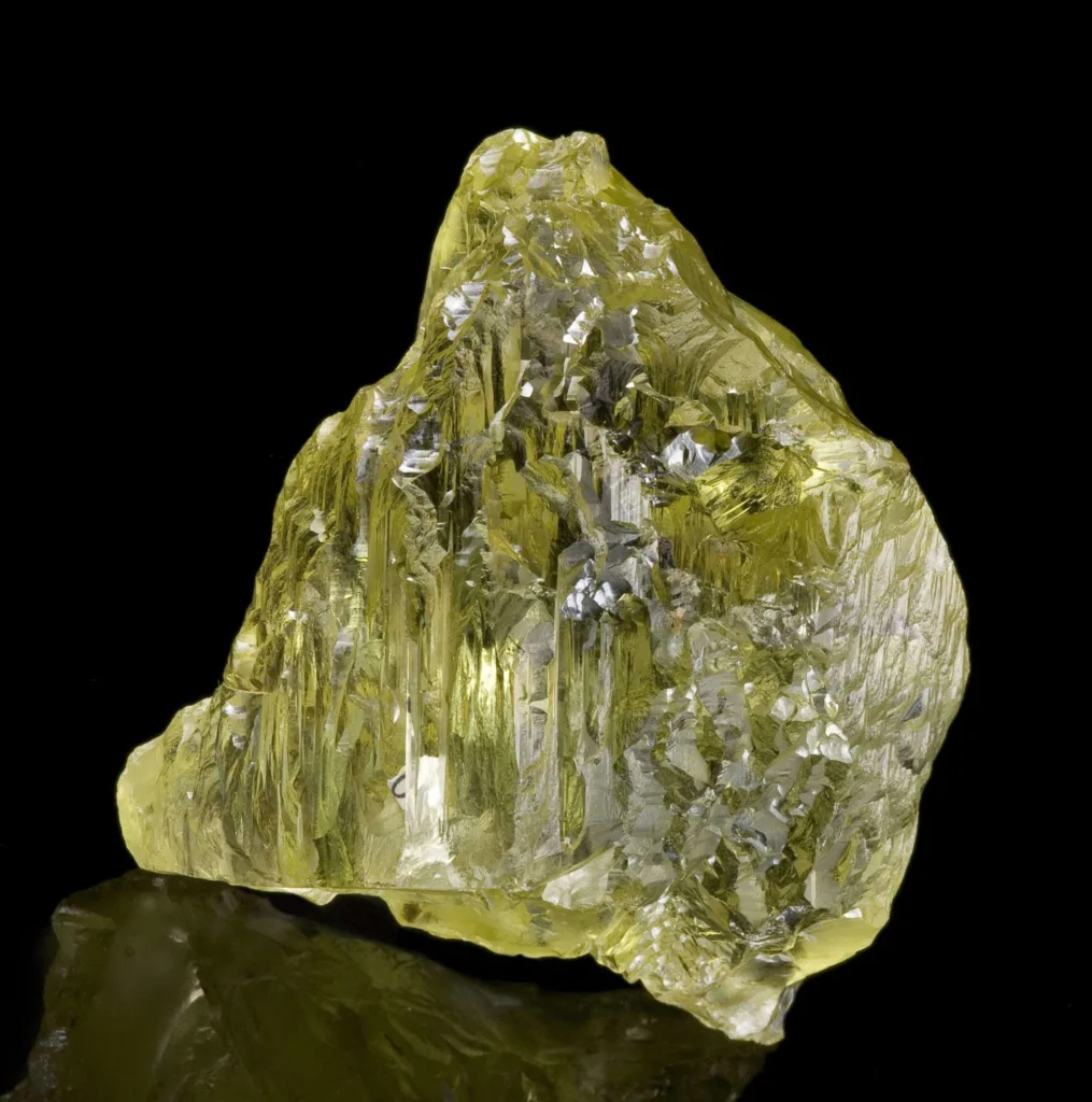
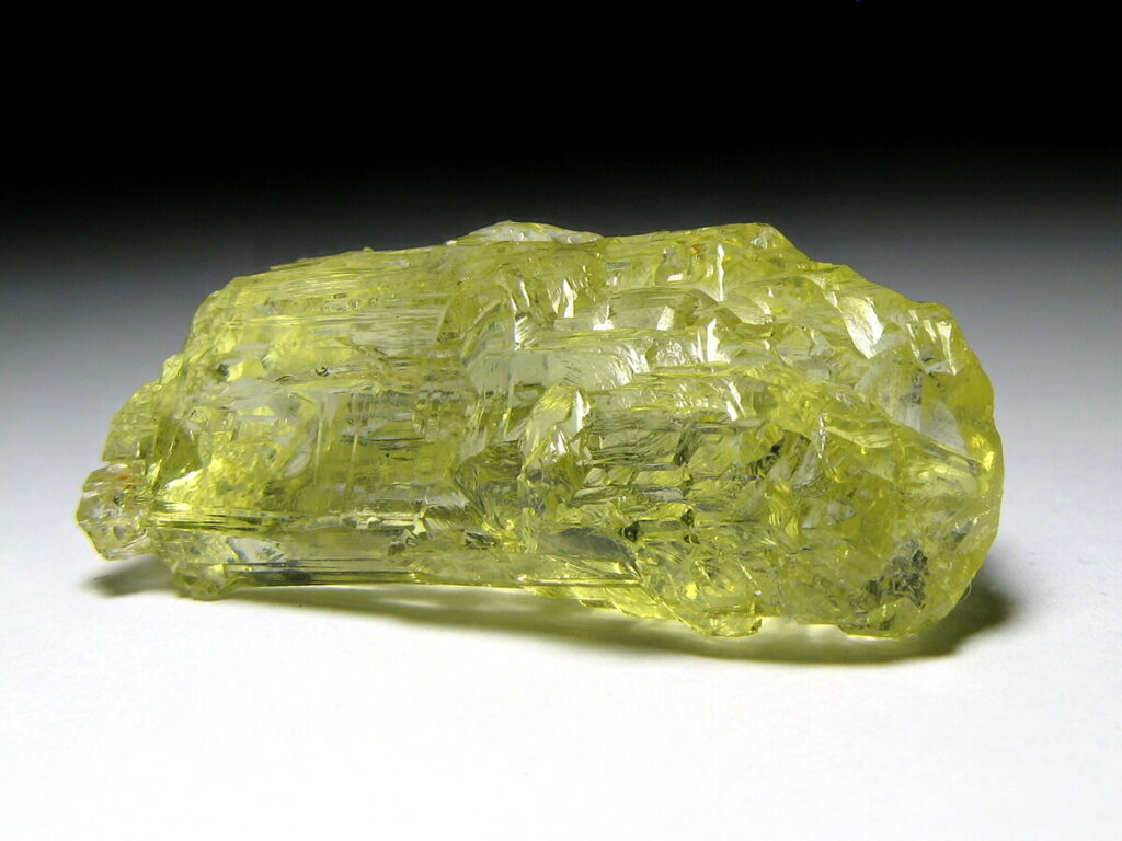
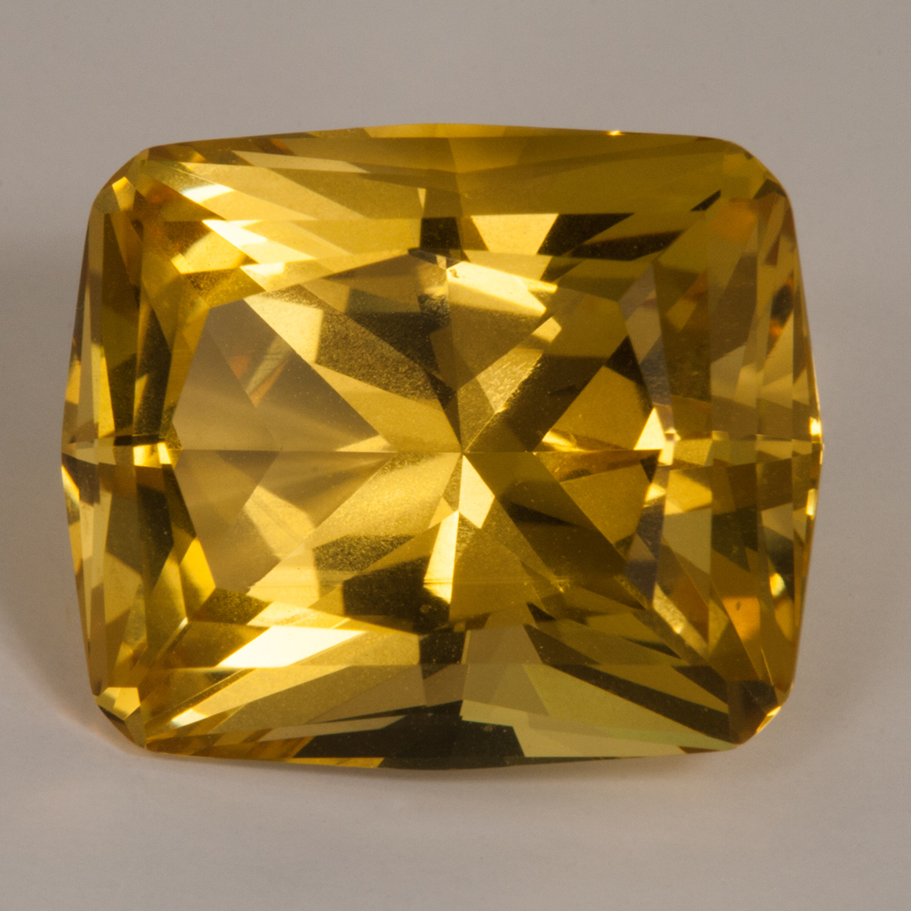
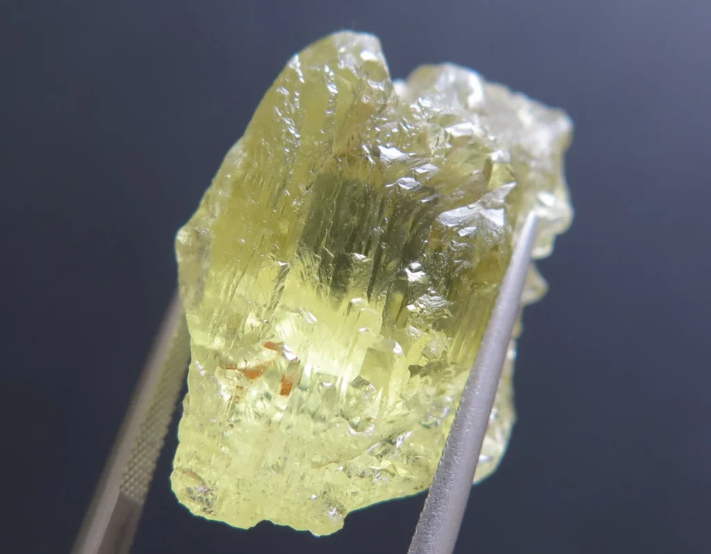
- Quartz Geodes: Quartz geodes are among the most common and well-known types of geodes. They are characterized by their inner cavity lined with crystals of quartz. The crystals can range in color from clear to smoky, amethyst, citrine, or other variations of quartz. Quartz geodes can be found in many geode-producing regions worldwide.
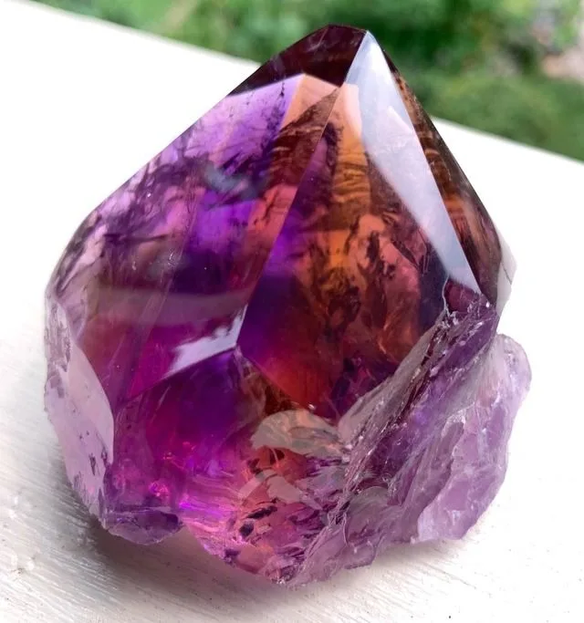
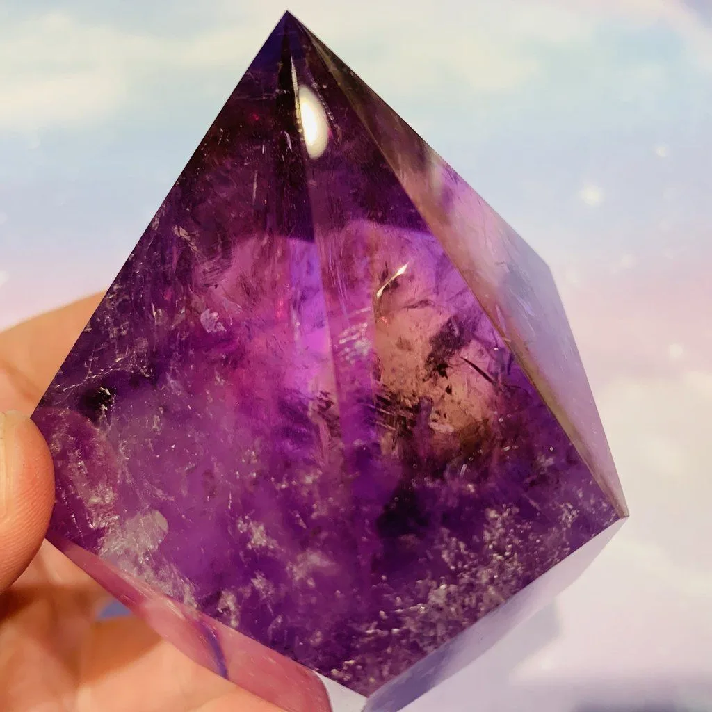
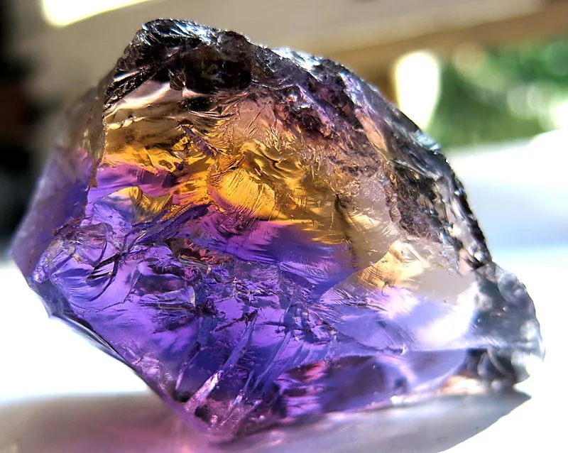
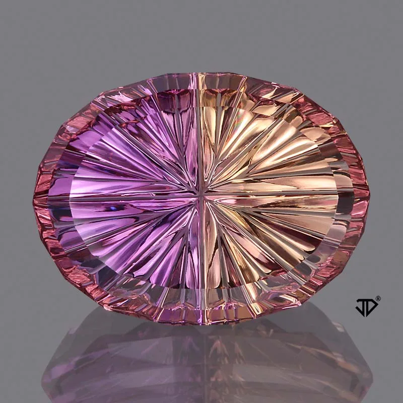
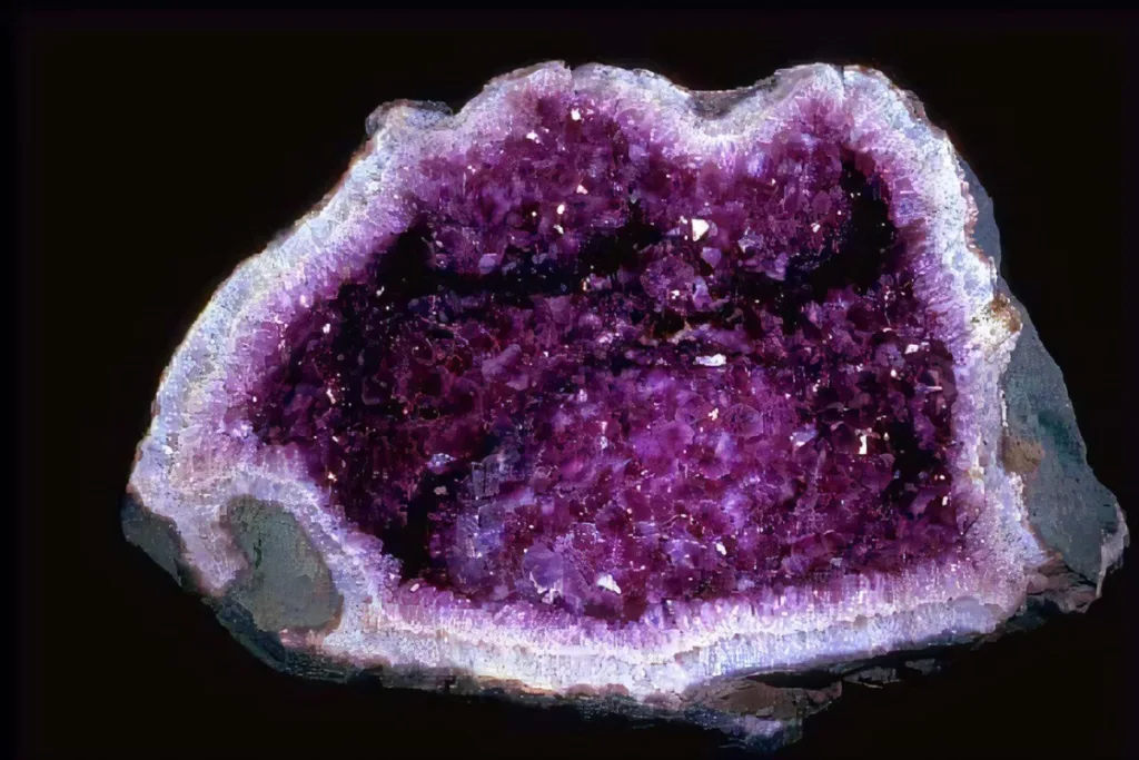
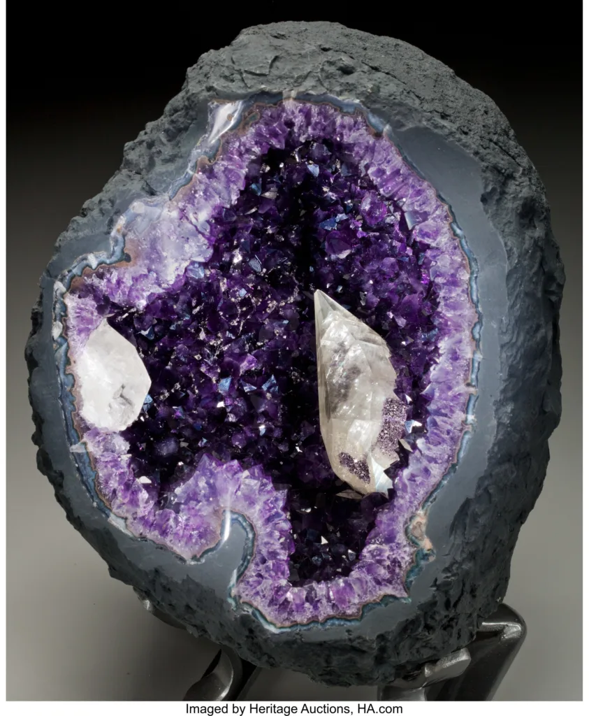
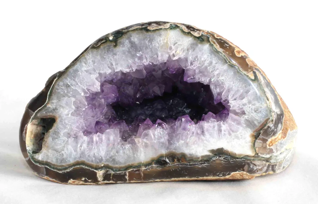
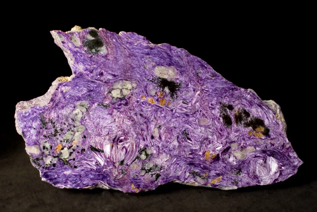
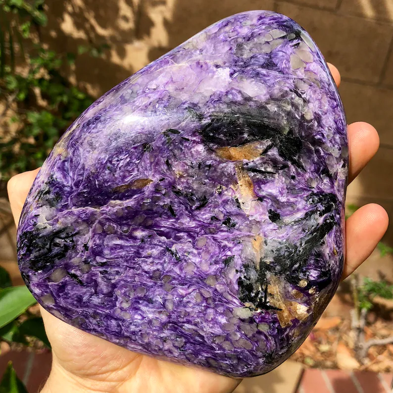
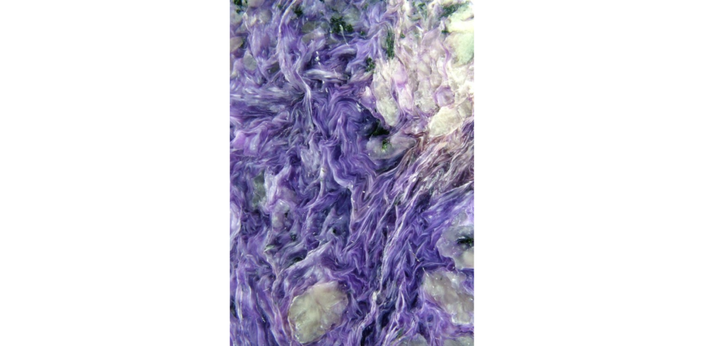
- Amethyst Geodes: Amethyst geodes are a specific type of quartz geode that exhibit deep purple or violet-colored amethyst crystals lining the cavity. These geodes are highly prized for their vibrant color and are often used in jewelry and decorative pieces. Amethyst geodes are commonly found in regions such as Uruguay, Brazil, and Mexico.
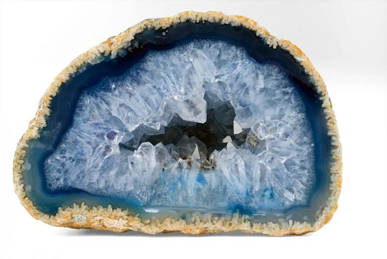
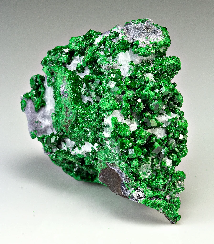
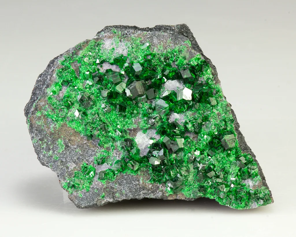
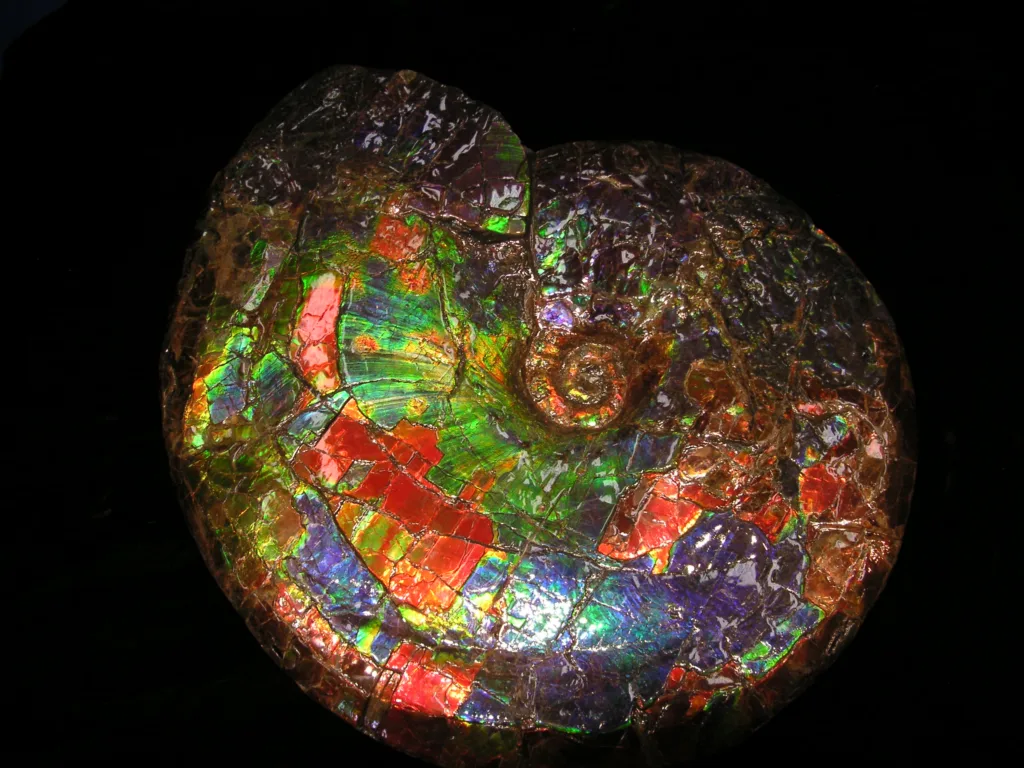
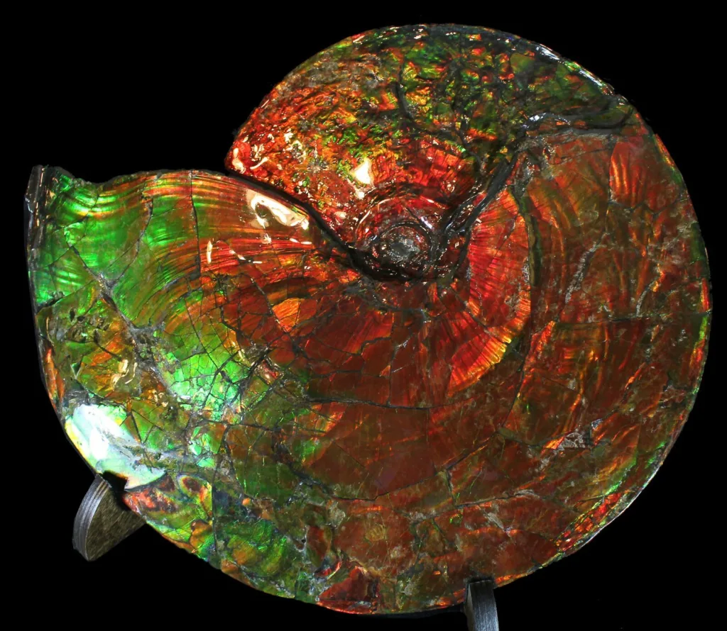
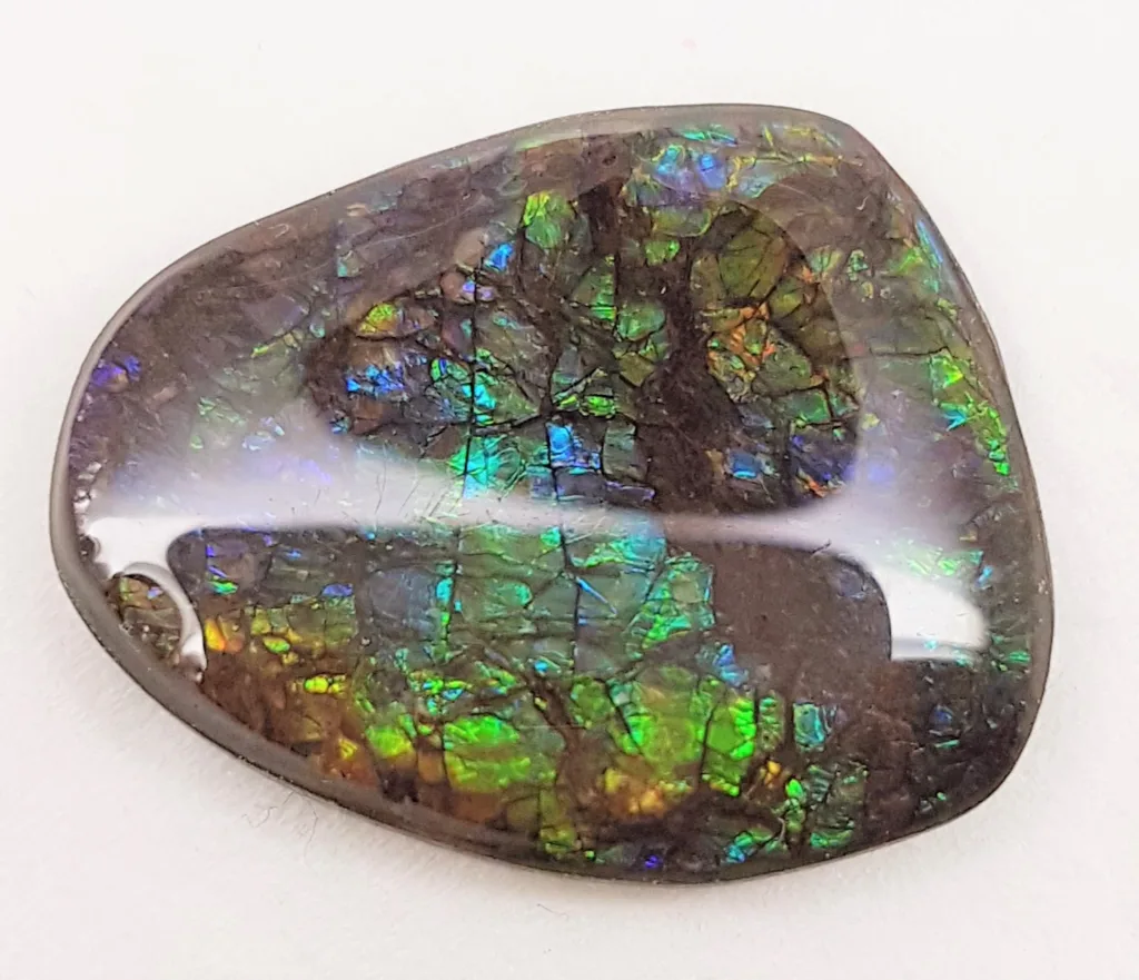
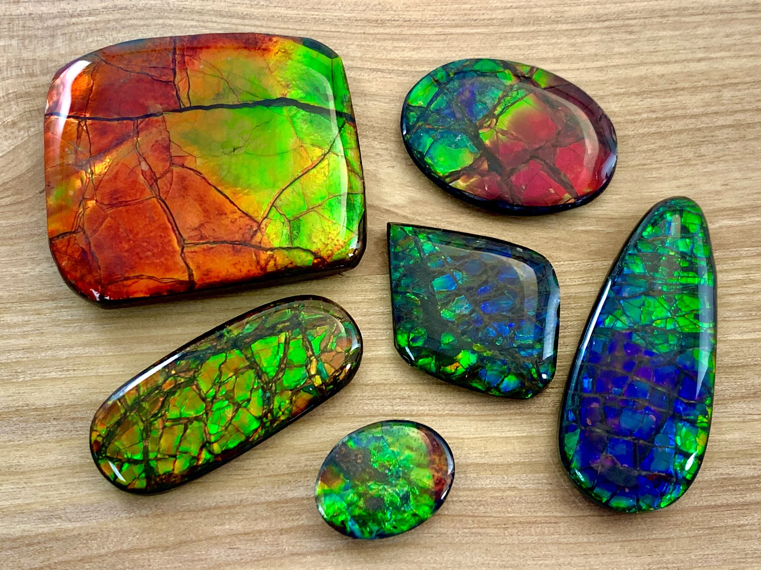
- Agate Geodes: Agate geodes are characterized by their concentric banding patterns formed by layers of different minerals. The inner cavity of an agate geode typically contains layers of chalcedony, quartz, and various other minerals. Agate geodes can display a wide range of colors and patterns, making them popular among collectors. They can be found in numerous locations, including Brazil, Mexico, and the United States.
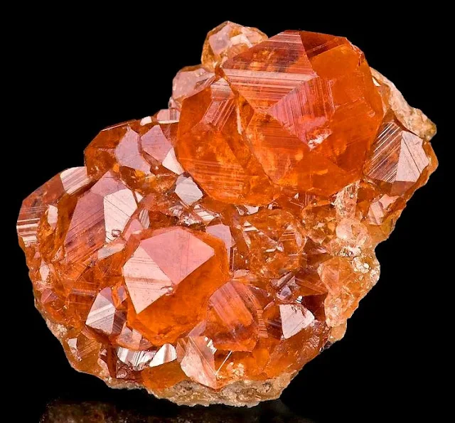
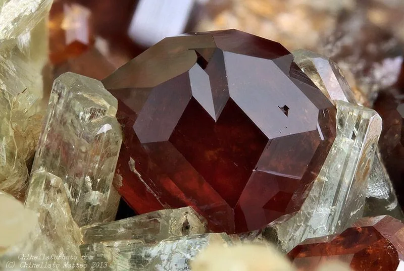
- Calcite Geodes: Calcite geodes are known for their formations of calcite crystals. The crystals inside these geodes can exhibit various colors, including white, yellow, orange, and brown. Calcite geodes are often found in limestone or dolomite formations and can be seen in regions such as Brazil, Mexico, and Morocco.
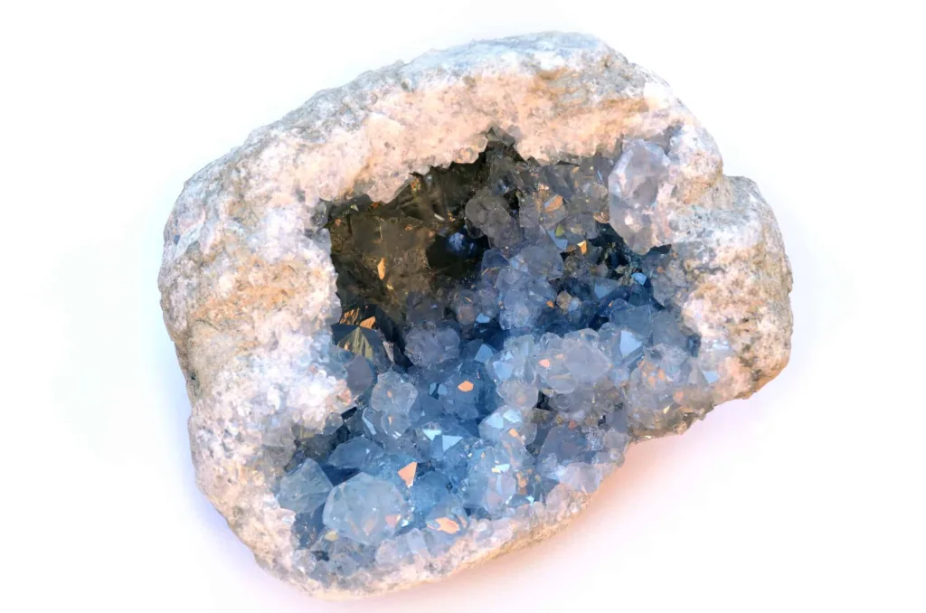
- Celestite Geodes: Celestite geodes are prized for their delicate, sky-blue crystals of the mineral celestite (strontium sulfate). These geodes often have well-formed, elongated crystals that create a visually stunning display. Celestite geodes are found in various locations worldwide, including Madagascar, Madagascar, and the United States.
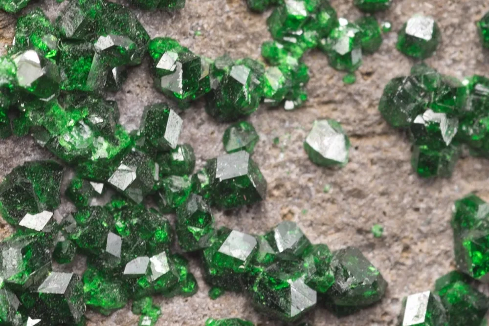
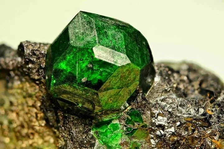
- Geodes with Multiple Minerals: Some geodes contain a variety of minerals within their cavities, resulting in a stunning array of colors and crystal formations. These geodes can feature combinations of quartz, amethyst, calcite, agate, celestite, and other minerals. They are highly sought after by collectors and can be found in various geode-producing regions.
It’s important to note that the availability of specific geode varieties can vary based on the geological regions where they are formed. Each variety of geode holds its own beauty and geological significance, making them a captivating subject of study and a source of fascination for collectors and enthusiasts.
Geode Locations
Geodes can be found in various locations around the world. The presence and abundance of geodes in a particular region depend on the geological conditions and the types of rocks present. Here are some notable locations known for their geode formations:
- Chihuahua, Mexico: The state of Chihuahua in Mexico is famous for its rich deposits of stunning geodes. The region near the town of Naica is particularly renowned for its large gypsum crystal geodes, including the famous Cave of Crystals.
- Rio Grande do Sul, Brazil: The state of Rio Grande do Sul in Brazil is a well-known source of amethyst geodes. The town of Ametista do Sul, in particular, is famous for its abundant amethyst mines and the production of high-quality amethyst geodes.
- Keokuk, Iowa, USA: Keokuk, Iowa, is a notable location for geode enthusiasts. The region along the Mississippi River is known for its geodes, which typically contain quartz and chalcedony crystals. The area hosts an annual Geode Fest, attracting collectors from around the world.
- Morocco: Morocco is renowned for its diverse range of minerals and geodes. The region near Erfoud is famous for its abundant geode deposits, including quartz and amethyst varieties. Moroccan geodes often display unique formations and colorful crystals.
- Uruguay: Uruguay is recognized for its amethyst geodes, particularly those found in the Artigas department. The country is a significant source of deep purple amethyst geodes with well-formed crystals.
- Southern Brazil: Besides amethyst, southern Brazil is known for its agate geodes. The state of Rio Grande do Sul, in particular, is famous for producing stunning agate geodes with colorful banding patterns.
- Madagascar: Madagascar is a treasure trove of unique geode formations. The region around Antsirabe is renowned for its geodes containing a variety of minerals, including amethyst, celestite, and agate.
- Australia: Several locations in Australia are known for their geodes. The Thunder Egg is the official state gem of Queensland and is a variety of agate-filled geode. Agate Creek, in northwestern Queensland, is a well-known area for collecting agate geodes.
- Uruguay: Uruguay is another significant producer of geodes, particularly those containing amethyst and agate. The town of Artigas in Uruguay is famous for its amethyst geode mines.
These are just a few examples of notable geode locations, but geodes can be found in various other regions worldwide. It’s worth noting that geodes can be discovered in diverse geological environments, including volcanic regions, sedimentary areas, and places where tectonic activity has occurred. Remember to respect local regulations and obtain proper permissions before collecting geodes from any location.
Geodes Uses and Applications
Geodes have several uses and applications that span across different fields. Here are some notable uses and applications of geodes:
- Collecting and Display: Geodes are highly sought after by collectors and enthusiasts due to their natural beauty and unique crystal formations. Many people collect geodes as a hobby, appreciating their aesthetic appeal and the variety of minerals they contain. Geodes make stunning display pieces, whether kept intact or cut open to showcase their crystal-lined cavities.
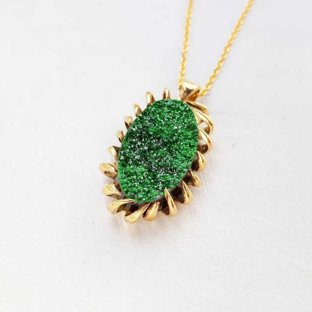
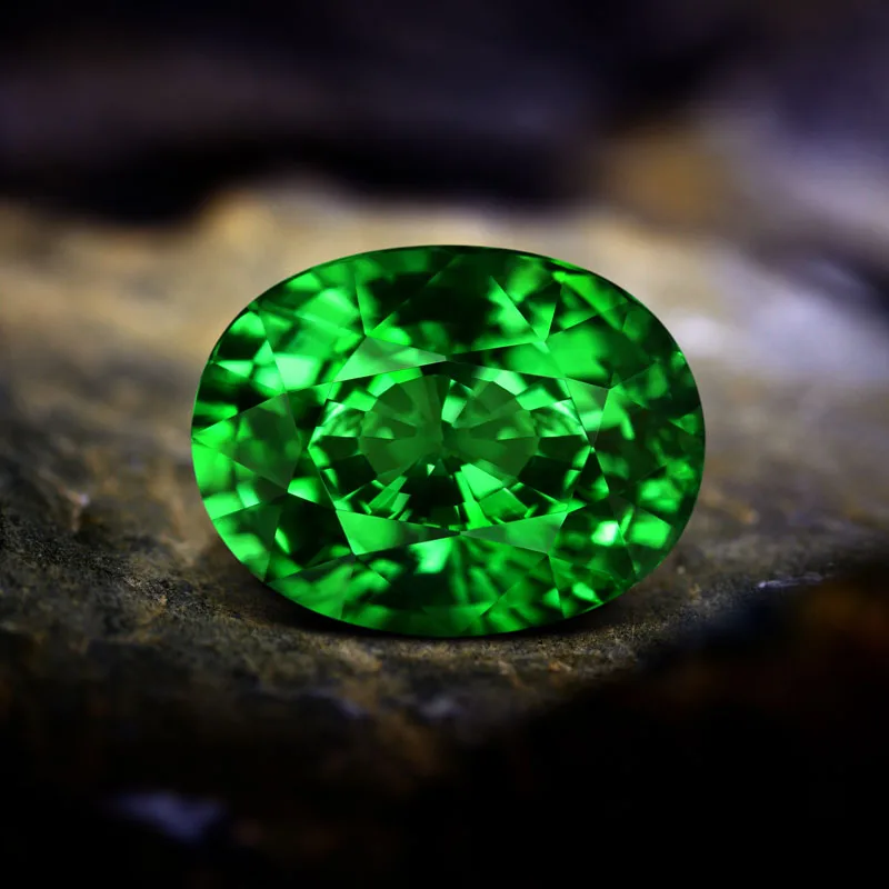
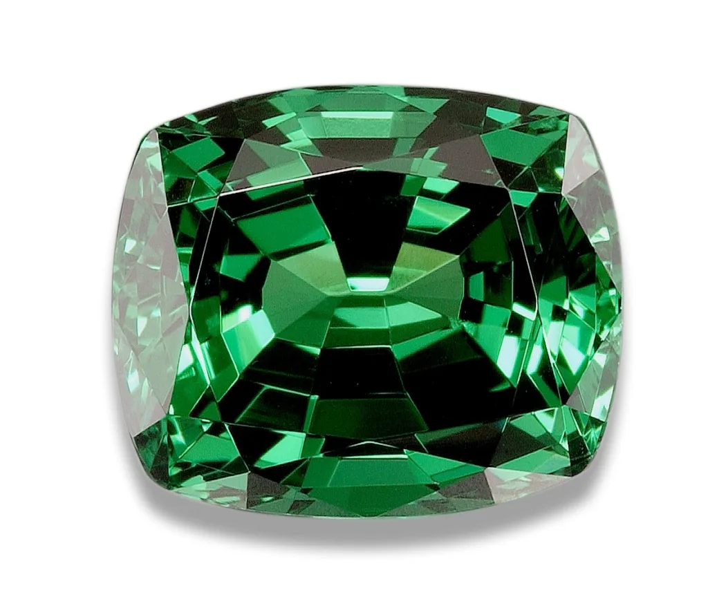
- Jewelry and Ornamental Objects: Geodes, particularly those with vibrant and well-formed crystals, are often used in the creation of jewelry and ornamental objects. Crystals extracted from geodes can be cut, polished, and set into various types of jewelry such as necklaces, pendants, rings, earrings, and bracelets. Geodes are also used to create decorative objects like bookends, paperweights, and home decor items.
- Education and Research: Geodes serve as valuable educational tools for geology students and researchers. By studying geodes, scientists gain insights into the geological processes that formed them, the mineral composition of specific regions, and the environmental conditions of the past. Geodes can also be used to demonstrate crystal growth patterns and the occurrence of different minerals within a confined space.
- Healing and Metaphysical Practices: In various healing and metaphysical practices, geodes are believed to possess certain energetic properties. Different types of geodes are associated with different healing properties and are used for energy balancing, meditation, and spiritual purposes. For example, amethyst geodes are often used for promoting relaxation, spiritual growth, and enhancing intuition.
- Decorative and Interior Design: Geodes add a touch of natural beauty and uniqueness to interior spaces. Large geodes or geode slices can be used as decorative elements, such as centerpieces, tabletop displays, or incorporated into wall art. Geode-inspired patterns and designs are also utilized in textiles, wallpapers, and other interior design applications.
- Geode Cutting and Lapidary: Geodes are commonly cut and polished to reveal their beautiful crystal formations. Lapidaries and gem cutters use specialized equipment and techniques to create flat slices or open the geodes in a controlled manner. The resulting pieces can be used for display, jewelry making, or lapidary art.
It’s important to note that while geodes have various applications, their natural beauty and geological significance are often the primary reasons for their value and appeal. Whether appreciated for their aesthetic qualities, utilized in scientific research, or incorporated into decorative and artistic endeavors, geodes continue to captivate and inspire people around the world.
Geodes Interesting Facts and Records

- Largest Geode: The “Pulpí Geode” holds the record for the world’s largest geode. Discovered in 1999 in Pilar de Jaravía, Spain, this enormous gypsum crystal geode measures about 11 meters (36 feet) in length and contains stunning transparent crystals.
- Crystal Cave: The Naica Cave in Chihuahua, Mexico, is home to the largest crystals ever found. Within this cave, known as the Cave of Crystals, enormous selenite crystals have been discovered, some reaching lengths of up to 12 meters (39 feet) and weighing several tons.
- Geological Time: Geodes often provide a glimpse into the Earth’s geological history. Some geodes are estimated to have formed millions or even hundreds of millions of years ago, offering insights into the geological conditions and processes that prevailed during those times.
- State Gemstones: Several U.S. states have designated geodes as their official state gemstones. For example, Iowa chose the geode as its state rock and established the “Geode State Park” to honor these unique formations.
- Geode Etymology: The word “geode” is derived from the Greek term “geoides,” which means “earthlike” or “resembling the Earth.” This name is fitting as geodes resemble ordinary rocks on the outside but contain magnificent crystal formations inside, reflecting the diverse beauty found in nature.
- Agate Bookends: Geodes are commonly used as bookends due to their natural shape and stability. These bookends not only hold books in place but also provide an aesthetically pleasing display of the geode’s interior when positioned on a bookshelf or desk.
- Hidden Treasures: Geodes often hold hidden treasures within their cavities. While cracking open a geode, collectors and enthusiasts can discover a variety of crystals, including quartz, amethyst, calcite, agate, and many other beautiful minerals.
- Geode Formation Time: The process of geode formation is slow and can take millions of years. It involves a combination of geological processes such as volcanic activity, sedimentation, mineral saturation, and crystallization, resulting in the formation of these stunning natural wonders.
- Geodes in Space: Geodes and similar formations have been discovered on other celestial bodies as well. Moon geodes and geode-like structures have been found on the Moon’s surface, adding to our understanding of the geology of extraterrestrial environments.
These fascinating facts and records highlight the incredible nature of geodes, their geological significance, and their impact on scientific exploration and appreciation of natural beauty.
Reference Lists
Certainly! Here are some reference lists that you can use to explore more information about geodes, their formation, locations, and other related topics:
Books:
- “Geodes: Nature’s Treasures” by Brad L. Cross
- “The World of Geodes: Inside and Out” by Patti Polk
- “Geodes: The First Book You Should Read” by Robert R. Carlson
- “Geodes: Nature’s Incredible Hidden Treasures” by A.E. Seaman
- “The Book of Crystal Geodes: The Natural Formation of Crystals” by P. Bissell, J. McNutt, and A. Smith
Websites:
- Mindat.org: A comprehensive online mineral database that provides information on geodes, their mineralogy, and locations. Website: https://www.mindat.org/
- Geode Gallery: A website dedicated to geode exploration and showcasing geodes from various locations around the world. Website: http://geodegallery.com/
- Geological Society of America (GSA): The GSA website offers resources, publications, and scientific articles related to geology, including geodes. Website: https://www.geosociety.org/
- Rockhounding Arkansas: An informative website focused on rockhounding in Arkansas, which is known for its abundant geode deposits. Website: http://rockhoundingar.com/
- The-Vug.com: An online platform featuring articles, forums, and a gallery of mineral specimens, including geodes. Website: http://www.the-vug.com/
Geology Journals and Publications:
- “Geology” – A scientific journal that publishes research papers on various geological topics, including geodes. Website: https://pubs.geoscienceworld.org/geology
- “American Mineralogist” – A peer-reviewed journal that covers the study of minerals, crystals, and their formations, including geodes. Website: https://pubs.geoscienceworld.org/ammin
- “The Mineralogical Record” – A publication dedicated to mineralogy, featuring articles and information about geodes and other mineral specimens. Website: https://mineralogicalrecord.com/


:max_bytes(150000):strip_icc()/GettyImages-846770942-5b473114c9e77c0037e29e0e.jpg)