")


Magnetic Surveys

Magnetic surveys are a geophysical exploration technique used to measure and map variations in the Earth’s magnetic field. The Earth’s magnetic field is not uniform, and changes in the magnetic properties of subsurface materials can influence the overall field. By measuring these variations, scientists and researchers can gather valuable information about the underlying geological structures and properties of the Earth’s crust. The primary purpose of magnetic surveys is to identify and delineate subsurface features that exhibit distinct magnetic signatures.
Historical Context and Development of Magnetic Survey Techniques: The history of magnetic surveys dates back to the mid-19th century when scientists began to recognize the Earth’s magnetic anomalies. Early instruments, such as the magnetometer, were used to measure the intensity of the magnetic field. Over time, advancements in technology led to the development of more sophisticated instruments like the proton precession magnetometer and the fluxgate magnetometer, which provided higher precision and sensitivity.
In the mid-20th century, the advent of airborne magnetic surveys revolutionized the field. Airborne surveys allowed for large-scale and rapid data acquisition over vast areas, making magnetic exploration more efficient. Today, satellite-based magnetic surveys further enhance our ability to collect data on a global scale.
Applications in Different Fields:
- Geology:
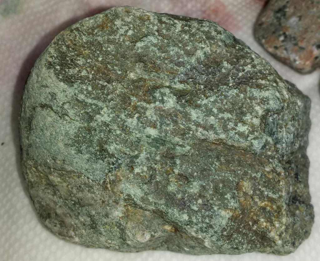
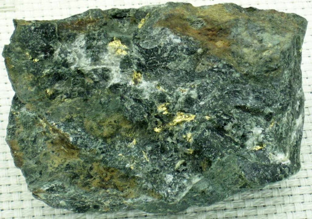
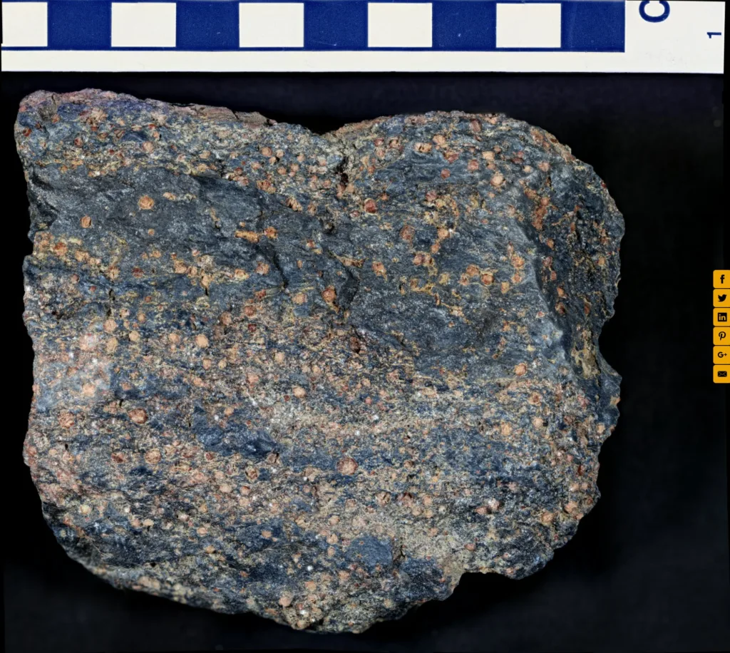
- Mineral Exploration: Magnetic surveys are extensively used in mineral exploration to identify ore bodies, as certain minerals can significantly affect the magnetic field.
- Crustal Studies: Geologists utilize magnetic surveys to study the Earth’s crust, map geological structures, and understand tectonic processes.
- Archaeology:
- Site Prospection: Magnetic surveys aid archaeologists in locating buried structures, artifacts, and ancient features with distinct magnetic properties.
- Cultural Heritage: Identifying buried magnetic anomalies helps preserve cultural heritage sites by providing information without invasive excavation.
- Environmental Studies:
- Groundwater Exploration: Magnetic surveys can help locate subsurface geological formations related to groundwater resources.
- Environmental Impact Assessments: Assessing the impact of human activities on the environment, such as identifying buried waste or monitoring changes in subsurface conditions.
- Oil and Gas Exploration:
- Identification of Sedimentary Basins: Magnetic surveys are used to map sedimentary basins, aiding in the exploration and extraction of oil and gas resources.
- Volcano and Earthquake Studies:
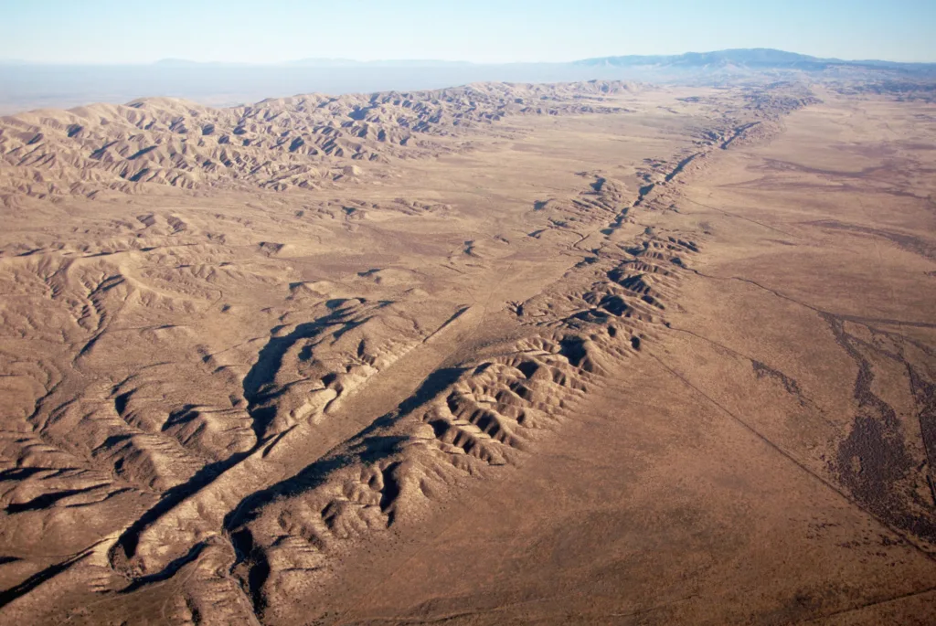
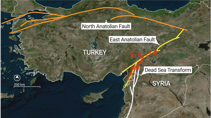
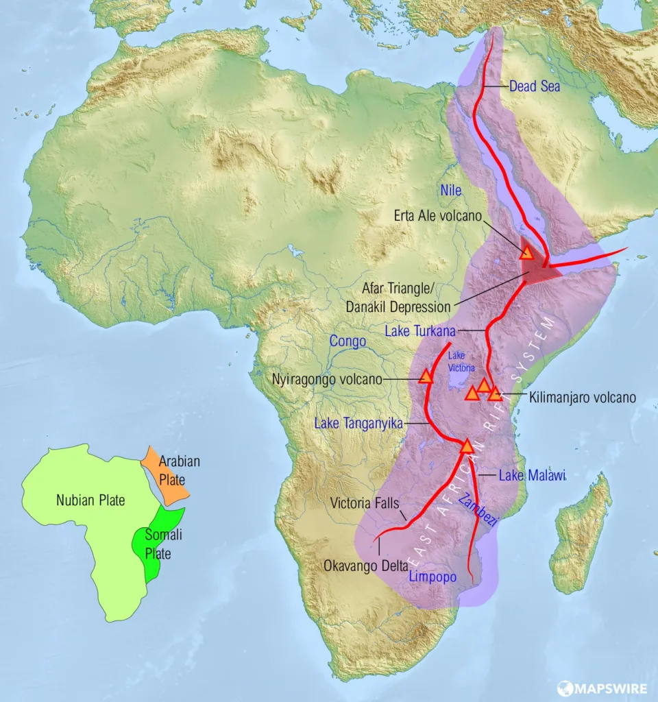
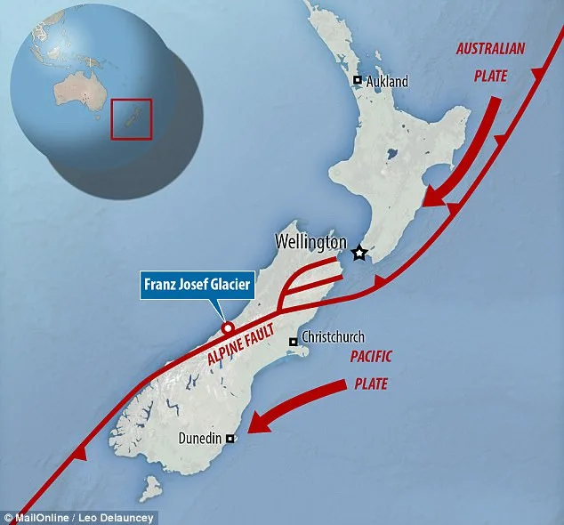
- Crustal Dynamics: Magnetic surveys contribute to understanding the geological structure of volcanic and seismically active regions, providing insights into subsurface magma chambers and fault systems.
- Navigation and Defense:
- Navigation: Magnetic surveys assist in magnetic navigation, as the Earth’s magnetic field is utilized in compass-based navigation.
- Military Applications: Magnetic surveys have applications in defense, including detecting submarines and mapping magnetic anomalies for military planning.
In conclusion, magnetic surveys have evolved into a versatile and indispensable tool in various scientific and applied fields, offering valuable insights into the Earth’s subsurface and contributing to advancements in exploration, environmental studies, and archaeological research.
Basic Principles of Magnetism
- Magnetic Properties of Materials:
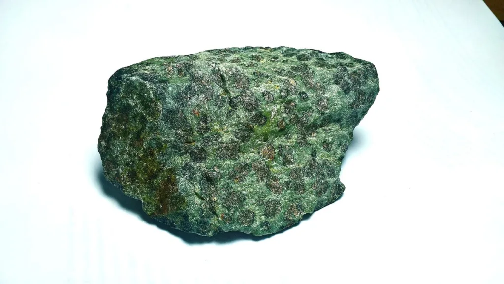
- Ferromagnetism: Materials like iron, nickel, and cobalt exhibit ferromagnetism. In these materials, atomic magnetic moments align parallel to each other, creating a strong magnetic field within the material.
- Paramagnetism: Materials with unpaired electrons, such as aluminum and platinum, show paramagnetic behavior. They become weakly magnetized when subjected to an external magnetic field.
- Diamagnetism: Materials like copper and bismuth are diamagnetic, meaning they are repelled by a magnetic field. Diamagnetism occurs due to the induced magnetic moments opposing the external field.
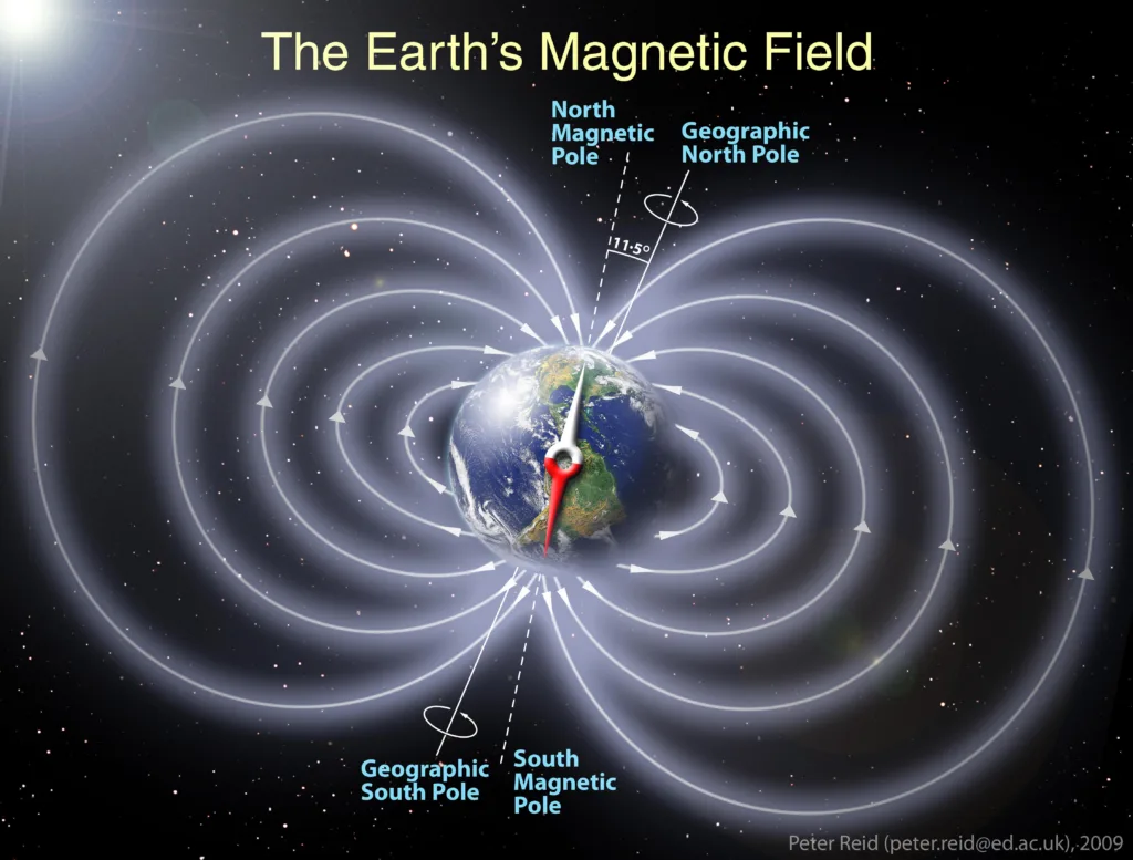
- Earth’s Magnetic Field and Its Variations:
- The Earth acts like a giant magnet with a north and south magnetic pole.
- The geomagnetic field is not uniform and varies across the Earth’s surface.
- The magnetic field lines are not aligned with the geographic axis, resulting in magnetic declination (the angle between magnetic north and true north) and magnetic inclination (the angle between the magnetic field lines and the horizontal plane).
- Magnetic Anomalies and Their Significance:
- Definition: A magnetic anomaly is a deviation from the expected or background magnetic field strength in a particular location.
- Causes:
- Geological Structures: Variations in rock types and structures can lead to differences in magnetic properties, causing anomalies.
- Mineral Deposits: Certain minerals, especially those with high magnetic susceptibility, can create local magnetic anomalies.
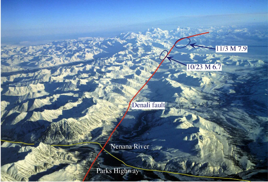
- Tectonic Activity: Earth’s crustal movements, such as faulting or folding, can result in magnetic anomalies.
- Human Activities: Anthropogenic factors like buried metal objects or construction can introduce magnetic anomalies.
- Measurement Techniques:
- Magnetometers: Instruments like proton precession magnetometers or fluxgate magnetometers measure the strength and direction of the magnetic field at a specific location.
- Aerial and Satellite Surveys: Airborne and satellite-based magnetic surveys provide large-scale coverage and help identify regional magnetic anomalies.
- Significance:
- Mineral Exploration: Magnetic anomalies are crucial in identifying potential mineral deposits due to the association of certain minerals with distinctive magnetic signatures.
- Oil and Gas Exploration: Magnetic surveys aid in mapping sedimentary basins, helping locate potential hydrocarbon resources.
- Geological Studies: Magnetic anomalies provide insights into the Earth’s crustal structure, aiding in the understanding of tectonic processes and regional geology.
- Archaeological Prospection: Locating buried structures and artifacts through magnetic anomalies contributes to archaeological research.
Understanding and interpreting magnetic anomalies play a pivotal role in various scientific disciplines, contributing to advancements in geophysics, mineral exploration, environmental studies, and archaeology.
Instrumentation and Equipment in Magnetic Surveys

- Magnetometers:
- Fluxgate Magnetometer:
- Principle: Measures magnetic field strength by detecting changes in the magnetic properties of materials as they are exposed to an external field.
- Applications: Used in ground-based, marine, and airborne magnetic surveys due to its sensitivity and precision.
- Proton Precession Magnetometer:
- Principle: Utilizes the precession of protons in a magnetic field to measure the Earth’s magnetic field strength.
- Applications: Common in ground-based surveys for its high accuracy, especially in mineral exploration.
- Cesium Vapor Magnetometer:
- Principle: Employs the magnetic resonance of cesium atoms to measure magnetic field strength.
- Applications: Used in both ground-based and airborne surveys, offering high sensitivity and fast response.
- Overhauser Magnetometer:
- Principle: Based on the Overhauser effect, where the nuclear magnetic resonance of protons is enhanced by free radicals.
- Applications: Known for its low noise and is suitable for ground-based surveys.
- SQUID Magnetometer (Superconducting Quantum Interference Device):
- Principle: Utilizes the quantum properties of superconducting materials to measure extremely weak magnetic fields.
- Applications: Used in specialized applications requiring ultra-high sensitivity, such as biomagnetic measurements.
- Fluxgate Magnetometer:

- Gradiometers:
- Scalar Gradiometer:
- Principle: Measures the spatial variation in the magnetic field strength between two closely spaced sensors.
- Applications: Enhances resolution in detecting small magnetic anomalies, commonly used in archaeological and environmental studies.
- Tensor Gradiometer:
- Principle: Measures both the gradient and the direction of the magnetic field vector.
- Applications: Provides detailed information on the three components of the magnetic field, useful in mineral exploration and geological mapping.
- Scalar Gradiometer:
- GPS (Global Positioning System) and Data Acquisition Systems:
- GPS:
- Purpose: Provides accurate positioning information, allowing for precise location referencing during surveys.
- Applications: Essential for ground-based, airborne, and satellite-based magnetic surveys, ensuring accurate spatial data.
- Data Acquisition Systems:
- Purpose: Record, store, and process magnetic field data collected during surveys.
- Components: Include data loggers, computers, and software for real-time monitoring and post-processing of magnetic data.
- Applications: Integral in ground-based and airborne surveys, facilitating the collection of high-quality magnetic data for analysis.
- GPS:
In magnetic surveys, the selection of instrumentation depends on the specific objectives, the environment of the survey (land, marine, airborne), and the desired level of sensitivity and accuracy. Advances in technology continue to refine these instruments, enhancing their capabilities and expanding their applications across various scientific and applied fields.
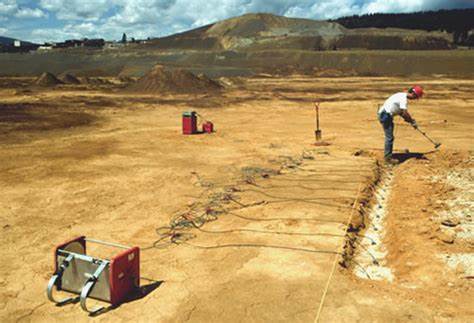
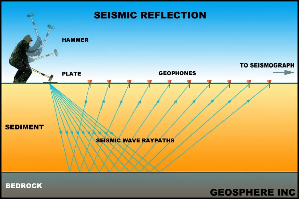
Data Collection Techniques in Magnetic Surveys:
Ground-Based Surveys vs. Airborne Surveys
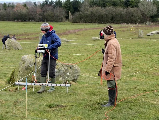
- Ground-Based Surveys:
- Methodology: Involves collecting magnetic data while stationed on the Earth’s surface.
- Advantages:
- High resolution for detailed investigations.
- Direct access to the survey area for instrument calibration and maintenance.
- Limitations:
- Time-consuming for large areas.
- Challenging in remote or inaccessible terrains.
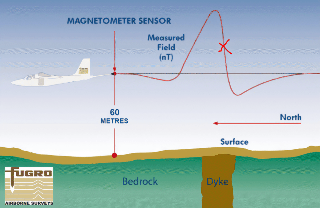
- Airborne Surveys:
- Methodology: Magnetic sensors are mounted on aircraft to collect data over large areas.
- Advantages:
- Rapid coverage of extensive areas.
- Suitable for remote or inaccessible regions.
- Limitations:
- Lower resolution compared to ground-based surveys.
- Limited ability to perform detailed investigations.
Survey Design and Planning:
- Grid Design:
- Purpose: Define the layout of measurement points to cover the survey area systematically.
- Considerations: Grid spacing depends on the desired resolution and the characteristics of the geological features being investigated.
- Line Spacing:
- Purpose: Determine the distance between parallel measurement lines.
- Considerations: Influenced by the target size and expected geological features; smaller line spacing provides higher resolution.
- Orientation:
- Purpose: Decide the direction of survey lines concerning the geological or magnetic features of interest.
- Considerations: Align survey lines to maximize information about the target and reduce noise.
- Altitude (Airborne Surveys):
- Purpose: Determine the flight altitude of the aircraft carrying the magnetometer.
- Considerations: Balancing the need for higher-altitude coverage and the desire for increased resolution at lower altitudes.
- Base Station Locations:
- Purpose: Establish reference points with known magnetic values for instrument calibration.
- Considerations: Base stations should be strategically placed to account for local magnetic variations.
Data Acquisition Parameters:
- Sampling Rate:
- Definition: The rate at which magnetic field measurements are recorded.
- Considerations: Higher sampling rates provide more detailed data but may increase data storage requirements.
- Line Spacing:
- Definition: The distance between measurement lines in ground-based surveys.
- Considerations: Smaller line spacing enhances resolution but may increase survey time and data processing requirements.
- Flight Line Spacing (Airborne Surveys):
- Definition: The lateral distance between adjacent flight lines.
- Considerations: Balancing the need for coverage with the desire for high-resolution data.
- Sensor Elevation (Airborne Surveys):
- Definition: The vertical distance between the magnetometer sensor and the Earth’s surface.
- Considerations: Influences the detection sensitivity; lower sensor elevation improves resolution but may increase the risk of terrain interference.
- Data Quality Control:
- Definition: Procedures to ensure the reliability and accuracy of collected data.
- Considerations: Regular checks for instrument calibration, noise levels, and systematic errors.
Successful survey design and planning involve a careful balance between the desired resolution, the nature of the geological features under investigation, and practical considerations such as time, budget, and accessibility. Optimizing data acquisition parameters ensures the collection of high-quality magnetic data for accurate interpretation and analysis.
Data Processing and Analysis in Magnetic Surveys

1. Data Correction:
- Diurnal Variations:
- Issue: Magnetic field variations due to daily changes, especially the influence of the Sun.
- Correction: Subtracting the expected diurnal variation based on time and location.
- Latitude Variations:
- Issue: Magnetic field strength varies with latitude.
- Correction: Applying corrections to account for the latitude-dependent component of the Earth’s magnetic field.
- External Interference:
- Issue: Noise from external sources, such as power lines or cultural features.
- Correction: Identifying and removing or mitigating interference through filtering techniques.
2. Filtering and Gridding Techniques:
- Trend Removal:
- Purpose: Eliminate long-wavelength variations in the magnetic field.
- Technique: Applying a high-pass filter to highlight short-wavelength anomalies.
- Digital Filtering:
- Purpose: Enhance or isolate specific frequencies in the magnetic data.
- Technique: Using filters (e.g., low-pass, high-pass, band-pass) to emphasize desired features.
- Upward and Downward Continuation:
- Purpose: Adjusting data at different altitudes to enhance features or reduce noise.
- Technique: Mathematically shifting data to simulate measurements at higher or lower altitudes.
- Gridding:
- Purpose: Interpolate data points to create a continuous surface.
- Technique: Various algorithms like kriging or splines are used to generate gridded magnetic data for easier visualization and analysis.
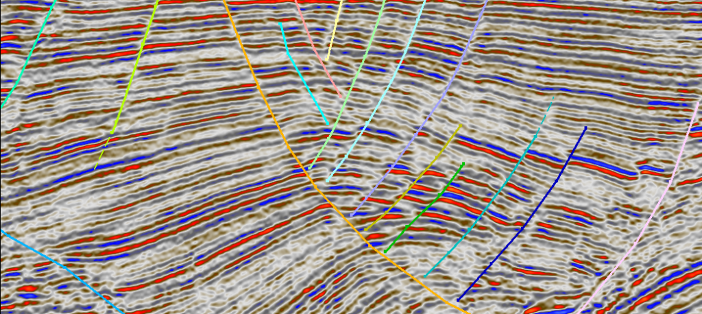
3. Interpretation of Magnetic Anomalies:
- Visual Inspection:
- Method: Examining magnetic anomaly maps for patterns and trends.
- Interpretation: Identifying spatial relationships, trends, and anomalies that correlate with geological features.
- Depth Estimation:
- Method: Inverting magnetic data to estimate the depth of magnetic sources.
- Interpretation: Understanding the depth and geometry of subsurface structures contributing to magnetic anomalies.
- Source Characterization:
- Method: Analyzing anomaly shapes and amplitudes.
- Interpretation: Distinguishing between different geological or man-made sources based on magnetic signature characteristics.
- Integration with Other Data:
- Method: Combining magnetic data with other geophysical, geological, or environmental data.
- Interpretation: Enhancing the understanding of subsurface features by integrating multiple datasets.
- Forward Modeling:
- Method: Simulating magnetic responses based on hypothetical geological structures.
- Interpretation: Testing different geological models to match observed magnetic anomalies.
- Quantitative Inversion:
- Method: Mathematically inverting magnetic data to obtain quantitative information about subsurface properties.
- Interpretation: Providing more detailed insights into the physical properties of geological structures.
Interpreting magnetic anomalies involves a combination of quantitative analysis, geological knowledge, and consideration of the survey’s objectives. Correcting for various external influences and applying appropriate filtering techniques are crucial steps to enhance the accuracy and reliability of the final interpretations.
Interpretation and Mapping in Magnetic Surveys
1. Identifying Magnetic Anomalies and Their Characteristics:
- Visual Inspection:
- Process: Examining magnetic anomaly maps to identify areas of deviation from the background magnetic field.
- Characteristics: Anomalies may appear as highs or lows in the magnetic field, with varying shapes, sizes, and amplitudes.
- Gradient Analysis:
- Process: Analyzing the gradients of magnetic data to highlight boundaries and enhance anomaly edges.
- Characteristics: Gradient maps can reveal sharper contrasts in magnetic properties, aiding in the delineation of geological structures.
- Statistical Analysis:
- Process: Applying statistical methods to identify anomalies based on threshold values.
- Characteristics: Statistical parameters such as standard deviation or anomaly amplitude can be used to define and categorize anomalies.
2. Correlation with Geological Features:
- Geological Mapping:
- Process: Overlaying magnetic anomaly maps onto geological maps for spatial correlation.
- Correlation: Matching anomalies with known geological formations helps interpret the subsurface geology.
- Lithological Studies:
- Process: Correlating magnetic anomalies with surface lithology to infer subsurface rock types.
- Correlation: Certain minerals associated with magnetic anomalies can indicate specific lithological units.
- Structural Geology:
- Mineralogy Analysis:
- Process: Analyzing magnetic anomalies for associations with mineral deposits.
- Correlation: Magnetic surveys can assist in locating ore bodies or mineralized zones based on distinct magnetic signatures.
3. 3D Modeling of Subsurface Structures:
- Depth Estimation:
- Process: Using mathematical models or inversion techniques to estimate the depth of magnetic sources.
- Modeling: Creating depth profiles to visualize how magnetic anomalies relate to subsurface structures.
- Forward Modeling:
- Process: Simulating magnetic responses based on hypothetical geological structures.
- Modeling: Testing different geological models to match observed magnetic anomalies, aiding in understanding subsurface geometry.
- Inversion Techniques:
- Process: Mathematically inverting magnetic data to obtain quantitative information about subsurface properties.
- Modeling: Generating 3D models that represent the distribution of magnetic susceptibility or other physical properties.
- Integration with Other Geophysical Data:
- Process: Combining magnetic data with data from other geophysical methods (e.g., seismic, gravity) for comprehensive 3D modeling.
- Modeling: Building more accurate representations of subsurface structures by integrating multiple datasets.
- Visualization Techniques:
- Process: Using advanced visualization tools to represent 3D models of subsurface structures.
- Modeling: Enhancing the interpretation and communication of complex geological features.
Interpretation and mapping in magnetic surveys involve a multidisciplinary approach, integrating geological knowledge, statistical analysis, and advanced modeling techniques. The correlation of magnetic anomalies with geological features and the development of 3D models contribute to a comprehensive understanding of the subsurface environment.