")


Ore Minerals

Ore minerals are naturally occurring minerals that contain valuable elements or minerals in sufficient quantities to be economically mined and processed for their desired metal or mineral content. These minerals are typically extracted from the Earth’s crust and processed to obtain the valuable elements or minerals for various industrial, manufacturing, and commercial purposes. Ore minerals are the source of most of the world’s metals and minerals, which are critical for modern society and economic development.
The definition of ore minerals can vary depending on the specific context and industry. In general, for a mineral to be considered an ore mineral, it should meet the following criteria:
- Economic Value: The mineral should contain valuable elements or minerals that are in demand in the market and have sufficient economic value to justify the costs of extraction, processing, and transportation.
- Concentration: The valuable elements or minerals should be present in sufficient concentrations or grades within the mineral deposit to make mining and processing economically feasible.
- Extractability: The valuable elements or minerals should be extractable using existing mining and processing technologies and methods.
- Geological Occurrence: The mineral should occur in a geological setting or deposit that is suitable for mining and extraction, such as in accessible locations and in quantities that can be economically recovered.
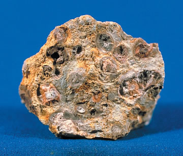
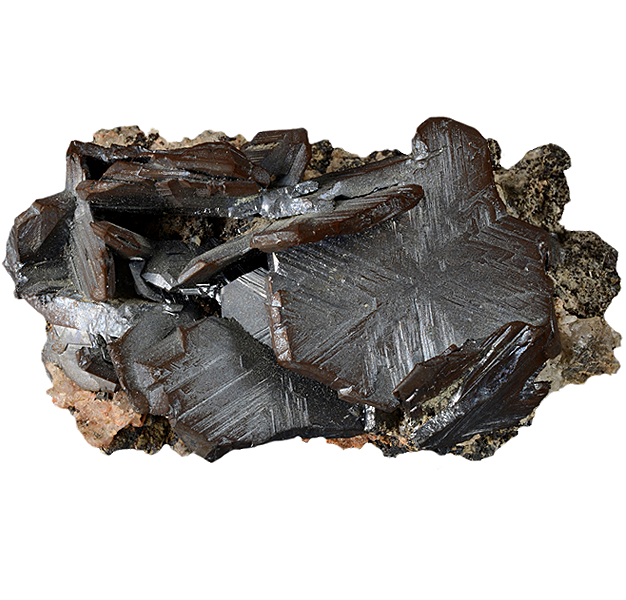
Manganese ore – psilomelane (size: 6.7 × 5.8 × 5.1 cm)
It’s important to note that not all minerals in the Earth’s crust are considered ore minerals. Many minerals may contain valuable elements or minerals, but if their concentrations are too low or the costs of extraction are too high, they may not be considered economically viable as ore minerals.
Ore minerals are typically associated with specific types of geological deposits, such as magmatic deposits, hydrothermal deposits, sedimentary deposits, or placer deposits. The type of ore deposit and the associated ore minerals can vary widely depending on the geology and mineralization processes involved, and different ore minerals may have different physical, chemical, and mineralogical properties. Understanding the characteristics and properties of ore minerals is crucial in the exploration, evaluation, and extraction of mineral resources from the Earth’s crust.

Importance of ore minerals in society and the global economy
Ore minerals play a crucial role in society and the global economy for several reasons:
- Metal and mineral production: Ore minerals are the primary source of most of the world’s metals and minerals, which are essential for modern society and economic development. Metals such as iron, copper, aluminum, gold, silver, and platinum are used in various industries, including construction, manufacturing, transportation, electronics, energy production, and many others. Minerals such as phosphates, potash, and sulfur are vital for agriculture and fertilizer production. Without ore minerals, many industries and sectors of the global economy would be severely impacted or unable to function.
- Job creation and economic growth: The mining and processing of ore minerals contribute to the creation of employment opportunities and economic growth in many regions around the world. Mining operations require a workforce for exploration, extraction, processing, transportation, and other activities, providing jobs and livelihoods to millions of people. Additionally, the revenue generated from the extraction and sale of ore minerals contributes to local, national, and global economies through taxes, royalties, and export earnings.
- Supply chain for manufacturing and production: Ore minerals are a critical component of the global supply chain for manufacturing and production. Many industries rely on a stable and reliable supply of ore minerals to produce goods and products. For example, the automotive industry relies on metals such as steel, aluminum, and copper for vehicle manufacturing, while the electronics industry relies on metals like gold, silver, and rare earth elements for the production of electronic devices. Any disruption in the supply of ore minerals can have significant impacts on global manufacturing and production processes.
- Infrastructure development: Ore minerals are essential for building infrastructure, such as roads, bridges, buildings, and other structures. Metals like steel and aluminum are used extensively in construction and infrastructure development, while minerals like cement, gypsum, and aggregates are critical for concrete production. Ore minerals are thus fundamental to the development and expansion of modern infrastructure, which is crucial for economic growth and societal well-being.
- Technological innovation: Many technological advancements and innovations depend on the availability of ore minerals. For example, renewable energy technologies such as solar panels and wind turbines require metals like silicon, silver, and rare earth elements. Advanced technologies in electronics, telecommunications, aerospace, and defense industries also rely on a stable supply of ore minerals for their production. The availability of ore minerals is therefore vital for driving technological innovation and advancements in various sectors.
In summary, ore minerals are of paramount importance in society and the global economy due to their critical role in metal and mineral production, job creation and economic growth, supply chain for manufacturing and production, infrastructure development, and technological innovation. They are essential for modern society’s functioning and economic development, and ensuring their sustainable and responsible extraction and use is crucial for the continued well-being and progress of humanity.
Basic characteristics and properties of ore minerals
Ore minerals exhibit various characteristics and properties that make them suitable for economic extraction and processing. Some of the basic characteristics and properties of ore minerals include:
- Chemical composition: Ore minerals typically have a specific chemical composition that distinguishes them from other minerals. They often contain high concentrations of valuable elements or minerals that are economically significant, such as metals like iron, copper, gold, silver, and others. The chemical composition of ore minerals determines their physical and chemical properties, including their density, hardness, melting point, and reactivity.
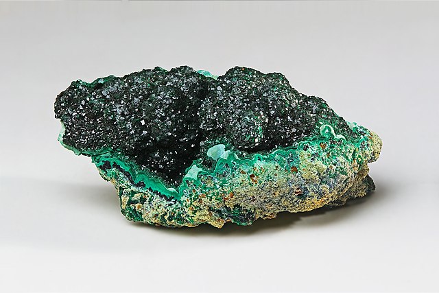
- Mineralogical properties: Ore minerals can have specific mineralogical properties, such as crystal structure, mineral habit, and color, that are indicative of their identity and economic value. For example, gold often occurs as nuggets or flakes, while copper typically forms sulfide minerals like chalcopyrite or oxide minerals like malachite. Understanding the mineralogical properties of ore minerals is crucial in their identification and characterization.
- Ore grade: The ore grade refers to the concentration or abundance of valuable elements or minerals in the ore deposit. High-grade ores contain a relatively high percentage of valuable elements or minerals, while low-grade ores have lower concentrations. Ore grade is an important factor in determining the economic viability of mining and processing operations, as higher-grade ores are typically more economically attractive for extraction.
- Physical properties: Ore minerals can exhibit various physical properties, such as density, hardness, and color, that influence their extraction and processing. For example, ores with high density and hardness may require more energy-intensive processes for extraction, while ores with specific colors may indicate the presence of certain minerals or impurities that can affect the processing methods used.
- Association with host rocks: Ore minerals are often associated with specific types of host rocks or geological formations. The type of host rock can influence the mode of occurrence, distribution, and extraction of ore minerals. For example, ore minerals in igneous rocks may have different characteristics compared to those in sedimentary or metamorphic rocks, and the physical and chemical properties of the host rock can affect the processing methods used for ore extraction.
- Occurrence in mineral deposits: Ore minerals are typically found in specific types of mineral deposits, such as magmatic, hydrothermal, sedimentary, or placer deposits. The type of mineral deposit can affect the characteristics and properties of ore minerals, including their mode of occurrence, distribution, and geological setting. Understanding the characteristics of different types of mineral deposits is important in the exploration and evaluation of ore resources.
- Economic value: The economic value of ore minerals is a critical characteristic that determines their significance as potential sources of valuable elements or minerals. The economic value of ore minerals is influenced by various factors, including market demand, global commodity prices, extraction and processing costs, and environmental and social considerations.
Understanding the basic characteristics and properties of ore minerals is essential in the exploration, evaluation, and extraction of mineral resources. It helps in identifying and characterizing ore minerals, assessing their economic viability, and determining the appropriate extraction and processing methods for their utilization.
Classification of ore minerals
Ore minerals can be classified based on various criteria, including their chemical composition, mineralogical properties, mode of occurrence, and geological setting. Here are some common classifications of ore minerals:
- Metallic ore minerals: Metallic ore minerals are those that contain valuable metals, such as iron, copper, gold, silver, lead, zinc, and others. They are typically classified based on the type of metal they contain. For example, copper ores may include chalcopyrite, bornite, and malachite, while iron ores may include hematite, magnetite, and goethite.
- Non-metallic ore minerals: Non-metallic ore minerals are those that do not contain valuable metals but are still economically important due to their industrial uses. Examples of non-metallic ore minerals include limestone, gypsum, talc, graphite, and potash. They are often used in various industrial applications, such as construction, agriculture, chemicals, and ceramics.
- Sulfide ore minerals: Sulfide ore minerals are those that contain sulfur as a significant component. They are commonly associated with hydrothermal and magmatic deposits and often contain valuable metals, such as copper, lead, zinc, and nickel. Examples of sulfide ore minerals include chalcopyrite, galena, sphalerite, and pyrite.
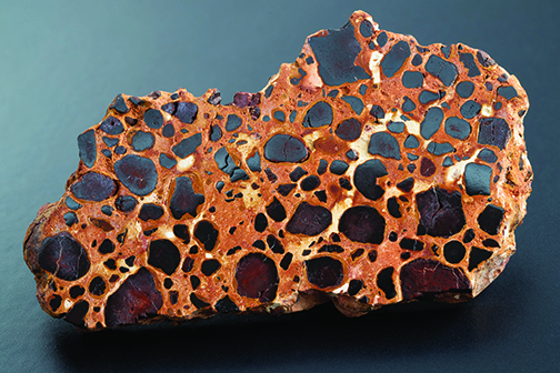
- Oxide ore minerals: Oxide ore minerals are those that contain oxygen as a significant component. They can be formed through weathering and alteration of other minerals and are commonly found in oxidized ore deposits. Examples of oxide ore minerals include hematite, magnetite, cassiterite, and bauxite.
- Carbonate ore minerals: Carbonate ore minerals are those that contain carbonate (CO3) as a significant component. They are commonly associated with sedimentary deposits, such as limestone, and often contain valuable metals, such as lead, zinc, and copper. Examples of carbonate ore minerals include cerussite, malachite, and smithsonite.
- Native ore minerals: Native ore minerals are those that occur in nature in a pure, uncombined form. They are relatively rare but can be economically important due to their high concentration of valuable elements. Examples of native ore minerals include native gold, native copper, and native silver.
- Residual ore minerals: Residual ore minerals are those that remain after the weathering and erosion of surrounding rocks, leaving behind concentrated deposits of valuable minerals. They are commonly found in placer deposits, which are accumulations of heavy minerals, such as gold, tin, and platinum, in riverbeds or sedimentary basins.
- Skarn ore minerals: Skarn ore minerals are those that form in contact metamorphic environments, where hot fluids from intruding igneous rocks react with the surrounding host rocks, leading to the formation of economically significant mineral deposits. Skarn ore minerals can include a variety of minerals, such as garnet, pyroxene, and tungsten minerals.
- Sedimentary ore minerals: Sedimentary ore minerals are those that form in sedimentary environments, such as marine or lacustrine (lake) settings. They can include a wide range of minerals, such as phosphates, carbonates, and sulfates, and are often associated with rock formations, such as evaporites, that precipitate from concentrated solutions.
These are just some examples of the different ways ore minerals can be classified. The classification of ore minerals can be complex and may vary depending on the specific criteria or context used for classification. Understanding the classification of ore minerals is important in the exploration, evaluation, and extraction of mineral resources, as it helps in identifying and characterizing different types of ore deposits and selecting appropriate extraction and processing methods.
Classification based on composition
Ore minerals can also be classified based on their chemical composition. Here are some common classifications based on composition:
- Sulfide ore minerals: Sulfide ore minerals are those that contain sulfur as a significant component. They are typically found in hydrothermal and magmatic deposits and often contain valuable metals, such as copper, lead, zinc, nickel, and others. Examples of sulfide ore minerals include chalcopyrite (CuFeS2), galena (PbS), sphalerite (ZnS), and pyrite (FeS2).
- Oxide ore minerals: Oxide ore minerals are those that contain oxygen as a significant component. They can form through weathering and alteration of other minerals and are commonly found in oxidized ore deposits. Examples of oxide ore minerals include hematite (Fe2O3), magnetite (Fe3O4), cassiterite (SnO2), and bauxite (Al2O3·nH2O).
- Carbonate ore minerals: Carbonate ore minerals are those that contain carbonate (CO3) as a significant component. They are commonly associated with sedimentary deposits, such as limestone, and often contain valuable metals, such as lead, zinc, and copper. Examples of carbonate ore minerals include cerussite (PbCO3), malachite (Cu2CO3(OH)2), and smithsonite (ZnCO3).
- Sulfate ore minerals: Sulfate ore minerals are those that contain sulfate (SO4) as a significant component. They are commonly found in evaporite deposits and can contain valuable metals, such as barite (BaSO4) and gypsum (CaSO4·2H2O).
- Phosphate ore minerals: Phosphate ore minerals are those that contain phosphate (PO4) as a significant component. They are commonly found in sedimentary deposits and are important as a source of phosphorus for fertilizers. Examples of phosphate ore minerals include apatite (Ca5(PO4)3(F,Cl,OH)) and monazite ((Ce,La,Nd,Th)PO4).
- Native elements: Native elements are ore minerals that occur in nature in a pure, uncombined form. They can include valuable metals, such as native gold (Au), native silver (Ag), and native copper (Cu).
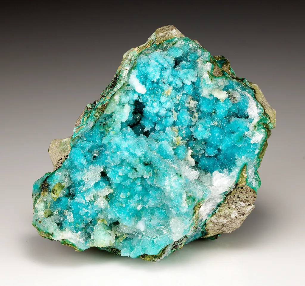
- Silicate ore minerals: Silicate ore minerals are those that contain silicate (SiO4) as a significant component. They are commonly found in various types of ore deposits, such as porphyry copper deposits and skarn deposits, and can contain valuable metals, such as copper, iron, and rare earth elements. Examples of silicate ore minerals include chrysocolla (CuSiO3·2H2O), garnet ((Mg,Fe,Ca,Mn)3(Al,Fe)2(SiO4)3), and feldspar ((K,Na,Ca)(Al,Si)4O8).
These are some common classifications of ore minerals based on their chemical composition. The composition of ore minerals is important in understanding their properties, behavior, and potential uses, as it affects their physical and chemical characteristics, as well as their economic value.
Classification based on mode of occurrence
Ore minerals can also be classified based on their mode of occurrence, which refers to the geological setting in which they are found. Here are some common classifications based on the mode of occurrence:
- Hydrothermal ore minerals: Hydrothermal ore minerals are formed by the precipitation of mineral-rich fluids from hot, aqueous solutions that are typically associated with volcanic or magmatic activity. These fluids can deposit minerals in fractures, veins, and other openings in the rocks. Examples of hydrothermal ore minerals include quartz (SiO2), fluorite (CaF2), and cassiterite (SnO2).
- Magmatic ore minerals: Magmatic ore minerals are formed during the cooling and crystallization of magma, which is molten rock that solidifies beneath the Earth’s surface. As the magma cools, certain minerals can crystallize and separate from the remaining liquid, forming ore deposits. Examples of magmatic ore minerals include chromite (FeCr2O4), magnetite (Fe3O4), and platinum group elements (e.g., platinum, palladium, and rhodium).
- Sedimentary ore minerals: Sedimentary ore minerals are formed by the accumulation, transportation, and deposition of mineral-rich materials in sedimentary environments, such as river deltas, lakes, and ocean basins. Over time, these materials can undergo diagenesis and become consolidated into sedimentary rocks, where ore minerals can be found. Examples of sedimentary ore minerals include bauxite (Al2O3·nH2O), uranium-bearing minerals, and phosphate minerals.
- Residual ore minerals: Residual ore minerals are formed by the weathering and erosion of rocks at the Earth’s surface, which results in the concentration of valuable minerals in residual soils or sediments. This process typically occurs in tropical or subtropical environments with high precipitation and intense weathering. Examples of residual ore minerals include laterite nickel deposits, bauxite deposits, and saprolite-type gold deposits.
- Placer ore minerals: Placer ore minerals are formed by the mechanical concentration of heavy minerals, such as gold, tin, and diamonds, in riverbeds, beaches, and other sedimentary environments. These heavy minerals are typically transported by water and sorted by their density, resulting in the accumulation of valuable minerals in specific locations.
- Metamorphic ore minerals: Metamorphic ore minerals are formed by the recrystallization of pre-existing minerals in rocks due to high temperature, pressure, or chemical changes during the process of metamorphism. Metamorphic ore minerals can be found in a variety of rock types, such as schists, gneisses, and marbles, and can include minerals such as garnet, staurolite, and kyanite, which can be valuable as gemstones or industrial minerals.
These are some common classifications of ore minerals based on their mode of occurrence. The mode of occurrence of ore minerals is important in understanding their geological context, formation processes, and potential extraction methods, as it affects their distribution, concentration, and accessibility.
Classification based on economic significance
Another way to classify ore minerals is based on their economic significance, which refers to their value and importance in the extraction and production of metals or other valuable resources. Here are some common classifications based on economic significance:
- Major ore minerals: Major ore minerals are those that are economically significant and are mined on a large scale for the extraction of metals or other valuable resources. Examples of major ore minerals include chalcopyrite (CuFeS2) for copper, hematite (Fe2O3) for iron, sphalerite (ZnS) for zinc, and galena (PbS) for lead. These minerals are typically abundant and widespread, and their extraction plays a significant role in the global economy.
- Minor ore minerals: Minor ore minerals are those that have economic value but are not as abundant or widespread as major ore minerals. They may be extracted as byproducts during the mining or processing of other ores, or they may be mined on a smaller scale due to their lower economic value. Examples of minor ore minerals include cobaltite (CoAsS) for cobalt, wolframite ((Fe,Mn)WO4) for tungsten, and columbite-tantalite ((Fe,Mn)(Nb,Ta)2O6) for tantalum and niobium.
- Trace ore minerals: Trace ore minerals are those that occur in very small quantities in ores and may not be economically viable to extract on their own. However, they may still have value as byproducts or as indicators of the presence of other valuable minerals. Examples of trace ore minerals include gold (Au) and silver (Ag) in many ores, which may occur in small quantities but are highly valuable due to their precious metal status.
- Gangue minerals: Gangue minerals are not economically valuable and do not contain significant amounts of valuable resources. They are typically associated with ore minerals in mineral deposits and are discarded during the mining and processing of ores. Examples of gangue minerals include quartz, calcite, and feldspar.
- Strategic ore minerals: Strategic ore minerals are those that are considered critical or strategic due to their importance in various industries, technologies, or national security. These minerals may have limited availability or be subject to geopolitical concerns, and their extraction and supply are closely monitored. Examples of strategic ore minerals include rare earth elements (REEs), which are used in many high-tech applications, and lithium (Li), which is used in batteries for electric vehicles and energy storage.
These are some common classifications of ore minerals based on their economic significance. Understanding the economic significance of ore minerals is important in assessing the value and potential of mineral deposits, determining extraction methods, and managing the supply and demand of valuable resources in the global economy.
Importance of ore minerals in the economy and industry
Ore minerals are critical resources that play a crucial role in the global economy and various industries. They are used as raw materials in the production of a wide range of products, from infrastructure and construction materials to electronics, transportation, and consumer goods. The importance of ore minerals in the economy and industry can be summarized as follows:
- Economic Value: Ore minerals are often valuable commodities that are bought, sold, and traded in global markets. They are a source of revenue for mining companies and producing countries, and their extraction and processing can generate jobs, income, and tax revenue. The global trade of ore minerals contributes significantly to the global economy, with many countries relying on mineral resources for their economic growth and development.
- Industrial Applications: Ore minerals are essential components in the production of numerous industrial products. For example, metals such as iron, copper, aluminum, and gold are used in the manufacturing of machinery, vehicles, electronics, electrical wiring, and a wide range of consumer goods. Non-metallic minerals, such as gypsum, limestone, and phosphate, are used in the production of cement, fertilizers, and other construction materials. Without access to ore minerals, many industrial processes and products would be severely impacted, affecting various sectors of the economy.
- Infrastructure and Construction: Ore minerals are critical in the construction and maintenance of infrastructure, including buildings, roads, bridges, and transportation systems. For example, steel, which is derived from iron ore, is a key material used in the construction of buildings and infrastructure, as well as in the manufacturing of vehicles and machinery. Concrete, which relies on aggregates derived from various ore minerals, is the most widely used construction material in the world. Access to reliable and sustainable sources of ore minerals is essential for the construction and maintenance of infrastructure, which is vital for economic development and societal well-being.
- Energy Production: Many ore minerals are used in the production of energy, including fossil fuels, uranium for nuclear power, and rare earth elements for renewable energy technologies. For example, coal, oil, and natural gas are critical sources of energy for electricity generation, transportation, and industrial processes, and their extraction and processing rely on ore minerals. Uranium, a key ore mineral, is used as fuel in nuclear power plants, which generate a significant portion of the world’s electricity. Rare earth elements, such as neodymium, dysprosium, and lithium, are used in renewable energy technologies, such as wind turbines, solar panels, and electric vehicle batteries. Access to reliable sources of ore minerals is crucial for meeting the world’s energy needs and transitioning to a more sustainable energy future.
- Technological Advancements: Ore minerals are essential for the advancement of technology and innovation. They are used in the manufacturing of electronic devices, telecommunications equipment, and advanced technologies in various sectors, including aerospace, defense, medical equipment, and consumer electronics. For example, copper is used in the production of electrical wiring and electronics, while rare earth elements are critical components in smartphones, computers, and other high-tech devices. Advances in technology rely on access to reliable and sustainable sources of ore minerals.
In conclusion, ore minerals are of paramount importance to the global economy and various industries. They are critical raw materials used in the production of a wide range of products, from infrastructure and construction materials to energy production, technological advancements, and industrial applications. Access to reliable and sustainable sources of ore minerals is essential for economic development, technological innovation, and societal well-being.
Market trends and challenges in the ore mining industry
The ore mining industry is influenced by various market trends and faces several challenges. Some of the key market trends and challenges in the ore mining industry include:
- Fluctuating commodity prices: Commodity prices, including those of metals and minerals, can be volatile and subject to fluctuations in global supply and demand, geopolitical factors, and macroeconomic conditions. Volatile commodity prices can impact the profitability and viability of ore mining operations, as they affect the revenues and costs associated with extracting, processing, and selling ore minerals.
- Increasing demand for sustainable and responsible mining practices: There is a growing global awareness and demand for sustainable and responsible mining practices that prioritize environmental stewardship, social responsibility, and community engagement. Stakeholders, including investors, customers, and local communities, are increasingly demanding transparency, accountability, and adherence to environmental and social standards in the ore mining industry. Meeting these demands requires additional investments in technologies, processes, and practices that minimize the environmental impact of mining operations, promote worker safety, and contribute positively to local communities.
- Technological advancements and automation: The ore mining industry is witnessing rapid technological advancements, including automation, remote sensing, and data analytics, which are transforming the way ore minerals are extracted, processed, and marketed. Automation and digitization are enabling increased efficiency, productivity, and safety in mining operations, but they also pose challenges related to workforce displacement, retraining, and adapting to new technologies.
- Access to capital and financing: The ore mining industry requires significant capital investments for exploration, development, and production of mineral resources. Access to capital and financing can be a challenge, especially for smaller mining companies or projects in less-developed regions. Changes in capital markets, regulatory environments, and investor sentiment can impact the availability and cost of capital for ore mining operations, affecting their ability to finance and develop new projects or sustain existing operations.
- Environmental and regulatory challenges: The ore mining industry is subject to a complex web of environmental regulations and permitting requirements that vary by jurisdiction. Compliance with these regulations can impose significant costs, timeframes, and challenges on ore mining operations, including those related to land use, water management, waste disposal, emissions, and reclamation. Adapting to evolving environmental and regulatory requirements can be a challenge for the ore mining industry, and failure to comply with regulations can result in fines, penalties, and reputational risks.
- Resource depletion and declining ore grades: The availability of high-grade ore deposits, which are easier and cheaper to extract and process, is diminishing, leading to a decline in ore grades in many mining operations. Lower ore grades require more extensive mining, processing, and energy inputs to extract the same amount of valuable minerals, resulting in increased costs and environmental impacts. Finding and developing new ore deposits with economic viability becomes more challenging as accessible resources are depleted, requiring technological advancements, exploration in more remote or complex regions, and higher capital investments.
- Geopolitical and trade uncertainties: Geopolitical factors, including trade disputes, tariffs, export restrictions, and political instability, can impact the global ore mining industry by affecting the flow of minerals and metals, disrupting supply chains, and creating market uncertainties. Changes in trade policies, export regulations, or political regimes can impact the prices, demand, and availability of ore minerals, affecting the profitability and sustainability of mining operations.
In conclusion, the ore mining industry is influenced by various market trends and faces several challenges, including fluctuating commodity prices, increasing demand for sustainable practices, technological advancements, access to capital and financing, environmental and regulatory challenges, resource depletion, and geopolitical uncertainties. Adapting to these trends and challenges requires ongoing innovation, investment in sustainable practices, compliance with regulations, and strategic planning to ensure the long-term viability and sustainability of the ore mining industry.
Summary of key points related to ore minerals
In summary, here are the key points related to ore minerals:
- Ore minerals are naturally occurring minerals that contain valuable elements or compounds, which can be extracted and processed for economic purposes.
- Ore minerals are typically found in various types of ore deposits, including magmatic, hydrothermal, sedimentary, and metamorphic deposits, as well as placer deposits and weathering/supergene-enriched deposits.
- The formation of ore minerals can occur through various geological processes, such as cooling and crystallization of magma, hydrothermal activity, sedimentation, metamorphism, weathering, and erosion.
- Ore minerals are essential for the global economy and industry, as they are the primary source of valuable elements and compounds used in various applications, including manufacturing, construction, energy production, transportation, and electronics.
- The mining and processing of ore minerals involve complex and capital-intensive operations, including exploration, extraction, beneficiation, and refining, with environmental and social considerations becoming increasingly important.
- Market trends and challenges in the ore mining industry include fluctuating commodity prices, increasing demand for sustainable practices, technological advancements, access to capital and financing, environmental and regulatory challenges, resource depletion, and geopolitical uncertainties.
- Adapting to these trends and challenges requires ongoing innovation, investment in sustainable practices, compliance with regulations, and strategic planning to ensure the long-term viability and sustainability of the ore mining industry.
- Understanding the geology, mineralogy, and economic potential of ore minerals is crucial for exploration and mining companies, policymakers, investors, and other stakeholders involved in the ore mining industry.


:max_bytes(150000):strip_icc()/rainbow-river-cano-cristales-colombia-RAINBOWRIVER1118-ff61ecc9714747f5ba131e5ceac14af9.jpg)


")


:max_bytes(150000):strip_icc()/white-sands-national-park-new-mexico-01-WHITESANDS0322-dfd47748a17f46d382986fb4bcc30664.jpg)