
















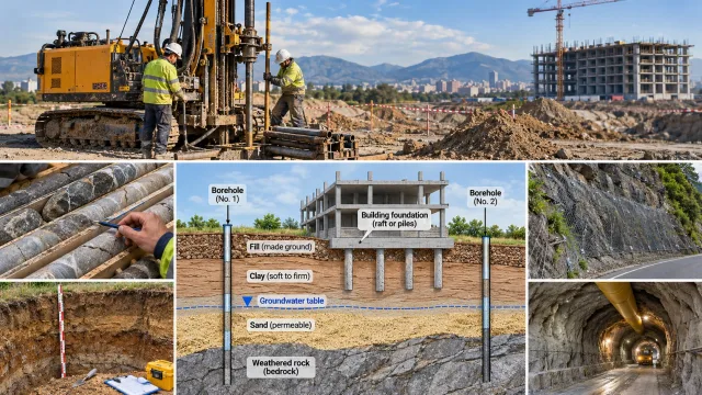
A building can look perfectly designed on paper, yet its performance may depend on conditions hidden several meters underground. Soft clay can settle under foundations, fractured rock can destabilize an excavation, and groundwater can turn an apparently simple construction project into a complex engineering challenge.
Engineering geology for construction helps identify these problems before they become expensive or dangerous. By investigating soil, rock, geological structures, and groundwater, engineering geologists provide information that guides foundation selection, excavation planning, slope stabilization, and infrastructure development.
The process goes beyond identifying rock types. It explains how the ground is likely to behave when excavated, loaded, drained, or otherwise disturbed by construction.
Why Engineering Geology Matters in Construction
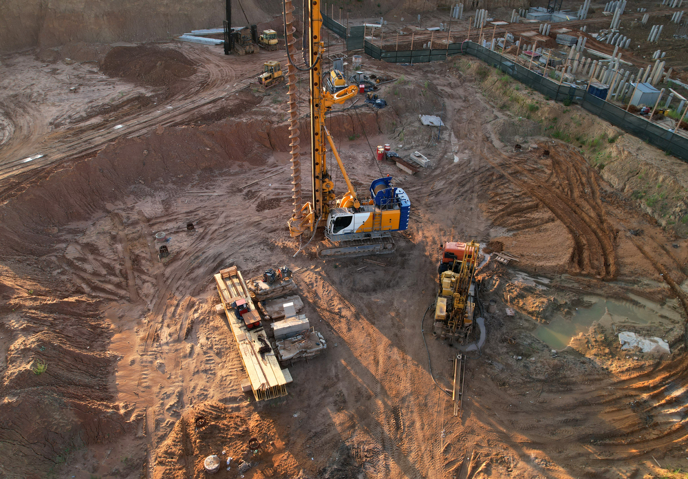
Every construction project interacts with the ground. Whether the project involves a small building, a highway bridge, or a railway tunnel, subsurface conditions influence the safety, cost, and feasibility of the work.
Engineering geological investigations help project teams:
- Identify soil and rock layers beneath the proposed structure.
- Locate groundwater and assess its possible effects.
- Recognize geological hazards, including landslides, faults, karst cavities, and unstable slopes.
- Estimate the variability and engineering behavior of ground materials.
- Provide geological information for geotechnical design and construction planning.
- Identify uncertainties that require additional investigation or monitoring.
Engineering geologists typically work alongside geotechnical, civil, and structural engineers. The geologist develops and interprets the geological understanding of the site, while qualified design engineers use investigation data and engineering analyses to select and verify suitable structural and geotechnical solutions.
1. Site Investigation: Understanding the Ground Before Construction
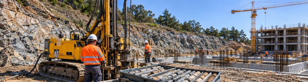
A geotechnical site investigation is one of the most important steps in planning a construction project.
Its purpose is to establish a reliable understanding of underground conditions and identify potential problems before excavation or foundation construction begins.
Desk Study and Geological Mapping
The investigation usually begins with existing information, including geological maps, historical land use, topographic surveys, previous borehole records, groundwater data, and known geological hazards.
Field observations can then identify exposed rock formations, soil changes, fractures, bedding, weathering, and signs of previous ground movement.
For example, a proposed building site located on an old river terrace may contain layers of gravel, sand, and finer sediments. These materials can have very different stiffness, permeability, and settlement characteristics.
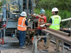
Borehole Drilling and Sampling
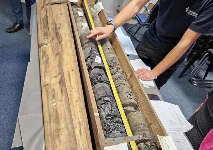
Boreholes allow geologists and engineers to investigate subsurface conditions directly.
Depending on the investigation method, drilling may recover disturbed or relatively undisturbed soil samples, rock cores, or drilling cuttings.
A geological borehole log commonly records:
- Depth and thickness of the encountered layers.
- Soil and rock descriptions.
- Weathering, fractures, and discontinuities.
- Sample depths and recovery.
- Groundwater observations.
- Field test results and drilling conditions.
Rock cores may also be examined for fracture frequency, weathering, intact rock strength estimates, and Rock Quality Designation (RQD), where applicable.
Because each borehole represents only a limited area, observations must be combined with geological interpretation to understand conditions between investigation points.
Trial Pits and Test Trenches
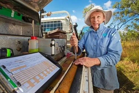
Trial pits provide direct access to shallow ground conditions.
They are useful for examining soil horizons, shallow rock, made ground, buried structures, and possible geological discontinuities.
Unlike a narrow borehole, an excavated pit allows the investigator to observe exposed soil layers across a wider area. However, excavation depth, ground stability, underground services, and groundwater must be considered before work begins.
2. In-Situ Geotechnical Tests
Field tests measure or estimate ground behavior under conditions closer to those encountered in place.
Different tests are selected according to the ground type, investigation objectives, applicable standards, and engineering questions.
| Test | What It Measures or Evaluates | Common Application |
|---|---|---|
| Standard Penetration Test (SPT) | Penetration resistance expressed as an N-value | Soil characterization and empirical correlations |
| Cone Penetration Test (CPT/CPTu) | Cone resistance, sleeve friction, and, for CPTu, pore pressure | Continuous soil profiling and geotechnical interpretation |
| Pressuremeter Test | Ground response to expansion of a cylindrical probe | Stiffness, deformation, and foundation analysis |
| Plate Load Test | Load–settlement response over a test area | Local ground stiffness and foundation assessment |
| Permeability Test | Water movement through soil or rock | Drainage, seepage, and groundwater assessment |
No individual test provides every parameter required for design. Results must be interpreted in relation to ground conditions, test quality, and other available data.
For a detailed explanation, see our In-Situ Testing guide.
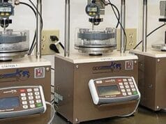
3. Laboratory Testing of Soil and Rock
Laboratory tests provide additional information about the physical, mechanical, and hydraulic behavior of construction materials.
Soil Testing
Common laboratory investigations include grain-size analysis, Atterberg limits, moisture content, density measurements, shear strength testing, and consolidation testing.
For example, a clay layer may appear firm at the surface but undergo significant consolidation when loaded by a new structure. Laboratory results help geotechnical engineers evaluate the magnitude and rate of possible settlement.
Rock Testing
Rock investigations may include uniaxial compressive strength, point-load strength index, density, and durability testing.
An important distinction is that intact rock strength is not the same as rock mass strength.
A strong rock specimen may come from a heavily fractured rock mass whose stability is controlled by joints, faults, bedding planes, or weathered zones.
4. From Geological Findings to Engineering Decisions
This is where engineering geology becomes especially valuable.
The investigation must explain what the geological conditions mean for the proposed construction—not simply describe the material encountered.
| Ground condition | Potential engineering problem | Possible response to evaluate |
|---|---|---|
| Soft, compressible clay | Excessive or differential settlement | Raft foundation, piles, ground improvement |
| Loose saturated sand | Settlement or liquefaction susceptibility under relevant loading | Ground densification, groundwater evaluation, seismic assessment |
| Highly fractured rock | Unstable excavation faces or rockfall | Rock support, slope redesign, controlled excavation |
| Shallow groundwater | Excavation flooding, uplift, or reduced stability | Dewatering, drainage, waterproofing, temporary support |
| Variable fill material | Uneven settlement and uncertain bearing behavior | Removal, replacement, compaction, or ground improvement |
| Soluble limestone with cavities | Localized subsidence or sinkhole hazards | Additional investigation, grouting, foundation adaptation |
These are examples of options to assess, not automatic design recommendations. The final solution depends on project loads, investigation results, risk assessments, applicable standards, and engineering calculations.
5. Foundation Design and Ground Conditions
The choice of foundation depends on both the structure and the properties of the supporting ground.
Shallow Foundations
Shallow foundations, such as isolated footings, strip footings, and rafts, may be suitable where relatively competent soil or rock exists near the surface.
The design must consider bearing resistance, total settlement, differential settlement, groundwater conditions, and other relevant factors.
Deep Foundations
Deep foundations, including piles and drilled shafts, may be considered where near-surface materials cannot adequately support the structure.
They can transfer loads through weaker layers to deeper supporting material, or mobilize resistance through shaft friction, end bearing, or both.
However, deep foundations are not automatically necessary whenever soft ground is present. Appropriate alternatives depend on the site’s technical and economic conditions.
6. Excavation Stability and Temporary Works
Excavation changes the stresses acting within the ground.
Removing material can destabilize nearby soil or rock, particularly when excavation faces are steep, groundwater is present, or geological discontinuities are unfavorably oriented.
Engineering geological assessments examine:
- Soil and rock strength.
- Groundwater levels and seepage.
- Bedding planes, joints, and faults.
- Excavation depth and geometry.
- Nearby structures and construction loads.
Depending on the conditions, a project may require temporary slopes, sheet piles, retaining structures, anchors, soil nails, or other designed support systems.
Temporary excavation stability is a critical construction safety issue, and support arrangements must be designed and implemented by competent professionals.
7. Groundwater and Drainage in Construction
Groundwater can significantly affect construction even when the soil and rock appear mechanically suitable.
Water pressure can reduce effective stress, contribute to excavation instability, increase uplift forces, and influence long-term settlement.
In permeable deposits, groundwater may enter excavations rapidly. In clay-rich formations, low permeability can create different challenges, including slow drainage and consolidation.
Site investigations may therefore include groundwater monitoring wells, piezometers, pumping tests, and permeability measurements.
Groundwater levels can also change seasonally, so a single observation during drilling may not represent the highest water level likely to affect the project.
Understanding groundwater is essential for foundation planning, basement construction, tunnels, drainage design, and underground infrastructure.
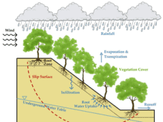
8. Slope Stability and Landslide Prevention
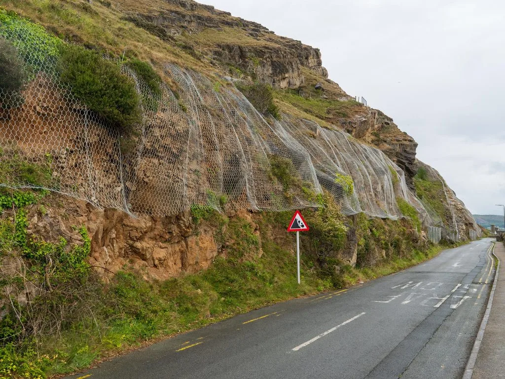
Road construction, hillside developments, quarries, and infrastructure projects frequently require excavation on sloping ground.
Engineering geologists evaluate the geological conditions that influence slope behavior, including material strength, discontinuity orientation, weathering, groundwater, and previous slope movement.
Soil Slopes
In soil, potential instability may involve shallow sliding, deep rotational failure, or movement along weaker layers.
Possible mitigation measures include slope regrading, improved drainage, retaining structures, reinforcement, and monitoring.
Rock Slopes
In rock, failure may occur along joints, faults, or bedding surfaces.
Common mechanisms include planar sliding, wedge failure, toppling, and rockfall.
The orientation of discontinuities relative to the slope face is often as important as the strength of the intact rock.
Potential protection measures include rock bolts, anchored mesh, rockfall barriers, and modifications to the excavation geometry.
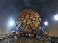
9. Tunnels and Underground Construction
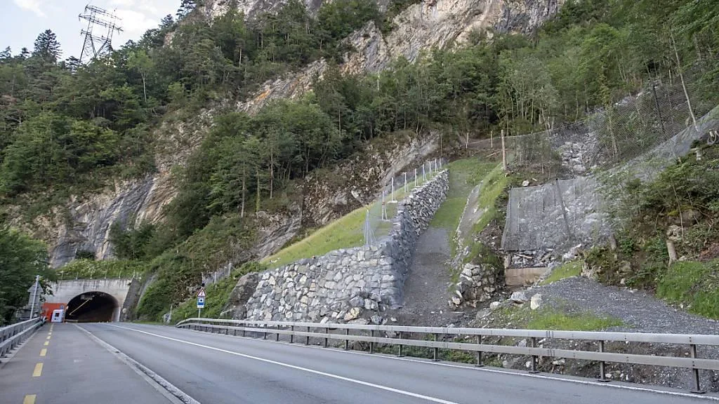
Tunneling presents additional challenges because geological conditions may change continuously along the excavation route.
Engineering geological investigations help identify the expected distribution of rock and soil units, faults, weak zones, groundwater inflows, and possible changes in ground behavior.
The findings can influence excavation methods, support requirements, tunnel alignment, and monitoring strategies.
For example, a tunnel passing through relatively competent rock may encounter a fault zone containing crushed or altered material. The ground conditions can change over a short distance, requiring revised excavation and support measures.
A reliable geological model and observations made during excavation are therefore essential components of underground construction.
10. Geological Models and Geotechnical Reports
The final investigation report should provide more than a list of test results.
A useful engineering geological report explains how geological conditions vary across the site and how these conditions may affect construction.
Typical outputs include:
- Site location and investigation methods.
- Geological and geomorphological descriptions.
- Borehole and trial pit logs.
- Groundwater observations.
- Field and laboratory test results.
- Geological cross-sections and a ground model.
- Identified geological hazards and uncertainty.
- Recommendations for further investigation, construction observations, or monitoring.
A geological model may begin with a desk study, become more detailed through drilling and testing, and be refined as construction exposes new ground conditions.
11. Practical Example: Investigating a Building Site
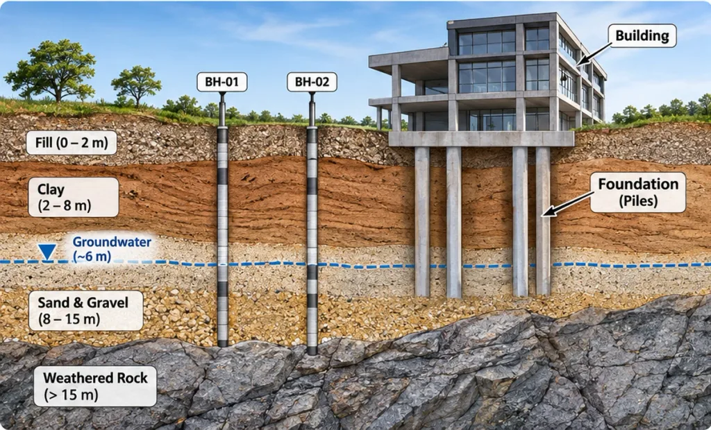
Consider a hypothetical project involving a multistory building on a gently sloping site.
Step 1: Preliminary Assessment
A geological map indicates superficial deposits above weathered bedrock. Historical records also suggest that groundwater may occur at relatively shallow depth.
Step 2: Field Investigation
Boreholes identify approximately 2 meters of variable fill, followed by soft to firm clay and deeper weathered rock.
Groundwater is observed within the clay-bearing deposits.
Step 3: Testing and Interpretation
Laboratory tests indicate that portions of the clay are compressible. Field testing also suggests variable ground stiffness across the site.
Step 4: Engineering Assessment
The findings raise several questions:
- Could the clay undergo significant settlement under the building loads?
- How variable is the depth to competent bearing material?
- Will groundwater affect basement excavation?
- Is additional investigation required before foundation selection?
Step 5: Design and Construction Decisions
The design team evaluates suitable foundation and excavation options using the geotechnical parameters, structural loads, and identified uncertainties.
Additional investigation or monitoring may be required before final decisions are made.
This example illustrates why geological interpretation is central to construction planning: a borehole description becomes useful only when it is connected to the project’s engineering requirements.
Frequently Asked Questions
What is engineering geology in construction?
Engineering geology applies geological knowledge to construction projects by investigating soil, rock, groundwater, geological structures, and natural hazards that may affect engineering design and construction.
Why is a geological survey necessary before construction?
A geological and geotechnical investigation helps identify subsurface conditions, potential hazards, and uncertainties that could influence foundations, excavations, drainage, and long-term structural performance.
What is the difference between engineering geology and geotechnical engineering?
Engineering geology focuses on understanding and interpreting geological materials, structures, and processes. Geotechnical engineering applies soil and rock mechanics and engineering design methods to foundations, slopes, earthworks, and underground structures. The disciplines overlap and work closely together.
Which tests are used in geotechnical site investigations?
Common methods include boreholes, trial pits, SPT, CPT, pressuremeter tests, permeability testing, and laboratory analysis of soil and rock samples. The selected methods depend on the project and ground conditions.
How does groundwater affect construction?
Groundwater can influence excavation stability, seepage, uplift pressures, effective stress, and settlement. Its effects must be evaluated during investigation and design.
Can engineering geology prevent foundation failure?
Engineering geology can identify important ground-related hazards and reduce uncertainty, but it cannot eliminate every risk. Safe foundation performance also depends on appropriate design, construction quality, inspection, and monitoring.
Conclusion
Engineering geology connects the natural ground with the practical requirements of construction.
From the first geological map to the final excavation inspection, it helps engineers understand what lies beneath a project, how that ground may behave, and where important uncertainties remain.
The greatest value of an engineering geological investigation is not simply identifying soil and rock. It is turning geological observations into reliable information that supports safer and more effective engineering decisions.