")


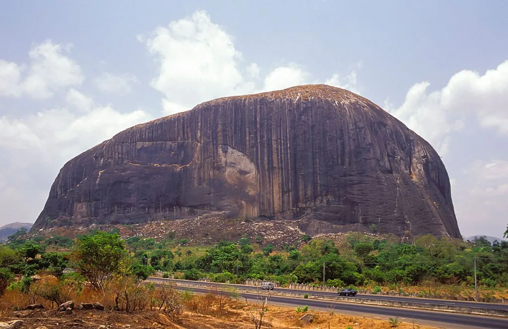
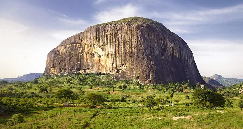
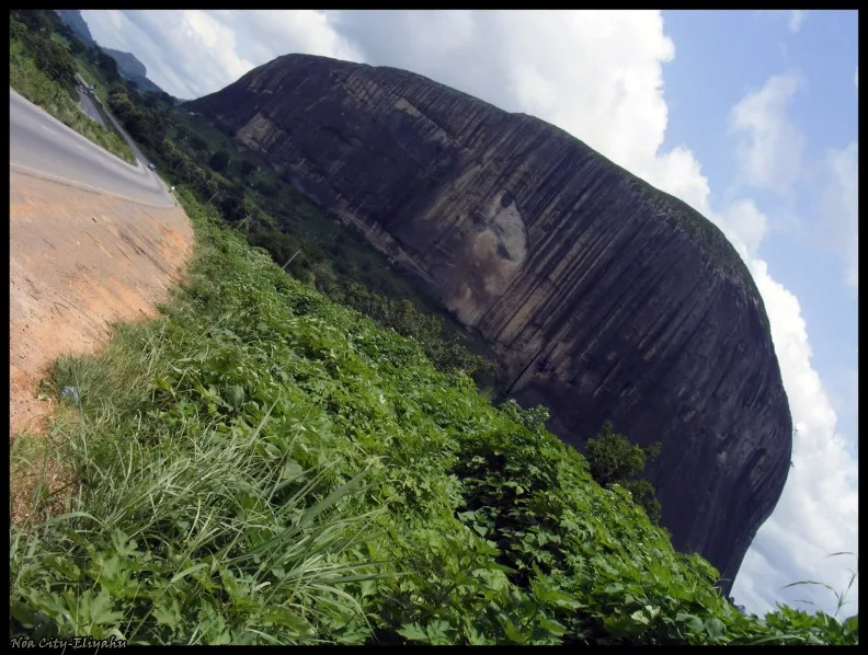
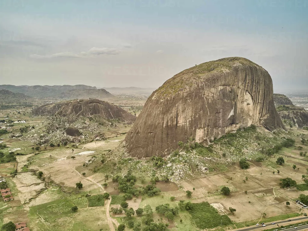
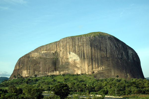
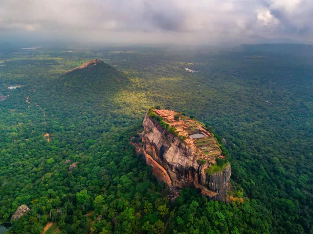
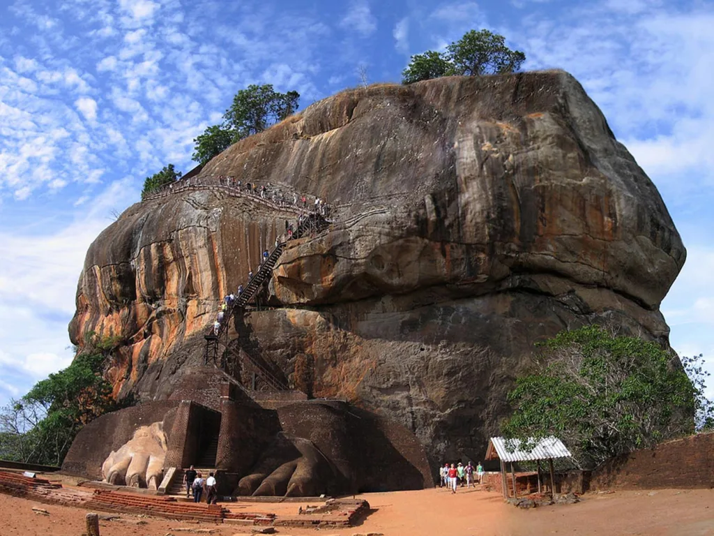
Sigiriya, or Lion Rock, Sri Lanka

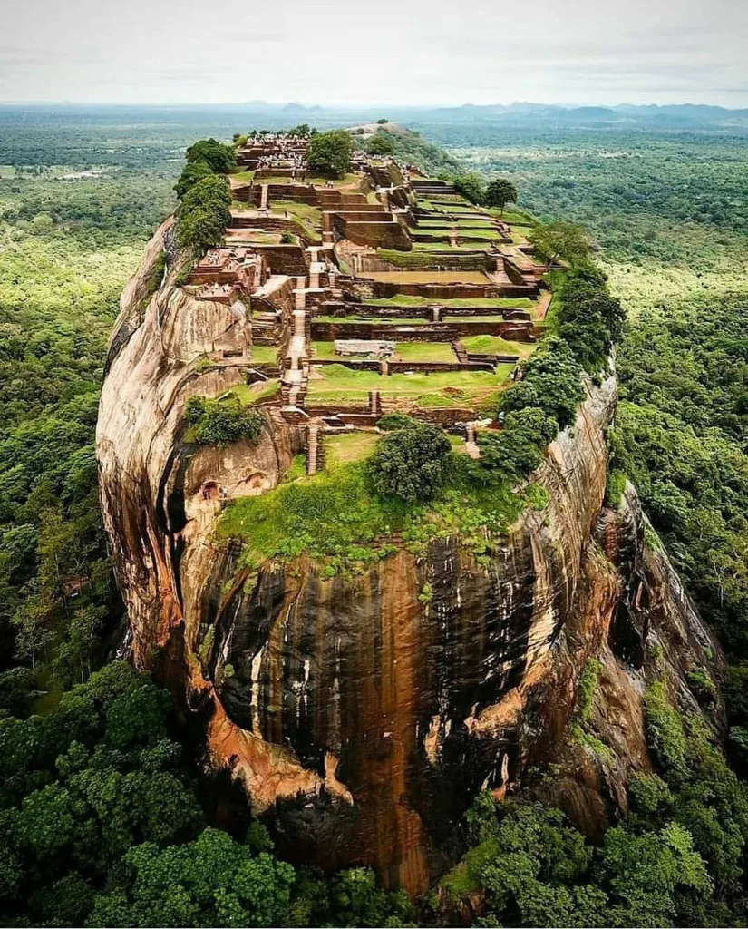
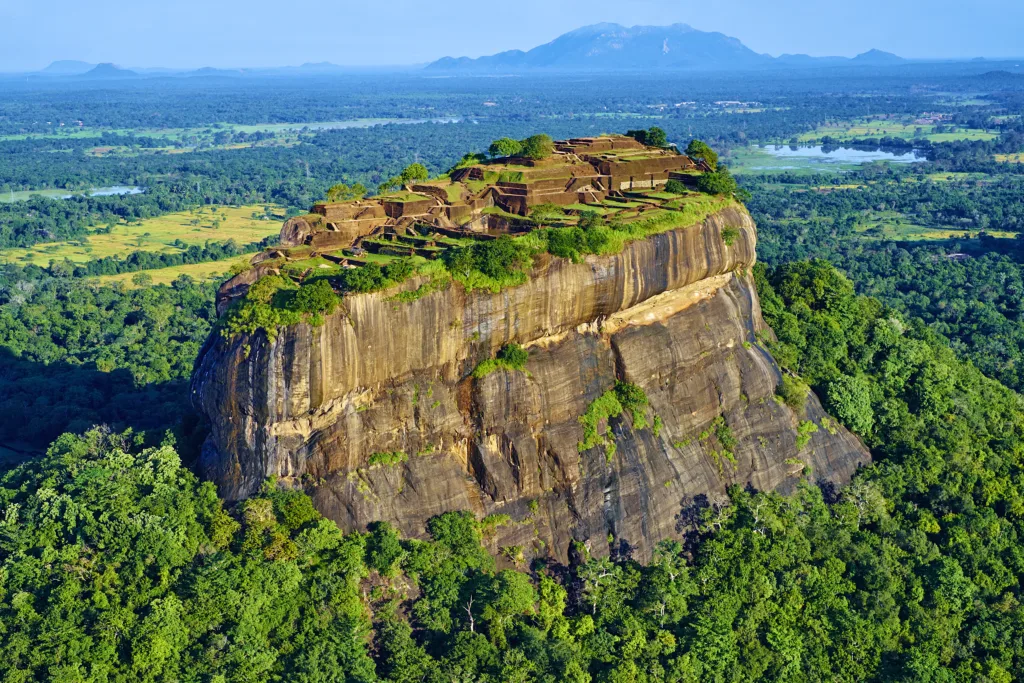
Sigiriya, also known as the Lion Rock, is a remarkable ancient rock fortress and palace located in the central Matale District of Sri Lanka. It stands as a UNESCO World Heritage Site and is one of the most iconic landmarks in the country. The site is renowned for its stunning architecture, breathtaking frescoes, and extensive landscaped gardens. Sigiriya’s historical, cultural, and architectural significance makes it a popular destination for tourists and historians alike.
Historical and Cultural Significance:
Sigiriya’s history dates back to the 5th century AD when it was built by King Kasyapa I, who sought to establish an impregnable fortress as well as a luxurious palace on the summit of a massive rock. The site’s historical importance is tied to the complex political intrigues of ancient Sri Lanka. After King Kasyapa’s death, Sigiriya was abandoned and eventually used as a Buddhist monastery until the 14th century.
The rock fortress is not only significant for its military and defensive features but also for its cultural and artistic elements. The Sigiriya Frescoes, located on a sheltered rock face, depict graceful and beautifully detailed female figures. These frescoes provide valuable insights into the art and aesthetics of the time and shed light on the lives of people who lived there centuries ago.
Geological Understanding for Preservation and Interpretation:
Understanding the geology of Sigiriya is crucial for its preservation and interpretation for several reasons:
- Structural Stability: The geological composition of the rock itself, including its layers, faults, and stability, has a direct impact on the structural integrity of the site. A comprehensive understanding of the rock’s geology helps in identifying potential weaknesses, erosion patterns, and areas prone to natural disasters. This information is vital for ensuring the long-term preservation of the site.
- Conservation Efforts: A deep understanding of the geology assists conservationists in developing appropriate strategies to mitigate the effects of weathering, erosion, and human impact. This might involve installing protective measures, such as barriers, drainage systems, and vegetation management.
- Site Interpretation: The geology of Sigiriya can also provide valuable insights into the cultural practices and technological capabilities of the time. The choice of building on a massive rock, the use of natural features for defense, and the integration of architectural elements with the rock’s features all reflect the ingenuity of the builders and their understanding of geology.
- Visitor Experience: A geological understanding enhances the visitor experience by enabling interpreters and guides to explain how the natural environment influenced the construction and purpose of Sigiriya. This adds depth to the narrative and allows visitors to appreciate the site from a multidisciplinary perspective.
In conclusion, Sigiriya’s historical and cultural significance as an ancient fortress and palace, combined with its geological context, makes it a unique and valuable site. Understanding its geology is essential for its preservation, interpretation, and continued appreciation for generations to come.
Geological Formation of Sigiriya Rock
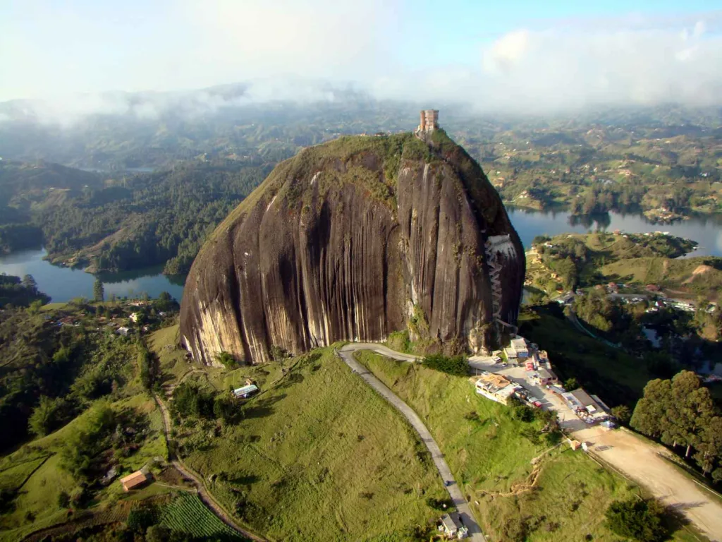
Sigiriya Rock is a massive column of rock that stands out prominently in the surrounding landscape. Its geological formation is the result of intricate natural processes that have occurred over millions of years. The rock is an erosional remnant of an ancient magma intrusion that has been exposed through the processes of weathering and erosion.
Geological Processes:
- Magma Intrusion: The formation of Sigiriya Rock began deep within the Earth’s crust during the Precambrian geological period, around 550 million years ago. Molten magma, rich in minerals and gases, intruded into existing rock layers. This intrusion slowly cooled and solidified over a long period of time.
- Uplift and Erosion: Subsequent geological processes, such as tectonic uplift and erosion, gradually exposed the ancient magma intrusion at the surface. The surrounding rock layers were weathered and eroded away, leaving behind the resistant column of rock that we see as Sigiriya today.
- Chemical Weathering: Over millions of years, chemical weathering processes, including the dissolution of minerals and the action of acidic rainwater, contributed to the shaping of the rock. The soluble minerals within the rock matrix were gradually dissolved, leading to the formation of distinctive features and shapes.
Rock Type and Characteristics:
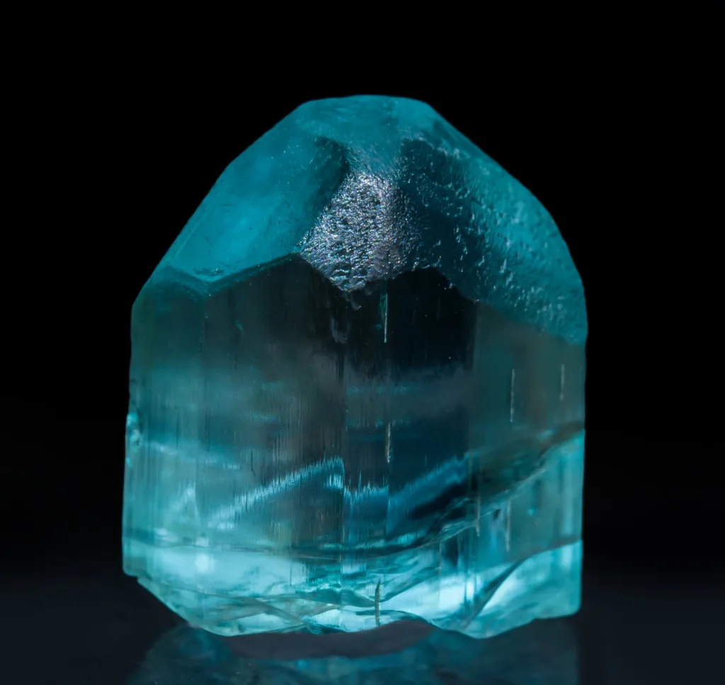
The rock that comprises Sigiriya is primarily a type of granite known as syenite. Syenite is a coarse-grained intrusive igneous rock that is composed primarily of feldspar minerals, including orthoclase and plagioclase feldspar, as well as smaller amounts of dark minerals such as hornblende and mica. This composition gives syenite its characteristic appearance, which often features light-colored feldspar crystals embedded in a darker matrix.
Time Frame and Geological Periods:
The geological formation of Sigiriya Rock spans a vast timeframe and is associated with multiple geological periods:
- Precambrian Period: The initial formation of the magma intrusion that eventually became Sigiriya Rock occurred during the Precambrian period, which lasted from approximately 4.6 billion to 541 million years ago. The specific timeframe of Sigiriya’s formation falls within this period.
- Paleozoic and Mesozoic Eras: The subsequent geological processes of uplift and erosion that exposed the rock formation occurred over the Paleozoic and Mesozoic eras, which spanned from about 541 million to 66 million years ago. These processes gradually shaped the landscape and revealed the distinct rock formation.
It’s important to note that the geological history of Sigiriya Rock spans millions of years and is a testament to the dynamic and ever-changing nature of the Earth’s crust. The rock’s unique formation and the rich geological history it embodies contribute to its significance as both a natural wonder and a cultural treasure.
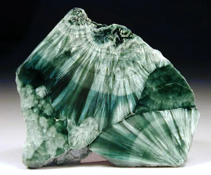
Rock Composition and Mineralogy of Sigiriya Rock
Sigiriya Rock is primarily composed of a type of granite known as syenite. Syenite is an intrusive igneous rock that is rich in feldspar minerals and typically contains lesser amounts of darker minerals like hornblende and mica. The specific mineral composition of Sigiriya syenite contributes to its distinct appearance and properties.
The key minerals present in Sigiriya syenite include:
- Orthoclase Feldspar: This is one of the dominant minerals in syenite. Orthoclase feldspar is typically pale in color and gives the rock its light-colored appearance. It also contributes to the rock’s overall hardness and durability.
- Plagioclase Feldspar: Another type of feldspar present, plagioclase is usually white or gray and forms part of the lighter matrix of the rock.
- Quartz: While not as abundant as feldspar, quartz is an essential component of syenite. It is a hard and resistant mineral that contributes to the rock’s durability.
- Hornblende: This dark-colored mineral adds contrast to the rock’s appearance. It is part of the amphibole group of minerals and can appear as elongated crystals or grains.
- Biotite Mica: Biotite is another dark mineral that belongs to the mica group. It forms thin, sheet-like layers and contributes to the rock’s texture.
- Accessory Minerals: Small amounts of other minerals may also be present, including magnetite, apatite, and zircon.
Influence on Fortress Construction and Artwork:
- Durability and Strength: The composition of syenite, particularly the presence of hard and resistant minerals like quartz and feldspar, made Sigiriya Rock an ideal choice for construction. The rock’s durability and strength provided a solid foundation for the construction of the fortress and palace complex.
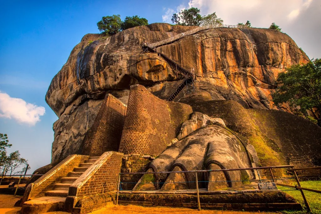
- Defense and Architecture: The natural features of Sigiriya Rock, including its steep sides and prominent elevation, combined with the durable rock composition, contributed to the defensive capabilities of the fortress. The hard rock surface made it difficult for invaders to breach the walls. Additionally, the syenite’s unique appearance may have influenced the architectural decisions, as the builders could have incorporated the natural rock formations into their construction plans.
- Frescoes and Artwork: The smooth and relatively stable surfaces of Sigiriya Rock allowed for the creation of intricate frescoes and artwork. The presence of orthoclase and plagioclase feldspar, which can weather more slowly than some other minerals, contributed to the preservation of these artworks over time. The artists could create detailed and vibrant paintings on the rock surface, showcasing the cultural and artistic achievements of the time.
- Integration with Natural Features: The mineral composition and the rock’s unique textures may have influenced the selection of locations for construction and artwork. The natural contours and color variations of the rock could have been incorporated into the overall design, enhancing the aesthetic appeal of the site.
In summary, the specific mineral composition of Sigiriya syenite played a significant role in shaping the fortress construction and artwork. Its durability, strength, and suitability for carving and painting allowed for the creation of an impressive fortress complex and intricate frescoes that continue to captivate visitors and researchers to this day.
Structural Geology of Sigiriya
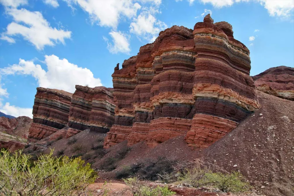
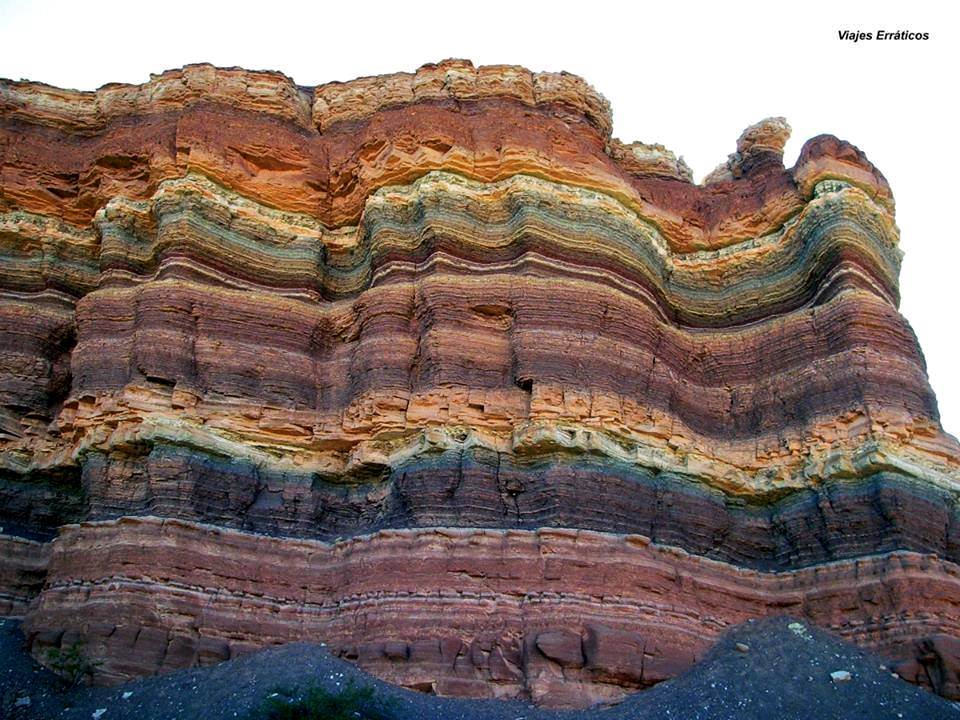
Sigiriya Rock’s structural geology refers to the arrangement and characteristics of internal features such as bedding planes, fractures, and faults within the rock mass. These geological elements can significantly impact the construction, stability, and overall design of the fortress and palace complex.
Bedding Planes: Bedding planes are horizontal layers or stratifications within a rock mass, resulting from the deposition of sediments or lava flows over time. In Sigiriya Rock’s case, the presence of bedding planes in the syenite can influence how the rock weathers and erodes. If these bedding planes are well-defined and continuous, they may create planes of weakness along which the rock is more susceptible to splitting or breaking apart. The builders of Sigiriya would have needed to consider the orientation of these bedding planes when selecting construction sites and carving chambers and passageways within the rock.
Fractures: Fractures are cracks or breaks in the rock that can occur due to various geological processes, including tectonic forces, temperature changes, and weathering. Fractures can have a significant impact on the stability of the rock mass. In the case of Sigiriya, fractures could have provided natural crevices that could be incorporated into the construction of the fortress. However, they also have the potential to weaken the rock and make it more susceptible to weathering and erosion.
Faults: Faults are larger-scale fractures along which significant displacement has occurred. While it’s not clear if major faults are present within Sigiriya Rock itself, the broader geological setting of the region could have influenced the formation of fractures and faults in the vicinity. These geological features can affect the overall stability of the rock mass and impact the safety and longevity of the fortress.
Impact on Construction and Stability:
- Site Selection: The presence of bedding planes, fractures, and faults would have influenced where and how the builders constructed various elements of the fortress. They may have chosen locations with more stable and continuous rock for critical structures like the palace, while utilizing natural crevices and fractures for passageways, chambers, or defensive features.
- Stability Considerations: Understanding the orientation and characteristics of these geological features is essential for ensuring the stability of the constructed structures. Builders would have needed to avoid areas prone to structural weakness and focus on areas with more intact and stable rock.
- Weathering and Erosion: Bedding planes, fractures, and faults can create pathways for water infiltration, which can accelerate weathering and erosion. The builders may have had to implement strategies to divert water away from critical areas and prevent excessive degradation of the rock.
- Defensive Features: Natural fractures and faults could have been integrated into the design of defensive features, such as walls and barriers. These geological features could have been utilized to enhance the natural defenses of the fortress.
In summary, the structural geology of Sigiriya Rock, including bedding planes, fractures, and faults, played a significant role in shaping the construction and stability of the fortress and palace complex. The builders would have needed to carefully consider these geological features to ensure the longevity and effectiveness of their architectural endeavors.
Cultural Significance of Sigiriya

Sigiriya holds immense cultural significance in Sri Lanka and is deeply woven into the country’s literature, art, and folklore. It has inspired poets, writers, and artists for centuries, becoming a symbol of artistic and architectural excellence.
Sri Lankan Literature: Sigiriya is often referenced in Sri Lankan literature, both ancient and modern. It is mentioned in classical Sinhalese texts, including the “Mahavamsa” and “Culavamsa,” which chronicle the island’s history. The rock fortress has been praised in poetry for its grandeur and beauty.
Sri Lankan Art: Sigiriya’s influence is evident in various forms of traditional Sri Lankan art. The iconic Sigiriya Frescoes, which depict elegant female figures, showcase the artistic skill of the time. The motifs and themes from Sigiriya have also been incorporated into traditional art forms such as paintings, sculptures, and woodwork.
Folklore and Legends: Over time, myths and legends have developed around Sigiriya, adding to its cultural mystique. Stories of its creation, its transformation into a fortress, and its abandonment have become part of Sri Lanka’s folklore.
UNESCO Recognition and Preservation:
Sigiriya’s exceptional cultural and historical value led to its designation as a UNESCO World Heritage Site in 1982. The UNESCO recognition highlights the importance of preserving this remarkable site for future generations.
Preservation Efforts:
UNESCO’s designation has spurred significant efforts toward the preservation and conservation of Sigiriya. Several initiatives have been undertaken to protect the site from environmental degradation, erosion, and the impact of tourism. These efforts include:
- Structural Stabilization: Measures have been taken to reinforce and stabilize the rock, ensuring the safety of visitors and the long-term preservation of the ancient structures.
- Vegetation Management: Proper management of vegetation helps prevent root systems from causing damage to the rock’s surface and structures.
- Visitor Management: Strategies are in place to manage the number of visitors and their impact on the site. Walkways and paths have been constructed to guide visitors and prevent erosion.
- Conservation of Artifacts: The frescoes and other artifacts at Sigiriya are carefully monitored and conserved to protect them from deterioration.
- Educational Initiatives: Educational programs and guided tours are conducted to raise awareness about the historical and cultural significance of Sigiriya and the importance of its preservation.
- Research and Documentation: Ongoing research, documentation, and monitoring of the site contribute to a deeper understanding of its history and geology, which in turn aids preservation efforts.
In conclusion, Sigiriya’s cultural significance is deeply ingrained in Sri Lankan heritage, inspiring literature, art, and folklore. Its UNESCO status has spurred dedicated efforts to preserve and protect the site, ensuring that its historical and architectural treasures continue to be appreciated by present and future generations.
Tourism and Visitor Experience at Sigiriya
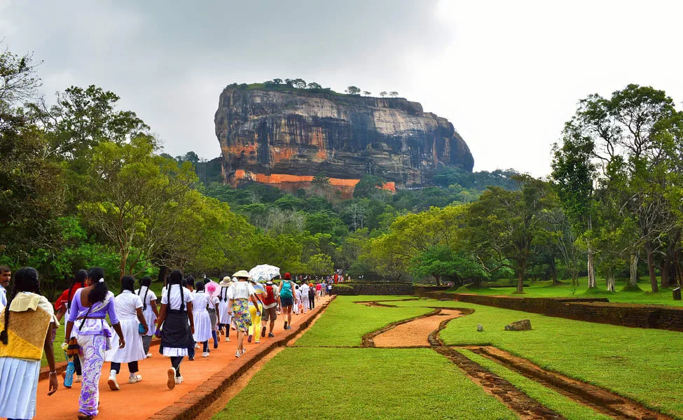
Sigiriya is a renowned tourist destination in Sri Lanka, attracting visitors from around the world who come to experience its rich history, stunning architecture, and breathtaking natural beauty. The site offers a unique blend of cultural and natural attractions, providing an immersive and educational experience for tourists.
Visitor Activities and Experiences:
- Climbing the Rock: One of the main attractions at Sigiriya is the opportunity to climb the rock fortress. The ascent involves ascending a series of staircases, pathways, and terraces while enjoying panoramic views of the surrounding landscape. The climb is a rewarding experience and allows visitors to explore the ancient ruins at the summit.
- Exploring the Palace Complex: At the top of the rock, visitors can explore the remains of King Kasyapa’s palace complex, including foundations, walls, and pools. This offers insights into the architectural and engineering prowess of the time.
- Sigiriya Frescoes: The well-preserved frescoes on a sheltered rock face are a highlight for many visitors. These vibrant paintings of elegant female figures provide a glimpse into ancient Sri Lankan art and culture.
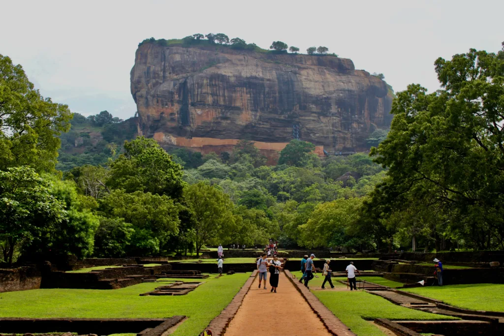
- Landscape Gardens: The beautifully landscaped gardens at the base of the rock are a peaceful retreat for visitors. The symmetrical water gardens, fountains, and boulder gardens showcase the advanced engineering and design aesthetics of the ancient builders.
- Museum and Interpretive Center: Sigiriya has an on-site museum that provides historical context and artifacts related to the site. The interpretive center offers insights into the cultural and historical significance of Sigiriya.
Visitor Facilities:
Sigiriya is equipped with facilities to enhance the visitor experience:
- Guided Tours: Knowledgeable guides offer guided tours, sharing historical, cultural, and geological insights about the site.
- Information Centers: Information centers provide educational materials, maps, and guides to help visitors navigate and understand the site.
- Rest Areas: Rest areas and benches are strategically placed along pathways for visitors to take breaks and enjoy the surroundings.
- Restaurants and Shops: There are restaurants and shops near the entrance, providing food, beverages, and souvenirs for visitors.
- Safety Measures: Safety measures, such as railings and designated pathways, ensure that visitors can explore the site securely.
Sustainability and Responsible Tourism:
Efforts are made to promote sustainable and responsible tourism at Sigiriya, including:
- Visitor Limits: To minimize the impact on the site, there may be restrictions on the number of visitors allowed per day.
- Environmental Conservation: Measures are taken to protect the natural environment and manage waste.
- Cultural Respect: Visitors are encouraged to respect the cultural heritage of the site and follow guidelines to preserve its integrity.
In conclusion, the tourism experience at Sigiriya offers a fascinating journey through history, art, and nature. Its combination of historical significance and breathtaking landscapes creates a memorable and enriching experience for tourists while striving to ensure the long-term preservation of this exceptional site.
Recap of the key geological aspects of Sigiriya
- Formation and Composition: Sigiriya Rock is primarily composed of syenite, a type of intrusive igneous rock. It contains minerals such as orthoclase and plagioclase feldspar, quartz, hornblende, and biotite mica.
- Structural Features: Sigiriya exhibits bedding planes, which are horizontal layers or stratifications within the rock, fractures, which are cracks in the rock, and potentially faults, which are larger-scale fractures with significant displacement.
- Influence on Construction: The rock’s composition, including its durability, strength, and texture, influenced the construction of the fortress and palace complex. Builders selected stable areas for construction while incorporating natural crevices and fractures.
- Stability Considerations: Understanding the orientation of bedding planes, fractures, and faults was crucial to ensure the stability of constructed structures, helping to avoid areas of potential weakness.
- Weathering and Erosion: Geological features affected how the rock weathers and erodes. Proper management of these features was necessary to prevent degradation of the rock and structures.
- Defensive and Artistic Integration: Fractures and natural features might have been integrated into defensive structures and artwork, showcasing the ingenious use of geological formations in construction and artistic expression.
Overall, the geological aspects of Sigiriya played a significant role in shaping its construction, stability, and cultural significance. Understanding these geological features is essential for both preserving the site and appreciating its historical and architectural marvels.