Home Blog Page 64

Musgravite

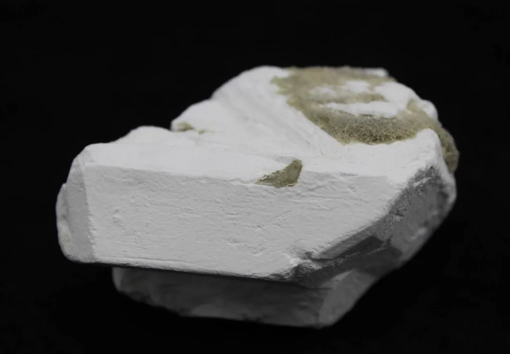
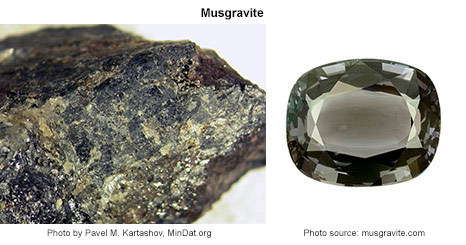
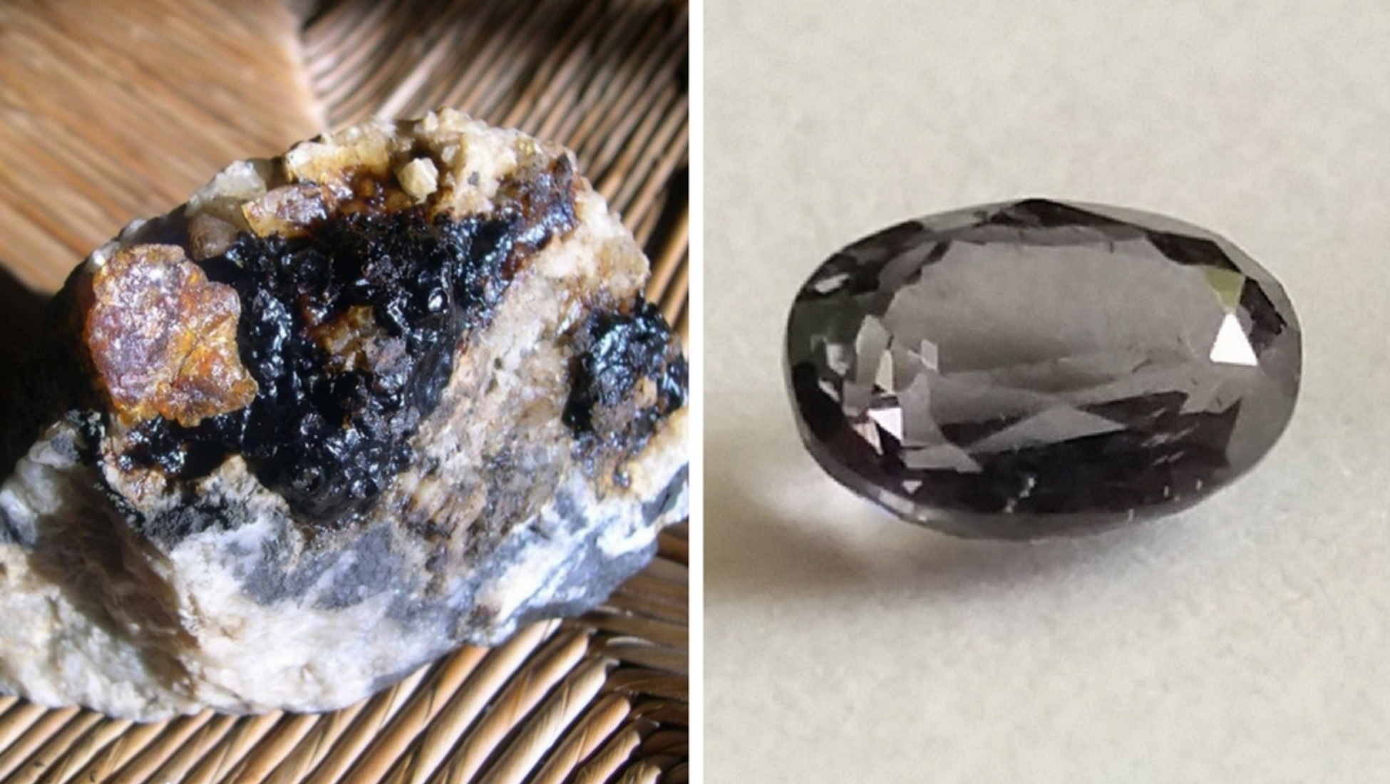
Musgravite is a rare and precious gemstone that belongs to the oxide mineral family. It is a member of the taaffeite family, which also includes taaffeite and lavenderite. Musgravite is renowned for its exquisite beauty, exceptional brilliance, and stunning color range. As one of the rarest gemstones on Earth, it holds great value in the world of gem enthusiasts and collectors.

Musgravite is a beryllium aluminum oxide mineral with the chemical formula (BeAl3O12). It has a high hardness on the Mohs scale, typically ranging from 8 to 8.5, making it one of the most durable gemstones suitable for jewelry use. Its refractive index and dispersion properties contribute to its excellent brilliance and sparkle, making it highly desirable in the gem market.

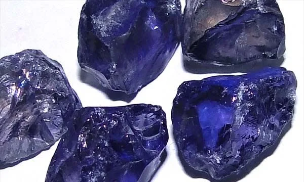
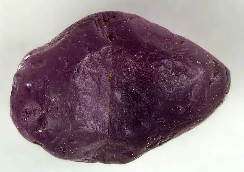
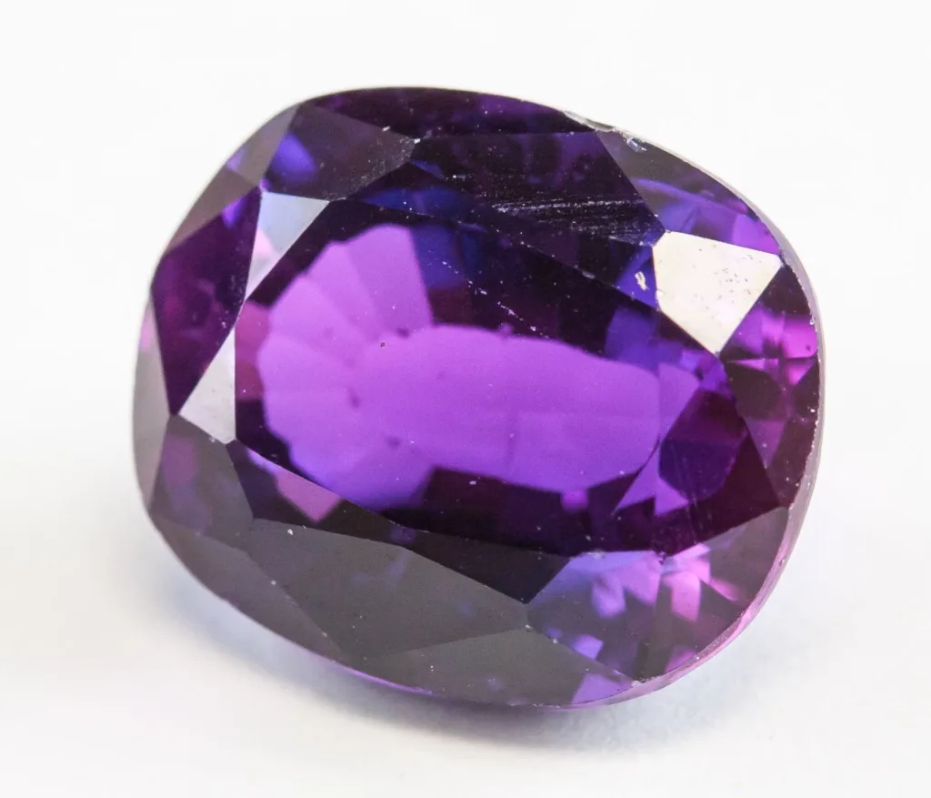
The gemstone’s color can vary, ranging from a deep greenish-blue to violet or purple, and occasionally even gray or colorless. The presence of certain trace elements influences the color of the stone, and this variation adds to the gem’s allure.

Origin and Discovery:

Musgravite was first discovered in 1967 in the Musgrave Ranges of South Australia, which gave it its name. It was found as small, rare crystals in the alluvial deposits of the region. The discovery was initially mistaken for another rare gemstone, taaffeite, due to their similar properties and occurrence.

It wasn’t until 2005 that gemological studies confirmed musgravite as a distinct gemstone and a new member of the taaffeite family. This acknowledgment further increased its appeal and popularity among gemstone collectors.

Rarity and Value in the Gem Market:

Musgravite is exceptionally rare, and its scarcity contributes significantly to its high value in the gem market. The gemstone’s limited occurrence and the difficulty in obtaining sizable and high-quality specimens make it a coveted collector’s item. Its rarity and exclusivity elevate its market value, often placing it among the most expensive gemstones in the world.

Prices for musgravite can vary greatly depending on various factors, including the size, color, clarity, and overall quality of the gem. Top-quality musgravite gemstones can command astronomical prices per carat, comparable to or even exceeding some of the finest diamonds and other precious gemstones.

Due to its extraordinary rarity, musgravite is seldom available in mainstream jewelry stores. Instead, it is predominantly sold through specialized gem dealers, auctions, and private collectors, further adding to its allure and mystique. As with all valuable gemstones, it is essential to ensure the authenticity and quality of the musgravite before making a significant purchase.

Geology and Formation

Musgravite is a rare gemstone formed under specific geological conditions. It is a member of the taaffeite family and is classified as an oxide mineral, with the chemical formula (BeAl3O12). The formation of musgravite is closely tied to the geological processes that occur in specific geological environments.

Geological Conditions for Musgravite Formation:

Musgravite is believed to form under extreme geological conditions involving metamorphism and pegmatite formation. Metamorphism is the process where existing rocks undergo changes in mineral composition and structure due to high temperature and pressure. Pegmatites are igneous rocks characterized by their exceptionally large crystals, often forming in the final stages of the solidification of magma.

Musgravite is typically formed in the presence of beryllium and aluminum-rich minerals, and the presence of other trace elements can influence its coloration. The specific geological conditions required for musgravite formation are relatively rare, contributing to its extreme scarcity in nature.

Locations of Primary Deposits:

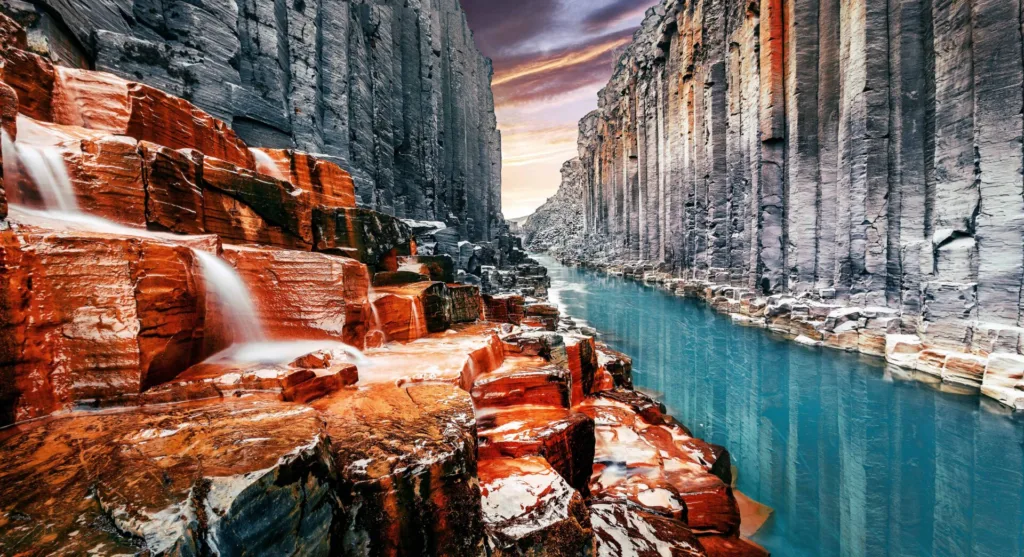
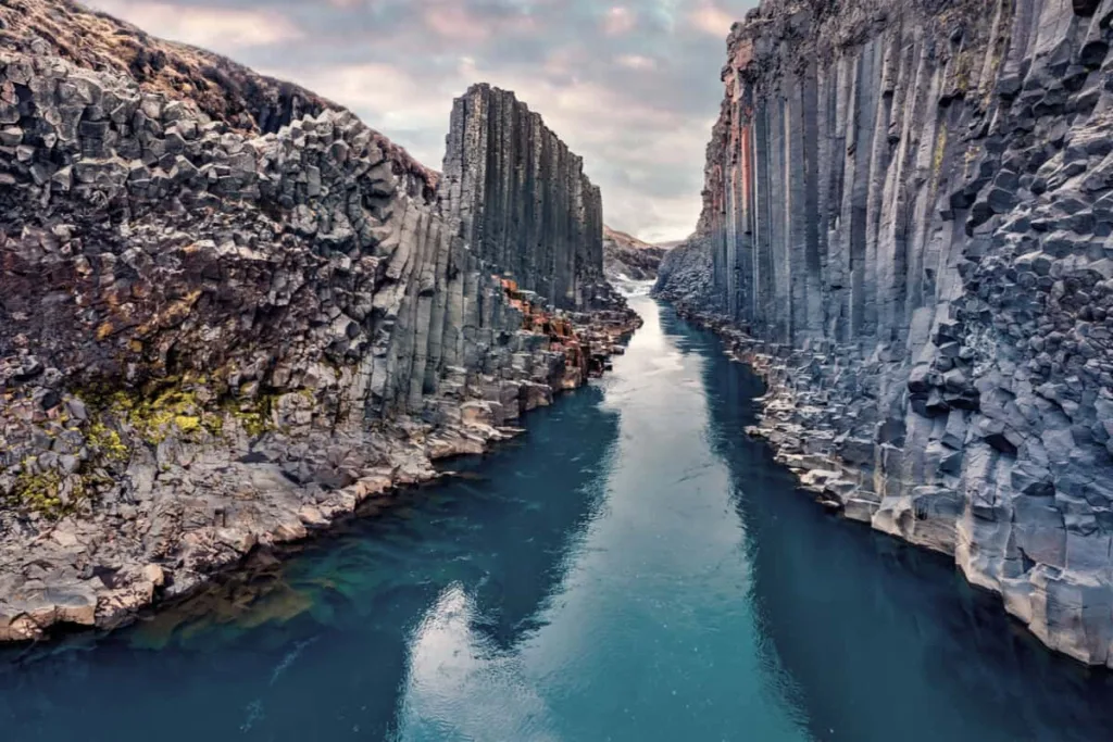
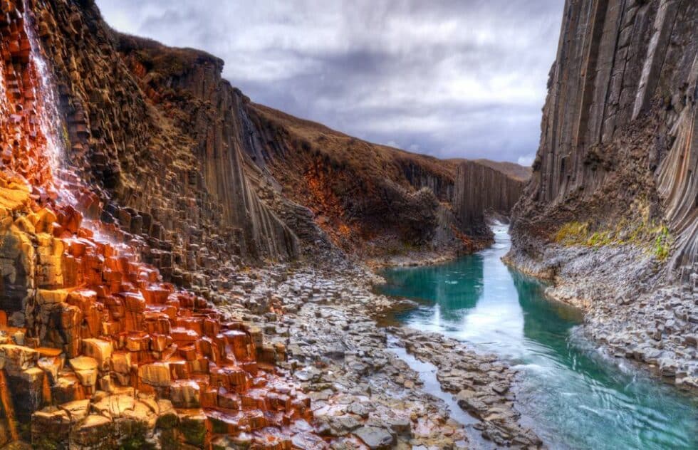
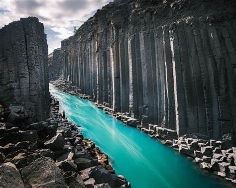
The primary source of musgravite is the Musgrave Ranges in South Australia, where it was first discovered. The Musgrave Ranges are known for their complex geological history, involving various tectonic processes, which contributed to the formation of unique mineral assemblages, including musgravite.

Other than the original discovery site, there are only a few known locations worldwide where musgravite has been found. These locations are generally limited to regions with geological features conducive to the formation of rare and exotic minerals. However, the exact locations and specific details of these deposits are often closely guarded by mining companies and collectors due to the gemstone’s extreme rarity and high value.

Mining and Extraction Processes:

Musgravite mining is an arduous and challenging process due to the gemstone’s rarity and the remote locations of the deposits. The primary method of musgravite extraction is through traditional mining techniques, which involve the following steps:

  1. Exploration: Geologists and mineral experts conduct surveys and studies to identify potential musgravite-bearing deposits. This often involves satellite imagery, geological mapping, and soil sampling.
  2. Mining: Once a viable deposit is identified, miners use heavy machinery and equipment to extract the ore-bearing rocks from the ground.
  3. Processing: The extracted rocks are transported to processing facilities, where they are crushed, sorted, and concentrated to isolate the musgravite-bearing material.
  4. Sorting and Grading: The extracted material undergoes further sorting to separate the musgravite from other minerals and impurities. Gemologists grade the musgravite based on color, clarity, and size.
  5. Cutting and Polishing: The graded musgravite is sent to lapidaries, where skilled craftsmen cut and polish the gemstones to reveal their full beauty and brilliance.
  6. Market: The cut and polished musgravite gemstones are then distributed to gem dealers, collectors, and specialty jewelry stores, where they are made available to potential buyers.

Due to the extreme rarity of musgravite, its mining operations are relatively small-scale and conducted in a limited number of locations. Furthermore, ethical and sustainable mining practices are essential to ensure the preservation of these scarce resources and the surrounding environments.

Physical and Chemical Properties of Musgravite

Crystal Structure and Morphology: Musgravite belongs to the oxide mineral family and has a hexagonal crystal system. Its crystal structure is characterized by the presence of beryllium, aluminum, and oxygen atoms arranged in a specific repeating pattern. The crystals are typically prismatic or tabular, and their morphology can vary depending on the specific conditions under which they form.

Optical Properties:

  1. Color: Musgravite can exhibit a range of colors, including deep greenish-blue, violet, purple, gray, or even colorless. The coloration is primarily influenced by trace elements present in the crystal lattice. The most desirable musgravite gemstones are those with intense and vivid colors.
  2. Transparency: Musgravite is usually transparent, which means that light can pass through it without significant obstruction. Transparent musgravite gemstones are highly valued for their clarity and ability to showcase the gem’s color and brilliance.
  3. Refractive Index: The refractive index of musgravite ranges from approximately 1.714 to 1.730. This property determines the gem’s ability to bend light, contributing to its brilliance and sparkle.
  4. Dispersion: Musgravite exhibits relatively high dispersion, which refers to the separation of white light into its spectral colors as it passes through the gem. This property enhances the gemstone’s fire and scintillation, adding to its visual appeal.

Physical Properties:

  1. Hardness: Musgravite has a hardness of 8 to 8.5 on the Mohs scale. This high level of hardness makes it quite durable and resistant to scratches, suitable for use in various types of jewelry.
  2. Specific Gravity: The specific gravity of musgravite ranges from approximately 3.29 to 3.37. Specific gravity is the ratio of a substance’s density to the density of water and is useful in gemstone identification.
  3. Cleavage and Fracture: Musgravite displays imperfect basal cleavage, meaning that it may break along planes of weakness parallel to its crystal structure. Its fracture is conchoidal, resulting in smooth, curved surfaces when broken.
  4. Luster: Musgravite exhibits a vitreous to sub-adamantine luster, giving the gemstone a shiny and glassy appearance when polished.
  5. Birefringence: Musgravite is birefringent, meaning that it can split light into two rays as it passes through the crystal. This property is due to the gem’s hexagonal crystal structure.
  6. Pleochroism: In some cases, musgravite may display pleochroism, showing different colors when viewed from different angles.
  7. Fluorescence: Musgravite is not known to exhibit strong fluorescence under ultraviolet light, though it may show weak to moderate fluorescence in certain cases.

These physical and optical properties contribute to musgravite’s beauty, rarity, and value in the gem market. As one of the rarest gemstones on Earth, it is highly sought after by collectors and connoisseurs of fine gemstones.

Identification and Grading of Musgravite

Distinguishing Musgravite from Other Gemstones:

Distinguishing musgravite from other gemstones can be challenging due to its rarity and similarity to other members of the taaffeite family, such as taaffeite and lavenderite. To differentiate musgravite from other gemstones, gemologists and experienced professionals may use a combination of gemological testing and physical characteristics:

  1. Color: Musgravite’s color can range from deep greenish-blue to violet, purple, gray, or colorless. However, its color might overlap with other gemstones, so additional tests are required for conclusive identification.
  2. Refractive Index: Measuring the refractive index of a gemstone using a refractometer can provide valuable information for identification purposes. Musgravite has a refractive index ranging from approximately 1.714 to 1.730.
  3. Dispersion: Testing the dispersion of the gemstone, which refers to its ability to split light into spectral colors, can be helpful in distinguishing musgravite from similar-looking gemstones.
  4. Birefringence: Musgravite’s birefringence, the ability to split light into two rays, is a characteristic feature that can aid in its identification.
  5. Hardness: Musgravite’s hardness of 8 to 8.5 on the Mohs scale can help distinguish it from other gemstones with different hardness levels.
  6. Gemological Testing and Equipment:

Gemological laboratories and trained gemologists use specialized equipment to identify and grade musgravite. Some of the common gemological tests and equipment used include:

  • Refractometer: Measures the gem’s refractive index, which aids in gemstone identification.
  • Spectroscope: Helps identify the spectral colors and dispersion pattern, assisting in gemstone differentiation.
  • Microscope: Used to inspect the gem’s inclusions, cleavage, and other internal and external characteristics.
  • Specific Gravity Balance: Measures the gem’s specific gravity, which is useful in identifying certain gem materials.
  • Polariscope: Helps identify anisotropism and birefringence, useful for separating gemstones with different optical properties.
  • UV Lamp: Used to observe fluorescence in gemstones, which can be an identifying feature.

Gemstone Grading Criteria:

Gemstone grading involves assessing various factors to determine a gem’s quality and value. While the criteria for grading may vary depending on the gemstone type, the following are some common factors considered in musgravite grading:

  1. Color: The gem’s color is one of the most critical factors in grading. Intensity, hue, and saturation are all considered.
  2. Clarity: The presence of inclusions and blemishes affects a gemstone’s clarity grade.
  3. Cut: The cut’s quality, including symmetry, proportions, and overall finish, determines how well the gemstone reflects light.
  4. Carat Weight: The gemstone’s size, measured in carats, influences its value.
  5. Brilliance and Fire: A well-cut and high-quality musgravite will exhibit exceptional brilliance and fire due to its optical properties.
  6. Origin: Musgravite from certain locations may carry a premium due to its rarity or desirable characteristics.

Gemstone grading reports issued by reputable gemological laboratories provide detailed information about a gemstone’s properties and assist buyers and sellers in understanding its quality and value.

Natural vs. Synthetic Musgravite

Natural Musgravite: Natural musgravite refers to gemstones that are formed by natural geological processes without any human intervention. They are extremely rare and highly valuable due to their scarcity and unique properties. Natural musgravite is typically found in small quantities in specific geological locations, such as the Musgrave Ranges in South Australia.

Synthetic Musgravite: Synthetic musgravite, also known as lab-grown or man-made musgravite, is produced in a laboratory under controlled conditions that simulate the natural gemstone-forming process. Synthetic musgravite has the same chemical and physical properties as natural musgravite, but it is created in a much shorter timeframe and in larger quantities. Synthetic musgravite is generally more affordable than natural musgravite, but it lacks the rarity and exclusivity of its natural counterpart.

Enhancement Treatments and Their Impact on Value:

Enhancement treatments are processes applied to gemstones to alter their appearance or improve their clarity. Since musgravite is incredibly rare and already highly valuable in its natural form, enhancement treatments are uncommon and not typically applied to this gemstone. Any form of enhancement could significantly impact the value and authenticity of the stone. As such, buyers and collectors of musgravite often prefer natural, untreated specimens.

Detecting Treatments and Synthetic Identification:

Detecting treatments and identifying synthetic musgravite can be challenging but is essential to ensure the gemstone’s authenticity and value. Gemologists and specialized laboratories employ various techniques to determine if a musgravite has undergone treatment or if it is a synthetic:

  1. Microscopic Examination: Gemologists use high-powered microscopes to inspect the gemstone for inclusions, growth patterns, and other characteristic features that may indicate natural origin or potential treatments.
  2. Spectroscopy: Techniques like UV-Vis spectroscopy and infrared spectroscopy can provide valuable information about the gemstone’s absorption and reflection properties, aiding in identifying treatments or synthetic origin.
  3. Refractive Index and Specific Gravity: Comparing the measured refractive index and specific gravity of the gemstone to known values for natural musgravite can help determine its authenticity.
  4. Magnification and Loupe Inspection: Detailed inspection under magnification, often with a loupe, can reveal tell-tale signs of synthetic growth processes or treatment residues.
  5. Fluorescence: Some gemstones exhibit specific fluorescence patterns under ultraviolet light, which can be useful in identifying natural versus synthetic musgravite.
  6. Advanced Laboratory Testing: In some cases, advanced gemological testing, such as using Raman spectroscopy or X-ray diffraction, may be necessary for a conclusive identification.

To ensure the authenticity and value of musgravite, it is recommended to purchase from reputable and trustworthy gem dealers or seek a certification from a recognized gemological laboratory. Gemological reports from reliable labs can provide essential information about a gemstone’s origin and any treatments it may have undergone.

Uses and Application of Musgravite

Musgravite, being a rare and valuable gemstone, is primarily used in high-end jewelry and as a collector’s gem. Its exceptional brilliance, captivating colors, and scarcity make it highly desirable for creating exquisite and unique pieces of jewelry. Some of the common uses and applications of musgravite include:

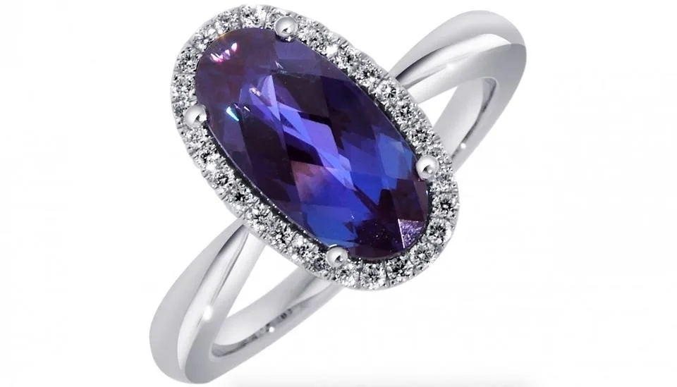
1. Gemstone Jewelry: Musgravite is fashioned into various types of jewelry, such as rings, earrings, necklaces, bracelets, and pendants. Its vibrant colors and excellent brilliance make it an attractive centerpiece gemstone in fine jewelry designs.

2. Investment and Collecting: Musgravite’s extreme rarity and limited availability make it an attractive option for gemstone collectors and investors. As a valuable and sought-after gem, it can appreciate significantly in value over time.

3. Custom and High-End Jewelry Design: Due to its scarcity, musgravite is often used in exclusive and one-of-a-kind jewelry pieces created by renowned jewelers and custom jewelry designers.

4. Heirloom and Legacy Jewelry: Musgravite’s rarity and value make it an excellent choice for heirloom pieces that can be passed down through generations as valuable family treasures.

5. Museum Exhibits: Exceptional and significant musgravite specimens may find their way into museum exhibits and gemological collections to showcase the beauty and uniqueness of this rare gem.

6. Celebrity and Red Carpet Jewelry: Musgravite’s rarity and prestige make it an attractive choice for celebrities and influencers, who may wear musgravite jewelry to red carpet events and special occasions.

7. Private Collections and Investments: Wealthy individuals and gem enthusiasts may acquire musgravite for their private collections or as part of a diversified investment portfolio.

It’s worth noting that due to musgravite’s extreme rarity, it is primarily available to a select few, and most people may never encounter this gem in person. It remains a gemstone of fascination and desire among gem collectors, lapidaries, and jewelry connoisseurs worldwide.

Mount Nyiragongo, Congo

Mount Nyiragongo is an active stratovolcano located in the eastern part of the Democratic Republic of the Congo (DRC), within the Virunga National Park. It is one of the most active and dangerous volcanoes in the world, renowned for its impressive lava lake and frequent eruptions. The volcano is part of the East African Rift, which is a tectonic plate boundary characterized by geological activity, including volcanic eruptions and seismic activity.

Location and Geographical Setting

Mount Nyiragongo is situated about 20 kilometers north of the city of Goma, in the North Kivu province of the Democratic Republic of the Congo. It lies in the western branch of the East African Rift, a major geological fault system that stretches from the Afar region in Ethiopia down to Mozambique. The volcano is part of the Virunga Massif, a chain of eight volcanoes in Rwanda, Uganda, and the DRC. Nyiragongo’s elevation stands at approximately 3,470 meters (11,384 feet) above sea level.

Background and Geological History:

The formation of Mount Nyiragongo can be attributed to the tectonic activity associated with the East African Rift. This rift is caused by the African Plate slowly pulling apart along a series of fault lines. The resulting tension and movement in the Earth’s crust create openings, allowing magma from the mantle to rise to the surface and form volcanoes.

Nyiragongo is classified as a stratovolcano, also known as a composite volcano, which means it is built up of alternating layers of lava flows, volcanic ash, and other volcanic materials. The volcano’s shape is steep and conical, and it features a prominent summit crater that often holds a lava lake.

Notable Eruptions and Volcanic Activity:

Mount Nyiragongo has a history of frequent eruptions, with notable eruptions occurring throughout the 20th and 21st centuries. One of the most significant eruptions happened in 1977 when the lava lake in the summit crater drained catastrophically, causing a massive lava flow that reached the city of Goma and claimed several lives.

Another significant eruption occurred in January 2002, which led to a large lava flow that engulfed parts of Goma, displacing around 400,000 people. The lava flow destroyed homes, infrastructure, and the city’s airport.

Due to its active nature and the proximity of densely populated areas, Mount Nyiragongo remains a considerable concern for the local population and authorities. Constant monitoring and study of the volcano’s activity are essential to predict potential eruptions and ensure the safety of the communities living in its vicinity.

Geology and Formation of Mount Nyiragongo

Mount Nyiragongo is a stratovolcano, also known as a composite volcano, formed by a combination of geological processes, tectonic activity, and volcanic eruptions. Let’s explore its geology and formation in more detail:

Tectonic Setting and Plate Boundaries:

Mount Nyiragongo is located in the eastern part of the Democratic Republic of the Congo, within the East African Rift system. The East African Rift is a geological fault system caused by the movement of tectonic plates. It stretches for over 3,000 kilometers from the Afar region in Ethiopia down to Mozambique.

The rift system is a divergent boundary, where the African Plate is slowly pulling apart along two main branches: the Eastern Rift and the Western Rift. Mount Nyiragongo is situated in the Western Rift, which extends from the northern end of Lake Malawi to the Red Sea. As the African Plate pulls apart, tension fractures form, creating weaknesses in the Earth’s crust where magma can rise to the surface, leading to volcanic activity.

Formation of Stratovolcano:

Stratovolcanoes like Mount Nyiragongo are typically formed by repeated eruptions over time. As magma rises from the mantle to the surface, it often contains high amounts of gas and silica, making it highly viscous. This viscous magma has a tendency to build up near the volcanic vent, forming a steep and conical structure.

Over time, multiple eruptions deposit layers of solidified lava, volcanic ash, and other volcanic materials, creating the characteristic alternating layers of a stratovolcano. These layers build up over thousands of years, resulting in a large, towering structure like Mount Nyiragongo.

Formation of Lava Lake:

One of the most striking features of Mount Nyiragongo is its lava lake, which is relatively rare in volcanoes around the world. The presence of a lava lake is due to the specific properties of the magma and the geometry of the summit crater.

The magma beneath Mount Nyiragongo is characterized by its low viscosity, meaning it flows more easily compared to other magmas. This allows the lava to collect in the summit crater and form a lava lake rather than flowing away from the volcano.

The summit crater of Mount Nyiragongo is also deep and wide, providing enough space for the lava lake to be sustained over time. The constant supply of magma from the mantle replenishes the lake, and the balance between incoming magma and lava outflows maintains the lava lake’s existence.

In summary, Mount Nyiragongo’s formation is a result of tectonic forces associated with the East African Rift, leading to the buildup of layers of volcanic materials over time. The presence of a lava lake is due to the unique properties of the magma and the shape of the summit crater, making it a truly remarkable and geologically significant volcano.

Physical Characteristics of Mount Nyiragongo

Mount Nyiragongo possesses several distinctive physical characteristics that make it a remarkable and unique volcano. Here are some of its main physical attributes:

  1. Stratovolcano Shape: Mount Nyiragongo has a classic stratovolcano shape, characterized by a steep and conical profile. Its slopes rise sharply from the surrounding landscape, and the volcano’s summit is dominated by a large, circular crater.
  2. Impressive Summit Crater: The summit crater of Mount Nyiragongo is one of its defining features. It is remarkably large, measuring about 1.2 kilometers (0.75 miles) in diameter. Within this crater, there is often a lava lake, which has made Nyiragongo famous. The lava lake has fluctuated in size over the years due to varying volcanic activity.
  3. Lava Lake: One of the most extraordinary aspects of Mount Nyiragongo is the persistent lava lake that often occupies its summit crater. This lava lake is relatively rare among volcanoes globally, and Nyiragongo is one of the few places on Earth where visitors can witness the captivating sight of molten lava roiling within the crater.
  4. Active Volcanism: Mount Nyiragongo is known for its frequent and sometimes catastrophic eruptions. The volcano remains highly active, and its eruptions can pose significant risks to nearby communities and wildlife.
  5. Elevation: The summit of Mount Nyiragongo reaches an elevation of approximately 3,470 meters (11,384 feet) above sea level, making it one of the highest peaks in the Democratic Republic of the Congo.
  6. Lava Flows: During eruptions, Nyiragongo produces fast-flowing and highly fluid lava. These lava flows are often capable of traveling great distances, posing a threat to nearby towns and villages.
  7. Location within Virunga National Park: Mount Nyiragongo is situated within the Virunga National Park, one of the oldest and most biodiverse national parks in Africa. The park is home to a wide variety of flora and fauna, including rare mountain gorillas.
  8. Close Proximity to Urban Areas: Mount Nyiragongo is situated relatively close to the city of Goma, which lies approximately 20 kilometers south of the volcano. This proximity to densely populated areas makes the volcano’s activity particularly concerning for the safety of local communities.

In summary, Mount Nyiragongo is a spectacular stratovolcano with an impressive summit crater and a famous lava lake. Its active nature and close proximity to populated areas make it a volcano of significant geological and humanitarian interest. Scientists and authorities closely monitor the volcano to ensure the safety of nearby communities and to study its unique volcanic features.

Mount Nyiragongo 2002 eruption

The Mount Nyiragongo eruption of 2002 was a significant and devastating volcanic event that had a profound impact on the city of Goma and surrounding areas in the Democratic Republic of the Congo. Here are the key details about the eruption:

Date and Duration: The eruption of Mount Nyiragongo began on January 17, 2002, and continued for several days.

Eruption Description: During the 2002 eruption, a large fracture opened on the southern flank of the volcano, near the summit. This fracture allowed a massive outpouring of lava, creating a fast-moving lava flow that advanced towards the city of Goma.

Lava Flow: The lava flow from the 2002 eruption was exceptionally fast and reached speeds of up to 100 kilometers per hour (62 miles per hour). It was also highly fluid, allowing it to travel long distances rapidly.

Impact on Goma: The lava flow from Mount Nyiragongo’s 2002 eruption reached the outskirts of Goma within hours, causing widespread destruction. The lava engulfed homes, schools, and infrastructure, displacing hundreds of thousands of people. The lava flow was so hot and fast that people had little time to evacuate, resulting in significant loss of property and, tragically, loss of life.

Displacement of People: The eruption forced an estimated 400,000 people to flee their homes, seeking safety in neighboring towns and across the border into Rwanda. The eruption’s impact on Goma’s population was severe, and many faced difficulties in accessing food, water, and shelter in the aftermath.

Damage to Infrastructure: The lava flow caused extensive damage to Goma’s infrastructure, including roads, buildings, and utilities. The city’s airport was also severely affected, making relief efforts challenging.

Lava Lake: During the 2002 eruption, the lava lake within Mount Nyiragongo’s summit crater drained catastrophically. The exact mechanism behind this event is not fully understood, but it contributed to the large lava flow that descended towards Goma.

Humanitarian Crisis: The eruption of Mount Nyiragongo in 2002 triggered a humanitarian crisis in the region. Relief organizations and international agencies worked to provide aid and assistance to the affected population, but the situation remained challenging due to ongoing volcanic activity and regional instability.

Lessons Learned: The 2002 eruption of Mount Nyiragongo highlighted the need for improved volcanic monitoring, early warning systems, and disaster preparedness in the region. It also emphasized the importance of considering volcanic hazards when planning urban development near active volcanoes.

Since the 2002 eruption, efforts have been made to enhance monitoring and response capabilities in the Democratic Republic of the Congo to mitigate the impacts of future volcanic events. However, the threat of further eruptions from Mount Nyiragongo remains, and ongoing vigilance is essential to protect the communities living in the region.

Recap of Mount Nyiragongo’s significance and uniqueness

  1. Active Stratovolcano: Mount Nyiragongo is an active stratovolcano, a type of volcano known for its steep and conical shape, formed by layers of lava flows, ash, and other volcanic materials.
  2. Lava Lake: One of the most remarkable features of Nyiragongo is its persistent lava lake within its summit crater. This relatively rare phenomenon sets it apart from many other volcanoes, and the lava lake has been a subject of scientific fascination for decades.
  3. Frequent Eruptions: Nyiragongo is known for its frequent eruptions, making it one of the most active volcanoes in the world. The regular volcanic activity poses significant hazards and risks to nearby communities and wildlife.
  4. Proximity to Urban Areas: The volcano is situated in close proximity to the city of Goma, making it a particularly dangerous and closely monitored volcano due to the potential risks posed to the densely populated urban area.
  5. East African Rift: Nyiragongo’s location in the eastern part of the Democratic Republic of the Congo places it within the East African Rift, a tectonic plate boundary known for its geological activity, including volcanic eruptions and seismic events.
  6. Virunga National Park: The volcano is situated within the Virunga National Park, one of the oldest and most biodiverse national parks in Africa. The park is home to rare mountain gorillas and other unique wildlife.
  7. Humanitarian Concern: The combination of Nyiragongo’s active nature and proximity to populated areas, such as Goma, raises humanitarian concerns regarding potential volcanic hazards and the need for preparedness and response plans.
  8. Geological Research: Mount Nyiragongo has been the subject of extensive scientific research, contributing to our understanding of volcanoes, lava lakes, and the processes governing volcanic eruptions.
  9. Tourism Attraction: Despite the potential risks, Mount Nyiragongo attracts adventurous tourists and researchers who wish to witness the awe-inspiring lava lake and explore the unique geological features of the volcano.

In summary, Mount Nyiragongo’s significance lies in its unique attributes, including the persistent lava lake, frequent eruptions, proximity to populated areas, and its role in scientific research. As a complex and active volcano, Nyiragongo serves as a reminder of the dynamic forces shaping our planet and the importance of studying and managing volcanic hazards.

The Totem Pole, Tasmania, Australia

The Totem Pole is an iconic natural rock formation located on the southeastern coast of Tasmania, Australia. It stands within the Tasman National Park, near the Cape Hauy Track, and is renowned for its stunning coastal landscape and challenging rock climbing opportunities.

The Totem Pole gets its name from its distinctive tall and slender shape, resembling a totem pole. It is a sea stack, which is a geological formation formed by the erosion of coastal cliffs over thousands of years. This process leaves behind isolated pillars of rock in the sea, like the Totem Pole.

The location’s significance lies in its breathtaking beauty, attracting hikers, climbers, and nature enthusiasts from around the world. The area is also home to diverse marine and bird life, making it a protected habitat for various species.

Studying the geology of the Totem Pole is essential for several reasons

a. Geological Understanding: Investigating the formation and composition of the Totem Pole can provide valuable insights into the geological processes that shape coastal landscapes. Understanding how sea stacks are created and eroded can contribute to our knowledge of coastal evolution.

b. Erosion and Conservation: The Totem Pole, like other sea stacks, is susceptible to natural processes such as erosion and weathering. Studying these processes helps in assessing the vulnerability of the formation and aids in implementing effective conservation measures to protect it.

c. Climbing Safety: The Totem Pole is a popular destination for rock climbers, but it presents significant challenges due to its isolated location and unique shape. Researching the geology can provide climbers with crucial information about the stability of the rock and potential risks, improving safety protocols and reducing accidents.

d. Biodiversity: The geology of the Totem Pole also influences the marine and bird life in the area. Understanding the geological aspects can lead to better insights into the habitat preferences and distribution of various species, aiding in conservation efforts.

e. Tourism and Education: The Totem Pole’s geological significance adds to its appeal as a tourist destination. Understanding and promoting its geological importance can enhance educational opportunities for visitors and locals alike, fostering a greater appreciation for the natural world and geological processes.

In conclusion, the Totem Pole’s unique geological formation and its significance as a natural landmark make it an intriguing subject for study. From enhancing our understanding of coastal geology to promoting conservation efforts and safe climbing practices, investigating the geology of the Totem Pole offers numerous benefits to both the scientific community and the general public.

Geological Formation of the Totem Pole

The Totem Pole’s geological formation can be attributed to a combination of processes over an extended period. It began millions of years ago when sedimentary rocks were deposited in layers at the seabed. Over time, various geological processes contributed to its present-day sea stack form. The primary processes involved are:

a. Sedimentary Deposition: Initially, layers of sedimentary rocks, such as sandstone and mudstone, were deposited in horizontal layers on the ocean floor. These sedimentary rocks formed the foundation of the future sea stack.

b. Tectonic Uplift: The region underwent tectonic activity, which caused uplift and created coastal cliffs. These cliffs exposed the underlying sedimentary layers to the influence of weathering and erosion.

c. Erosion: Coastal erosion, driven by the action of waves, wind, and currents, began to wear away the less resistant rock layers, leaving behind isolated rock formations, known as sea stacks. As the softer rocks eroded faster, the more resistant rocks formed the vertical pinnacle of the Totem Pole.

d. Subaerial Processes: Weathering processes, including freeze-thaw cycles and chemical weathering, further contributed to the breakdown of rocks, shaping the Totem Pole into its distinctive form.

Role of the sea in shaping the sea stack

The sea played a crucial role in shaping the Totem Pole into a sea stack. Coastal erosion, predominantly driven by waves and currents, continuously acted upon the coastal cliffs, wearing away the softer rock layers. The sea’s influence can be understood through the following processes:

a. Wave Action: Waves carry sand, pebbles, and other particles, which act as natural abrasives, constantly hitting the base of the cliffs. This leads to the formation of sea caves and notches at the bottom of the cliffs.

b. Hydraulic Action: The force of waves crashing against the cliff face creates pressure, causing cracks and fractures in the rock. This process, known as hydraulic action, weakens the structure of the cliff.

c. Abrasion: The movement of water carries sand and pebbles that collide with the cliff, causing abrasion and gradually wearing it down over time.

d. Marine Erosion: The presence of seawater allows for chemical erosion, where minerals in the rocks react with saltwater, further weakening the cliff’s composition.

As these processes continue over thousands of years, the softer rock layers erode more rapidly, leaving behind the more resistant rock formations like the Totem Pole.

Influence of weathering and erosion on the Totem Pole’s formation

Weathering and erosion have played a fundamental role in shaping the Totem Pole. Weathering refers to the breakdown of rocks in situ, while erosion involves the transportation of weathered material by external agents like water and wind. The specific impacts of weathering and erosion on the Totem Pole’s formation include:

a. Differential Weathering: The Totem Pole’s unique shape is a result of the varying resistance of the rock layers to weathering. The more resistant layers withstand erosion better, forming the narrow pinnacle, while the softer layers erode more rapidly, creating the broader base.

b. Jointing and Fracturing: Weathering processes, such as freeze-thaw cycles and expansion-contraction due to temperature changes, create cracks and fractures in the rock. These joints and fractures provide avenues for erosion to act more effectively on the Totem Pole.

c. Transport and Deposition: The weathered material from the Totem Pole’s formation is transported away by the action of waves, currents, and wind. The deposition of these sediments in other areas can contribute to the formation of different geological features.

Overall, the combined effects of weathering and erosion over geological time have sculpted the Totem Pole into its distinct sea stack shape, making it an impressive and significant natural landmark on Tasmania’s coastline.

Rock Types and Composition

The Totem Pole, being a sea stack on the southeastern coast of Tasmania, consists primarily of sedimentary rocks. The predominant rock types found in the Totem Pole include:

a. Sandstone: Sandstone is the most common rock type in the Totem Pole. It forms from the consolidation of sand-sized grains of mineral, rock, or organic material. Sandstone is often composed of quartz grains cemented together, and it typically appears in layers or strata due to its formation from ancient beach or shallow marine environments.

b. Mudstone: Mudstone is another significant rock type present in the Totem Pole. It forms from fine-grained sediment, such as silt and clay, that has been compacted and lithified over time. Mudstone often appears in thinner layers between sandstone layers and is associated with calmer, low-energy environments like tidal flats or lagoons.

c. Conglomerate: Some sections of the Totem Pole may also contain conglomerate rocks. Conglomerates are sedimentary rocks composed of rounded pebbles and cobbles cemented together by finer-grained material. They indicate the deposition of sediment in high-energy environments like river channels or alluvial fans.

These rock types represent different geological environments and processes that occurred over millions of years, contributing to the formation of the Totem Pole.

Geological composition and mineral content of the sea stack

The geological composition of the Totem Pole is predominantly sedimentary, as mentioned earlier. Therefore, its mineral content primarily consists of minerals commonly found in sedimentary rocks. The main minerals found in the Totem Pole’s rocks include:

a. Quartz: Quartz is a common mineral found in sandstone, and it is also present in some conglomerates. It is a durable mineral that contributes to the hardness and resistance of the rocks.

b. Feldspar: Feldspar is another mineral that may be present in the sandstone and conglomerate layers. It is not as resistant as quartz and tends to weather more easily.

c. Clay Minerals: Mudstone, being composed of fine-grained sediment, contains various clay minerals like kaolinite, illite, and smectite.

d. Carbonate Minerals: In some cases, carbonate minerals like calcite or dolomite may be present in the rocks, especially if the area experienced periods of marine influence.

Geological History

The geological history of the region where the Totem Pole is located spans millions of years and is characterized by various geological events and processes. This area is part of the southeastern coast of Tasmania, Australia, within the Tasman National Park. The geological history of this region includes:

a. Sedimentary Deposition: Millions of years ago, the region was part of a marine environment. Sediments, including sand, silt, and clay, were deposited on the ocean floor, leading to the formation of sedimentary rocks like sandstone and mudstone.

b. Tectonic Activity: The region experienced tectonic movements, including uplift and folding, which resulted in the emergence of the land and the formation of coastal cliffs.

c. Coastal Erosion: The continuous action of waves, wind, and water eroded the coastal cliffs, leading to the creation of sea caves, notches, and eventually, sea stacks like the Totem Pole.

Final thoughts on the geological uniqueness and beauty of the site

The Totem Pole stands as a remarkable testament to the power of geological processes and the beauty of our natural world. Its slender, vertical form, shaped by millions of years of coastal erosion, makes it a breathtaking sight and a dream destination for hikers, climbers, and nature enthusiasts.

The geological uniqueness of the Totem Pole lies not only in its formation as a sea stack but also in the intricate layers of sedimentary rocks that narrate a geological story stretching back through time. It serves as a window into the ancient marine environments and tectonic events that shaped the landscape we see today.

The beauty of the site is not just in its physical appearance but also in the wonder and awe it instills in those who visit. Standing amidst the rugged coastline, gazing at the Totem Pole, one can’t help but marvel at the forces of nature that have sculpted this natural masterpiece.

In conclusion, the Totem Pole’s geology is a fascinating story of Earth’s geological history, and its conservation is vital to preserve its scientific, environmental, and cultural significance for generations to come. As one of nature’s most captivating creations, the Totem Pole serves as a reminder of the grandeur and uniqueness of our planet’s geological heritage.

Old Harry Rocks and the Jurassic Coast, England

Old Harry Rocks: Old Harry Rocks are a striking formation of chalk sea stacks located on the Jurassic Coast in Dorset, England. These iconic rock formations are one of the most famous natural landmarks in the area and hold significant geological and historical importance.

The formation consists of three chalk stacks standing just off the eastern edge of Studland Bay, near the town of Swanage. The three stacks are named after a local legend about a pirate named Old Harry who used to hide in the rocks, although this tale might not have any historical basis.

The Jurassic Coast: The Jurassic Coast is a UNESCO World Heritage Site that stretches for about 96 miles (154 kilometers) along the southern coast of England, from Exmouth in East Devon to Studland Bay in Dorset. It is renowned for its exceptional geological and paleontological significance, as it showcases rocks and fossils dating back to the Mesozoic Era, which spanned over 180 million years.

The coast features a wide range of geological formations, including cliffs, bays, beaches, and iconic landmarks like Durdle Door and Lulworth Cove. It is one of the most geologically diverse coastlines in the world and provides a unique window into the Earth’s history, particularly from the Triassic, Jurassic, and Cretaceous periods.

Geological Significance: The Jurassic Coast is famous for its abundance of fossils, which have helped scientists and researchers gain valuable insights into the history of life on Earth. Fossils of ancient marine reptiles, dinosaurs, and various prehistoric creatures have been discovered here, providing critical information about their evolution and the ancient environments they lived in.

The coast’s geological formations also reveal the impact of natural processes such as erosion, landslides, and sedimentation, which have shaped the landscape over millions of years. The cliffs and rock formations, including Old Harry Rocks, serve as a living record of the Earth’s geological history and have attracted countless visitors and geologists from around the world.

Tourism and Conservation: The Jurassic Coast is a popular tourist destination, attracting nature enthusiasts, geologists, and history buffs alike. Visitors come to explore the stunning coastline, take in the breathtaking views, and learn about the fascinating geological history of the area.

To protect its geological and natural significance, the Jurassic Coast is managed by various conservation organizations and local authorities. These efforts aim to strike a balance between tourism and preservation, ensuring that this unique heritage site can be enjoyed by generations to come while safeguarding its fragile ecosystems and geological treasures.

Overall, Old Harry Rocks and the Jurassic Coast represent a captivating blend of geological wonders, natural beauty, and cultural history, making it a must-visit destination for anyone interested in the Earth’s past and the beauty of the British coastline.

Formation of Old Harry Rocks

Old Harry Rocks were formed through natural erosion processes that took place over millions of years. The rocks are made of chalk, a soft and porous type of limestone composed mainly of microscopic shells of marine organisms.

The formation of Old Harry Rocks can be traced back to the Cretaceous Period, which occurred approximately 66 to 145 million years ago. At that time, the area was submerged under a shallow sea, and over time, layers of sediment, including the remains of tiny marine organisms, accumulated on the seafloor. These accumulated sediments eventually compacted and cemented together to form the chalk rock.

As the Earth’s tectonic plates shifted and the sea levels fluctuated, the chalk deposits were gradually exposed to the elements. The combination of coastal erosion, wave action, and weathering contributed to the sculpting of the chalk cliffs and the formation of sea stacks, such as Old Harry Rocks.

Composition of Old Harry Rocks

Old Harry Rocks are primarily composed of chalk, which is a soft, white, and fine-grained rock made up of calcium carbonate (CaCO3). Chalk is formed from the compacted remains of marine plankton, mainly tiny coccolithophores, which are single-celled algae with calcareous plates or shells.

Chalk is a relatively soft rock compared to many other types of rock, making it susceptible to erosion by the relentless force of the sea. Over time, coastal erosion and the action of waves and weathering have shaped the chalk cliffs into distinctive formations, including the three sea stacks known as Old Harry Rocks.

The chalk’s white color, along with the contrasting blue of the sea and the greenery of the surrounding landscape, adds to the scenic beauty and appeal of Old Harry Rocks and makes them a popular attraction for tourists and nature enthusiasts.

It’s worth noting that, due to the ongoing process of erosion, the shape and size of Old Harry Rocks are continually changing. Erosion from wind and water will gradually wear away the chalk cliffs, shaping them differently over time, creating a dynamic and ever-evolving landscape.

The Role of Erosion in Shaping Old Harry Rocks

Erosion plays a vital role in shaping Old Harry Rocks and the surrounding coastline. Over millions of years, various erosion processes have acted upon the chalk cliffs, sculpting them into the distinct sea stacks we see today. The primary agents of erosion that have influenced the formation of Old Harry Rocks are:

  1. Coastal Erosion: Coastal erosion refers to the wearing away of coastal land by the action of waves, currents, and tides. The Jurassic Coast, including the area around Old Harry Rocks, is subject to constant wave action due to its exposure to the English Channel. As waves crash against the chalk cliffs, they gradually erode the softer rock, removing particles and wearing it down over time.
  2. Abrasion: This process involves the wearing down of rock surfaces by the impact of sediment and pebbles carried by the waves. As these particles strike the chalk cliffs, they help break down the rock, leading to the formation of sea caves, arches, and stacks, like Old Harry Rocks.
  3. Hydraulic Action: This form of erosion occurs when waves force air and water into cracks and crevices in the rock. Over time, the pressure exerted by this trapped air and water weakens the rock, causing it to break apart and form features such as sea stacks.
  4. Weathering: Weathering refers to the breakdown of rock due to exposure to weather elements such as rain, frost, and temperature changes. In the case of Old Harry Rocks, the chalk cliffs are susceptible to weathering, which further loosens the rock and makes it more vulnerable to coastal erosion.
  5. Mass Movement: Mass movement, including landslides and slumping, can also contribute to the shaping of Old Harry Rocks. As the cliffs erode and lose stability, sections of rock may collapse and slide, altering the coastal landscape and contributing to the formation of sea stacks.

The combination of these erosion processes has led to the creation of Old Harry Rocks as isolated sea stacks, standing out against the coastline. It’s essential to note that erosion continues to be an ongoing process, and the shapes of Old Harry Rocks may continue to evolve and change over time as the forces of nature continually shape and reshape the coastal cliffs.

Preserving these natural landmarks is crucial to protecting their geological and environmental significance, and conservation efforts are necessary to balance the impact of tourism and safeguarding this unique and iconic part of the Jurassic Coast.

The Devil’s Postpile, California, USA

The Devil’s Postpile is a fascinating geological formation located in the eastern Sierra Nevada Mountains of California, United States. It is a columnar basalt structure, which means it is composed of tightly packed, vertical columns of basalt rock. These unique columns were formed through volcanic activity millions of years ago.

The story of Devil’s Postpile begins with a volcanic eruption that occurred over 100,000 years ago. During this volcanic event, lava flowed across the landscape, filling a river valley. As the lava cooled and solidified, it contracted and cracked into hexagonal and pentagonal columns, creating the incredible pattern that we see today.

The columns at the Devil’s Postpile are mostly around 60 feet tall and have remarkably uniform shapes. The hexagonal columns, which are the most common, fit together like giant puzzle pieces, creating a striking natural spectacle.

While the Devil’s Postpile was discovered by Native Americans and is considered a sacred site by some tribes, it gained wider attention in the mid-19th century when its unique geological features attracted the interest of geologists and nature enthusiasts.

Located within the Ansel Adams Wilderness of the Inyo National Forest, the Devil’s Postpile is now a National Monument to preserve and protect this exceptional natural wonder. The area also features beautiful hiking trails that lead visitors through scenic landscapes, including the nearby Rainbow Falls, which cascades over volcanic cliffs.

Due to its delicate geological nature, visitors are encouraged to practice responsible tourism and adhere to park guidelines to ensure the preservation of this extraordinary geological marvel for generations to come. Whether you are a geology enthusiast or simply a lover of natural wonders, the Devil’s Postpile is undoubtedly a place worth exploring and admiring.

Geological Formation

The Devil’s Postpile, like other columnar basalt formations, was formed through a process called columnar jointing. This geological phenomenon occurs when certain types of lava cool and contract, causing the rock to crack and split into polygonal columns with distinct shapes. Here’s an overview of how columnar basalt formations, including the Devil’s Postpile, are created:

  1. Volcanic Origins: The process begins with a volcanic eruption that releases lava onto the Earth’s surface. In the case of the Devil’s Postpile, this volcanic activity occurred over 100,000 years ago in what is now the eastern Sierra Nevada Mountains of California.
  2. Composition of Lava: Columnar basalt formations are primarily composed of basaltic lava, which is a type of mafic lava that contains high levels of iron and magnesium. Basaltic lava has a relatively low viscosity, which means it can flow more easily compared to other types of lava.
  3. Cooling and Solidification: As the lava flows across the landscape, it is exposed to the relatively cooler air or water at the surface. This rapid cooling causes the outer layer of the lava flow to solidify quickly.
  4. Contraction and Stress: As the lava continues to cool, it contracts, creating tensile stresses within the rock. These stresses cause the cooling lava to crack and fracture along planes that are roughly perpendicular to the cooling surface.
  5. Columnar Jointing: The cracks propagate downward into the still-molten interior of the lava flow, forming polygonal columns. The most common column shapes are hexagonal (six-sided) and pentagonal (five-sided), although other polygonal shapes can also occur depending on the specific cooling conditions.
  6. Uniformity of Columns: One remarkable aspect of columnar basalt formations is the relatively uniform size and shape of the columns. The regularity of the columns is due to the systematic pattern of contraction and cracking that occurs during the cooling process.
  7. Exhumation: Over time, geological processes, such as erosion and glaciation, may expose these columnar basalt formations. The Devil’s Postpile, for instance, was revealed as glaciers eroded the surrounding terrain, exposing the impressive columnar structure.

In the case of the Devil’s Postpile, the columns are approximately 60 feet tall and are incredibly well-preserved. This unique formation has attracted scientists, geologists, and nature enthusiasts alike, providing valuable insights into the geological processes that shaped the Earth’s surface millions of years ago.

Physical Characteristics

The Devil’s Postpile, a columnar basalt formation located in the eastern Sierra Nevada Mountains of California, exhibits several distinct physical characteristics that make it a remarkable natural wonder. Here are some key physical characteristics of the Devil’s Postpile:

  1. Columnar Basalt Structure: The most prominent and defining feature of the Devil’s Postpile is its columnar basalt structure. The columns are made up of tightly packed, vertically oriented basalt rock segments. These columns are mostly hexagonal in shape, though some pentagonal and other polygonal shapes can also be found.
  2. Height and Size: The columns at the Devil’s Postpile can reach impressive heights of around 60 feet (approximately 18 meters). The columns are well-preserved and uniform in size, which adds to the site’s aesthetic appeal.
  3. Symmetry: The columns’ hexagonal and pentagonal shapes contribute to the overall symmetry of the formation. When viewed from various angles, the Devil’s Postpile showcases a harmonious and visually striking display of natural geometry.
  4. Geological Age: The Devil’s Postpile formation is estimated to be over 100,000 years old, dating back to a volcanic eruption that occurred in the area during the Pleistocene epoch.
  5. Basalt Composition: The columns are composed of basaltic lava, which is a dark, fine-grained volcanic rock. Basalt is rich in iron and magnesium and forms from the rapid cooling of lava on the Earth’s surface.
  6. Surrounding Landscape: The Devil’s Postpile is situated within the Ansel Adams Wilderness of the Inyo National Forest, surrounded by a picturesque alpine landscape. The site is also in close proximity to the San Joaquin River, which further enhances its scenic beauty.
  7. Accessibility: The Devil’s Postpile is accessible to visitors through hiking trails that allow them to explore the columns up close. The site is a popular destination for nature enthusiasts and geology lovers alike.
  8. Conservation Status: The Devil’s Postpile was designated as a National Monument in 1911 by President William Howard Taft, and it is now protected and managed by the National Park Service to ensure its preservation for future generations.

Overall, the Devil’s Postpile’s physical characteristics, including its unique columnar basalt structure and scenic surroundings, make it a must-visit destination for anyone interested in geology, natural formations, and the beauty of the great outdoors.

The San Joaquin River and Rainbow Falls

The San Joaquin River and Rainbow Falls are two natural features located near the Devil’s Postpile in the eastern Sierra Nevada Mountains of California. They are both stunning attractions that complement the beauty of the area and offer visitors an opportunity to explore diverse landscapes. Here’s an overview of each:

  1. San Joaquin River: The San Joaquin River is a major watercourse that flows through the central Sierra Nevada range in California. It starts its journey from the high peaks of the Sierra Nevada and eventually flows into the San Joaquin Valley, making it one of the most significant rivers in the state.

As the river passes through the Ansel Adams Wilderness, it carves a path near the Devil’s Postpile, adding to the scenic allure of the area. The river is known for its clear, cold waters, making it a popular destination for fishing, kayaking, and other recreational activities.

  1. Rainbow Falls: Rainbow Falls is an impressive waterfall located on the San Joaquin River, just downstream from the Devil’s Postpile. The falls are named after the rainbows that often form in the mist created by the cascading water, providing a breathtaking and colorful display.

The height of Rainbow Falls is approximately 101 feet (30 meters), and its thunderous flow is a remarkable sight, especially during the spring and early summer when the snowmelt from the surrounding mountains increases the river’s volume. The falls create a stunning contrast against the dark basalt columns of the Devil’s Postpile, making it a picturesque scene.

To reach Rainbow Falls, visitors can take a scenic hiking trail from the Devil’s Postpile National Monument. The trail is approximately 2.5 miles (4 kilometers) roundtrip and offers spectacular views of both the Devil’s Postpile and the falls.

Both the San Joaquin River and Rainbow Falls are part of the diverse natural landscape of the region, making the Devil’s Postpile area a popular destination for nature lovers, hikers, and photographers seeking to experience the beauty of the Sierra Nevada Mountains and its remarkable geological formations.

Volcán de Fuego

Volcán de Fuego, also known as the “Volcano of Fire,” is a highly active and renowned stratovolcano located in Central America. Situated in Guatemala, this volcano has a long history of eruptions, making it one of the most dangerous and closely monitored volcanoes in the region. Its name aptly describes the frequent explosive eruptions that often result in lava flows and pyroclastic flows, creating a stunning yet hazardous natural spectacle.

Volcán de Fuego is famous for its frequent eruptions, which have been documented for centuries. The volcano is part of the Pacific Ring of Fire, an area known for its intense tectonic activity and numerous active volcanoes. Its continuous activity and proximity to populated areas have made it a subject of great interest for scientists, geologists, and emergency authorities.

Location and Geological Characteristics

This stratovolcano is located in the western region of Guatemala, within the Central American Volcanic Arc. It forms part of the Sierra Madre mountain range, situated approximately 16 kilometers (10 miles) southwest of Antigua, a UNESCO World Heritage site and a popular tourist destination.

With an elevation of approximately 3,763 meters (12,346 feet) above sea level, Volcán de Fuego stands as an imposing volcanic peak. Like other stratovolcanoes, it is constructed of alternating layers of volcanic material, including lava flows, ash, and pyroclastic debris. This conical shape results from centuries of volcanic activity and the accumulation of various volcanic products.

Importance of Monitoring Active Volcanoes

The monitoring of active volcanoes, such as Volcán de Fuego, is of paramount importance for numerous reasons:

  1. Public Safety: By closely monitoring volcanic activity, authorities can detect early signs of potential eruptions, allowing them to issue timely evacuation warnings and safeguard nearby communities from potential hazards.
  2. Hazard Assessment: Monitoring data helps in assessing the potential risks and hazards posed by the volcano. Understanding the volcano’s behavior and eruption patterns is essential for developing effective emergency response plans.
  3. Scientific Research: Studying active volcanoes provides valuable insights into volcanic processes and the Earth’s geology. It contributes to our understanding of volcanic behavior, helping scientists predict future eruptions and enhance preparedness.
  4. Aviation Safety: Volcanic eruptions can produce ash clouds that pose risks to aircraft. Monitoring allows aviation authorities to issue warnings and reroute flights to ensure safe air travel.
  5. Environmental Impact: Eruptions can have significant environmental consequences, such as disrupting weather patterns, altering landscapes, and affecting ecosystems. Monitoring helps in assessing and mitigating these impacts.

In conclusion, Volcán de Fuego’s fame and notoriety stem from its frequent eruptions and potential hazards. The volcano’s location, geological characteristics, and active nature make it crucial to continuously monitor its activity for public safety, scientific research, hazard assessment, aviation safety, and environmental protection.

Historical Background

Volcán de Fuego has a long and storied volcanic history that dates back thousands of years. Its eruptions have been documented since the Spanish colonial era, and it has remained one of the most active and dangerous volcanoes in Central America.

The exact date of the volcano’s formation is not precisely known, but it is believed to have been active for at least several hundred thousand years. Volcán de Fuego is part of a volcanic complex that also includes the nearby Acatenango volcano. These two volcanoes are often considered twin volcanoes due to their close proximity and shared geological characteristics.

Throughout its history, Volcán de Fuego has exhibited frequent explosive eruptions, characterized by the release of ash, lava flows, and pyroclastic flows. Its eruptions are typically highly explosive and pose significant hazards to nearby communities and the surrounding environment.

Notable Eruptions in the Past

Volcán de Fuego has had numerous notable eruptions throughout history. Some of the most significant eruptions include:

  1. The Great Eruption of 1581: This eruption was one of the largest and most catastrophic in the volcano’s recorded history. It caused extensive damage to nearby settlements and resulted in significant loss of life.
  2. The 1717 Eruption: Another major eruption occurred in 1717, causing widespread devastation in the surrounding areas and leading to further loss of life and property.
  3. The 2018 Eruption: In recent times, one of the most devastating eruptions occurred in June 2018. The volcano spewed a massive column of ash and gas, triggering pyroclastic flows that engulfed nearby villages. This eruption led to the tragic loss of over 190 lives and caused extensive damage to homes and infrastructure.

Impact on Nearby Communities in Previous Eruptions

The frequent eruptions of Volcán de Fuego have had a profound impact on the nearby communities over the years. The volcano’s proximity to densely populated areas has made it particularly hazardous, and its eruptions have led to significant human and economic losses.

The volcanic ash and pyroclastic flows can destroy crops, contaminate water sources, and disrupt transportation and communication networks. Entire villages and settlements have been buried or severely damaged during some of the more catastrophic eruptions.

Communities living in the vicinity of Volcán de Fuego have had to adapt to the ongoing volcanic threats by implementing early warning systems and emergency preparedness plans. Regular monitoring and communication from volcanologists and authorities are crucial to help residents evacuate safely and minimize the impact of future eruptions.

In conclusion, Volcán de Fuego’s historical background is marked by frequent explosive eruptions that have had devastating effects on nearby communities. The volcano’s eruptions have caused loss of life, property damage, and disruption to local livelihoods, making it a constant concern for those living in its shadow.

2018 Eruption

The 2018 eruption of Volcán de Fuego, which occurred on June 3, 2018, was one of the most devastating and deadly eruptions in the volcano’s recent history. The eruption resulted in a significant loss of life and caused extensive damage to nearby communities.

During this eruption, the volcano expelled a massive column of ash and gas into the atmosphere, reaching heights of several kilometers. The eruption triggered fast-moving pyroclastic flows, which are extremely hot and dense mixtures of volcanic ash, rock fragments, and gases. These flows raced down the slopes of the volcano, engulfing everything in their path.

Several villages and settlements near the volcano were directly impacted by the pyroclastic flows. The communities of San Miguel Los Lotes and El Rodeo, located on the southwestern slopes of Volcán de Fuego, suffered the most devastating consequences. These villages were almost completely buried under layers of volcanic debris, leaving little chance for residents to escape.

The 2018 eruption claimed the lives of more than 190 people, injured many others, and led to the displacement of thousands of residents who had to flee from the danger zone. The intense heat of the pyroclastic flows and the high-speed avalanches of volcanic material left little time for evacuation, resulting in a tragic loss of life.

Emergency responders, volunteers, and authorities immediately initiated rescue and relief efforts to assist those affected by the eruption. However, the scale and intensity of the disaster posed significant challenges to the response operations.

The 2018 eruption highlighted the ongoing need for closely monitoring Volcán de Fuego and the importance of implementing effective early warning systems and emergency preparedness plans for nearby communities. It also underscored the hazards associated with living in close proximity to active volcanoes and the necessity of adhering to evacuation protocols during volcanic emergencies.

In the aftermath of the eruption, efforts were made to aid in recovery, rebuild damaged infrastructure, and provide support to those who lost their homes and loved ones. Additionally, the eruption prompted renewed attention to volcanic risk assessment and the importance of public education on volcanic hazards to enhance community resilience in the face of future eruptions.

Recap of the significance of the Volcán de Fuego eruption

The eruption of Volcán de Fuego in 2018 was a highly significant event due to its devastating impact on nearby communities and its demonstration of the hazards associated with living near active volcanoes. Here’s a recap of the eruption’s significance:

  1. Loss of Life: The 2018 eruption resulted in over 190 fatalities, making it one of the deadliest volcanic events in Guatemala’s recent history. The rapid and intense pyroclastic flows caught many residents off guard, leaving little time for evacuation.
  2. Destruction of Property and Infrastructure: The volcanic ash, lava flows, and pyroclastic flows caused extensive damage to homes, agricultural land, and infrastructure in nearby villages. Entire communities were buried or severely damaged by the volcanic debris.
  3. Displacement and Humanitarian Impact: The eruption led to the displacement of thousands of people who had to evacuate from the danger zone. The affected communities faced significant humanitarian challenges, including the need for shelter, food, and medical assistance.
  4. Emergency Response and Preparedness: The eruption highlighted the importance of effective emergency response and preparedness measures. It exposed the need for better evacuation plans, early warning systems, and community education to reduce the impact of future eruptions.
  5. Volcanic Risk Assessment: The 2018 eruption prompted renewed attention to volcanic risk assessment in the region. It emphasized the necessity of understanding the potential hazards posed by active volcanoes and developing strategies to minimize the risks to human lives and property.
  6. Regional and International Cooperation: The eruption demonstrated the importance of regional and international cooperation in monitoring and responding to volcanic events. Collaboration among neighboring countries and international organizations facilitated information sharing and support during the crisis.
  7. Public Awareness and Education: The eruption raised awareness about the risks of living near active volcanoes and the importance of educating the public about volcanic hazards. It emphasized the need for communities to be well-informed and prepared to respond to volcanic emergencies.
  8. Scientific Research: The eruption provided valuable data for scientists and researchers studying volcanic processes and hazards. It contributed to a deeper understanding of Volcán de Fuego’s behavior and the potential implications for future eruptions.

In conclusion, the 2018 eruption of Volcán de Fuego had a profound impact on the affected communities and highlighted the importance of monitoring, early warning systems, emergency preparedness, and public education in volcanic regions. The tragedy served as a reminder of the inherent risks of living near active volcanoes and the ongoing need for proactive measures to protect lives and property in volcanic-prone areas.

Borax

Borax, also known as sodium borate or sodium tetraborate, is a naturally occurring mineral that has been used for various purposes throughout history. It is composed of boron, sodium, oxygen, and water molecules. The chemical formula for borax is Na2B4O7·10H2O.

Origin and Occurrence: Borax is typically found in dry lake beds, salt flats, and sedimentary rocks. It forms through the evaporation of water in arid regions, leading to the concentration of boron compounds. One of the most famous and abundant sources of borax is the Searles Lake in California, United States.

Historical Uses: The history of borax usage dates back thousands of years. Ancient civilizations, such as the Egyptians and Romans, used borax for various purposes, including as a cleaning agent, a flux to assist with soldering metals, and as a preservative for food. It was also used in traditional medicine and in the production of glass and ceramics.

Modern Applications: In the modern era, borax continues to have numerous applications across various industries:

  1. Household Cleaning: Borax is a common ingredient in many household cleaning products due to its natural cleansing and deodorizing properties. It can be used to clean surfaces, remove stains, and eliminate odors.
  2. Laundry Detergent: Borax is an essential component in homemade laundry detergents and can enhance the cleaning power of commercial laundry detergents.
  3. Insecticides: Borax can be used as a less toxic alternative to chemical insecticides to control pests such as ants, cockroaches, and fleas.
  4. Fire Retardant: Borax can be incorporated into certain fire retardant products, especially for wood and cellulose-based materials.
  5. Metallurgy: In metallurgical processes, borax acts as a flux to facilitate the welding, soldering, and brazing of metals.
  6. Agriculture: Borax is used in agriculture as a micronutrient for plants, especially in regions where boron deficiency is prevalent in the soil.

Safety Considerations: While borax has a wide range of applications, it is essential to handle it with care. Borax can be harmful if ingested in large quantities, and prolonged exposure to high concentrations may cause skin and respiratory irritation. As with any chemical substance, it is crucial to follow safety guidelines and use appropriate protective measures when handling borax.

In conclusion, borax is a versatile mineral with a long history of practical applications. From its ancient uses to modern-day applications, borax continues to be a valuable resource in various industries and households around the world.

Occurrence and distribution

Borax occurs naturally in various geological settings, and its distribution is influenced by specific environmental conditions. The primary natural occurrences of borax are found in arid and semi-arid regions with high evaporation rates, which promote the concentration of boron-containing compounds in water bodies. Here are some key aspects of the occurrence and distribution of borax:

  1. Salt Flats and Dry Lake Beds: One of the most common places to find borax is in salt flats and dry lake beds. These areas experience periodic flooding followed by evaporation, which concentrates the boron minerals, including borax. Examples of well-known borax-rich salt flats include Searles Lake in California, United States, and the Rio Tinto basin in Spain.
  2. Borate Deposits: Borax is often found in borate deposits, which are sedimentary formations rich in boron minerals. These deposits can be found in regions with ancient volcanic activity or tectonic processes that have concentrated boron-bearing minerals over geological time. Turkey, the United States, Chile, Argentina, and China are some countries with significant borate deposits.
  3. Hot Springs and Geothermal Areas: Borax can also occur near hot springs and geothermal areas where thermal waters leach boron from surrounding rocks and deposit it as borax-rich deposits upon cooling.
  4. Boron-Rich Soils: Borax can be found in soils with high boron content. In some areas, the decomposition of boron-rich minerals and rocks contributes to elevated boron levels in the soil.
  5. Associated Minerals: Borax is commonly associated with other boron-bearing minerals, such as ulexite, colemanite, and kernite, which often co-occur in borate deposits.

Distribution: The distribution of borax deposits is not uniform globally. Major borax-producing countries include:

  • United States: The United States, particularly California and Nevada, is a significant producer of borax, with the vast Searles Lake being a prominent source.
  • Turkey: Turkey is a major producer of borax, with significant deposits located in the Bigadiç region.
  • Chile and Argentina: These South American countries also have substantial borax deposits.
  • China: China is another significant producer of borax, with deposits in Tibet and Qinghai provinces.

Other countries with smaller borax reserves and production include Bolivia, Peru, Iran, and Russia.

In conclusion, borax occurs naturally in arid and semi-arid regions, particularly in salt flats, dry lake beds, and borate deposits. The distribution of borax-rich areas is concentrated in specific countries with favorable geological and environmental conditions for its formation.

Properties of Borax

Borax, also known as sodium borate or sodium tetraborate, possesses several interesting and useful properties due to its unique chemical composition. Here are some key properties of borax:

  1. Chemical Formula: The chemical formula of borax is Na2B4O7·10H2O, indicating that each unit contains two sodium (Na) ions, four boron (B) atoms, seven oxygen (O) atoms, and ten water (H2O) molecules.
  2. Solubility: Borax is highly soluble in water, meaning it readily dissolves in water to form a colorless alkaline solution. This property is crucial in various applications, such as cleaning and laundry products.
  3. pH: The aqueous solution of borax is alkaline, with a pH around 9-10. This alkalinity contributes to its effectiveness as a cleaning agent and a buffer in certain chemical processes.
  4. Dehydrating Agent: When heated, borax loses its water molecules and becomes anhydrous borax (Na2B4O7), which can act as a dehydrating agent in some applications.
  5. Fluxing Agent: In metallurgy, borax acts as a fluxing agent, facilitating the fusion of metals during soldering, welding, and brazing operations.
  6. Crystal Structure: Borax forms monoclinic crystals that exhibit interesting shapes and properties, making it a visually appealing substance.
  7. Low Toxicity: Borax is considered relatively low in toxicity for humans and animals when used appropriately. However, ingesting large quantities can lead to adverse effects, so it should be handled with care.
  8. Hygroscopic: Borax has some hygroscopic properties, meaning it can absorb moisture from the air under certain conditions.
  9. Insoluble in Organic Solvents: While borax is highly soluble in water, it is insoluble in most organic solvents.
  10. Flame Retardant: Borax is used as a flame retardant in certain applications, where it can help reduce the flammability of materials.
  11. Insecticidal Properties: Borax is known to have insecticidal properties and is used as a natural and less toxic option for pest control in certain situations.
  12. Buffering Agent: Due to its alkaline nature, borax can act as a buffering agent, helping to stabilize pH levels in various applications.
  13. Crystal Clearing Agent: In science and microscopy, borax is used as a clearing agent to make certain specimens more transparent for observation.

These properties make borax a versatile and valuable substance with various applications in household cleaning, laundry, agriculture, metallurgy, and more. However, it is important to use borax safely and follow guidelines to avoid potential health hazards associated with improper handling or ingestion.

Physical properties

  1. Appearance: Borax typically appears as colorless or white crystalline powder or granules. It may sometimes have a slight yellow or green tinge due to impurities.
  2. Odor: Borax is odorless.
  3. Taste: Borax has a mild, alkaline taste.
  4. Density: The density of borax varies depending on the form, but typically it is around 1.73 grams per cubic centimeter (g/cm³) for the anhydrous form and about 1.71 g/cm³ for the decahydrate (the common hydrated form).
  5. Melting Point: The melting point of borax decahydrate (the most common form) is around 75°C (167°F). Upon heating, it loses water molecules and becomes anhydrous borax, which has a higher melting point at approximately 743°C (1369°F).
  6. Boiling Point: Borax decahydrate starts to lose water molecules at around 62°C (144°F) and undergoes complete dehydration at higher temperatures.
  7. Solubility: Borax is highly soluble in water, and its solubility increases with higher temperatures. Approximately 15-20 grams of borax can dissolve in 100 grams of water at room temperature.
  8. Crystal System: Borax crystallizes in the monoclinic crystal system. The crystals are often prismatic or tabular.
  9. Hygroscopicity: Borax exhibits some hygroscopic properties, meaning it can absorb and retain moisture from the surrounding air under certain conditions.
  10. Electrical Conductivity: Borax is a poor conductor of electricity in its solid state but can enhance the conductivity of some substances when dissolved in water.
  11. Refractive Index: The refractive index of borax is approximately 1.47.
  12. Specific Heat: The specific heat capacity of borax is around 1.4 joules per gram per degree Celsius (J/g°C).
  13. Hardness: Borax has a Mohs hardness of about 2-2.5, indicating it is relatively soft.
  14. Cleavage: Borax has perfect basal cleavage, meaning it can be easily cleaved parallel to its crystal surfaces.

These physical properties contribute to the diverse uses and applications of borax in various industries and household products. Its solubility, low toxicity, and alkaline nature make it especially useful in cleaning agents, while its ability to act as a flux and fire retardant is valuable in metallurgy and fire safety applications.

Uses of Borax

Borax, with its unique properties, has numerous practical applications across various industries and everyday household use. Some of the most common uses of borax include:

  1. Household Cleaning: Borax is an effective and natural cleaning agent used for various household cleaning tasks. It can remove stains, deodorize, and act as a mild abrasive cleaner for surfaces.
  2. Laundry: Borax is used as a laundry booster to enhance the cleaning power of detergents. It helps remove stains, soften water, and deodorize clothes.
  3. Insecticide: Borax is employed as a less toxic alternative to chemical insecticides. It can be used to control ants, cockroaches, fleas, and other pests by disrupting their exoskeletons and digestive systems.
  4. Fire Retardant: Borax can be used as a fire retardant for certain materials, especially in applications like treating wood and cellulose-based products.
  5. Metallurgy: Borax acts as a flux in metallurgical processes, facilitating the fusion of metals during soldering, welding, and brazing operations.
  6. Pottery and Ceramics: Borax is used in pottery and ceramic glazes to promote better adhesion and improve the surface finish.
  7. Glass Manufacturing: Borax is utilized in glassmaking as a flux to lower the melting point of silica, making the glass easier to shape.
  8. Agriculture: In agriculture, borax is used as a micronutrient supplement for plants in regions where boron deficiency is common. It helps improve plant growth and crop yields.
  9. pH Buffer: Borax acts as a buffering agent to stabilize the pH levels in various chemical processes and solutions.
  10. Science and Education: Borax is used in science experiments and educational demonstrations, such as making slime and crystal formations.
  11. Pharmaceutical Applications: Borax has been used in certain traditional medicines and personal care products, although its use in these areas has diminished due to safety concerns.
  12. Cleaning Products: Borax is a common ingredient in various commercial cleaning products, such as multipurpose cleaners, toilet bowl cleaners, and rust removers.
  13. Taxidermy: Borax is used in taxidermy to preserve and protect animal hides and skins.
  14. Photography: Borax is used in the preparation of certain photographic developing solutions.

It’s important to note that while borax has numerous practical uses, it should be handled with care and used responsibly. Direct ingestion of large quantities can be harmful, and it’s essential to follow safety guidelines and recommendations for appropriate usage in various applications.

Economic Importance and Trade

Borax holds significant economic importance and is traded internationally due to its various industrial and household applications. Some key points regarding the economic importance and trade of borax include:

  1. Industrial Demand: Borax is a crucial raw material in several industries, such as the glass industry, ceramics, metallurgy, and the manufacture of fiberglass and borosilicate glass. Its applications as a flux, fire retardant, and corrosion inhibitor contribute to its industrial demand.
  2. Household Products: Borax is extensively used in household cleaning products and laundry detergents. Its effectiveness as a cleaning agent and laundry booster has led to a consistent demand in the consumer market.
  3. Agriculture: Borax is an essential micronutrient for various crops, and its use in agriculture helps improve plant growth and yields in regions where boron deficiency affects crop productivity.
  4. Pest Control: As an eco-friendly and less toxic alternative to chemical insecticides, borax is sought after for controlling pests like ants, cockroaches, and fleas.
  5. International Trade: Major borax-producing countries engage in international trade to meet global demand. The United States, Turkey, Chile, Argentina, China, and other countries with borate deposits export borax and borate compounds to various regions worldwide.
  6. Commercial Production: Companies specializing in the mining and processing of borax play a vital role in the global trade of the mineral. The largest borax production facilities are often concentrated in the countries with significant borate reserves.
  7. Borate Products: Apart from borax, other borate compounds like boric acid and boron oxide are also traded and used in various applications, contributing to the overall boron market.
  8. Economic Contribution: The boron industry contributes to the economy of producing countries through job creation, export revenues, and investment in mining and processing facilities.
  9. Environmental Considerations: The sustainable mining and processing of borax is essential to maintain a balance between economic importance and environmental conservation.
  10. Global Demand: The demand for borax and boron products is influenced by economic growth, industrial activities, agricultural needs, and consumer preferences in various regions.

Overall, the economic importance and trade of borax are driven by its diverse applications across industries and its widespread use in households. As global awareness of eco-friendly and sustainable products increases, the demand for borax and other borate compounds as environmentally friendly alternatives is likely to grow.

Boron (B)

Boron minerals are a group of naturally occurring compounds that contain the element boron in various forms. Boron is a chemical element with the symbol “B” and atomic number 5. It is a metalloid, meaning it has properties of both metals and nonmetals. Boron minerals are essential to many industrial and technological applications due to their unique properties and characteristics.

There are several boron minerals, but the most common and economically significant ones include borax (sodium tetraborate decahydrate), kernite (sodium borate hydrate), colemanite (calcium borate hydrate), and ulexite (sodium calcium borate hydrate). These minerals are often found in arid regions with high evaporation rates, such as deserts and salt flats.

Boron minerals have various industrial uses, including:

  1. Glass and Ceramics: Boron compounds are used as additives in the production of high-quality glass and ceramics. They lower the melting point and improve the thermal and chemical resistance of these materials.
  2. Agriculture: Boron is an essential micronutrient for plant growth. It is used as a fertilizer in agriculture to correct boron-deficient soils, which can improve crop yield and quality.
  3. Flame Retardants: Certain boron compounds are used as flame retardants in plastics, textiles, and other materials, reducing their flammability and increasing fire safety.
  4. Detergents and Cleaners: Borax, one of the most widely used boron minerals, is a key ingredient in laundry detergents and household cleaning products.
  5. Metallurgy: Boron is used as an alloying agent in the production of steels and other metals, enhancing their mechanical properties.
  6. Nuclear Energy: Boron compounds are used as neutron absorbers in nuclear reactors for safety and control purposes.

It is essential to note that while boron is a necessary nutrient for plants and animals in small amounts, excessive exposure to boron or its compounds can be toxic. Thus, proper handling and management of boron-containing products are essential to ensure safety and environmental protection.

Overall, boron minerals play a crucial role in various industries and technologies, making them valuable resources with diverse applications. As technology and industrial processes continue to advance, the demand for boron and its minerals is expected to remain significant.

Occurrence and distribution in the Earth’s crust

Boron is a relatively rare element in the Earth’s crust, accounting for about 0.001% of its composition. It is not evenly distributed throughout the crust but is concentrated in certain geological settings. Boron minerals typically form in arid or semi-arid regions with high evaporation rates, as they are often deposited from ancient lakes, seas, or hot springs.

The primary sources of boron minerals are sedimentary deposits, evaporite deposits, and volcanic environments. Here are some common occurrences and distribution patterns of boron minerals:

  1. Evaporite Deposits: The majority of the world’s boron production comes from evaporite deposits. These deposits are formed when water with high boron concentrations evaporates, leaving behind boron-rich minerals. The most significant evaporite deposits are found in arid regions such as the Mojave Desert in the United States, the Atacama Desert in Chile, and the Qaidam Basin in China.
  2. Playa Lakes and Salt Flats: Boron minerals are commonly found in ancient playa lakes and salt flats, where boron-rich brines evaporated and precipitated out the boron compounds. Searles Lake in California and the Great Salt Lake in Utah are well-known locations for boron-rich minerals.
  3. Hot Springs and Geothermal Areas: Some boron minerals can form in geothermal environments where heated water carries boron from deep within the Earth’s crust. The geothermal fields in Turkey, such as Kütahya and Bigadiç, are important sources of boron minerals.
  4. Marine Sediments: Marine sediments can also contain boron minerals, though they are less common than evaporite deposits. Marine borates are often found in association with other elements, such as calcium, sodium, and magnesium.
  5. Volcanic Environments: Boron can be released during volcanic activity, and boron minerals can form in hydrothermal systems associated with volcanic regions. However, these deposits are less common than evaporite or sedimentary deposits.

It’s worth noting that boron minerals are not distributed uniformly worldwide. The largest known boron reserves are found in Turkey, the United States, and Russia. Additionally, other significant deposits are found in Chile, Argentina, China, and Kazakhstan.

Boron’s distribution in the Earth’s crust is influenced by geological processes, climate conditions, and hydrothermal activities. As our understanding of Earth’s geology advances, there may be further discoveries of boron deposits in different parts of the world. Nonetheless, boron remains a relatively scarce resource, and its sustainable extraction and use are essential to ensure its availability for various industrial applications.

Mineralogy

Boron mineralogy refers to the study of minerals that contain boron as a significant constituent. Boron minerals exhibit diverse chemical compositions and crystal structures, which contribute to their unique properties and applications. Some of the most important boron minerals are:

  • Borax (Sodium Tetraborate Decahydrate – Na2B4O7 · 10H2O): Borax is one of the most well-known boron minerals. It forms as colorless or white crystals and is soluble in water. Borax is commonly used in household cleaning products, as a flux in metallurgy, and in the manufacture of glass and ceramics.
Borax (Sodium Tetraborate Decahydrate – Na2B4O7 · 10H2O)
  • Colemanite (Ca2B6O11 · 5H2O): Colemanite is a calcium borate mineral with monoclinic crystal structure. It occurs as white, gray, or yellowish crystals and is an essential source of boron for industrial purposes, particularly in the production of boron-based compounds and glass.
Colemanite
  • Kernite (Na2B4O7 · 4H2O): Kernite is a sodium borate hydrate mineral. It appears as colorless to white or yellow crystals and is a significant source of boron for the glass and ceramics industry.
Kernite
  • Ulexite (NaCaB5O9 · 8H2O): Ulexite, also known as “TV rock” due to its unique fiber-optic properties, is a sodium calcium borate hydrate mineral. It has thin, flexible fibers that transmit light along their length, making it appear as if images are “projected” onto its surface. Ulexite has applications in optical systems and as a boron fertilizer in agriculture.
Ulexite
  • Tincalconite (Na2B4O7 · 5H2O): Tincalconite is a hydrated sodium borate mineral. It forms as white or colorless crystals and is often associated with borax and kernite deposits.
Tincalconite
  • Howlite (Ca2B5SiO9(OH)5): Howlite is a borate mineral with a more complex chemical structure, also containing silicon and oxygen. It is often found as white nodules and is used as a decorative stone in jewelry and carvings.
Howlite
  • Pandermite (NaB5O6(OH)4 · 3H2O): Pandermite is a borate mineral that occurs as colorless to white crystals. It is relatively rare and not as well-known as some of the other boron minerals.
Pandermite

These boron minerals have varying degrees of economic importance and applications in industries such as glass and ceramics manufacturing, agriculture, metallurgy, and flame retardants. They are typically found in arid regions with high evaporation rates, where boron-rich brines or evaporites can accumulate over time.

Boron mineralogy continues to be an area of research and exploration, as new deposits may be discovered, and further understanding of their crystal structures and properties can lead to more efficient and sustainable applications in various fields.

Industrial and Commercial Uses of Boron Minerals

Boron minerals have a wide range of industrial and commercial uses due to their unique properties and chemical compositions. Some of the most significant applications include:

  1. Glass and Ceramics: Boron compounds, such as borax and colemanite, are used as fluxes in glass and ceramics production. They lower the melting point and improve the thermal and chemical resistance of these materials, resulting in high-quality glass and ceramics.
  2. Detergents and Cleaners: Borax, a common boron mineral, is a key ingredient in many laundry detergents and household cleaning products. It helps to soften water, remove stains, and enhance cleaning efficiency.
  3. Agriculture: Boron is an essential micronutrient for plants, playing a crucial role in cell wall formation and reproductive processes. Boron-containing fertilizers are used to correct boron-deficient soils, promoting healthy plant growth, and improving crop yield and quality.
  4. Flame Retardants: Certain boron compounds, like borax and boric acid, are used as flame retardants in plastics, textiles, and other materials. They reduce the flammability of these products and enhance fire safety.
  5. Metallurgy: Boron is utilized as an alloying agent in the production of steel and other metals. It improves the mechanical properties, hardness, and machinability of the alloys.
  6. Nuclear Energy: Boron compounds, such as boron carbide and boron steel, are used as neutron absorbers in nuclear reactors. They help control nuclear reactions and ensure safety in nuclear power plants.
  7. Fiberglass and Insulation: Boron minerals, like borax and colemanite, are used in the manufacturing of fiberglass and thermal insulation materials. They enhance the mechanical strength and thermal resistance of these products.
  8. Enamels and Glazes: Boron compounds are used in enamels and glazes for ceramics and metals. They provide a smooth, glossy finish and improve the adherence of the coatings.
  9. Pharmaceuticals: Boron compounds are used in some pharmaceutical formulations, particularly in topical treatments and eye care products.
  10. Optics and Electronics: Ulexite, with its unique fiber-optic properties, is used in optical systems, such as in optical fibers and lenses, and as a substrate for electronics.
  11. Boron Neutron Capture Therapy (BNCT): Boron-10, a naturally occurring isotope of boron, is used in BNCT, a cancer treatment that targets tumor cells using boron’s ability to capture neutrons and cause localized radiation damage.

The widespread applications of boron minerals highlight their importance in various industries and technologies. As advancements in science and engineering continue, the demand for boron and its minerals is expected to grow, making them valuable resources for modern society. However, it is essential to ensure responsible and sustainable extraction and use of boron minerals to protect the environment and conserve these valuable natural resources.

Boron Minerals in High-Tech Applications

Boron minerals play a crucial role in high-tech applications due to their unique properties and versatility. Some of the key high-tech uses of boron minerals include:

  1. Electronics: Boron is used in the production of semiconductor materials, such as boron-doped silicon, which is an essential component of electronic devices like diodes and transistors. Boron is also employed in the manufacture of boron nitride, a material with high thermal conductivity, used as a heat sink in electronic devices.
  2. Magnets: Neodymium magnets, a type of rare-earth magnet widely used in high-tech applications like computer hard drives, speakers, and electric motors, often contain boron as a critical alloying element to improve their magnetic properties.
  3. High-Temperature Applications: Boron-based materials, such as boron carbide and boron nitride, possess excellent thermal stability and high-temperature resistance. They are used in aerospace applications, plasma-facing components of nuclear fusion reactors, and in refractory materials for extreme environments.
  4. Nuclear Applications: Boron is utilized as a neutron absorber and shielding material in nuclear reactors and radiation detection instruments. Boron carbide is particularly valued for its neutron-absorbing capabilities in nuclear control rods and other safety systems.
  5. Aerospace: Boron fibers and composites are used in the aerospace industry due to their high strength-to-weight ratio. They are employed in aircraft components, rocket casings, and other structural parts, contributing to lightweight and fuel-efficient designs.
  6. Photovoltaics: Boron is incorporated into the production of solar cells, enhancing their efficiency and conductivity. Boron-doped silicon is a common material in photovoltaic devices, converting sunlight into electricity.
  7. Superconductors: Boron is used in the development of high-temperature superconductors, which have applications in advanced power transmission and electrical devices with minimal energy loss.
  8. Batteries: Some advanced battery technologies, like lithium boron batteries, utilize boron compounds to enhance battery performance and energy storage capacity.
  9. Advanced Materials: Boron-based materials, such as boron nitride nanotubes, are being explored for their exceptional mechanical and thermal properties, which have potential applications in nanotechnology and advanced materials engineering.
  10. Sensors: Boron is incorporated into various sensors, such as pH sensors and radiation detectors, due to its unique chemical properties and sensitivity to environmental changes.

The high-tech applications of boron minerals demonstrate their critical role in advancing modern technology and improving various industries. As research and development in materials science continue, boron’s potential in high-tech applications is likely to expand further, contributing to innovations in a wide range of fields.

Recap of the significance of boron minerals

  1. Industrial Applications: Boron minerals, such as borax and colemanite, are used in the production of glass, ceramics, and detergents. They act as fluxes, reducing the melting point and enhancing the properties of these materials.
  2. Agriculture: Boron is an essential micronutrient for plants. Boron-containing fertilizers derived from boron minerals are used to correct boron-deficient soils, improving crop yield and quality.
  3. Flame Retardants: Certain boron compounds serve as effective flame retardants in plastics, textiles, and other materials, reducing their flammability and enhancing fire safety.
  4. Metallurgy: Boron is utilized as an alloying agent in the production of steel and other metals, enhancing their mechanical properties and machinability.
  5. Nuclear Energy: Boron compounds are used as neutron absorbers in nuclear reactors, contributing to safety and control in nuclear power plants.
  6. Optics and Electronics: Boron minerals like ulexite have unique fiber-optic properties and are used in optical systems. Boron is also employed in electronics, such as semiconductor materials and high-temperature applications.
  7. Aerospace and Advanced Materials: Boron fibers and composites find applications in aerospace and advanced materials engineering, contributing to lightweight and high-strength designs.
  8. High-Temperature Applications: Boron-based materials, such as boron carbide and boron nitride, possess exceptional thermal stability and are used in extreme environments, including aerospace and nuclear applications.
  9. Energy Storage: Boron compounds are utilized in advanced battery technologies, enhancing energy storage capacity and performance.
  10. Health and Pharmaceuticals: Boron compounds have applications in pharmaceuticals, and boron neutron capture therapy (BNCT) is used as a cancer treatment.

The significance of boron minerals lies in their diverse applications across various industries, making them valuable resources that contribute to technology advancement, safety, and sustainable development. As technology continues to evolve, the importance of boron minerals is expected to grow, driving further research and exploration to ensure their responsible use and conservation.

Nepal (Gorkha) Earthquake 2015

The 2015 Nepal earthquake, also known as the Gorkha earthquake, was a devastating seismic event that struck Nepal on April 25, 2015. It was a magnitude 7.8 earthquake that had a significant impact on Nepal and its neighboring countries. The epicenter of the earthquake was located in the Gorkha district, about 80 kilometers northwest of the capital city, Kathmandu.

The earthquake caused widespread destruction and loss of life, resulting in more than 8,000 fatalities and leaving tens of thousands injured. It also triggered numerous aftershocks, some of which were powerful enough to cause additional damage to the already weakened infrastructure.

The quake had devastating effects on Nepal’s cultural heritage, particularly in the Kathmandu Valley, which is home to many UNESCO World Heritage Sites. Several ancient temples, monuments, and historical structures were severely damaged or reduced to rubble during the earthquake and its aftershocks.

The disaster triggered a massive international humanitarian response, with countries and organizations from around the world offering aid, relief supplies, and assistance to Nepal in its recovery efforts. Rescue teams, medical personnel, and relief workers were dispatched to the affected areas to provide immediate help to those in need.

The Nepalese government, along with the support of the international community, initiated extensive efforts to provide emergency relief, shelter, and medical aid to the affected population. However, due to logistical challenges and the scale of the disaster, the recovery process was slow and faced numerous challenges.

The 2015 Nepal earthquake highlighted the vulnerability of the region to seismic activity and raised concerns about the country’s preparedness for such natural disasters. It also sparked discussions on the importance of building earthquake-resistant infrastructure and implementing effective disaster preparedness and response strategies.

Even years after the earthquake, Nepal continued to work on rebuilding and rehabilitation projects to restore its communities and infrastructure to pre-disaster levels. However, such a massive disaster leaves long-lasting impacts on a nation, and recovery efforts can take years or even decades.

Magnitude and epicenter

The 2015 Nepal earthquake, also known as the Gorkha earthquake, had a magnitude of 7.8. The epicenter of the earthquake was located in the Gorkha district of Nepal, approximately 80 kilometers northwest of the capital city, Kathmandu.

The specific coordinates of the epicenter were approximately 28.147°N latitude and 84.708°E longitude. This location is situated in a region that lies along the boundary between the Indian tectonic plate and the Eurasian tectonic plate, where the Indian plate is converging northward at a rate of several centimeters per year, resulting in the ongoing uplift of the Himalayan mountain range. The earthquake occurred due to the release of accumulated stress resulting from the interaction of these two tectonic plates.

The earthquake struck on April 25, 2015, and it caused widespread devastation and loss of life in Nepal and its neighboring countries. The powerful shaking triggered numerous aftershocks, some of which were also significant in magnitude and contributed to the overall impact of the seismic event.

Casualties and Damage

The 2015 Nepal earthquake was a catastrophic event that resulted in significant casualties and widespread damage. Here are the key aspects related to casualties and damage:

Casualties:

  • The earthquake resulted in more than 8,000 fatalities, making it one of the deadliest earthquakes in Nepal’s history.
  • Tens of thousands of people were injured, many of them requiring immediate medical attention and emergency assistance.
  • The earthquake caused a substantial loss of life in various regions across Nepal, including rural and urban areas.

Damage:

  • The earthquake caused extensive damage to buildings, infrastructure, and roads, particularly in densely populated areas like Kathmandu and surrounding regions.
  • Numerous historical and cultural heritage sites in the Kathmandu Valley, including UNESCO World Heritage Sites, were severely affected, with some ancient temples and monuments reduced to rubble.
  • The destruction of critical infrastructure, including hospitals and schools, exacerbated the impact on affected communities.
  • Earthquake-induced landslides further damaged and obstructed roads and access to remote regions, hampering rescue and relief efforts.
  • The earthquake also triggered avalanches in mountainous areas, posing additional dangers to people and structures.

The devastation caused by the earthquake was immense, leading to a significant humanitarian crisis. The Nepalese government, along with the support of international organizations and foreign aid, responded promptly to provide relief and assistance to affected communities. However, the scale of the disaster and the challenges in reaching remote areas made relief and recovery efforts difficult and time-consuming.

Even years after the earthquake, the process of rebuilding and rehabilitation continued as Nepal aimed to restore its communities and infrastructure, along with preserving its rich cultural heritage. The disaster served as a wake-up call for the country and the region to focus on earthquake preparedness, disaster risk reduction, and the development of earthquake-resistant structures to mitigate the impact of future seismic events.

Causes of Earthquake

The 2015 Nepal earthquake was caused by a sudden release of energy along the Main Himalayan Thrust, a major fault line that runs through Nepal and India. The earthquake occurred at a depth of about 15 kilometers (9.3 mi).

The Main Himalayan Thrust is a convergent boundary, where the Indian Plate is moving northward and colliding with the Eurasian Plate. This collision is causing the Indian Plate to subduct (or slide) beneath the Eurasian Plate. The 2015 earthquake was caused by a rupture along the Main Himalayan Thrust, where the Indian Plate slipped about 2 meters (6.6 ft) beneath the Eurasian Plate.

The 2015 Nepal earthquake was the strongest earthquake to hit Nepal in over 80 years. The earthquake caused widespread damage and loss of life. The official death toll is over 8,000, but some estimates put the death toll as high as 20,000. The earthquake also caused widespread damage to infrastructure, including roads, bridges, and buildings.

The 2015 Nepal earthquake was a tragedy, but it also highlighted the importance of earthquake preparedness. Nepal is a seismically active country, and there is a high risk of future earthquakes. The government of Nepal is working to improve earthquake preparedness in the country, but more needs to be done.

Turkey–Syria Earthquake 2023

Aerial photo showing the destruction in Kahramanmaras city center, southern Turkey, Thursday, Feb. 9, 2023. Thousands who lost their homes in a catastrophic earthquake huddled around campfires and clamored for food and water in the bitter cold, three days after the temblor and series of aftershocks hit Turkey and Syria. (IHA via AP)

The 2023 Turkey–Syria earthquake was a 7.8 magnitude earthquake that struck southern and central Turkey and northern and western Syria on February 6, 2023. The epicenter was 37 km (23 mi) west–northwest of Gaziantep. The earthquake had a maximum Mercalli intensity of XII around the epicenter and in Antakya. It was followed by a Mw 7.7 earthquake at 13:24. This earthquake was centered 95 km (59 mi) north-northeast from the first. There was widespread damage and tens of thousands of fatalities.

The earthquake was caused by shallow strike-slip faulting. The region is seismically active due to its location on the North Anatolian Fault, a major fault line that runs through Turkey. The earthquake was the strongest to hit Turkey since the 1999 Düzce earthquake, and one of the strongest to hit Syria since the 1987 Hama earthquake.

The earthquake caused widespread damage in both Turkey and Syria. In Turkey, the most affected provinces were Gaziantep, Hatay, and Kahramanmaraş. In Syria, the most affected provinces were Aleppo, Idlib, and Raqqa. The earthquake also caused damage in neighboring countries, including Iraq, Lebanon, and Jordan.

The earthquake is estimated to have killed over 55,000 people, injured nearly 130,000 people, and displaced millions of people. It is one of the deadliest earthquakes in recent history.

The earthquake has had a significant impact on the region. It has caused widespread damage to infrastructure, including roads, bridges, and buildings. It has also caused widespread economic disruption. The earthquake has also had a significant impact on the humanitarian situation in the region. Millions of people have been displaced from their homes, and many are in need of food, water, shelter, and medical care.

The international community has responded to the earthquake with a significant amount of aid. The United Nations has launched an appeal for $1 billion in aid, and many countries have pledged to contribute. The earthquake has also highlighted the need for better earthquake preparedness in the region.

  • Date and time: February 6, 2023, at 12:34 p.m. local time
  • Location: Southern and central Turkey and northern and western Syria
  • Magnitude: 7.8
  • Maximum Mercalli intensity: XII (Extreme)
  • Fatalities: Over 55,000
  • Injuries: Nearly 130,000
  • Displacement: Millions
  • Damage: Widespread damage to infrastructure, including roads, bridges, and buildings
  • Economic disruption: Significant economic disruption
  • Humanitarian situation: Millions of people displaced from their homes, in need of food, water, shelter, and medical care
  • International response: United Nations has launched an appeal for $1 billion in aid, many countries have pledged to contribute
  • Need for better earthquake preparedness: The earthquake has highlighted the need for better earthquake preparedness in the region

Cause of the earthquake

The 2023 Turkey–Syria earthquake was caused by shallow strike-slip faulting. This type of faulting occurs when two tectonic plates slide past each other horizontally. In the case of the 2023 earthquake, the Arabian Plate was sliding past the Anatolian Plate.

The North Anatolian Fault is a major fault line that runs through Turkey. It is a transform fault, which means that the two plates are moving in opposite directions. The fault is responsible for many earthquakes in Turkey, including the 1999 Düzce earthquake and the 1999 İzmit earthquake.

The 2023 earthquake was the strongest to hit Turkey since the 1999 Düzce earthquake. It was also one of the strongest earthquakes to hit Syria since the 1987 Hama earthquake. The earthquake caused widespread damage in both countries, and is estimated to have killed over 55,000 people.

The earthquake has highlighted the need for better earthquake preparedness in the region. The North Anatolian Fault is a seismically active region, and there is a high risk of future earthquakes. Countries in the region should take steps to improve their earthquake preparedness, such as building earthquake-resistant structures and educating people about earthquake safety.

Geological context

The 2023 Turkey–Syria earthquake occurred in a region that is geologically active due to its location on the North Anatolian Fault. The North Anatolian Fault is a major fault line that runs through Turkey and Syria. It is a transform fault, which means that the two plates are moving in opposite directions. The fault is responsible for many earthquakes in Turkey, including the 1999 Düzce earthquake and the 1999 İzmit earthquake.

The region where the 2023 earthquake occurred is also located in the Eastern Mediterranean region, which is a seismically active region. The Eastern Mediterranean region is located at the intersection of three tectonic plates: the Arabian Plate, the African Plate, and the Eurasian Plate. These plates are moving in different directions, which creates a lot of stress in the region. This stress can lead to earthquakes.

The 2023 earthquake was the strongest to hit Turkey since the 1999 Düzce earthquake. It was also one of the strongest earthquakes to hit Syria since the 1987 Hama earthquake. The earthquake caused widespread damage in both countries, and is estimated to have killed over 55,000 people.

The earthquake has highlighted the need for better earthquake preparedness in the region. The North Anatolian Fault is a seismically active region, and there is a high risk of future earthquakes. Countries in the region should take steps to improve their earthquake preparedness, such as building earthquake-resistant structures and educating people about earthquake safety.

Here are some additional details about the geological context of the 2023 Turkey–Syria earthquake:

  • The earthquake occurred at a depth of 10 kilometers (6.2 miles).
  • The earthquake was preceded by a series of foreshocks, and was followed by aftershocks that continued for several months.
  • The earthquake caused widespread damage to buildings and infrastructure in both Turkey and Syria.
  • The earthquake is estimated to have killed over 55,000 people, and injured nearly 130,000 people.
  • The earthquake has had a significant impact on the economy of both Turkey and Syria.

The 2023 Turkey–Syria earthquake is a reminder of the seismic hazard that exists in the Eastern Mediterranean region. Countries in the region should take steps to improve their earthquake preparedness in order to mitigate the impact of future earthquakes

Impact on the region

The 2023 Turkey–Syria earthquake had a significant impact on the region. The earthquake caused widespread damage to buildings and infrastructure in both Turkey and Syria. It is estimated to have killed over 55,000 people, and injured nearly 130,000 people. The earthquake has also had a significant impact on the economy of both countries.

Here are some of the specific impacts of the earthquake on the region:

  • Damage to infrastructure: The earthquake caused widespread damage to buildings and infrastructure in both Turkey and Syria. In Turkey, the most affected provinces were Gaziantep, Hatay, and Kahramanmaraş. In Syria, the most affected provinces were Aleppo, Idlib, and Raqqa. The earthquake also caused damage in neighboring countries, including Iraq, Lebanon, and Jordan.
  • Loss of life: The earthquake is estimated to have killed over 55,000 people, and injured nearly 130,000 people. It is one of the deadliest earthquakes in recent history.
  • Economic disruption: The earthquake has had a significant impact on the economy of both Turkey and Syria. The earthquake has caused businesses to close, and has disrupted transportation and communication networks. It is estimated that the earthquake will cost billions of dollars to rebuild.
  • Humanitarian crisis: The earthquake has created a humanitarian crisis in the region. Millions of people have been displaced from their homes, and many are in need of food, water, shelter, and medical care. The international community has responded to the earthquake with a significant amount of aid, but more is needed.

The 2023 Turkey–Syria earthquake is a reminder of the seismic hazard that exists in the Eastern Mediterranean region. Countries in the region should take steps to improve their earthquake preparedness in order to mitigate the impact of future earthquakes.

International response

The international community has responded to the 2023 Turkey–Syria earthquake with a significant amount of aid. The United Nations has launched an appeal for $1 billion in aid, and many countries have pledged to contribute.

Here are some of the countries that have responded to the earthquake with aid:

  • United States: The United States has pledged $100 million in aid.
  • European Union: The European Union has pledged €50 million in aid.
  • Turkey: Turkey has pledged $500 million in aid.
  • Saudi Arabia: Saudi Arabia has pledged $200 million in aid.
  • Qatar: Qatar has pledged $100 million in aid.

The international community has also provided humanitarian aid to the region. This aid has included food, water, shelter, and medical care.

The international response to the 2023 Turkey–Syria earthquake has been significant. However, more is needed. The region is still recovering from the earthquake, and there is a need for continued aid.

Here are some of the ways that you can help the victims of the 2023 Turkey–Syria earthquake:

  • Donate to a relief organization: There are many relief organizations that are working to help the victims of the earthquake. You can donate to one of these organizations to help them continue their work.
  • Volunteer your time: There are also many opportunities to volunteer your time to help the victims of the earthquake. You can find volunteer opportunities through relief organizations or local government agencies.
  • Spread awareness: You can help spread awareness about the earthquake by sharing information about it on social media or with your friends and family.

Studlagil (Stuðlagil) Canyon, Iceland

Studlagil (Stuðlagil) Canyon, located in East Iceland, is a mesmerizing geological wonder that captivates visitors with its unique basalt column formations and pristine beauty. Carved over millions of years by the relentless forces of nature, this remote and stunning canyon is a hidden gem in the Jökuldalur valley.

What sets Studlagil Canyon apart are the extraordinary basalt columns that line its walls. These hexagonal pillars were formed through the cooling and solidification of ancient lava flows, creating a surreal and otherworldly landscape that beckons adventurers and photographers alike. The geometric patterns and symmetrical shapes of the columns present a visual masterpiece, particularly during the golden hours of sunrise and sunset when the warm light enhances their textures.

The Jökla River gracefully flows through the canyon, adding to its allure with its crystal-clear, glimmering blue waters. As the river meanders through the basalt columns, it creates small waterfalls and rapids, adding to the canyon’s dynamic beauty and making it a dream destination for nature enthusiasts seeking tranquility and awe-inspiring vistas.

To reach Studlagil Canyon, visitors embark on a moderate hike that takes them through the untouched Icelandic wilderness. This sense of remoteness and seclusion enhances the experience, allowing guests to connect with nature and appreciate the unspoiled environment.

As a place of natural wonder, Studlagil Canyon deserves special care and preservation. Visitors are encouraged to follow designated paths and adhere to guidelines to protect the delicate ecosystem and ensure that future generations can continue to marvel at the canyon’s magnificence.

Whether you’re an avid hiker, a photography enthusiast, or simply seeking to immerse yourself in the beauty of Iceland’s nature, Studlagil Canyon promises an unforgettable journey into the heart of one of the country’s most remarkable and hidden treasures.

Geology and Formation

The geology and formation of Studlagil Canyon are rooted in the volcanic history of Iceland. The canyon’s defining feature is its impressive basalt column formations, which are a result of volcanic activity and subsequent geological processes. Here’s an overview of the geology and formation of Studlagil Canyon:

  1. Volcanic Activity: Millions of years ago, Iceland was formed through intense volcanic activity, as it sits atop the Mid-Atlantic Ridge, a tectonic boundary where the North American and Eurasian plates diverge. The region experiences frequent volcanic eruptions and lava flows.
  2. Lava Flows: During volcanic eruptions, molten lava emerges from the Earth’s crust and flows across the landscape. As the lava cools rapidly upon exposure to the air and water, it solidifies into basalt rock, which is rich in minerals like iron and magnesium.
  3. Columnar Jointing: The unique hexagonal basalt column formations in Studlagil Canyon are a result of a geological phenomenon known as columnar jointing. As the thick lava flows cool and contract, cracks develop perpendicular to the cooling surface. These cracks propagate through the entire thickness of the lava flow, creating the distinct polygonal column shapes.
  4. Erosion and River Incision: Over time, the Jökla River, which flows through the Jökuldalur valley, has carved its path through the hardened basalt layers, slowly eroding the surrounding rock and creating the impressive canyon we see today. The river’s constant flow, aided by sediment transport, has deepened and widened the canyon over centuries.
  5. Unveiling the Canyon: Despite being a natural wonder, Studlagil Canyon remained largely unknown to the outside world until relatively recently. It was hidden from view due to a diversion of the Jökla River for a hydroelectric power station in the 1980s. The diversion altered the course of the river and submerged the canyon under the newly created reservoir, keeping it concealed for decades. However, in recent years, the reservoir was drained during the winter months, revealing the awe-inspiring canyon and attracting attention from both locals and tourists.

It’s important to note that the geological processes responsible for forming Studlagil Canyon are ongoing, and the canyon’s appearance and shape may continue to evolve over time. As a testament to the forces of nature, this geological wonder offers a glimpse into Iceland’s volcanic history and showcases the remarkable beauty of columnar jointing in basalt rock formations.

Formation of Basalt Columns

  1. Volcanic Activity: The formation of basalt columns begins with volcanic activity. During volcanic eruptions, molten lava is extruded onto the Earth’s surface.
  2. Lava Flows: As the lava flows out, it starts to cool rapidly when exposed to the air and surrounding environment.
  3. Cooling and Contraction: The lava cools down and contracts as it loses its heat to the atmosphere. This cooling process causes the lava to solidify and harden into basalt rock.
  4. Columnar Jointing: The cooling process is not uniform, and as the lava solidifies, it develops cracks that extend from the surface to the interior of the lava flow. These cracks form perpendicular to the cooling surface and result in the characteristic hexagonal shape of basalt columns. The columns typically have six sides, but they can vary in the number of sides depending on the specific cooling conditions.

Carving of the Canyon by the Jökulsá á Dal River

  1. River Erosion: The carving of Studlagil Canyon was primarily the result of erosive forces exerted by the Jökulsá á Dal river.
  2. Uplift and Downcutting: Geological uplift and tectonic processes in the region caused the land to rise, creating a relatively higher elevation. As the Jökulsá á Dal river flowed downhill from its source, it started to cut into the uplifted landscape, creating a deepening channel over time.
  3. Hydraulic Action and Abrasion: The river’s flow, especially during periods of high water volume, played a significant role in the canyon’s formation. The force of the moving water and the sediments it carried (sand, pebbles, and rocks) acted like a powerful tool, abrading and eroding the basalt rock.
  4. Following the Path of Least Resistance: The river followed the path of least resistance, which was along the weaker points in the basalt rock, such as joints and fractures. As it continuously flowed along these lines of weakness, it gradually deepened and widened the canyon.
  5. Ongoing Process: Over thousands of years, the Jökulsá á Dal river continued its erosive work, sculpting the canyon’s walls and creating the breathtaking landscape that we see today. The process is ongoing, and the canyon’s features may continue to evolve over time.

Studlagil Canyon stands as a testament to the powerful interplay between volcanic activity, geological processes, and the relentless forces of river erosion, resulting in the formation of one of Iceland’s most remarkable natural wonders.

Description of the Basalt Column Formations

The basalt column formations in Studlagil Canyon are a breathtaking sight to behold. They showcase nature’s artistic prowess and stand as a testament to the geological processes that shaped them. The columns are characterized by their striking hexagonal shapes, resembling a giant honeycomb or a symphony of organ pipes standing side by side.

Each column is generally six-sided, though variations in the number of sides can occur depending on the specific cooling conditions during their formation. The sides of the columns are remarkably straight and uniform, stretching vertically from the canyon’s floor to the top of the canyon walls. The columns can reach impressive heights, with some towering several meters above the river below.

The basalt columns feature rich colors, ranging from dark, charcoal-like hues to lighter shades of grey, depending on the rock’s mineral content and weathering. As the sun’s light bathes the canyon, it casts intricate shadows on the columns, accentuating their geometric patterns and giving the canyon an ethereal atmosphere.

Surrounding Landscapes and Scenery

The landscapes surrounding Studlagil Canyon are equally captivating. The canyon is nestled within the Jökuldalur valley, a remote and picturesque region in East Iceland. Towering mountains and lush green hills surround the canyon, creating a dramatic backdrop that complements the basalt columns.

The Jökulsá á Dal river, with its clear blue waters, flows through the canyon, adding a serene and tranquil element to the scenery. The riverbanks are often adorned with colorful vegetation, contributing to the area’s overall charm.

The remoteness of the location enhances the feeling of seclusion and pristine wilderness. Hiking through the rugged terrain, visitors may encounter cascading waterfalls, diverse flora, and the occasional wildlife, making the journey to the canyon a memorable adventure.

Impact of Glacial Water on the Canyon’s Appearance

The Jökulsá á Dal river is a glacial river, fed by melting ice from nearby glaciers. The water flowing through the canyon has a distinctive blue hue, attributed to the fine glacial silt and minerals suspended in the water. This glacial water has a significant impact on the canyon’s appearance.

As the river flows through the canyon, it interacts with the basalt columns, polishing and shaping the rocks over time. The glacial water, filled with sediments, plays a crucial role in the ongoing erosion and widening of the canyon. The river’s power, especially during periods of higher flow and floods, sculpts the canyon walls, creating new shapes and features.

Additionally, the blue color of the glacial water contrasts beautifully with the dark basalt columns, adding to the canyon’s visual appeal. The interplay between the azure water and the grey basalt creates a captivating scene, particularly during sunny days when the light accentuates the colors and textures.

In summary, Studlagil Canyon’s basalt column formations, surrounded by captivating landscapes and complemented by the glacial water of the Jökulsá á Dal river, make it a truly remarkable and awe-inspiring natural wonder, offering visitors a glimpse into Iceland’s extraordinary geology and scenic beauty.

Accessibility and Visiting

As of my last update in September 2021, Studlagil Canyon is a remote and less-visited location in East Iceland, which adds to its allure as an off-the-beaten-path destination. However, it’s essential to note that the accessibility and visiting conditions may have changed since then. Here’s some general information on accessibility and visiting the canyon:

Accessibility:

  1. Location: Studlagil Canyon is situated in the Jökuldalur valley, approximately 25 kilometers (about 16 miles) south of Egilsstaðir, the largest town in East Iceland. The canyon is surrounded by rugged terrain and requires a moderate hike to reach its viewpoints.
  2. Seasonal Considerations: The accessibility of Studlagil Canyon can vary depending on the time of year. During the Icelandic winter (from November to March), the area may experience harsh weather conditions, including snow and ice, which can make hiking more challenging. For a more pleasant experience, it is advisable to visit during the warmer months from late spring to early autumn.

Visiting:

  1. Hiking: To visit Studlagil Canyon, visitors typically need to embark on a hiking adventure. The hike to the canyon can take around 1.5 to 2 hours each way, depending on your starting point and hiking pace. The trail can be rough and uneven, so appropriate footwear and outdoor gear are essential.
  2. Guided Tours: While it is possible to explore the canyon independently, some travelers may prefer to join guided tours, especially if they are unfamiliar with the area or prefer the expertise of local guides.
  3. Respect Nature: Studlagil Canyon is a natural wonder, and it’s crucial to treat the area with respect. Follow designated paths and guidelines, avoid leaving trash behind, and avoid disturbing wildlife or plants. Preserving the pristine environment ensures that future visitors can enjoy its beauty.
  4. Safety: As with any outdoor adventure, prioritize safety during your visit. Check weather conditions before setting out, inform someone about your plans, carry necessary supplies, and be mindful of your own physical abilities.
  5. Updated Information: For the most current information on accessibility, trail conditions, and regulations related to Studlagil Canyon, it’s recommended to check with local visitor centers or official tourism websites before planning your visit.

Plitvice Lakes National Park, Croatia

Plitvice Lakes National Park, located in Croatia, is a mesmerizing and enchanting natural paradise that captivates visitors with its extraordinary beauty. This iconic national park is renowned for its series of cascading lakes, interwoven by stunning waterfalls and surrounded by lush forests, creating a breathtaking landscape that seems almost surreal.

Established in 1949, Plitvice Lakes National Park is one of the oldest national parks in Southeast Europe and has been recognized as a UNESCO World Heritage Site since 1979. Spanning an area of approximately 300 square kilometers (116 square miles), the park is a haven of tranquility, offering a serene escape from the hustle and bustle of urban life.

The park’s centerpiece comprises sixteen interconnected lakes, arranged in cascades and separated by natural travertine barriers. These barriers are formed by the precipitation of calcium carbonate, creating a series of terraced basins filled with crystal-clear turquoise, green, and blue waters. The lakes’ ever-changing colors are a result of sunlight interacting with minerals and microorganisms in the water, adding to the park’s mystical charm.

The melodious sound of cascading water is an integral part of the Plitvice experience, with the Plitvica River flowing gracefully through the park, connecting the lakes with a network of magnificent waterfalls and rapids. The grandest of these falls is Veliki Slap, a thundering cascade that plunges dramatically into a deep pool, leaving visitors in awe of its power and beauty.

To explore the wonders of Plitvice Lakes National Park, a network of wooden footbridges and well-maintained hiking trails crisscross the landscape, allowing visitors to meander through lush vegetation, traverse over the lakes, and get up close to the glistening waterfalls. The trails lead to various viewpoints that offer awe-inspiring vistas of the park’s ethereal landscapes, creating a photographer’s paradise.

The park’s biodiversity is equally impressive, with diverse flora and fauna thriving in the protected area. The forests surrounding the lakes are home to numerous plant species, while the waters are inhabited by a variety of fish and aquatic life. Additionally, the park provides a sanctuary for various bird species and mammals, including brown bears, wolves, deer, and rare avian inhabitants.

Each season in Plitvice Lakes National Park offers a unique spectacle, from the vibrant colors of spring and autumn to the warm, sunlit summers and the serene winter wonderland adorned with snow and ice. Regardless of the time of year, the park’s allure is undeniable, making it a year-round destination for nature enthusiasts and travelers seeking a profound connection with the natural world.

As one of Croatia’s most prized gems, Plitvice Lakes National Park stands as a testament to the country’s commitment to environmental conservation and sustainable tourism. Visitors are encouraged to follow marked trails, adhere to park regulations, and respect the fragile ecosystem to ensure the preservation of this natural treasure for generations to come. A visit to Plitvice Lakes National Park promises an unforgettable journey into a realm of unparalleled beauty and tranquility, leaving visitors with cherished memories of a truly magical experience.

History and Formation of Plitvice Lakes National Park

The history and formation of Plitvice Lakes National Park in Croatia are deeply connected to the park’s geological evolution and its significance as a unique natural wonder. The park’s story spans millions of years and has shaped it into the breathtaking landscape we admire today.

Geological Formation: The formation of Plitvice Lakes National Park began around 20,000 years ago during the last ice age, known as the Pleistocene epoch. The park is situated in the Dinaric Alps, a mountain range that stretches across parts of Southeast Europe. During the ice age, glaciers covered the region, carving out deep valleys and shaping the landscape.

As the glaciers retreated, they left behind U-shaped valleys, and the process of travertine deposition began. Travertine is a sedimentary rock that forms when calcium carbonate-rich water flows over moss, algae, and other vegetation, creating cascades of terraced barriers. Over time, this natural phenomenon led to the formation of the interconnected lakes and waterfalls that define Plitvice Lakes National Park.

Historical Significance: The area around Plitvice Lakes has a long history of human habitation, dating back to prehistoric times. Archaeological findings suggest that people have lived in this region for thousands of years, with evidence of settlements and ancient artifacts discovered within the park’s vicinity.

In more recent history, during the 19th and early 20th centuries, the region attracted the attention of scientists and explorers who recognized its extraordinary natural beauty and geological significance. The growing interest in preserving such pristine landscapes led to the establishment of Plitvice Lakes National Park.

Establishment of Plitvice Lakes National Park: Plitvice Lakes National Park was officially established on April 8, 1949, making it one of the oldest national parks in Southeast Europe. The park was initially known as “National Park of Croatia,” and it covered a much smaller area than the present-day park. Over the years, the park’s boundaries were expanded to include more of the surrounding natural wonders.

In 1979, UNESCO inscribed Plitvice Lakes National Park as a World Heritage Site in recognition of its exceptional natural value and significance as a geological phenomenon. This designation further solidified its status as a globally recognized treasure deserving of protection and preservation.

Conservation and Management: Since its establishment, Plitvice Lakes National Park has been dedicated to the conservation and protection of its unique ecosystems, landscapes, and wildlife. The park’s management strives to balance tourism and environmental preservation, ensuring that visitors can experience its beauty while safeguarding its fragile natural balance.

As a result of its strict conservation efforts and sustainable tourism practices, Plitvice Lakes National Park continues to be a pristine and captivating destination, attracting millions of visitors from around the world each year.

In conclusion, Plitvice Lakes National Park’s history and formation are a testament to the transformative power of geological processes over millennia. Its establishment as a national park and subsequent recognition as a UNESCO World Heritage Site highlight its importance as a natural treasure that continues to inspire awe and wonder in all who visit.

The Lakes and Waterfalls

The lakes and waterfalls are the defining features and the main attraction of Plitvice Lakes National Park. They are the reason why this park is considered one of the most stunning natural wonders in the world. Let’s explore these enchanting elements in more detail:

  1. Lakes: Plitvice Lakes National Park is home to a series of sixteen interconnected lakes, each with its distinct size, shape, and depth. The lakes are arranged in cascades, meaning that water flows from one lake to the next through a series of picturesque waterfalls and cascades. These lakes are renowned for their incredibly clear and vibrant colors, which range from azure and turquoise to emerald green and grayish-blue.

The unique colors of the lakes are the result of their high mineral content, sunlight, and the presence of various microorganisms and algae. The changing hues, depending on the angle of sunlight and the mineral composition, create a mesmerizing and magical spectacle.

The names of the sixteen lakes, from the highest to the lowest in elevation, are: Prošćansko jezero, Ciginovac, Okrugljak, Batinovac, Veliko jezero, Malo jezero, Vir, Galovac, Milino jezero, Gradinsko jezero, Burgeti, Kozjak, Veliki Burget, Jezerce, Ciginovac, and Novakovića Brod.

  1. Waterfalls: The flow of water between the lakes gives rise to a stunning network of waterfalls and cascades. The waterfalls of Plitvice Lakes National Park are among the most captivating and photographed natural features in Croatia. They add an element of drama and grandeur to the already picturesque landscape.

The most prominent and famous waterfall in the park is Veliki Slap, also known as the Big Waterfall. Veliki Slap is the largest waterfall in Croatia, plunging down a limestone cliff with a height of approximately 78 meters (256 feet). The sight and sound of the water thundering down into the pool below are truly awe-inspiring.

In addition to Veliki Slap, there are numerous other waterfalls of varying sizes throughout the park, contributing to its magical atmosphere. Some other notable waterfalls include Milanovacki Slap, Galovacki Buk, and Gradinsko jezero waterfall.

Exploring the Lakes and Waterfalls: Visitors to Plitvice Lakes National Park can explore the lakes and waterfalls via a well-maintained network of wooden footbridges and hiking trails. The park offers several designated routes of different lengths and difficulty levels, allowing visitors to tailor their experience to their preferences.

The footbridges take visitors over the lakes, providing unique perspectives of the crystal-clear waters and underwater life. The trails meander through lush greenery and offer breathtaking views of the waterfalls as they cascade down the terraced rock formations.

Swimming is not allowed in the lakes to protect their fragile ecosystem, but visitors can take boat tours on the largest lake, Lake Kozjak, to get a closer look at the stunning surroundings.

Overall, the lakes and waterfalls of Plitvice Lakes National Park create an ethereal and otherworldly experience, making it a must-visit destination for nature lovers, photographers, and anyone seeking to be immersed in the beauty of untouched nature.

Plitvice Lakes National Park Geology

The geology of Plitvice Lakes National Park is a fundamental aspect of its formation and the creation of its remarkable landscapes. The park’s geological features are a result of a complex interplay of geological processes that have shaped the region over millions of years. Let’s delve into the key geological aspects of the park:

  1. Karst Topography: Plitvice Lakes National Park is located in the Dinaric Alps, an extensive mountain range known for its karst topography. Karst landscapes are formed in regions with soluble bedrock, such as limestone, dolomite, and gypsum. The dissolution of these rocks by slightly acidic rainwater creates distinctive surface features, including sinkholes, caves, underground rivers, and porous rock formations.

In the case of Plitvice Lakes, the dominant rock is limestone, which is highly susceptible to karst processes. Over time, the dissolution of limestone has given rise to the unique terraced lakes and waterfalls that define the park.

  1. Travertine Deposition: The most extraordinary geological feature of Plitvice Lakes is the formation of travertine barriers that separate the lakes. Travertine is a sedimentary rock composed of calcium carbonate, and it forms when calcium-rich water emerges from underground springs and comes into contact with the air. As the water loses carbon dioxide, calcium carbonate is deposited, resulting in the gradual growth of travertine barriers, cascades, and waterfalls.

The travertine barriers act as natural dams between the lakes, creating the stunning cascades and tiered lake system that make Plitvice Lakes so captivating.

  1. Tufa Formation: Tufa is another type of calcium carbonate deposit that plays a role in shaping the park’s landscape. Tufa is formed in the aquatic environment, particularly in the vicinity of waterfalls and cascades. As water flows over the cascades, it loses carbon dioxide, leading to the precipitation of calcium carbonate. Over time, tufa builds up and contributes to the unique formations around the waterfalls and cascades in Plitvice Lakes.
  2. Dynamic Hydrology: The hydrological system of Plitvice Lakes National Park is incredibly dynamic and plays a crucial role in shaping the landscape. The area receives abundant rainfall throughout the year, and the numerous streams and rivers feed the interconnected lakes. The water constantly changes the shape and composition of the travertine barriers and tufa formations, resulting in an ever-evolving landscape.
  3. Geological Timeframe: The formation of Plitvice Lakes National Park is a process that has taken place over millions of years. The initial geological processes began during the last ice age, around 20,000 years ago. The retreating glaciers carved out the valleys and shaped the terrain. Subsequently, the dissolution of limestone and the deposition of travertine and tufa created the cascading lakes and waterfalls we see today.

Overall, the geology of Plitvice Lakes National Park is a testament to the intricate and fascinating processes of nature. The combination of karst topography, travertine deposition, and dynamic hydrology has produced a breathtaking and magical landscape that continues to awe and inspire visitors from around the world. It is a remarkable example of how geological processes can shape and transform the natural world over vast periods of time.

Visitor Information and Facilities

As one of Croatia’s most popular and cherished destinations, Plitvice Lakes National Park offers a range of visitor information and facilities to ensure that guests have a memorable and enjoyable experience while respecting the park’s natural beauty and conservation efforts. Here’s an overview of the visitor information and facilities available in the park:

  1. Visitor Centers: Plitvice Lakes National Park has several visitor centers strategically located at different entrances to the park. These centers provide essential information, maps, and guidance to help visitors plan their visit effectively. Knowledgeable park staff are available to answer questions, provide safety tips, and offer insights into the park’s natural and cultural heritage.
  2. Entrance Tickets: To access the park, visitors need to purchase entrance tickets, which vary in price depending on the season and the type of visit (single-day or multi-day). Tickets can be bought at the entrance gates or online through the park’s official website to save time and avoid potential queues.
  3. Guided Tours: The park offers guided tours led by experienced park rangers and guides. These tours provide visitors with in-depth information about the park’s geology, flora, fauna, and history. Guided tours can be an excellent way to gain a deeper appreciation for the unique features and ecological significance of Plitvice Lakes.
  4. Trails and Footbridges: Plitvice Lakes National Park has a well-developed network of wooden footbridges and hiking trails that allow visitors to explore the lakes, waterfalls, and surrounding landscapes. The trails are clearly marked, and the footbridges provide safe passage over the lakes and watercourses.
  5. Boat Tours: Boat tours are available on Lake Kozjak, the largest lake in the park. These boat rides offer visitors a different perspective of the lakes and allow them to witness the beauty of the lakeside cliffs and forests from the water.
  6. Restrooms and Picnic Areas: Throughout the park, visitors can find restrooms and designated picnic areas where they can take a break, enjoy a packed meal, and immerse themselves in the natural surroundings.
  7. Restaurants and Cafes: Plitvice Lakes National Park has a few restaurants and cafes within its boundaries, offering a selection of meals and refreshments to keep visitors energized during their exploration.
  8. Accommodation: For those who wish to stay within the park, there are accommodation options available, including hotels and campsites. Staying overnight allows visitors to experience the tranquility of the park during the early morning or late evening when the crowds have diminished.
  9. Souvenir Shops: Souvenir shops are scattered throughout the park, where visitors can purchase mementos to remember their visit to Plitvice Lakes.
  10. Park Regulations and Safety: Visitors are required to follow park regulations, which include staying on marked trails, not swimming in the lakes, and not feeding the wildlife. These regulations are in place to preserve the park’s fragile ecosystem and ensure the safety of visitors.

It’s essential to respect the natural environment and wildlife while visiting Plitvice Lakes National Park, as the park’s conservation efforts play a vital role in maintaining its exceptional beauty for future generations to enjoy. With its well-maintained facilities and ample opportunities for exploration, Plitvice Lakes offers a once-in-a-lifetime experience that leaves visitors in awe of nature’s wonders.