Hydrothermal deposits are mineral deposits that are formed from the precipitation of minerals dissolved in hot water that circulates through rocks. Hydrothermal fluids are usually hot, highly mineralized aqueous solutions that are created by the interaction of groundwater with deep-seated sources of heat. The fluids are often driven by volcanic activity, such as magmatic intrusions or volcanic vents. As they circulate through the host rocks, the hydrothermal fluids can dissolve and transport a wide variety of minerals. When these fluids cool and the minerals they contain become supersaturated, they can precipitate out of the solution and form mineral deposits.
Hydrothermal deposits
Hydrothermal deposits can be formed in a variety of geologic settings, including veins, breccias, and replacement bodies. They can also occur in a range of different host rocks, including igneous, metamorphic, and sedimentary rocks. The type and distribution of minerals that are found in hydrothermal deposits depend on the composition of the hydrothermal fluids, the temperature and pressure conditions under which the fluids circulated, and the nature of the host rocks.
Types of hydrothermal deposits
There are many different types of hydrothermal deposits, but some of the most important ones are:
Vein deposits: These are mineral deposits that occur in fissures or cracks in rocks. They are formed when hydrothermal fluids circulate through the rocks and deposit minerals in the cracks. Vein deposits are often rich in metals such as gold, silver, copper, and lead.
Skarn deposits: Skarns are contact metamorphic rocks that form when hydrothermal fluids come into contact with carbonate rocks. Skarn deposits can contain a wide range of minerals, including copper, zinc, iron, and tungsten.
Replacement deposits: These deposits are formed when hydrothermal fluids replace the minerals in the rocks they come into contact with. Replacement deposits are often associated with limestone or other carbonate rocks, and can contain lead, zinc, and copper.
Volcanogenic massive sulfide deposits (VMS): VMS deposits are associated with underwater volcanic activity. They form when hot, metal-rich hydrothermal fluids mix with cold seawater and precipitate metal sulfides. VMS deposits can contain copper, zinc, lead, gold, and silver.
Porphyry deposits: Porphyry deposits are large, low-grade deposits that are often associated with copper and gold. They are formed when large volumes of hydrothermal fluids circulate through a large area of rock, altering the rock and depositing minerals.
Epithermal deposits: Epithermal deposits are formed at shallow depths and are typically associated with high-sulfidation or low-sulfidation mineralization. These deposits are often associated with volcanic rocks and can contain gold, silver, copper, and other metals.
Formation processes and mineralogy
Hydrothermal deposits are formed from hot, mineral-laden fluids that are expelled from magma chambers or flow through rocks deep in the Earth’s crust. The fluids are typically heated by the magma and are under high pressure, which allows them to dissolve and transport metals and other elements in solution. As the fluids move through rocks, they react with them and deposit their mineral content as the temperature, pressure, and chemical conditions change.
There are several types of hydrothermal deposits, including:
Vein deposits: These are formed by the deposition of minerals from fluids that fill open fractures or cavities in rocks. The minerals can form large, continuous veins, or they may be scattered in a network of smaller veins. Vein deposits are often rich in precious metals like gold and silver, as well as base metals like copper and zinc.
Replacement deposits: These are formed when the mineral content of a rock is replaced by minerals that are brought in by hydrothermal fluids. This process occurs when the fluids chemically react with the rock, dissolving some minerals and replacing them with others. Replacement deposits are often found in limestone and other carbonate rocks, and can be rich in lead, zinc, and other metals.
Skarn deposits: These are formed when hydrothermal fluids react with carbonate rocks, causing the development of a metamorphic rock called a skarn. Skarn deposits can be rich in a variety of minerals, including copper, gold, iron, and tungsten.
Porphyry deposits: These are formed when large volumes of hydrothermal fluids interact with a large, intrusive body of magma deep in the Earth’s crust. The fluids are released from the magma and move through surrounding rocks, depositing minerals as they go. Porphyry deposits can be very large and can contain a wide variety of minerals, including copper, gold, and molybdenum.
Volcanogenic massive sulfide (VMS) deposits: These are formed at the seafloor by the interaction of hot, mineral-rich fluids with cold seawater. The fluids are typically released by underwater volcanoes and contain high concentrations of metals like copper, zinc, and lead.
The mineralogy of hydrothermal deposits can be quite complex and is highly dependent on the specific conditions of the deposit’s formation. Common minerals found in hydrothermal deposits include quartz, calcite, pyrite, chalcopyrite, galena, sphalerite, and bornite, among others.
Examples of notable hydrothermal deposits
Some notable hydrothermal deposits include:
Epithermal gold deposits: These deposits are formed at shallow depths (less than 1 km) and are typically associated with recent volcanic activity. Examples include the deposits in the Comstock Lode in Nevada, USA.
Porphyry copper deposits: These are large, low-grade deposits of copper that are often associated with large granite intrusions. Examples include the deposits at Bingham Canyon, Utah, USA.
Massive sulfide deposits: These deposits are formed on the seafloor near hydrothermal vents and are typically rich in copper, zinc, lead, and other metals. Examples include the deposits in the Iberian Pyrite Belt in Spain and Portugal.
Kimberlite pipes: These are volcanic pipes that bring diamond-bearing rocks to the surface. Examples include the deposits in the Premier Mine in South Africa, which produced the famous Cullinan diamond.
Iron oxide-copper-gold deposits: These deposits are with large-scale hydrothermal alteration and mineralization systems that are rich in copper, gold, and iron. Examples include the deposits at Olympic Dam in Australia and the Grasberg mine in Indonesia.
Mississippi Valley-type lead-zinc deposits: These deposits are formed by the circulation of metal-rich brines in sedimentary basins. Examples include the deposits in the Tri-State Mining District in the central United States.
Carlin-type gold deposits: These deposits are characterized by the presence of disseminated gold in sedimentary rocks that have been altered by hydrothermal fluids. Examples include the deposits in the Carlin Trend in Nevada, USA.
Sedimentary exhalative deposits: These deposits are formed by the discharge of metal-rich fluids from seafloor vents into sedimentary basins. Examples include the deposits in the McArthur River mine in Australia.
Breccia-hosted deposits: These deposits are formed by the disruption and alteration of existing rock by hydrothermal fluids. Examples include the deposits at the Turquoise Ridge mine in Nevada, USA.
Vein deposits: These deposits are formed by the deposition of minerals in fractures and faults in rocks. Examples include the gold deposits in the Witwatersrand Basin in South Africa.
References
Guilbert, J.M., and C.F. Park Jr. (2007). The Geology of Ore Deposits. Waveland Press.
Heinrich, C.A., and T. Pettke (eds.). (2012). Ore Deposits and Mantle Plumes. Springer-Verlag.
Kusky, T.M. (2011). Global Geology: A Tectonic Interpretation of Earth’s Geology. John Wiley & Sons.
Marshak, S. (2015). Essentials of Geology. W.W. Norton & Company.
Skinner, B.J., and S.C. Porter (eds.). (2016). The Earth’s Mantle: Composition, Structure, and Evolution. Cambridge University Press.
Sverjensky, D.A., E.E. Shock, and H.C. Helgeson. (2014). Thermodynamics and Kinetics of Water-Rock Interaction. Springer-Verlag.
Taylor, R.P. (ed.). (2010). Geology of Base-Metal Deposits. Geological Society of London.
Vearncombe, J.R., and B.J. Franklin (eds.). (1992). Economic Geology 75th Anniversary Volume. Economic Geology Publishing Company.
Petroleum geology is the study of rock formations and the occurrence of petroleum within them. It is a crucial aspect of the exploration, appraisal, and development of oil and gas reserves. This field encompasses the understanding of how petroleum is formed, where it is found, and how it can be extracted and produced. With the increasing demand for energy and the continued reliance on oil and gas, petroleum geology has become increasingly important. In this article, we will explore the fundamentals of petroleum geology and the role it plays in the petroleum industry. From the origin of petroleum to the production geology, we will delve into the various aspects of this fascinating field and understand why it is essential to the energy sector. So, buckle up and let’s embark on this exciting journey through the world of petroleum geology.
The origin of petroleum
The origin of petroleum is a fascinating topic that has been the subject of scientific inquiry for many years. Petroleum is formed from organic matter that has been subjected to high pressure and heat over millions of years. The process of petroleum formation starts with the accumulation of dead plants and animals on the ocean floor. Over time, this organic material is buried by sediment, subjected to high pressure and heat, and transformed into petroleum.
The exact conditions that are required for petroleum formation are still not fully understood, but it is believed that the right combination of temperature, pressure, and the presence of certain microorganisms is necessary. The source rock, or the rock formation that contains the organic material, must also be present. Common source rocks include shale, limestone, and sandstone.
Once the petroleum is formed, it migrates from the source rock into nearby rock formations. If these rock formations are porous and permeable, the petroleum can accumulate and form a reservoir. The reservoir rock must also have a trap, such as an anticline or fault, that prevents the petroleum from escaping to the surface. This trap allows the petroleum to accumulate and be preserved, making it accessible for extraction.
In summary, the origin of petroleum is a complex process that involves the accumulation of organic material, high pressure and heat, the presence of source and reservoir rocks, and the presence of a trap. Understanding the origin of petroleum is important for petroleum geologists as they search for new oil and gas reserves and work to extract petroleum from existing reservoirs.
Petroleum traps mechanism
Petroleum traps are geological structures that prevent petroleum from escaping to the surface and allow it to accumulate and be preserved in a reservoir. The trap mechanism is a key factor in the formation of a petroleum reservoir and plays a crucial role in the exploration and development of oil and gas fields.
There are several types of trap mechanisms, including:
Structural traps: These traps are created by the deformation of rock formations due to tectonic activity. Anticlines, faults, and dome-like structures are common examples of structural traps.
Stratigraphic traps: These traps occur when a layer of permeable rock is overlain by an impermeable layer, preventing the petroleum from escaping. Examples of stratigraphic traps include pinchouts, shale seals, and mudstones.
Combined traps: Some petroleum reservoirs are formed by a combination of structural and stratigraphic traps. For example, an anticline that is capped by an impermeable layer is considered a combined trap.
It is important to note that the presence of a trap mechanism does not guarantee the presence of petroleum. A reservoir rock that contains petroleum must also be present for a petroleum trap to form. The quality and quantity of the petroleum in a trap are dependent on several factors, including the source rock, the porosity and permeability of the reservoir rock, and the fluid pressure within the reservoir.
In conclusion, petroleum traps are a critical component of the petroleum reservoir and play a crucial role in the exploration and development of oil and gas fields. Understanding the various types of traps and their mechanisms is essential for petroleum geologists as they search for new petroleum reserves and work to extract petroleum from existing reservoirs.
Exploration techniques
Exploration techniques are essential tools used by petroleum geologists to find and assess petroleum reserves. The goal of exploration is to locate and evaluate the size, quality, and recoverability of petroleum reserves. There are several techniques used in petroleum exploration, including:
Seismic surveys: Seismic surveys are used to create a subsurface image of the rocks and fluids beneath the earth’s surface. This is done by transmitting sound waves into the subsurface and measuring the time it takes for the waves to return to the surface. The data collected from seismic surveys is used to create subsurface maps that can help identify potential petroleum reservoirs.
Drilling: Drilling is the process of penetrating the subsurface to obtain rock samples and fluid data. This data is used to assess the size, quality, and fluid content of the reservoir. Exploration wells are drilled to determine the presence of petroleum, while appraisal wells are drilled to assess the size and quality of the reservoir.
Well logging: Well logging is the process of measuring various physical and chemical properties of the rocks and fluids within a wellbore. This data is used to determine the presence of petroleum, the type of rock formations, and the fluid content of the reservoir.
Remote sensing: Remote sensing is the use of satellite and aerial imagery to gather information about the earth’s surface. This data is used to identify surface features that may indicate the presence of petroleum, such as oil seeps or anomalous vegetation.
Geological and geochemical analysis: Geological and geochemical analysis is the study of rock samples and fluid data to determine the presence and quality of petroleum. This information is used to assess the potential of the reservoir and determine the best course of action for exploration and development.
In conclusion, exploration techniques are essential tools used by petroleum geologists to find and assess petroleum reserves. The combination of these techniques provides a comprehensive picture of the subsurface and helps to identify the best opportunities for petroleum exploration and development.
Reservoir rocks
Reservoir rocks are an essential component of a petroleum reservoir and play a crucial role in the exploration and development of oil and gas fields. A reservoir rock is defined as a permeable and porous rock that contains petroleum. The quality and quantity of the petroleum in a reservoir are dependent on several factors, including the porosity and permeability of the reservoir rock, the fluid pressure within the reservoir, and the presence of a trap mechanism that prevents the petroleum from escaping to the surface.
Common reservoir rocks include sandstones, carbonates, and conglomerates. Sandstones are made up of sand-sized grains of minerals and are typically composed of quartz, feldspar, and rock fragments. Carbonates are rocks that are composed mainly of calcium carbonate and are often formed from the accumulation of shells and other organic material. Conglomerates are rocks that are composed of large, rounded particles, and are often formed from the accumulation of gravel and boulders.
The porosity of a reservoir rock refers to the amount of void space within the rock, and is an important factor in determining the amount of petroleum that can be stored. High porosity rocks have large void spaces, which can store more petroleum. The permeability of a reservoir rock refers to the ease with which fluids can flow through the rock, and is also an important factor in determining the amount of petroleum that can be recovered. High permeability rocks allow for easy fluid flow and make it easier to extract petroleum.
In conclusion, reservoir rocks play a crucial role in the exploration and development of oil and gas fields. Understanding the properties of reservoir rocks, such as porosity and permeability, is essential for petroleum geologists as they assess the potential of petroleum reservoirs and determine the best course of action for exploration and development.
Production geology
Production geology is the study of petroleum reservoirs during the production stage. The goal of production geology is to optimize the extraction of petroleum and maximize the recovery of oil and gas. This involves the continuous monitoring of the reservoir and the wellbore, as well as the management of the production process.
Production geologists use a variety of techniques to monitor the petroleum reservoir and optimize production. These techniques include:
Reservoir modeling: Reservoir modeling is the process of creating a numerical model of the petroleum reservoir to simulate the flow of fluids within the reservoir. This helps production geologists to understand the behavior of the reservoir and predict future production.
Well logging: Well logging is the process of measuring various physical and chemical properties of the rocks and fluids within a wellbore. This data is used by production geologists to monitor changes in the reservoir and assess the effectiveness of the production process.
Reservoir monitoring: Reservoir monitoring involves the continuous measurement of fluid pressure, temperature, and other properties within the reservoir to assess the performance of the well and the behavior of the reservoir.
Enhanced oil recovery (EOR) techniques: Enhanced oil recovery techniques are methods used to increase the amount of petroleum that can be recovered from a reservoir. This can include techniques such as waterflooding, gas injection, and chemical flooding.
Production optimization: Production optimization involves the continuous adjustment of the production process to maximize the recovery of petroleum and minimize the costs associated with production.
In conclusion, production geology is an important aspect of petroleum exploration and production. The goal of production geology is to optimize the extraction of petroleum and maximize the recovery of oil and gas. This is achieved through the continuous monitoring of the reservoir and the wellbore, as well as the use of various techniques and technologies to improve the performance of the production process.
Enhanced oil recovery techniques
Enhanced oil recovery (EOR) techniques are methods used to increase the amount of petroleum that can be recovered from a reservoir. The primary goal of EOR techniques is to optimize the recovery of petroleum and maximize the economic benefits of oil and gas production.
There are several types of EOR techniques, including:
Waterflooding: Waterflooding is a method of EOR in which water is injected into the reservoir to displace trapped oil and increase the pressure within the reservoir. This helps to increase the flow of oil to the wellbore, making it easier to extract.
Gas injection: Gas injection is a method of EOR in which gases such as carbon dioxide or natural gas are injected into the reservoir to displace trapped oil and increase the pressure within the reservoir. This helps to increase the flow of oil to the wellbore, making it easier to extract.
Chemical flooding: Chemical flooding is a method of EOR in which chemicals are added to the injected fluid to improve the displacement of oil. This can include the use of surfactants, polymers, and other chemicals to alter the properties of the injected fluid and improve its ability to displace oil.
Thermal recovery: Thermal recovery is a method of EOR in which heat is applied to the reservoir to increase the viscosity of the oil and make it easier to extract. This can include the use of steam injection or in-situ combustion.
Microbial enhanced oil recovery (MEOR): MEOR is a method of EOR in which microorganisms are used to improve the recovery of petroleum. This can include the use of bacteria to degrade oil or produce surfactants to alter the properties of the oil and make it easier to extract.
In conclusion, EOR techniques are methods used to increase the amount of petroleum that can be recovered from a reservoir. The goal of EOR is to optimize the recovery of petroleum and maximize the economic benefits of oil and gas production. There are several types of EOR techniques, including waterflooding, gas injection, chemical flooding, thermal recovery, and microbial enhanced oil recovery.
Major topics in petroleum geology
Petroleum geology is a broad and interdisciplinary field that encompasses several subdisciplines. Some of the major subdisciplines in petroleum geology include:
Basin analysis: Basin analysis is the study of the geological and tectonic processes that have shaped sedimentary basins and their subsurface structures. Basin analysis helps to understand the distribution of petroleum and other minerals within a sedimentary basin.
Source rock analysis: Source rock analysis is the study of the rocks and sediments that contain organic material that can be converted into petroleum. This involves the characterization of the source rock, the assessment of its maturity, and the prediction of the quality and quantity of petroleum that can be generated from it.
Reservoir geology: Reservoir geology is the study of the rocks and fluids within a petroleum reservoir. This includes the characterization of the reservoir, the assessment of its productivity, and the prediction of its performance over time.
Petroleum geochemistry: Petroleum geochemistry is the study of the chemical composition of petroleum and its relationship with the source rock and the reservoir. This includes the analysis of the isotopic composition of petroleum, the assessment of its quality and maturity, and the prediction of its migration and accumulation history.
Petroleum engineering: Petroleum engineering is the application of engineering principles to the exploration, production, and transportation of petroleum. This includes the design and construction of wells, the management of the production process, and the optimization of the recovery of petroleum.
Seismic exploration: Seismic exploration is the use of seismic waves to image the subsurface structures and identify the potential locations of petroleum reservoirs. This involves the acquisition of seismic data, the processing and interpretation of the data, and the integration of the seismic data with other geological and geophysical data.
In conclusion, petroleum geology is a broad and interdisciplinary field that encompasses several subdisciplines. Some of the major subdisciplines in petroleum geology include basin analysis, source rock analysis, reservoir geology, petroleum geochemistry, petroleum engineering, and seismic exploration.
References
Petroleum Geology: North-West Europe and Global Perspectives—Volume 1, edited by Peter R. Dickson and J. Alan Parker
Reservoir Geology, edited by John W. Harbaugh and Richard C. Surdam
Petroleum Geoscience: From Sedimentary Environments to Rock Physics, edited by Trond H. Torsvik and Athanasios S. Kornprobst
Petroleum Geology of the South Caspian Basin, edited by B. A. Nurushev and M. K. R. B. Rais
Petroleum Geology: An Introduction, by Richard C. Selley, L. Robin M. Cocks, and Ian R. Palmer
Introduction to Petroleum Exploration for Non-Geologists, by William J. Dewey
The American Association of Petroleum Geologists (AAPG) website (www.aapg.org)
The Society of Petroleum Engineers (SPE) website (www.spe.org)
Every grain of sand, every mountain peak, and every fossil tells part of Earth’s story. But how do scientists piece together that story — from a planet of molten rock to one filled with life? The answer is the geologic time scale, a system that divides Earth’s history into eons, eras, periods, and epochs.
It’s the timeline that connects rocks to time — and time to life.
Geologic time scale illustration Copyright : normaals.
What Is the Geologic Time Scale?
The geologic time scale (GTS) is a chronological framework that organizes Earth’s 4.6 billion-year history based on major geological and biological events. It allows scientists to classify rocks and fossils not just by type or age, but by their place in the grand history of the planet.
The time scale is built from three main tools:
Stratigraphy – studying layers of sedimentary rock.
Fossil records – identifying changes in life forms through time.
Radiometric dating – using isotopes to calculate the absolute ages of rocks.
Together, these methods form the backbone of Earth’s chronology.
Geologic Time Scale
Earth’s 4.6-billion-year history summarized from the oldest eons to today.
Eon
Era
Period
Time (Million Years Ago)
Major Events & Life Forms
Phanerozoic (541 Ma – Today)
Cenozoic
Quaternary
2.6 – 0
Ice Ages; rise of humans; extinction of megafauna.
Neogene
23 – 2.6
First hominins; grasslands spread; modern mammals.
Paleogene
66 – 23
Mammals and birds diversify; early primates; mountain building.
Mesozoic
Cretaceous
145 – 66
Flowering plants appear; dinosaurs go extinct.
Jurassic
201 – 145
Age of giant dinosaurs; first birds.
Triassic
252 – 201
First dinosaurs and mammals; Pangaea begins to split.
Paleozoic
Permian
299 – 252
Pangaea forms; greatest mass extinction.
Carboniferous
359 – 299
Coal forests; giant insects; first reptiles.
Devonian
419 – 359
“Age of Fishes”; first amphibians; first forests.
Silurian
444 – 419
First land plants and animals; coral reefs expand.
Ordovician
485 – 444
First fish; marine life flourishes; major glaciation.
Cambrian
541 – 485
Cambrian Explosion; first complex animals.
Proterozoic
—
Ediacaran
635 – 541
First multicellular soft-bodied life.
—
Cryogenian
720 – 635
Global “Snowball Earth” glaciations.
—
Tonian
1000 – 720
Breakup of supercontinent Rodinia.
Archean
—
—
4000 – 2500
First stable continents; microbial life; stromatolites.
Hadean
—
—
4600 – 4000
Earth forms; molten surface; Moon created.
Why It Matters
The geologic time scale is more than a list of names. It’s the language of Earth history — used by geologists, paleontologists, and climatologists worldwide.
It helps us:
Reconstruct ancient environments.
Predict the distribution of oil, gas, and minerals.
Understand climate change patterns.
Date meteorite impacts and extinction events.
Compare planetary histories, including Mars and the Moon.
Without it, the story of our planet would be just a pile of rocks — not a readable book.
marine animals over geologic time scale
The Structure of Geologic Time
Earth’s history is divided into several hierarchical units. Each division marks a significant shift in Earth’s geology, climate, or life forms.
Level
Example
Approximate Duration
Eon
Phanerozoic
Hundreds to thousands of millions of years
Era
Mesozoic
Tens to hundreds of millions of years
Period
Jurassic
About 50 million years
Epoch
Pleistocene
Several million years
Age
Late Pleistocene
Hundreds of thousands of years
These divisions are defined globally by the International Commission on Stratigraphy (ICS) — which continuously refines the boundaries using new fossil and isotope data.
GSA Geologic Time Scale from https://www.geosociety.org/GSA/Education_Careers/Geologic_Time_Scale/GSA/timescale/home.aspx
The Four Major Eons
1. Hadean Eon (4.6 – 4.0 billion years ago)
The earliest chapter of Earth’s story. During the Hadean, Earth was a molten world bombarded by asteroids and comets. The surface slowly cooled, forming the first solid crust.
No known rocks remain from this time, except tiny zircon crystals in Australia (~4.4 Ga).
The Moon formed during this era, likely from a massive impact with a Mars-sized body.
Atmosphere: dominated by CO₂, methane, and steam — no oxygen yet.
2. Archean Eon (4.0 – 2.5 billion years ago)
The Archean marks the birth of stable continents and life.
First cratons (continental cores) formed.
Early oceans condensed.
The oldest known microbial fossils appeared (~3.5 Ga), mainly cyanobacteria.
Stromatolites — layered microbial structures — began producing oxygen, starting to change the planet’s chemistry.
3. Proterozoic Eon (2.5 billion – 541 million years ago)
A time of massive transformation — the “Age of Oxygen.”
The Great Oxidation Event (2.4 Ga) flooded the atmosphere with O₂.
Several supercontinents formed and broke apart (Columbia, Rodinia).
Global “Snowball Earth” glaciations occurred.
First multicellular life evolved, leading to soft-bodied Ediacaran organisms near the end of this eon.
4. Phanerozoic Eon (541 million years ago – Present)
The era of visible, complex life — from trilobites to trees, dinosaurs to humans. It’s subdivided into three great eras: Paleozoic, Mesozoic, and Cenozoic.
Paleozoic Era (541–252 million years ago)
Meaning: “Ancient Life” A time when the seas ruled the planet and life exploded in diversity. Continents collided to form the supercontinent Pangaea.
Cambrian Period (541–485 Ma)
Key theme:The Cambrian Explosion — life suddenly diversified.
Appearance of most major animal groups: trilobites, brachiopods, mollusks.
First hard shells and skeletons preserved in fossils.
Oceans dominated by invertebrates; land still barren.
Continental arrangement: scattered small landmasses near the equator.
Famous fossil site: Burgess Shale (Canada) — soft-bodied marine life preserved. Climate: Warm, with shallow seas covering much of the continents.
Ordovician Period (485–444 Ma)
Group of fossil brachiopods, Dalmanella sp., from the Ordovician Period (approximately 500-435 million years ago). Brachiopods are sessile marine invertebrates which have a bivalve shell and bear a number of ciliated tentacles around the mouth. The shell resembles that of a bivalve mollusc but the structure of the body is quite different and the animals are placed in a separate phylum, the Brachiopoda. Brachiopods were very common in Palaeozoic and Mesozoic times, but only a few species survive today. This specimen was found in the Acton Scott series of sediments.
Theme: Expansion of marine life and first vertebrates.
First true fish (jawless) evolve.
Coral reefs and cephalopods thrive.
Primitive plants begin colonizing damp shorelines.
Ends with a massive glaciation and extinction (~85% marine life lost). Continents: Gondwana drifts toward the South Pole. Climate: Stable and warm early, then sharp cooling near the end.
Coral reefs recover; jawed fish appear. Geography: Sea levels rise after the Ordovician ice age. Climate: Stable and warm — a recovery period for life.
Devonian Period (419–359 Ma)
Theme:The Age of Fishes.
Great diversity in fish: armored placoderms, lobe-finned ancestors of amphibians.
First forests with ferns and seed plants.
Amphibians evolve — the first vertebrates to walk on land.
Oxygen levels rise.
Ends with a mass extinction due to ocean anoxia. Continents: Laurussia and Gondwana begin to converge. Climate: Warm with periodic droughts; strong monsoons.
Carboniferous Period (359–299 Ma)
Theme:The Coal-Bearing Age.
Vast swamp forests form the world’s major coal deposits.
High oxygen → giant insects (dragonflies 70 cm wingspan).
Amphibians thrive; first reptiles evolve.
Two subperiods: Mississippian (early) and Pennsylvanian (late). Climate: Warm and humid; alternating glacial periods in the south. Continents: Gondwana moves north, forming Pangaea.
Permian Period (299–252 Ma)
Theme:Supercontinent and Super Extinction.
Pangaea fully assembled; vast deserts dominate.
Evolution of advanced reptiles, including the ancestors of mammals.
Ends with the largest mass extinction — ~96% marine and 70% terrestrial species vanish. Cause: Volcanism in Siberian Traps, climate collapse. Climate: Dry interior continents; fluctuating polar ice.
Mesozoic Era (252–66 million years ago)
Meaning: “Middle Life” — the Age of Reptiles. Dinosaurs dominate, Pangaea breaks apart, and flowering plants emerge.
Triassic Period (252–201 Ma)
Theme:Life rebounds after disaster.
Recovery from the Permian extinction.
First dinosaurs and mammals appear.
Modern coral reefs form.
Ends with another mass extinction (≈ 80% species lost). Geography: Pangaea begins splitting into Laurasia and Gondwana. Climate: Hot and dry, large deserts, monsoon cycles near coasts.
Jurassic Period (201–145 Ma)
Theme:The reign of the giants.
Dinosaurs diversify; sauropods and theropods roam.
First birds evolve from small theropods (Archaeopteryx).
Oceans filled with ichthyosaurs and plesiosaurs.
Forests lush with conifers, ferns, and cycads. Geography: Continents drifting apart; Atlantic begins opening. Climate: Warm and moist, greenhouse world.
Cretaceous Period (145–66 Ma)
Theme:Flowering Earth and the Fall of Dinosaurs.
Angiosperms (flowering plants) appear and spread.
Insects diversify alongside flowers.
New groups of dinosaurs (Tyrannosaurus, Triceratops).
Sea levels high — shallow epicontinental seas cover continents.
Ends with a mass extinction (asteroid impact + volcanism). Climate: Warm, high CO₂, no polar ice. Continents: Nearly modern configuration by the end.
Cenozoic Era (66 million years ago – Present)
Meaning: “Recent Life.” After the extinction of dinosaurs, mammals take over, and the planet gradually cools into the Ice Ages.
Paleogene Period (66–23 Ma)
Theme:Rebuilding the biosphere.
Rapid diversification of mammals and birds.
Tropical forests widespread; early primates appear.
Major mountain ranges begin rising (Rockies, Alps, Himalayas).
Epochs:
Paleocene (66–56 Ma): Recovery from asteroid impact.
Eocene (56–34 Ma): Warmest period; early whales and horses evolve.
Anthropocene (proposed): Human impact reshapes geology.
⚙️ Dating Earth’s Periods
Scientists use radiometric dating to assign absolute ages:
Uranium-lead dating for Precambrian rocks.
Argon-argon methods for volcanic layers.
Carbon-14 for recent Holocene materials. Modern tools in 2025 (like laser-ablation ICP-MS) improve precision to within ± 0.1%.
Relative dating (superposition + index fossils) is still crucial for correlating layers globally.
Climate Evolution Across Periods
Period
Climate Summary
Cambrian
Warm, rising seas.
Ordovician
Ends with major ice age.
Devonian
Warm, oxygen increase.
Carboniferous
Humid, tropical swamps.
Permian
Arid continental interiors.
Jurassic
Greenhouse, no polar ice.
Cretaceous
Warmest global climate.
Paleogene
Greenhouse → cooling.
Neogene
Continued cooling.
Quaternary
Repeated ice ages.
Summary: Reading Time in Stone
Every Period of Earth’s history is a snapshot of transformation — oceans opening, continents colliding, species evolving, and climates shifting. The Geologic Time Scale is more than a chart; it’s a living framework that grows as science refines the story. From the first microbial mats to modern humans, each layer beneath our feet records a page in Earth’s biography.
Rocks are the memory of time — and geologists are the readers.
Frequently Asked Questions (FAQ)
1. What is the geologic time scale used for?
It is a chronological framework that organizes Earth’s 4.6-billion-year history into eons, eras, periods, and epochs. It helps scientists correlate rock layers and understand how life and climate evolved through time.
2. Who maintains the official geologic time scale today?
The International Commission on Stratigraphy (ICS) defines and updates all official boundaries, color codes, and ages on the geologic time scale.
3. How do scientists determine the boundaries between periods?
They are defined by changes in fossils, chemical signals, and radiometric dating results. Each boundary usually coincides with a global event such as a mass extinction or the emergence of a new dominant species.
4. What caused the Cambrian Explosion?
The Cambrian Explosion was triggered by rising oxygen levels, genetic innovation, and environmental stability. These factors allowed the rapid evolution of complex, multicellular animals in Earth’s oceans.
5. How many mass extinctions has Earth experienced?
Earth has experienced five major mass extinctions, where more than half of all species disappeared. The largest occurred at the end of the Permian Period, and the most famous at the end of the Cretaceous, when dinosaurs went extinct.
6. When did dinosaurs appear and disappear?
Dinosaurs first appeared about 230 million years ago during the Triassic Period and ruled the Earth for over 160 million years. They disappeared 66 million years ago at the end of the Cretaceous Period due to an asteroid impact and massive volcanism.
7. When did humans first appear?
Early humans (Homo habilis) appeared around 2.5 million years ago during the Quaternary Period (Pleistocene Epoch). Modern humans (Homo sapiens) evolved about 300,000 years ago in Africa and began forming civilizations only in the last 10,000 years of the Holocene Epoch.
8. Which period is known as the “Age of Fishes”?
The Devonian Period (419–359 million years ago) is called the Age of Fishes. It witnessed the diversification of fish and the first amphibians venturing onto land.
9. What is the difference between an era and a period?
An era is a large time division containing several periods. For example, the Mesozoic Era includes the Triassic, Jurassic, and Cretaceous Periods.
10. What is the significance of the Quaternary Period?
The Quaternary (last 2.6 million years) includes the Ice Ages and the rise of humans. It represents the most recent and climatically dynamic chapter in Earth’s story.
11. Are we living in a new geological epoch?
Officially, we live in the Holocene Epoch (beginning ~11,700 years ago). However, many scientists argue for a new epoch — the Anthropocene — marked by human activity, plastic pollution, and atmospheric carbon changes.
12. Which was the longest period in Earth’s history?
The Precambrian (combining Hadean, Archean, and Proterozoic eons) lasted about 88% of Earth’s total history — nearly 4 billion years. Most of it predates complex life and includes the formation of continents and the rise of oxygen.
13. How accurate are the dates in the geologic time scale?
Modern radiometric dating provides accuracy within ±1 million years, even for billion-year-old rocks. New methods like laser ablation ICP-MS and isotope mass spectrometry have further improved precision in 2025.
14. What will determine the next geological epoch?
Future epochs could be defined by major planetary-scale changes — such as nuclear signatures, climate shifts, or artificial materials in sediments. If the Anthropocene is formally approved, it will mark the first epoch caused by a single species: humans.
15. How do scientists know what ancient climates were like?
They study fossils, ice cores, sediment layers, and isotopes trapped in minerals. These records reveal temperature, atmospheric gases, and even seasonal cycles from hundreds of millions of years ago.
References
International Commission on Stratigraphy (ICS). International Chronostratigraphic Chart 2024.
Gradstein, F.M. et al. (2020). Geologic Time Scale 2020. Elsevier.
Geological Society of America (GSA). Time Scale Chart, 2025 Update.
NASA Earth Observatory. History of Earth’s Climate and Life.
Britannica. Geologic Time: Eons, Eras, and Periods.
USGS. Principles of Stratigraphy and Radiometric Dating.
National Center for Earth Science Education. Mass Extinctions Overview.
OpenGeology. Stratigraphic Correlations and Deep Time.
Ediacaran Research Network (2024). Precambrian Fossil Boundaries.
Prothero, D.R. (2017). Bringing Fossils to Life. Columbia University Press.
Earthquakes are one of the most powerful and destructive natural disasters that can occur on our planet. They are caused by the movement of tectonic plates, volcanic activity, and even human activities. Understanding the causes of earthquakes is critical for predicting and mitigating the impact of earthquakes on communities, as well as advancing our understanding of the Earth’s interior and the dynamics of plate tectonics.
An earthquake is caused by the movement of tectonic plates, volcanic activity, or human activities.
Plate tectonics: Earthquakes are often caused by the movement of tectonic plates that make up the Earth’s crust. When two plates grind against each other, they can cause a build-up of energy that is released as an earthquake when the plates finally slip.
Volcanic activity: Earthquakes can also be caused by volcanic activity, as the movement of magma and ash beneath the Earth’s surface can cause the ground to shake.
Human activities: Some earthquakes are induced by human activities, such as the construction of large dams, the extraction of oil and gas, and the disposal of waste in underground repositories. These activities can change the stress on the Earth’s crust and trigger earthquakes in otherwise stable areas.
It’s worth noting that earthquakes can also be caused by a combination of these factors, and that the exact cause of an earthquake can sometimes be difficult to determine. Nevertheless, understanding the causes of earthquakes is an important aspect of earthquake science, as it helps us to better predict where and when earthquakes are likely to occur.
Plate Tectonics
Plate boundaries
Earthquakes are often caused by the movement of tectonic plates that make up the Earth’s crust. When two plates grind against each other, they can cause a build-up of energy that is released as an earthquake when the plates finally slip.
Plate tectonics is one of the main causes of earthquakes. Earthquakes are often caused by the movement of tectonic plates that make up the Earth’s crust. When two plates grind against each other, they can cause a build-up of energy that is released as an earthquake when the plates finally slip. This can happen at plate boundaries, where plates are colliding or moving apart, or within plates, where the motion of the plates can cause stresses to build up.
Plate tectonics is a fundamental aspect of Earth science, and the study of earthquakes and their relationship to plate tectonics has helped us to better understand the structure and evolution of our planet.
Volcanic Activity
Yes, volcanic activity is another cause of earthquakes. When magma and ash move beneath the Earth’s surface, they can cause the ground to shake, resulting in an earthquake. These earthquakes are often referred to as “volcanic earthquakes,” and they can be associated with the eruption of a volcano, or with the movement of magma within a volcano’s conduit or magma chamber.
Volcanic earthquakes can be relatively small, or they can be large and devastating. For example, the eruption of Mount St. Helens in 1980 was accompanied by hundreds of earthquakes, some of which were felt hundreds of miles away from the volcano.
The study of earthquakes associated with volcanic activity is an important aspect of volcano monitoring, as earthquakes can provide early warning signs of an impending eruption. By monitoring the patterns and magnitudes of earthquakes at a volcano, scientists can gain valuable insights into the behavior of the magma beneath the surface, and can use this information to predict when an eruption might occur.
Human Activities
Human activities can also cause earthquakes. These are known as “induced earthquakes” or “human-induced earthquakes.”
Human activities that can cause earthquakes include:
Oil and gas extraction: The extraction of oil and gas from the ground can cause earthquakes by changing the stress on the Earth’s crust and triggering earthquakes in otherwise stable areas.
Dams: The construction of large dams can alter the balance of forces on the Earth’s crust and cause earthquakes.
Waste disposal: The disposal of waste in underground repositories can also cause earthquakes, as the weight of the waste changes the stress on the Earth’s crust and triggers earthquakes.
It’s worth noting that while human activities can cause earthquakes, they only account for a small fraction of all earthquakes that occur. Nevertheless, induced earthquakes can still have a significant impact on local communities, and understanding the relationship between human activities and earthquakes is an important aspect of earthquake science.
Measuring Earthquakes
Measuring earthquakes is an important aspect of earthquake science. There are several ways to measure earthquakes, including:
Richter Scale: The Richter scale is a logarithmic scale that measures the magnitude, or size, of an earthquake. The Richter scale ranges from 1.0 to 9.9, with higher numbers indicating a more powerful earthquake.
Moment Magnitude Scale: The moment magnitude scale is another way to measure the size of an earthquake, and is becoming increasingly popular among seismologists. Unlike the Richter scale, the moment magnitude scale takes into account the total amount of energy released by an earthquake, and provides a more accurate measure of its size.
Modified Mercalli Intensity Scale: The Modified Mercalli Intensity scale is used to describe the effects of an earthquake on the environment and on people and structures. The scale ranges from I (not felt) to XII (total damage), and provides a measure of the intensity of ground shaking caused by an earthquake.
Seismographic instruments: Seismographic instruments, such as seismographs and accelerographs, are used to measure the ground motion caused by an earthquake. These instruments provide detailed information about the magnitude, duration, and frequency of ground shaking, and are used to study earthquakes and to design earthquake-resistant structures.
By measuring earthquakes, scientists can gain valuable insights into the size, location, and cause of an earthquake, and can use this information to better understand the dynamics of our planet and to develop strategies for reducing the impact of earthquakes on communities.
Richter Scale
Aanuoluwa, Adagunodo & Oyeyemi, Kehinde & Hammed, Olaide & Bansal, A.R. & Omidiora, Oluwasegun & Pararas-Carayannis, George. (2018). Seismicity anomalies of m 5.0+ earthquakes in chile during 1964-2015. Science of Tsunami Hazards. 37. 130-156.
The Richter scale is a logarithmic scale used to measure the magnitude, or size, of an earthquake. It was developed by the American seismologist Charles Richter in the 1930s and remains one of the most widely recognized scales for measuring earthquakes.
The Richter scale is based on a logarithmic relationship between the magnitude of an earthquake and the size of the ground motions it generates. This means that each step on the Richter scale corresponds to a tenfold increase in the amplitude of ground motion, or a thirtyfold increase in the energy released by the earthquake.
The Richter scale ranges from 1.0 to 9.9, with higher numbers indicating a more powerful earthquake. A magnitude 5.0 earthquake is considered to be moderate, while a magnitude 6.0 earthquake is considered to be strong, and a magnitude 7.0 earthquake is considered to be a major earthquake. Earthquakes of magnitude 8.0 or higher are considered to be great earthquakes, and can cause widespread damage and loss of life.
It’s worth noting that the Richter scale only measures the size of an earthquake, and does not take into account its location or the type of ground it occurs on. Therefore, the impact of an earthquake with a given magnitude can vary greatly depending on where it occurs and the characteristics of the local environment.
Moment magnitude scale
The moment magnitude scale is a measure of the size of an earthquake that takes into account the total amount of energy released by the earthquake. It is becoming increasingly popular among seismologists, and is considered to be a more accurate measure of the size of an earthquake than the Richter scale.
The moment magnitude scale is based on the concept of seismic moment, which is a measure of the rigidity of the Earth’s crust and the amount of slip on a fault during an earthquake. Seismic moment is calculated by multiplying the amount of slip on the fault by the area of the fault plane and the rigidity of the Earth’s crust.
The moment magnitude scale ranges from -2.0 to 9.9, with higher numbers indicating a more powerful earthquake. Like the Richter scale, each step on the moment magnitude scale corresponds to a tenfold increase in the energy released by an earthquake.
One advantage of the moment magnitude scale over the Richter scale is that it can be used to measure earthquakes of any size, from the smallest to the largest. The Richter scale, on the other hand, becomes less accurate for earthquakes above a certain magnitude, making it difficult to accurately measure the size of the largest earthquakes.
Another advantage of the moment magnitude scale is that it is less sensitive to distance than the Richter scale, meaning that it provides a more accurate measure of the size of an earthquake regardless of where it is measured from. This makes the moment magnitude scale particularly useful for comparing earthquakes that occur at different locations and for global seismic networks.
Importance of accurate measurement
Accurate measurement of earthquakes is important for several reasons:
Understanding the size and frequency of earthquakes: By measuring earthquakes, scientists can better understand the size and frequency of earthquakes, which provides important information for understanding the underlying geology of our planet and the dynamics of plate tectonics.
Predicting and mitigating the impact of earthquakes: Accurate measurements of earthquakes can be used to develop early warning systems and to improve building codes and construction methods to reduce the impact of earthquakes on communities.
Improving seismic hazard assessments: Seismic hazard assessments are used to evaluate the potential impact of earthquakes on a given area, and accurate measurement of earthquakes is critical for making these assessments.
Monitoring volcanic activity: Volcanic activity can trigger earthquakes, and measuring earthquakes can provide important information about the level of activity and potential hazards associated with a volcano.
Studying the Earth’s interior: By measuring the wave velocity of seismic waves as they travel through the Earth, seismologists can learn about the structure and composition of the Earth’s interior.
Advancing our understanding of earthquakes: Measuring earthquakes is critical for advancing our understanding of earthquakes and for developing theories about the underlying processes that cause earthquakes to occur.
Overall, accurate measurement of earthquakes is critical for improving our understanding of earthquakes and for reducing the impact of earthquakes on communities.
Oceans are a vital component of the Earth’s system and play a crucial role in shaping the planet’s climate, weather patterns, and overall habitability. The oceans cover approximately 71% of the Earth’s surface, with a total volume of approximately 1.332 billion cubic kilometers. This article will discuss the formation and evolution of the world’s oceans and how they have shaped the planet over billions of years.
The Formation and Evolution of Oceans
Formation of the Oceans
The exact timing of the formation of the oceans is still debated among geologists, but most scientists believe that they formed around 4 billion years ago, shortly after the formation of the Earth. The most widely accepted theory for the formation of the oceans is that they were created by volcanic activity that released water vapor into the atmosphere, which then condensed and formed the oceans.
Over time, the Earth’s atmosphere changed, leading to the formation of an ozone layer that protected the planet from harmful solar radiation. This allowed the oceans to support life, and the first living organisms, such as single-celled organisms, evolved in the oceans.
Evolution of the Oceans
The evolution of the oceans has been shaped by a variety of geological processes, including plate tectonics, volcanic activity, and meteor impacts. Plate tectonics, for example, has caused the formation and movement of oceanic plates, which has led to changes in ocean currents, sea level, and climate over millions of years.
Volcanic activity has also played a role in the evolution of the oceans. Volcanic eruptions can cause the release of large amounts of volcanic ash and gases into the atmosphere, which can impact ocean temperatures and weather patterns. In addition, volcanic activity can also lead to the formation of new islands and volcanic arcs, which can influence the distribution of marine life.
Meteor impacts have also had a significant impact on the evolution of the oceans. Major meteor impacts, such as the one that led to the extinction of the dinosaurs, can cause massive tsunamis and changes in ocean currents, which can have a significant impact on marine life.
Conclusion
The oceans have played a critical role in the formation and evolution of the Earth, shaping the planet over billions of years through a variety of geological processes. Despite their importance, our understanding of the oceans is still limited, and much more research is needed to fully understand their role in shaping the planet and supporting life. As the global population continues to grow and demand for resources increases, it is more important than ever to understand the oceans and ensure their sustainability for future generations.
Geothermal energy is a form of renewable energy that is generated and stored in the Earth’s crust. It harnesses heat from the Earth’s interior to produce electricity and for other purposes such as heating and cooling. Here’s how it works:
Heat Source: The Earth’s interior is naturally hot due to heat generated by radioactive decay of isotopes. This heat is transferred to the Earth’s surface through hot springs, geysers, and volcanic activity.
Power Plants: Geothermal power plants tap into the Earth’s heat source by drilling wells into hot, underground reservoirs of water and steam. The hot water and steam are then brought to the surface to drive turbines, which generate electricity.
Direct Use: Geothermal energy can also be used directly for heating and cooling purposes, without being converted into electricity. For example, hot water from geothermal wells can be pumped directly into homes and buildings to provide heating.
Sustainability: Geothermal energy is a sustainable energy source because it is produced from a renewable source (the Earth’s heat) and does not emit greenhouse gases, which contribute to climate change.
How geothermal energy is produced and harnessed
Geothermal energy is produced and harnessed by tapping into the Earth’s natural heat source, which is generated by the radioactive decay of isotopes in the Earth’s mantle. This heat is transferred to the Earth’s surface through hot springs, geysers, and volcanic activity.
There are two main types of geothermal power plants: dry steam power plants and flash steam power plants.
Dry Steam Power Plants: Dry steam power plants use hot, pressurized steam directly from geothermal reservoirs to drive turbines, which generate electricity. The steam is channeled through pipes and into a turbine, where it drives a generator to produce electricity.
Flash Steam Power Plants: Flash steam power plants use hot water that is pumped from geothermal reservoirs to the surface. The water is separated into steam and water, and the steam is used to drive turbines and generate electricity. The remaining water is cooled and returned to the Earth’s surface, where it is re-injected into the geothermal reservoir to be heated again.
In both types of geothermal power plants, the steam is condensed into water and returned to the Earth’s surface, where it is re-injected into the geothermal reservoir to be heated again. This process is repeated continuously, producing a steady source of renewable energy.
Direct use of geothermal energy for heating and cooling purposes is also common. For example, hot water from geothermal wells can be pumped directly into homes and buildings to provide heating. Similarly, geothermal cooling systems use the constant temperature of the Earth’s surface to cool buildings.
The benefits of geothermal energy compared to traditional energy sources
Geothermal energy has several benefits compared to traditional energy sources such as coal, oil, and natural gas. Some of these benefits include:
Renewable: Geothermal energy is a renewable energy source, meaning it can be produced and used indefinitely without depleting the Earth’s natural resources. In contrast, traditional energy sources such as coal and oil are finite and will eventually run out.
Reliable: Geothermal energy is a reliable energy source because it can be produced continuously, 24 hours a day, 365 days a year. This makes it a reliable source of energy for electricity generation.
Environmentally Friendly: Geothermal energy does not produce greenhouse gases, air pollution, or waste products, making it a clean and environmentally friendly source of energy. In contrast, traditional energy sources such as coal and oil are major contributors to air pollution and greenhouse gas emissions.
Cost-Effective: Geothermal energy is a cost-effective source of energy because the costs of producing and harnessing geothermal energy are relatively low and stable, making it a cost-competitive alternative to traditional energy sources.
Direct Use: Geothermal energy can be used directly for heating and cooling purposes, without being converted into electricity. This direct use of geothermal energy can help reduce energy costs and improve energy efficiency.
Localized: Geothermal energy is produced and harnessed locally, reducing dependence on energy imports and improving energy security.
The history and its current global usage
The use of geothermal energy dates back thousands of years to the ancient Romans and Chinese, who used hot springs for bathing and heating. The first recorded use of geothermal energy for electricity generation was in Larderello, Italy, in 1904, when the first geothermal power plant was built there.
Since then, the use of geothermal energy has grown steadily, with the number of geothermal power plants increasing and new applications for direct use of geothermal energy being developed. Currently, geothermal energy is being used for electricity generation, heating, and cooling in more than 24 countries around the world, including the United States, Iceland, the Philippines, and Kenya.
According to the Geothermal Energy Association, the total installed capacity of geothermal power plants worldwide is approximately 17.5 GW, and the global geothermal power generation is estimated to be around 74 TWh per year. The largest producer of geothermal energy is the United States, followed by the Philippines, Indonesia, and Mexico.
In recent years, there has been a renewed interest in geothermal energy as a clean and renewable source of energy, and investments in geothermal energy projects have increased. The development of new technologies for drilling, exploration, and power generation has also made it easier and more cost-effective to harness geothermal energy.
Despite its potential, geothermal energy is still a relatively small contributor to the global energy mix, representing less than 1% of the total energy consumption worldwide. However, as the demand for renewable energy continues to grow, the use of geothermal energy is expected to increase in the future.
Geothermal energy development and usage
The challenges and limitations of geothermal energy development and usage
Despite its benefits, the development and usage of geothermal energy is not without its challenges and limitations. Some of these include:
Site Availability: One of the biggest challenges of geothermal energy is the limited availability of suitable sites for geothermal power plants. Geothermal power plants need to be located near geothermal reservoirs, which are not abundant and can be difficult to access.
High Initial Costs: The initial costs of exploring, drilling, and developing geothermal resources can be high, and the time it takes to bring a geothermal power plant into production can be several years.
Technological Challenges: The technology for harnessing geothermal energy is still relatively new, and there are ongoing challenges to improve the efficiency and reliability of geothermal power plants.
Environmental Concerns: Geothermal power plants and direct use of geothermal energy can have environmental impacts, such as the release of gases (such as hydrogen sulfide) and heat into the environment. Careful planning and management of geothermal projects are necessary to minimize these impacts.
Competition with Other Energy Sources: Geothermal energy competes with other energy sources for funding, investment, and resources. The high costs of geothermal energy projects can make it difficult to compete with other energy sources, such as fossil fuels.
Social and Political Challenges: Geothermal energy projects can be impacted by social and political challenges, such as land-use conflicts, public opposition, and regulatory barriers.
Despite these challenges and limitations, the use of geothermal energy is growing, and technological advances and increased investment are helping to overcome some of these barriers.
Larderello, Italy
Case studies of successful geothermal energy projects
There are several successful case studies of geothermal energy projects around the world that demonstrate the potential of geothermal energy as a reliable and sustainable source of power. Here are a few examples:
The Geysers, California, USA: The Geysers is the largest geothermal field in the world and has been producing electricity since 1960. The field provides over 7% of California’s electricity needs, and is a prime example of the long-term viability and stability of geothermal energy as a power source.
Reykjanes, Iceland: Reykjanes is one of the world’s largest geothermal power plants, producing over 300 MW of electricity. Iceland relies heavily on geothermal energy for its electricity and heating needs, and the Reykjanes power plant is a significant contributor to the country’s energy mix.
Larderello, Italy: Larderello is one of the oldest geothermal fields in the world, and was the first to produce electricity from geothermal energy. The field has been in operation for over a century, and continues to provide electricity to the local community.
Maibarara Geothermal, Philippines: Maibarara is a 24 MW geothermal power plant located in the Philippines. It is the largest geothermal power plant in the Philippines, and provides clean and reliable energy to the local community.
Hellisheidi, Iceland: Hellisheidi is the largest geothermal power plant in Iceland, and one of the largest in the world. The plant produces over 300 MW of electricity and provides clean and sustainable energy to the country.
These are just a few examples of successful geothermal energy projects around the world. Geothermal energy has the potential to play a significant role in the global energy mix, and these case studies demonstrate the feasibility and viability of geothermal energy as a reliable and sustainable source of power.
The future of geothermal energy and its potential for growth
The future of geothermal energy looks promising, with the potential for significant growth in the coming years. Here are a few factors that suggest a positive outlook for geothermal energy:
Increasing demand for clean energy: The world is moving towards cleaner and more sustainable sources of energy, and geothermal energy is well-positioned to meet this demand.
Technological advancements: Advances in technology are making it possible to extract more energy from geothermal resources, and to develop geothermal projects in previously untapped areas. This means that more geothermal energy can be produced in the future, increasing the potential for growth in this sector.
Growing investment: There is increasing investment in geothermal energy, with both private and public funds being invested in the development of geothermal projects. This investment is driving innovation and growth in the sector.
Policy support: Governments around the world are recognizing the potential of geothermal energy, and are providing policy support to encourage the development of geothermal projects.
Growing market: The market for geothermal energy is growing, with more and more countries adopting geothermal energy as a source of power. This growth is driving the development of new projects, and increasing the potential for growth in the sector.
Overall, the future of geothermal energy looks positive, with the potential for significant growth in the coming years. As the world moves towards cleaner and more sustainable sources of energy, geothermal energy is well-positioned to play a significant role in meeting the growing demand for clean energy.
The environmental impact of geothermal energy
The environmental impact
The environmental impact of geothermal energy is generally considered to be positive when compared to other traditional energy sources, such as coal, oil, and natural gas. Here are some key benefits:
Low greenhouse gas emissions: Unlike fossil fuels, geothermal energy does not release any greenhouse gases into the atmosphere, making it a clean and sustainable source of energy.
Minimal land use: Geothermal power plants take up very little land compared to other types of power plants, such as solar or wind.
No air pollution: Geothermal energy does not produce any air pollutants, such as sulfur dioxide, nitrogen oxides, or particulate matter, making it a cleaner energy source than fossil fuels.
No waste production: Unlike fossil fuels, which produce significant amounts of waste products, geothermal energy does not produce any waste products.
No water pollution: Geothermal energy does not produce any water pollution, as the water used in the geothermal process is typically recycled back into the ground.
However, there are also some potential environmental impacts associated with geothermal energy development and usage, such as:
Geothermal fluids: Geothermal fluids, which are used to transfer heat from the Earth’s interior to the surface, can contain high levels of dissolved minerals and gases, such as hydrogen sulfide and carbon dioxide. If not properly managed, these fluids can have a negative impact on the environment and local communities.
Surface alterations: The development of geothermal power plants can result in surface alterations, such as changes to the local landscape, that can have an impact on the environment and local communities.
Induced seismicity: Geothermal energy production can result in induced seismicity, or small earthquakes, that can be felt in the surrounding area.
Despite these potential environmental impacts, geothermal energy is still considered to be a sustainable and environmentally friendly source of energy. The key to minimizing any potential environmental impacts is to ensure that geothermal projects are carefully planned and managed, and that any negative impacts are mitigated.
A mass extinction is a widespread and rapid decrease in the biodiversity of life on Earth. They occur when a significant portion of the world’s species die out in a relatively short period of time. The most well-known mass extinction event is the extinction of the dinosaurs, which occurred about 65 million years ago. However, there have been several mass extinctions throughout Earth’s history, with varying causes such as asteroid impacts, volcanic eruptions, and climate change. Some scientists believe that the planet is currently experiencing a sixth mass extinction, caused by human activity such as habitat destruction, pollution, and climate change.
Volcanic Eruption in Holuhraun Iceland
There have been five known mass extinctions in the history of the Earth. These events are referred to as the “Big Five” mass extinctions. They are:
The End-Ordovician mass extinction, which occurred around 443 million years ago and wiped out 60% of marine species.
The Late Devonian mass extinction, which occurred around 359 million years ago and wiped out 75% of species.
The Permian-Triassic mass extinction, which occurred around 252 million years ago and wiped out 96% of species.
The Triassic-Jurassic mass extinction, which occurred around 201 million years ago and wiped out 80% of species.
The Cretaceous-Paleogene mass extinction, which occurred around 66 million years ago and wiped out 75% of species, including the dinosaurs.
It is worth noting that some scientists also include the Holocene extinction ( ongoing extinction) which is caused by human activity and is already causing loss of biodiversity.
The End-Ordovician mass extinction
The End-Ordovician mass extinction, also known as the Ordovician-Silurian extinction, was a major extinction event that occurred around 443 million years ago, at the boundary between the Ordovician and Silurian periods. This event was one of the five major mass extinctions in Earth’s history and one of the most severe, wiping out 60% of marine species.
The cause of the End-Ordovician mass extinction is still debated, but several theories have been proposed. One theory is that a massive volcanic eruption in what is now Norway released huge amounts of greenhouse gases, leading to a rapid warming of the planet and mass extinction of marine life. Another theory is that a comet or asteroid impact caused the extinction. Some scientists also propose that the extinction was caused by a combination of factors such as a drop in sea level, changes in ocean chemistry, and a decline in biodiversity due to over-exploitation of resources.
The extinction primarily affected shallow-water marine organisms, such as trilobites, brachiopods, and graptolites, but also had a significant impact on deep-sea life. The event also had a profound effect on the evolution of life on Earth, paving the way for the emergence of new groups of organisms and the radiation of life in the Silurian period.
The Late Devonian mass extinction
The Late Devonian mass extinction was a major extinction event that occurred around 359 million years ago, at the boundary between the Late Devonian and Early Carboniferous periods. This event was one of the five major mass extinctions in Earth’s history and one of the most severe, wiping out 75% of species.
The cause of the Late Devonian mass extinction is still debated, but several theories have been proposed. One theory is that a massive volcanic eruption in what is now North America and Europe released huge amounts of greenhouse gases, leading to a rapid warming of the planet and mass extinction of marine life. Another theory is that a comet or asteroid impact caused the extinction. Some scientists also propose that the extinction was caused by a combination of factors such as sea level changes, changes in ocean chemistry, and a decline in biodiversity due to over-exploitation of resources.
The extinction primarily affected marine organisms, such as trilobites, brachiopods, and coral reefs, but also had a significant impact on terrestrial life, wiping out many of the early terrestrial plants and animals. The event also had a profound effect on the evolution of life on Earth, paving the way for the emergence of new groups of organisms and the radiation of life in the Carboniferous and Permian periods.
The Permian-Triassic mass extinction
The Permian-Triassic mass extinction, also known as the “Great Dying,” was a major extinction event that occurred around 252 million years ago, at the boundary between the Permian and Triassic periods. This event was one of the five major mass extinctions in Earth’s history and the most severe, wiping out 96% of marine species and 70% of terrestrial species.
The cause of the Permian-Triassic mass extinction is still debated, but several theories have been proposed. One theory is that a massive volcanic eruption in what is now Siberia released huge amounts of greenhouse gases, leading to a rapid warming of the planet and mass extinction of life. Another theory is that a comet or asteroid impact caused the extinction. Some scientists also propose that the extinction was caused by a combination of factors such as sea level changes, changes in ocean chemistry, and a decline in biodiversity due to over-exploitation of resources.
The extinction affected organisms of all sizes and habitats, from single-celled organisms to complex animals, and from shallow-water marine organisms to terrestrial organisms. The event also had a profound effect on the evolution of life on Earth, paving the way for the emergence of new groups of organisms and the radiation of life in the Triassic period. The recovery from the event took around 10 million years which is considered a long period of time.
The Triassic-Jurassic mass extinction
The Triassic-Jurassic mass extinction was a major extinction event that occurred around 201 million years ago, at the boundary between the Triassic and Jurassic periods. This event was one of the five major mass extinctions in Earth’s history, wiping out 80% of species.
The cause of the Triassic-Jurassic mass extinction is still debated, but several theories have been proposed. One theory is that a massive volcanic eruption in what is now Central Atlantic Magmatic Province (CAMP) released huge amounts of greenhouse gases, leading to a rapid warming of the planet and mass extinction of life. Another theory is that a comet or asteroid impact caused the extinction. Some scientists also propose that the extinction was caused by a combination of factors such as sea level changes, changes in ocean chemistry, and a decline in biodiversity due to over-exploitation of resources.
The extinction primarily affected marine organisms, such as ammonoids, conodonts and marine reptiles, but also had a significant impact on terrestrial life, wiping out many of the early terrestrial plants and animals. The event also had a profound effect on the evolution of life on Earth, paving the way for the emergence of new groups of organisms and the radiation of life in the Jurassic period. It was considered that this extinction event had a major impact on the diversification of dinosaurs and the rise of mammals.
The Cretaceous-Paleogene mass extinction
The Cretaceous-Paleogene (K-Pg) mass extinction, also known as the K-T extinction, was a major extinction event that occurred around 66 million years ago, at the boundary between the Cretaceous and Paleogene periods. This event was one of the five major mass extinctions in Earth’s history, wiping out 75% of species, including the dinosaurs.
The most widely accepted theory for the cause of the K-Pg extinction is the impact of a large asteroid or comet, which created the Chicxulub crater in the Yucatan peninsula of Mexico. The impact would have caused massive wildfires, tsunamis, and a “nuclear winter” effect, with dust and debris blocking out sunlight and drastically reducing temperatures. The combination of these effects would have led to the mass extinction of life on Earth.
The extinction affected organisms of all sizes and habitats, from single-celled organisms to large dinosaurs. Marine organisms such as ammonites, rudist bivalves, and foraminifers were also severely affected, as well as many groups of plants. However, not all life on Earth was wiped out, and many groups of organisms, including birds, mammals, and reptiles, survived and went on to diversify and radiate in the Paleogene and Neogene periods. The K-Pg extinction event marked the end of the Mesozoic Era and the beginning of the Cenozoic Era.
Porphyry deposits are a type of mineral deposit that form from large-scale hydrothermal systems associated with intrusive igneous rocks. They are characterized by the presence of porphyritic rocks that contain large crystals (phenocrysts) surrounded by a fine-grained matrix (groundmass). The mineralization in porphyry deposits is typically associated with hydrothermal fluids that circulate through the porphyritic rocks, depositing minerals such as copper, gold, molybdenum, and silver in the form of sulfides and other minerals.
General Characteristics of Porphyry Deposits:
Large scale: Porphyry deposits are large in size, often covering several square kilometers.
Age: Porphyry deposits typically form in a relatively short time period, typically 1 to 5 million years after the formation of the associated intrusive igneous rock.
Mineralization: Porphyry deposits are typically mineralized with copper, gold, molybdenum, and silver. The minerals are typically found as sulfides and other minerals in the form of veins and disseminations.
Geology: Porphyry deposits are associated with intrusive igneous rocks, such as granites and diorites. The mineralization is typically related to hydrothermal fluids that circulate through the porphyritic rocks, depositing minerals as they cool and equilibrate with the surrounding rock.
Modeling of Porphyry Deposits:
3D geological modeling: 3D geological modeling is used to create a digital representation of the geometry and mineralization of a porphyry deposit. This model can be used to evaluate the distribution of minerals, the orientation of mineralization, and the size and shape of the deposit.
Resource estimation: Resource estimation is used to estimate the size and grade of a porphyry deposit based on drilling and other geological data. This information is used to estimate the economic value of the deposit.
Grade-tonnage modeling: Grade-tonnage modeling is used to estimate the relationship between the grade and size of a porphyry deposit. This information is used to estimate the size of the deposit and the potential for further exploration.
Hydrothermal modeling: Hydrothermal modeling is used to evaluate the conditions under which the mineralization in a porphyry deposit formed, such as temperature, pressure, and fluid chemistry. This information is used to understand the processes that led to the formation of the deposit and to guide future exploration.
Overall, the modeling of porphyry deposits is an important tool for evaluating the potential of these deposits and for guiding exploration and development activities.
The Basics
The basics of porphyry deposits can be summarized as follows:
Definition: Porphyry deposits are a type of mineral deposit that form from large-scale hydrothermal systems associated with intrusive igneous rocks.
Characteristics: Porphyry deposits are characterized by the presence of porphyritic rocks that contain large crystals (phenocrysts) surrounded by a fine-grained matrix (groundmass). The mineralization in porphyry deposits is typically associated with hydrothermal fluids that circulate through the porphyritic rocks.
Minerals: Porphyry deposits are typically mineralized with copper, gold, molybdenum, and silver. The minerals are typically found as sulfides and other minerals in the form of veins and disseminations.
Geology: Porphyry deposits are associated with intrusive igneous rocks, such as granites and diorites. The mineralization is typically related to hydrothermal fluids that circulate through the porphyritic rocks.
Modeling: Modeling is used to evaluate the potential of porphyry deposits, including 3D geological modeling, resource estimation, grade-tonnage modeling, and hydrothermal modeling. These models help to understand the size, shape, and mineralization of the deposit and to guide exploration and development activities.
The Basics: Field features
The field features of porphyry deposits include the following:
Intrusive Rocks: The main host rocks for porphyry deposits are intrusive igneous rocks, such as granites and diorites. These rocks form from the slow cooling of magma in the Earth’s crust and provide the setting for the formation of porphyry deposits.
Hydrothermal Alteration Zones: Porphyry deposits are associated with hydrothermal alteration zones, which are areas where the host rocks have been altered by the circulation of hot, mineral-rich fluids. The alteration zones are typically characterized by changes in rock type, color, and mineralogy, and are important indicators of the presence of mineralization.
Veins and Disseminations: The mineralization in porphyry deposits is typically found in the form of veins and disseminations. Veins are narrow, linear zones of mineralization that have been precipitated from the hydrothermal fluids. Disseminations are more widespread and consist of minerals that have been distributed throughout the host rocks.
Copper Skarns: Porphyry deposits are often associated with copper skarns, which are zones of mineralization that form at the contact between an intrusive igneous rock and a carbonate rock, such as limestone. Copper skarns are an important source of copper, gold, and molybdenum.
Geophysical Anomalies: Porphyry deposits can be identified using geophysical methods, such as magnetic, gravity, and electrical resistivity surveys. These methods are used to detect changes in the physical properties of the rocks that are indicative of the presence of mineralization.
These field features are important indicators of the presence of porphyry deposits and can be used to guide exploration and development activities. Understanding the field features of porphyry deposits is an essential aspect of modeling and evaluating the potential of these deposits.
Largest deposits:
The largest porphyry deposit in the world is the Escondida mine in Chile. This mine is the largest producer of copper in the world and also produces significant amounts of gold and silver. Other large porphyry deposits include the Grasberg mine in Indonesia, the Cadia mine in Australia, and the Piedra Buena mine in Argentina.
In addition to these large mines, there are many other porphyry deposits that are located throughout the world, including deposits in the Americas, Europe, Asia, and Africa. These deposits are an important source of copper, molybdenum, gold, and other minerals and are critical to the global economy.
It is worth noting that while some of the largest porphyry deposits are located in politically and economically stable regions, others are located in areas that are more challenging from a geopolitical and logistical perspective. This highlights the importance of understanding the regional and local factors that can impact the exploration, development, and production of these deposits.
Here is a list of some of the largest porphyry deposits in the world:
Escondida mine, Chile
Grasberg mine, Indonesia
Cadia mine, Australia
Piedra Buena mine, Argentina
Bingham Canyon mine, United States
Morenci mine, United States
Cerro Verde mine, Peru
El Teniente mine, Chile
Ok Tedi mine, Papua New Guinea
Freeport-McMoRan Sierrita mine, United States.
This list is not exhaustive and there may be other large porphyry deposits that are not included. It is important to note that the size of a deposit can change over time as mining and exploration activities continue.
Tectonic Setting
The tectonic setting is an important factor in the formation of porphyry deposits. Porphyry deposits are formed in areas where there has been significant tectonic activity and where magmatic intrusions have occurred. This activity can cause large-scale deformation and metamorphism in the surrounding rock, leading to the formation of mineral deposits.
Tectonic activity can also cause the formation of large-scale structures such as faults, which can act as conduits for the migration of mineral-rich fluids. These fluids can then interact with the surrounding rock, leading to the precipitation of minerals such as copper, molybdenum, and gold.
In general, porphyry deposits are associated with convergent plate boundaries, where two tectonic plates are moving towards each other. This type of tectonic setting is characterized by significant mountain building, large-scale faulting, and volcanic activity. The Andes mountain range in South America is an example of a region with a convergent plate boundary and a large number of porphyry deposits.
It is also worth noting that some porphyry deposits are formed in extensional tectonic settings, where tectonic plates are moving apart. In these settings, magma rises to the surface and cools to form large, porphyritic intrusions that are rich in copper, molybdenum, and other minerals.
Porphyry Model
Porphyry Cu Systems Granitic cupola at 3-10 km depth Hydrothermal alteration & ores at 1 to >6 km depth Central high sulfide & metals Increasing low pH, high fS2 alteration upward in system Transition from deep Ppy Cu to shallow epithermal environm’t Role of non-magmatic fluids traditionally restricted to dilute groundwater (meteoric)
Omer Hag, Sami & El Khidir, Sami & Yahya, Mohammed & Galil, Abdel & Eltom, Abdalla & Elsheikh, Abdalla & Awad, Musab & Eljah, Hassan & Ali, Mohammed. (2015). Remote Sensing And Gis Investigations For Geological And Alteration Zones Related To Hydrothermal Mineralization Mapping, Maman Area, Eastern Sudan. Journal of Remote Sensing and GIS. 3. 2052-5583.
Hypogene Mineralisation
Hypogene mineralization refers to the formation of minerals in subsurface environments. It is a term used in the context of mineral deposits, including porphyry deposits, to describe the process by which minerals are precipitated from mineral-rich fluids that have been derived from deeper within the Earth’s crust.
Hypogene mineralization is typically associated with magmatic systems that are characterized by the intrusion of magma into the surrounding rock. As the magma cools and solidifies, mineral-rich fluids are released and can migrate through the surrounding rock, leading to the precipitation of minerals such as copper, molybdenum, and gold.
This process can occur over long periods of time, with mineral-rich fluids circulating through the subsurface for millions of years before being expelled and precipitating minerals. The resulting mineral deposits can be extensive, with mineralization occurring over large areas and at great depths.
Hypogene mineralization is an important process in the formation of porphyry deposits and is responsible for the large quantities of copper, molybdenum, and other minerals that are present in these deposits. Understanding the processes involved in hypogene mineralization is important for mineral exploration and the development of new mines.
Genesis
The genesis of porphyry deposits refers to the origin and formation of these deposits. Porphyry deposits are formed through a combination of geological processes that take place over long periods of time. These processes include magmatism, hydrothermal activity, and the interaction of mineral-rich fluids with the surrounding rock.
The formation of porphyry deposits typically begins with the intrusion of magma into the Earth’s crust. As the magma cools and solidifies, mineral-rich fluids are released and can migrate through the surrounding rock. These fluids can then interact with the surrounding rock, leading to the precipitation of minerals such as copper, molybdenum, and gold.
Over time, the mineral-rich fluids can continue to circulate through the subsurface, leading to the formation of large, mineralized systems. The resulting deposits can be extensive, with mineralization occurring over large areas and at great depths.
The specific processes involved in the genesis of porphyry deposits can vary depending on the tectonic setting, the type of magma involved, and the age of the deposit. However, in general, porphyry deposits are formed through a combination of magmatic, hydrothermal, and metamorphic processes that take place over millions of years.
Understanding the genesis of porphyry deposits is important for mineral exploration and the development of new mines. It can help to identify areas where these deposits are likely to occur and to understand the processes involved in the formation of these deposits, which can impact the economics of mining.
Volatile Exsolution
Volatile exsolution refers to the process in which gases, such as water vapor and carbon dioxide, are separated or “exsolved” from a magma body. This process can occur as the magma cools, or as pressure changes due to magma movement or changes in the Earth’s crust.
During volatile exsolution, the gases are released from the magma and form separate pockets or bubbles within the magma. These pockets of gas can then interact with the surrounding rock, leading to the formation of mineral deposits, including porphyry deposits.
Volatile exsolution is an important process in the genesis of porphyry deposits because the exsolved gases can play a key role in the formation of mineralization. For example, the gases can carry metal ions and other minerals, which can be deposited in the surrounding rock. Additionally, the gases can change the chemistry of the surrounding rock, leading to the formation of mineral deposits.
Understanding the role of volatile exsolution in the genesis of porphyry deposits is important for mineral exploration and mining. It can help to identify areas where these deposits are likely to occur and to understand the processes involved in the formation of these deposits, which can impact the economics of mining.
Fertile Magma Production
Fertile magma production refers to the formation of magma that has the potential to form mineral deposits. The term “fertile” is used because these magmas are rich in elements that can form minerals, such as copper, gold, and molybdenum.
Fertile magma production can occur in a variety of tectonic settings and is thought to be related to the subduction of tectonic plates and the generation of magma in the Earth’s mantle. As tectonic plates converge and one plate is forced beneath another, the subducting plate is subjected to high pressures and temperatures, which can cause melting and the generation of magma.
The magma produced in this way is typically rich in elements that are derived from the subducting plate and can be important for the formation of mineral deposits. For example, porphyry copper deposits are often associated with fertile magmas that are rich in copper and other metals.
Fertile magma production is an important aspect of the genesis of porphyry deposits, and understanding the conditions that lead to the production of these magmas is important for mineral exploration and mining. It can help to identify areas where these deposits are likely to occur and to understand the processes involved in the formation of these deposits, which can impact the economics of mining.
Ore Formation
Ore formation is the process by which minerals with economic value, known as ore minerals, are formed and concentrated in the Earth’s crust. This process typically involves the concentration of ore minerals through geological processes such as weathering, erosion, and transportation, followed by the deposition of these minerals in concentrated areas such as veins, lodes, or other geological structures.
The specific processes that lead to the formation of ore deposits are complex and can vary depending on the type of deposit and the geological setting in which it occurs. Some of the factors that can influence ore formation include:
Tectonic activity: Tectonic activity, such as plate convergence and mountain building, can create conditions that are favorable for ore formation. For example, the compression and heating that occur during mountain building can cause minerals to recrystallize and form ore deposits.
Volcanism: Volcanic activity can also play a role in ore formation. For example, volcanic eruptions can release minerals from the Earth’s mantle and deposit them on the surface, where they can then be concentrated and form ore deposits.
Hydrothermal activity: Hydrothermal activity, such as hot springs and geysers, can also be important for ore formation. These systems can transport minerals from the Earth’s interior and deposit them in concentrated areas, where they can form ore deposits.
Weathering and erosion: Weathering and erosion can also play a role in ore formation. For example, the weathering and transportation of minerals from the Earth’s surface to lower elevations can lead to the concentration of minerals and the formation of ore deposits.
Understanding the processes that lead to ore formation is important for mineral exploration and mining, as it can help to identify areas where ore deposits are likely to occur and to understand the conditions that are favorable for ore formation. This information can be used to guide exploration efforts and to improve the economics of mining operations.
Hydrothermal Alteration
Hydrothermal alteration is a process by which rocks and minerals are altered or changed by hot, mineral-rich fluids that circulate through the Earth’s crust. The hot fluids can dissolve minerals and transport them to new locations, where they can precipitate and form new minerals. The resulting altered rock can contain minerals that are different from those in the original rock and may have different physical and chemical properties.
Hydrothermal alteration is a common process that occurs in many different geological environments, including volcanic systems, hot springs, geysers, and mineral deposits. It can play a key role in the formation of many different types of ore deposits, including porphyry copper deposits, epithermal gold deposits, and iron oxide-copper-gold (IOCG) deposits.
In summary, hydrothermal alteration is a process by which rocks and minerals are changed by hot, mineral-rich fluids. It can play a significant role in the formation of many different types of ore deposits, including porphyry copper deposits. Understanding the extent and nature of hydrothermal alteration is important for mineral exploration and mining, as it provides valuable information about the location and type of minerals present in an area.
References
“Ore Geology and Industrial Minerals” by Anthony M. Evans
“Introduction to Mineral Exploration” by Charles J. Moon, Michael K. G. Whateley, and Anthony M. Evans
“Economic Geology: Principles and Practice” by Graeme J. Tucker
“Mineral Deposits” by R. Peter King and Colin J. Sinclair
“Mineral Deposits of the World” edited by Richard J. Hershey and Donald A. Singer.
In paleontology, a fossil is the remains or traces of a plant or animal that lived in the past. Fossils can take many different forms, including bones, teeth, shells, and even impressions of plants or animals that have been preserved in rock or sediment. They are usually formed when the remains of an organism are buried in sediment, and over time the sediment turns to rock, preserving the remains in the rock. Fossils are an important source of information about the history of life on Earth and can help scientists understand how different species evolved over time.
What is Fossilization processes ?
What is Fossilization processes ?
Fossilization is the process by which the remains of plants and animals are preserved in rock or sediment, creating a fossil. Fossilization can occur through a number of different processes, including:
Permineralization: This is the most common process of fossilization, and it occurs when the pores or other openings in an organism’s hard parts are filled in with minerals, preserving the structure of the original tissue. Permineralization is most common in hard parts such as bones, teeth, and shells.
Carbonization: This process occurs when the organic matter in an organism is preserved by being converted into a carbon film. Carbonization is most common in soft tissues, such as leaves and feathers, as well as in wood.
Amber fossilization: This process occurs when an organism is preserved in amber, a type of tree resin that hardens over time. Amber fossilization is most common in insects and other small organisms.
Freezing: This process occurs when an organism is preserved in ice, such as in a glacier or permafrost. Freezing is most common in cold environments and can preserve both hard and soft tissues.
Mummification: This process occurs when an organism is preserved through desiccation, or drying out, in a dry environment. Mummification is most common in arid environments and can preserve both hard and soft tissues.
These are just a few examples of the different processes that can lead to fossilization. Each process has different requirements and can result in different types of fossils.
Fossils Types
Fossils Types
There are many different types of fossils, depending on the type of organism that was preserved and the way in which it was preserved. Some common types of fossils include:
Body fossils: These are the actual remains of an organism, such as bones, teeth, shells, and other hard parts.
Trace fossils: These are the marks or impressions left by an organism, such as footprints, burrows, and other traces of its activity.
Mold and cast fossils: These are formed when an organism is buried in sediment and the sediment hardens into rock, leaving an impression or “mold” of the organism. A cast is formed when the mold is later filled in with sediment, creating a three-dimensional replica of the original organism.
Permineralized fossils: These are formed when the pores or other openings in an organism’s hard parts are filled in with minerals, preserving the structure of the original tissue.
Carbonized fossils: These are formed when the organic matter in an organism is preserved by being converted into a carbon film.
Amber fossils: These are formed when an organism is preserved in amber, a type of tree resin that hardens over time.
Why do we need fossils in geology?
Fossils are an important tool in geology because they provide evidence of the history of life on Earth. By studying fossils, geologists can learn about the diversity of life in the past, how different species evolved over time, and how ancient environments differed from those of today. Fossils can also help geologists understand the geologic history of an area, including how the rocks were formed, what types of environments existed in the past, and how the landscape has changed over time. In addition, fossils can be used to correlate rocks from different locations, helping geologists to construct a more complete picture of the Earth’s geologic history.
What are the known fossils
There are many known fossils of a wide variety of plants and animals that lived in the past. Some of the most well-known and well-studied fossils include:
Dinosaurs: Fossils of dinosaurs, such as Tyrannosaurus rex and Stegosaurus, are some of the most well-known and well-studied fossils.
Marine animals: Fossils of marine animals, including ammonites, trilobites, and brachiopods, are also common and have been found in many different locations around the world.
Early human ancestors: Fossils of early human ancestors, such as Homo erectus and Homo habilis, have been found in Africa and are important for understanding the evolution of humans.
Extinct animals: There are also many known fossils of animals that are now extinct, such as saber-toothed cats, woolly mammoths, and giant ground sloths.
Plant fossils: Fossils of plants, including leaves, seeds, and wood, are also common and can provide important information about the environments and ecosystems of the past.
These are just a few examples of the many known fossils that have been discovered and studied. There are many more plant and animal fossils that have been found, and new ones are being discovered all the time.
What is index fossil ?
What is index fossil ?
An index fossil is a fossil of a species that was present for a relatively short period of time and had a wide geographic distribution, making it useful for determining the age of rocks and the relative ages of rocks in different locations. Index fossils are often used to correlate the ages of rocks in different areas, as they can help to establish the relative ages of rocks that are found in different places.
To be a good index fossil, a species must have lived during a specific time period, be easily recognizable and abundant, and have a wide geographic distribution. For example, ammonites, which are extinct marine animals with a coiled, snail-like shell, are often used as index fossils because they were present during a specific time period (the Mesozoic Era), are easily recognizable, and had a wide geographic distribution.
Index fossils can be very useful for geologists, as they can help to establish the relative ages of rocks in different areas and can provide important information about the geologic history of an area. However, it is important to note that index fossils are only useful for determining the relative ages of rocks and are not reliable for determining the absolute ages of rocks.
Other common index fossils include:
Trilobites: These are extinct marine arthropods that had a segmented body and a hard exoskeleton. Trilobites are often used as index fossils because they were present during the Paleozoic Era and had a wide geographic distribution.
Foraminifera: These are tiny, single-celled marine organisms that have a hard, shell-like structure called a test. Foraminifera are often used as index fossils because they are abundant in many types of sedimentary rocks and are useful for determining the ages of marine rocks.
Diatoms: These are tiny, single-celled algae that have a hard, silica-based cell wall. Diatoms are often used as index fossils because they are abundant in many types of sedimentary rocks and are useful for determining the ages of marine and freshwater rocks.
Bryozoans: These are small, aquatic animals that form colonies and have a hard, calcium carbonate-based exoskeleton. Bryozoans are often used as index fossils because they are abundant in many types of sedimentary rocks and are useful for determining the ages of marine and freshwater rocks.
Conodonts: These are tiny, extinct marine animals that had a tooth-like structure called a conodont element. Conodonts are often used as index fossils because they were present during the Paleozoic and Mesozoic Eras and are useful for determining the ages of marine and non-marine rocks.
Radiolarians: These are tiny, single-celled marine organisms that have a hard, silica-based exoskeleton. Radiolarians are often used as index fossils because they are abundant in many types of sedimentary rocks and are useful for determining the ages of marine rocks.
Ostracods: These are small, shrimp-like animals that have a hard, chitin-based exoskeleton. Ostracods are often used as index fossils because they are abundant in many types of sedimentary rocks and are useful for determining the ages of marine and freshwater rocks.
Pollen and spores: These are the reproductive cells of plants and are often preserved in sedimentary rocks. Pollen and spores are often used as index fossils because they are abundant in many types of sedimentary rocks and are useful for determining the ages of rocks and for understanding the environments and ecosystems of the past.
Fusulinids: These are small, single-celled marine organisms that have a hard, calcium carbonate-based exoskeleton. Fusulinids are often used as index fossils because they were present during the Paleozoic Era and are useful for determining the ages of marine rocks.
Graptolites: are small, extinct marine animals that formed colonies and had a hard, chitin-based exoskeleton. They lived during the Paleozoic Era, from about 541 to 252 million years ago, and are known from a wide variety of fossilized forms, including thecae (hollow tubes), stipes (supporting structures), and rhabdosomes (filamentous structures). Graptolites were colonial animals that lived in a tubular or fan-shaped structure called a graptolite colony. The individual graptolites within the colony were called zooids, and each zooid had a unique function within the colony. Some zooids were responsible for reproduction, while others were responsible for feeding or protecting the colony. Graptolites are important index fossils, as they are useful for determining the ages of rocks and for understanding the environments and ecosystems of the past. They are often found in sedimentary rocks, such as shale, and are abundant in many parts of the world.
Echinoids: These are fossils of a group of marine animals that includes sea urchins and sand dollars. Echinoids have a spiny exoskeleton and are common in rocks formed in shallow seas. They are often used as index fossils because they are abundant and easily recognizable.
Shark teeth: Shark teeth are a common type of marine fossil, as sharks have a high rate of tooth replacement and their teeth are often preserved after the shark dies. Shark teeth are often used as index fossils because they are common in many types of sedimentary rocks and are useful for determining the ages of marine rocks.
Coral reefs: Fossils of coral reefs are also common, as coral reefs are highly diverse ecosystems with many different species of plants and animals. Coral reefs are often used as index fossils because they are abundant and easily recognizable, and they are useful for determining the ages of marine rocks and for understanding the environments and ecosystems of the past.
Mollusks: Fossils of mollusks, such as ammonites, bivalves, and gastropods, are also common and are often used as index fossils. Mollusks are useful as index fossils because they are abundant, easily recognizable, and have a wide geographic distribution.
Dinoflagellates: These are single-celled marine organisms that have a hard, cellulose-based exoskeleton. Dinoflagellates are often used as index fossils because they are abundant in many types of sedimentary rocks and are useful for determining the ages of marine rocks.
Foraminifera: These are tiny, single-celled marine organisms that have a hard, shell-like structure called a test. Foraminifera are often used as index fossils because they are abundant in many types of sedimentary rocks and are useful for determining the ages of marine rocks.
Diatoms: These are tiny, single-celled algae that have a hard, silica-based cell wall. Diatoms are often used as index fossils because they are abundant in many types of sedimentary rocks and are useful for determining the ages of marine and freshwater rocks.
What are dinosaur fossils?
Dinosaur fossils are the remains of dinosaurs that have been preserved in rock or sediment. These fossils can take many different forms, including bones, teeth, eggs, and even impressions of skin or other soft tissues. Dinosaur fossils are usually found in sedimentary rock, which forms when layers of sediment, such as sand, mud, and pebbles, are deposited over time and then lithified, or turned to rock.
Dinosaur fossils are important for understanding the biology, behavior, and evolution of these ancient animals, as well as the environments in which they lived. By studying dinosaur fossils, scientists can learn about the anatomy, physiology, and behavior of different species of dinosaurs, and how they may have interacted with each other and their environment. Fossils can also help scientists understand the geologic history of an area and how the landscape has changed over time. There are many known species of dinosaurs, and new ones are being discovered all the time as more fossils are found and studied.
Marine animals fossils
The Famous Trilobites
Marine animal fossils are the remains of plants and animals that lived in the oceans, seas, and other bodies of saltwater in the past. These fossils can include the hard parts of marine animals, such as shells, bones, and teeth, as well as the softer parts, such as skin, scales, and fins. Marine animal fossils can also include the remains of marine plants, such as algae and seaweed.
Marine animal fossils are usually found in sedimentary rock, which forms when layers of sediment, such as sand, mud, and pebbles, are deposited over time and then lithified, or turned to rock. Marine animal fossils are often found in rocks that were formed in shallow seas or along coastlines, as these environments are more likely to preserve the remains of marine life.
Marine animal fossils are important for understanding the biology, behavior, and evolution of marine life, as well as the environments in which these animals lived. By studying marine animal fossils, scientists can learn about the anatomy, physiology, and behavior of different species of marine animals, and how they may have interacted with each other and their environment. Fossils can also help scientists understand the geologic history of an area and how the landscape has changed over time. There are many known species of marine animals, and new ones are being discovered all the time as more fossils are found and studied.
Ammonites: These are fossils of a group of extinct marine animals that had a coiled, snail-like shell. Ammonites were predatory mollusks that lived during the Mesozoic Era, and their fossils are common in rocks formed in shallow seas.
Trilobites: These are fossils of a group of extinct marine arthropods that had a segmented body and a hard exoskeleton. Trilobites were one of the first complex life forms to appear in the fossil record and are common in rocks formed in shallow seas.
Brachiopods: These are fossils of a group of bivalve mollusks that had a pair of shells hinged together. Brachiopods were common in shallow seas and are often found in rocks formed during the Paleozoic and Mesozoic Eras.
Echinoids: These are fossils of a group of marine animals that includes sea urchins and sand dollars. Echinoids have a spiny exoskeleton and are common in rocks formed in shallow seas.
Shark teeth: Shark teeth are a common type of marine fossil, as sharks have a high rate of tooth replacement and their teeth are often preserved after the shark dies.
Coral reefs: Fossils of coral reefs are also common, as coral reefs are highly diverse ecosystems with many different species of plants and animals.
These are just a few examples of the many common marine fossils that have been found and studied. There are many more marine fossils that have been discovered, and new ones are being found all the time as more rocks are studied and more fossil-bearing deposits are explored.
Fossils can be found in rocks from many different geological time periods, depending on the age of the rock and the types of organisms that lived during that time. Here is a more detailed list of some common fossils found in different geological time periods:
Prehistoric (before the last ice age, about 11,700 years ago): Fossils from this time period include those of early human ancestors, such as Homo erectus and Homo neanderthalensis, as well as extinct animals like saber-toothed cats, woolly mammoths, and giant ground sloths.
Paleozoic Era (541 to 252 million years ago): Fossils from this time period include trilobites, brachiopods, early fish and amphibians, and coral reefs.
Mesozoic Era (252 to 66 million years ago): Fossils from this time period include dinosaurs, ammonites, and early birds and mammals.
Cenozoic Era (66 million years ago to the present): Fossils from this time period include modern animals and plants, as well as extinct species like the dodo bird, saber-toothed tiger, and moa.
These are just a few examples of the many different types of fossils that have been found in different geological time periods. There are many more fossils that have been discovered, and new ones are being found all the time as more rocks are studied and more fossil-bearing deposits are explored.
Petra is an ancient city located in present-day Jordan. It is known for its rock-cut architecture, which includes a number of impressive temples, tombs, and other structures carved out of the sandstone cliffs. Petra is a UNESCO World Heritage site and is one of Jordan’s most popular tourist attractions.
Petra was founded around the 6th century BCE by the Nabataeans, a nomadic Arab people. The city became an important trading center, thanks to its location along the trade routes that connected Arabia, Egypt, and the Mediterranean. Petra prospered for several centuries, but it declined in importance after the Roman conquest of the area in the 2nd century CE. It was eventually abandoned and lost to the outside world, and it was not rediscovered until the early 19th century.
Today, Petra is a popular tourist destination, and it is known for its stunning rock-cut architecture, which includes a number of impressive temples, tombs, and other structures. Some of the most famous sites in Petra include the Treasury, the Monastery, and the Royal Tombs. The city is also home to a number of other ancient ruins, including an amphitheater, a temple, and a colonnaded street.
The Petra in Jordan
The Petra Geology
The geology of Petra is characterized by the presence of sandstone cliffs, which were formed from sedimentary rock that was deposited in the area millions of years ago. The sandstone cliffs in Petra are made up of a variety of different rock formations, including the Mujib Sandstone, the Qusayr ‘Amra Sandstone, and the Umm Ishrin Sandstone.
The sandstone cliffs in Petra were formed through a process known as lithification, which occurs when sediment is compacted and cemented together over time. The sandstone in Petra was formed from sand that was deposited in the area millions of years ago, and it was eventually compacted and cemented together by the weight of overlying layers of rock.
The sandstone cliffs in Petra are a popular site for rock climbing, and they are also home to a number of ancient ruins, including temples, tombs, and other structures that were carved out of the sandstone. The sandstone cliffs in Petra are also home to a number of geological features, including faults, joints, and bedding planes, which were formed by the movement of the Earth’s crust over time.
Al Khazneh (The Treasury) at old city Petra. Jordan
The Petra Rock Type
The rock type found in Petra is sandstone. Sandstone is a sedimentary rock that is formed from sand that has been compacted and cemented together over time. Sandstone is composed of sand-sized particles of minerals or rock, which are held together by a natural cement, such as silica or calcite.
The sandstone in Petra is made up of a variety of different rock formations, including the Mujib Sandstone, the Qusayr ‘Amra Sandstone, and the Umm Ishrin Sandstone. These rock formations were formed from sand that was deposited in the area millions of years ago, and they have been subjected to a variety of different geological processes, such as erosion, weathering, and tectonic activity, which have shaped and modified the rock over time.
Sandstone is a relatively hard and durable rock, and it is commonly used as a building material. It is also a popular rock type for rock climbing and other recreational activities. The sandstone cliffs in Petra are a popular site for rock climbing, and they are also home to a number of ancient ruins, including temples, tombs, and other structures that were carved out of the sandstone.
How did they make The Petra?
How did they make The Petra?
The ancient Nabataeans were skilled artisans and engineers, and they were able to create the impressive rock-cut structures of Petra by carving them out of the sandstone cliffs using a variety of tools and techniques. They used a combination of hand tools, such as chisels and hammers, and machines, such as water-powered saws, to cut and shape the sandstone.
The Nabataeans were able to create a number of impressive structures in Petra, including temples, tombs, and other buildings. They were also able to create a complex system of water channels and reservoirs to supply water to the city, which helped it to thrive in a desert environment.
Overall, the ancient Nabataeans were able to create the impressive structures of Petra through a combination of skill, ingenuity, and hard work. They were able to use their understanding of engineering and construction techniques to create a city that has stood the test of time and remains an impressive and iconic site to this day.
The Uluru, also known as Ayers Rock, is a large sandstone rock formation located in the southern part of the Northern Territory in Australia. It is a sacred site for the Aboriginal people and is known for its unique red color and striking rock formations.
The Uluru is a monolith, which means it is a single, massive rock that has been exposed above the surface of the earth. It is over 1,100 feet high and covers an area of around 4.2 square miles. The Uluru is made up of sandstone that was formed over 550 million years ago, and it has been shaped by weathering and erosion over time.
The Uluru is an important cultural and spiritual site for the Aboriginal people, and it is protected as a World Heritage Site. It is also a popular tourist destination, and visitors can learn about the cultural significance of the rock and the traditional stories of the Aboriginal people. The Uluru is a unique and fascinating geologic and cultural site, and it is a must-see destination for travelers to Australia.
It is a monolith, which means it is a single, massive rock that has been exposed above the surface of the earth. The Uluru is made up of sandstone that was formed over 550 million years ago, and it has been shaped by weathering and erosion over time.
The Uluru is a unique and fascinating geologic site, and it is made up of a variety of rock types and structures. The rock is mostly composed of sandstone, which is a type of sedimentary rock formed from the cementation and compaction of sand and other sediment particles. The sandstone at the Uluru is composed of particles of quartz, feldspar, and other minerals, and it has a distinctive red color due to the presence of iron oxide.
The Uluru is also home to a number of geologic features, including cliffs, caves, and natural arches. These features were formed by the weathering and erosion of the sandstone over time, and they provide a unique and dramatic landscape.
The Uluru is an important cultural and spiritual site for the Aboriginal people, and it is protected as a World Heritage Site. It is also a popular tourist destination, and visitors can learn about the cultural significance of the rock and the traditional stories of the Aboriginal people. The Uluru is a unique and fascinating geologic and cultural site, and it is a must-see destination for travelers to Australia.
The Uluru (Ayers Rock) How was It Formed?
The Uluru (Ayers Rock) How was It Formed?
The Uluru was formed during the Proterozoic era, when the area was a flat, arid plain. The sandstone that makes up the Uluru was formed from the sediments of an ancient river delta, which were laid down and compacted over time. The sandstone was later uplifted and exposed above the surface of the earth, and it has been shaped by weathering and erosion over time.
The Uluru is a unique and fascinating geologic site, and it is made up of a variety of rock types and structures. The rock is mostly composed of sandstone, which is a type of sedimentary rock formed from the cementation and compaction of sand and other sediment particles. The sandstone at the Uluru is composed of particles of quartz, feldspar, and other minerals, and it has a distinctive red color due to the presence of iron oxide.
The Uluru is an important cultural and spiritual site for the Aboriginal people, and it is protected as a World Heritage Site. It is also a popular tourist destination, and visitors can learn about the cultural significance of the rock and the traditional stories of the Aboriginal people. The Uluru is a unique and fascinating geologic and cultural site, and it is a must-see destination for travelers to Australia.
The Uluru Rock Type
The Uluru Rock Type
The Uluru is a large sandstone rock formation located in the southern part of the Northern Territory in Australia. It is a monolith, which means it is a single, massive rock that has been exposed above the surface of the earth. The Uluru is made up of sandstone, which is a type of sedimentary rock formed from the cementation and compaction of sand and other sediment particles.
Sandstone is a common rock type that is found all over the world, and it is formed in a variety of environments. The sandstone at the Uluru was formed from the sediments of an ancient river delta, which were laid down and compacted over time. The sandstone is composed of particles of quartz, feldspar, and other minerals, and it has a distinctive red color due to the presence of iron oxide.
The Uluru is an important cultural and spiritual site for the Aboriginal people, and it is protected as a World Heritage Site. It is also a popular tourist destination, and visitors can learn about the cultural significance of the rock and the traditional stories of the Aboriginal people. The Uluru is a unique and fascinating geologic and cultural site, and it is a must-see destination for travelers to Australia.
The Great Barrier Reef is the world's largest coral reef system
The Great Barrier Reef is the world’s largest coral reef system and is located in the Coral Sea, off the coast of Australia. It is made up of thousands of individual reefs and hundreds of islands, and it is home to a diverse array of plant and animal life.
The Great Barrier Reef is one of the most biodiverse ecosystems on earth, and it is home to over 1,500 species of fish, 400 species of coral, and thousands of other plants and animals. It is a popular destination for scuba diving, snorkeling, and other aquatic activities, and it is also an important economic and cultural resource for Australia.
The Great Barrier Reef is facing a number of threats, including climate change, pollution, and overfishing. The reef has experienced several mass bleaching events in recent years, in which the coral loses its color and becomes more vulnerable to disease. Efforts are being made to protect and preserve the reef, including the implementation of conservation measures and the restoration of damaged areas.
Despite these challenges, the Great Barrier Reef remains an important and beautiful natural wonder, and it is a popular destination for travelers from around the world.
The Great Barrier Reef
Geology of The Great Barrier Reef
The Great Barrier Reef is a geologic and geographic wonder located in the Coral Sea, off the coast of Australia. It is the world’s largest coral reef system and is made up of thousands of individual reefs and hundreds of islands.
In terms of geology, the Great Barrier Reef is made up of coral reefs, which are formed by colonies of coral polyps. These coral polyps secrete a hard, calcium carbonate skeleton, which over time forms the structure of the reef. The Great Barrier Reef is also home to a variety of other geologic features, such as sand cays, continental islands, and submarine canyons.
In terms of geography, the Great Barrier Reef is located in the tropical waters of the Coral Sea, which is part of the Pacific Ocean. It stretches over 1,400 miles along the coast of Queensland, and it is the world’s largest coral reef system. The reef is home to a diverse array of plant and animal life, and it is an important economic and cultural resource for Australia. The Great Barrier Reef is also a popular destination for tourists, who come to the area to enjoy activities such as scuba diving, snorkeling, and boating.
Geological history of the Great Barrier Reef
The geological history of the Great Barrier Reef spans millions of years. The reef began to form during the late Oligocene period, around 25 million years ago, when the area was covered by a shallow sea. As the sea level rose and fell over time, the reef grew and receded in response to changing water depths.
The reef is built primarily by two types of coral: hard corals and soft corals. Hard corals, also known as stony corals, are the main builders of the reef structure, while soft corals contribute to the diversity of the reef ecosystem. Corals are actually tiny animals that belong to the phylum Cnidaria and have a symbiotic relationship with algae called zooxanthellae, which provide them with food through photosynthesis.
Over time, the Great Barrier Reef has undergone cycles of growth and decline due to factors such as sea level changes, climate fluctuations, and geological activity. During the Pleistocene Epoch, which began around 2.6 million years ago, the reef grew rapidly in response to rising sea levels and favorable climate conditions. However, the reef also experienced periods of decline and erosion during the same period.
Today, the Great Barrier Reef is the largest coral reef system in the world, stretching over 2,300 kilometers along the coast of Australia. Its geological history provides valuable insights into the complex interplay between geological processes, climate change, and biological evolution.
The Great Barrier Reef
How the reef was formed
The Great Barrier Reef was formed through a process called bioconstruction, which involves the accumulation of skeletal remains of marine organisms, primarily corals. The reef is built by two main types of coral: hard corals (also known as stony corals) and soft corals.
Hard corals are the main builders of the reef structure. They secrete calcium carbonate, which forms a hard exoskeleton that provides a substrate for other organisms to attach and grow on. Soft corals, on the other hand, are not as important in building the reef structure but contribute to the overall diversity of the ecosystem.
As hard corals grow, they form colonies that eventually develop into massive structures known as coral reefs. The process is slow, with some corals growing as little as a few millimeters per year. Over time, the reef can become a complex system of channels, lagoons, and islands.
The Great Barrier Reef has formed over a period of millions of years through successive cycles of reef growth and decline. During periods of growth, the reef expanded outwards towards the sea surface, while during periods of decline, it may have been eroded by waves and storms.
Today, the Great Barrier Reef is a unique and complex ecosystem that is home to thousands of marine species. Its formation and evolution over time provide important insights into the interplay between geological processes and biological evolution.
Ecology The Great Barrier Reef
The Great Barrier Reef is a unique and biodiverse ecosystem located in the Coral Sea, off the coast of Australia. It is the world’s largest coral reef system and is home to a wide variety of plant and animal life, including over 1,500 species of fish, 400 species of coral, and thousands of other plants and animals.
The Great Barrier Reef is an important habitat for many species, and it plays a vital role in supporting the overall health of the marine environment. The coral reefs provide a home for a diverse array of plant and animal life, and they also serve as a nursery for many species of fish and other marine animals. The reef is also an important source of food for many species, and it supports a range of economic activities, such as fishing and tourism.
Despite its importance, the Great Barrier Reef is facing a number of threats, including climate change, pollution, and overfishing. These threats have led to declines in the health of the reef and have caused mass bleaching events, in which the coral loses its color and becomes more vulnerable to disease. Efforts are being made to protect and preserve the reef, including the implementation of conservation measures and the restoration of damaged areas.
The Great Barrier Reef
The Great Barrier Reef How was It Formed ?
The Great Barrier Reef is the world’s largest coral reef system and is located in the Coral Sea, off the coast of Australia. It is made up of thousands of individual reefs and hundreds of islands, and it is home to a diverse array of plant and animal life.
The Great Barrier Reef was formed over millions of years through a process called coral reef formation. Coral reefs are formed by colonies of coral polyps, which secrete a hard, calcium carbonate skeleton. Over time, these skeletons build up and form the structure of the reef.
The Great Barrier Reef is located in the tropical waters of the Coral Sea, which has a warm, stable climate that is conducive to coral growth. The reef is also located in an area with high levels of sunlight, which is necessary for the coral polyps to photosynthesize and produce the energy they need to grow.
The Great Barrier Reef is a dynamic ecosystem that is constantly changing and adapting. It is home to a wide variety of plant and animal life, and it plays a vital role in supporting the overall health of the marine environment. Despite facing a number of threats, the reef remains an important and beautiful natural wonder and is a popular destination for tourists from around the world.
Summary of key points
The Great Barrier Reef was formed through a process called bioconstruction, where skeletal remains of marine organisms accumulate over time.
The reef is primarily built by two types of coral: hard corals (stony corals) and soft corals.
Hard corals secrete calcium carbonate, which forms a hard exoskeleton that provides a substrate for other organisms to grow on.
Soft corals do not contribute much to the reef structure but contribute to the diversity of the ecosystem.
The reef has undergone cycles of growth and decline over millions of years due to factors such as sea level changes, climate fluctuations, and geological activity.
Today, the Great Barrier Reef is the largest coral reef system in the world, stretching over 2,300 kilometers along the coast of Australia and is home to thousands of marine species.


")


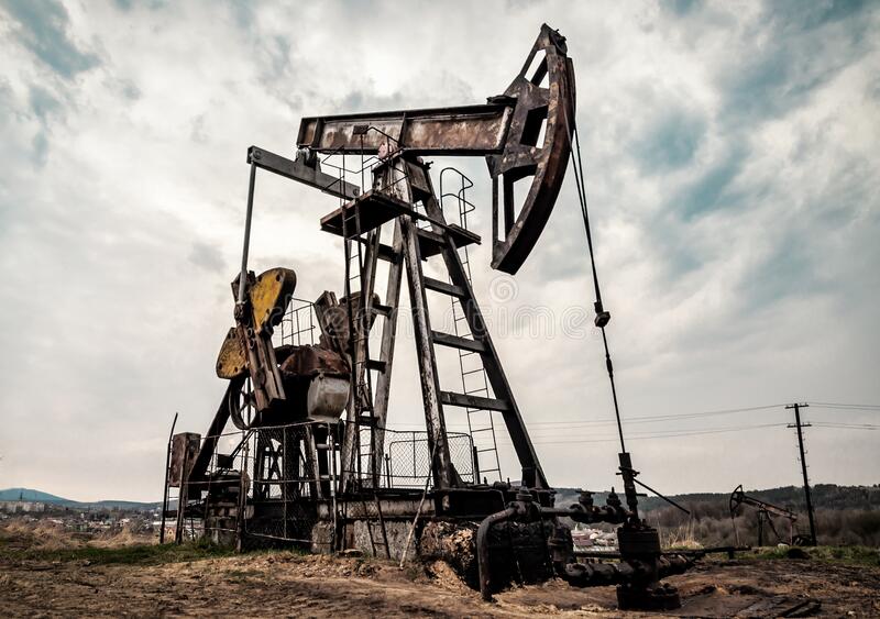


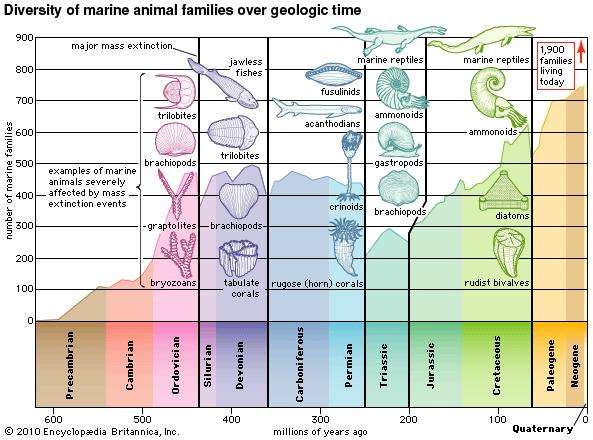
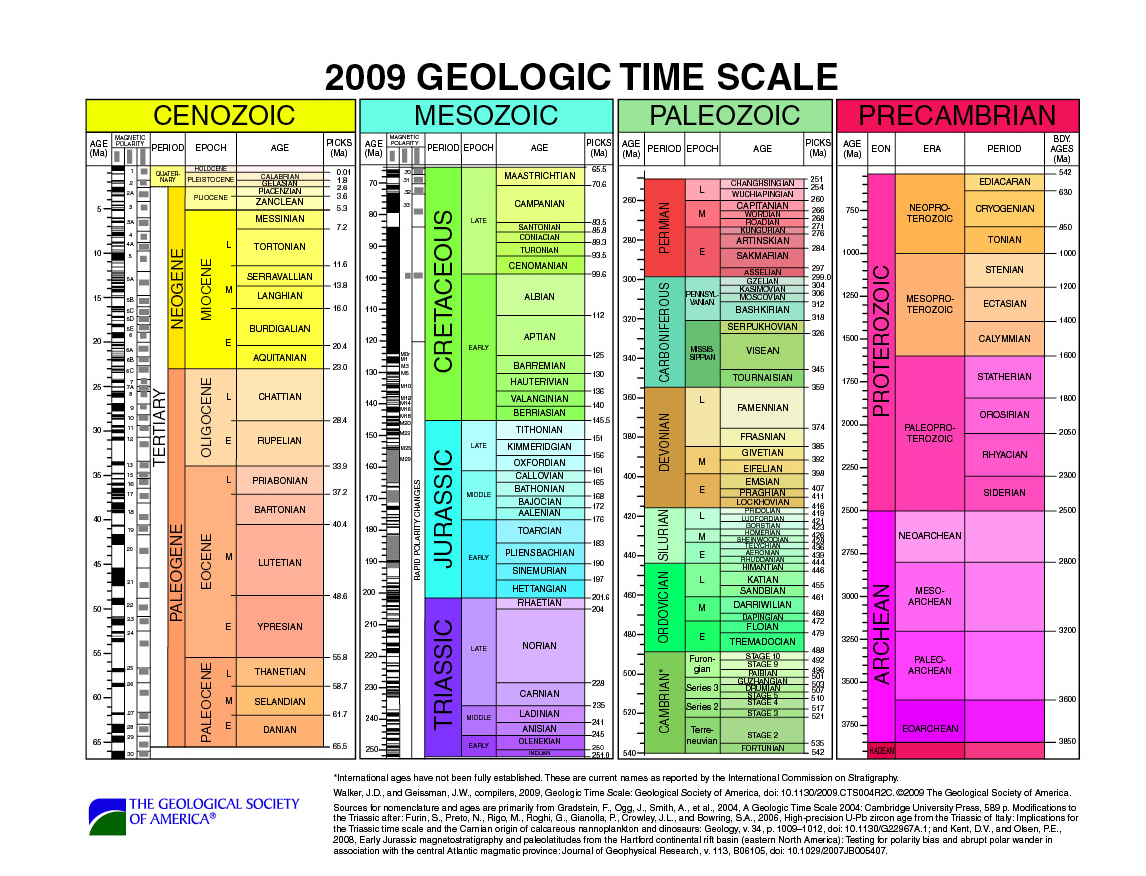
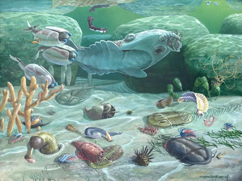
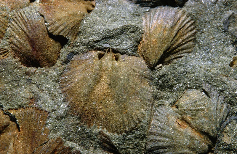
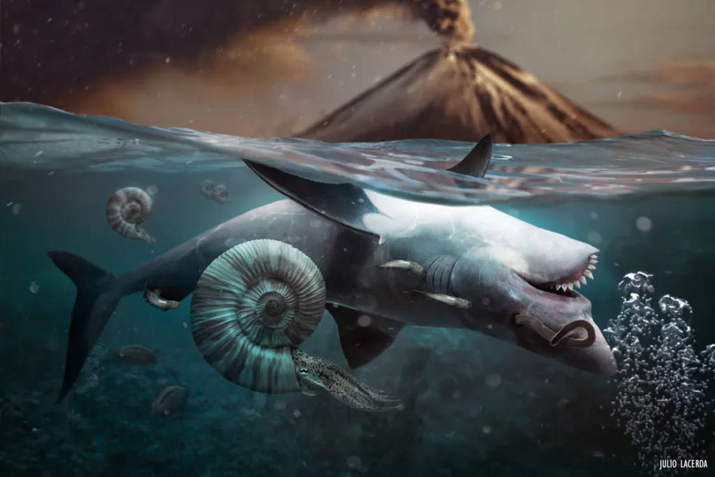
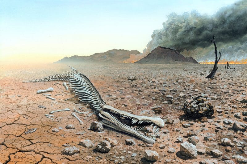
")
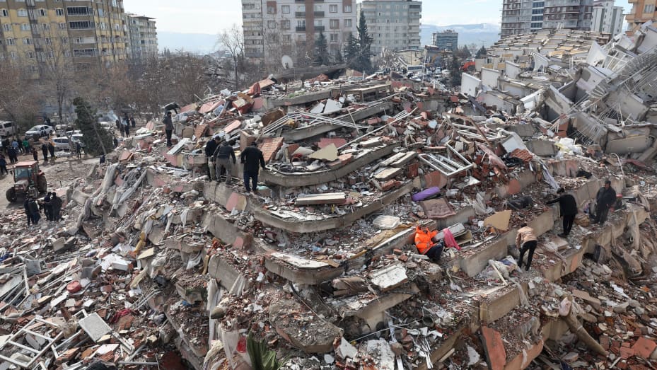
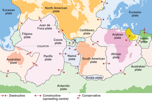


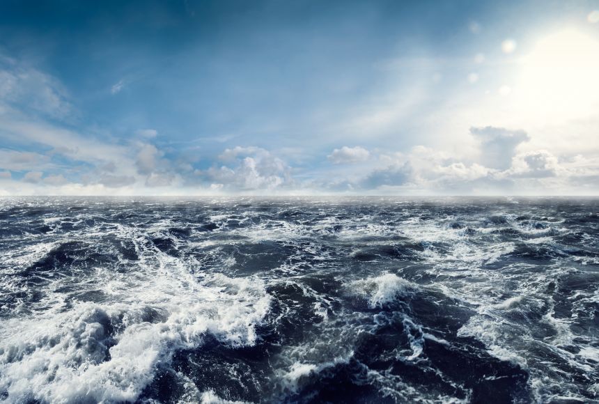

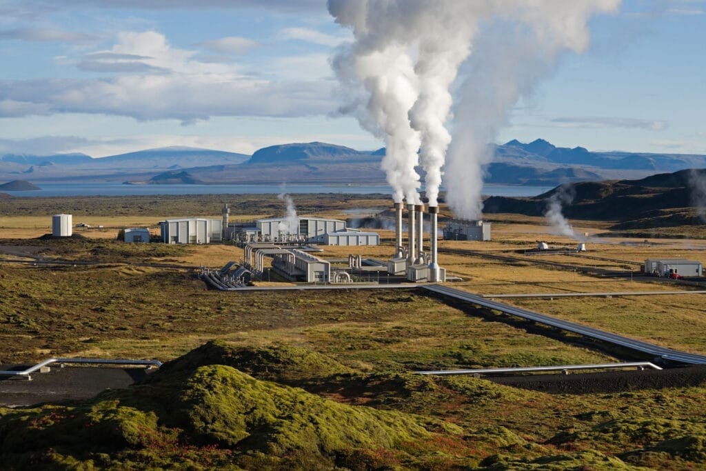

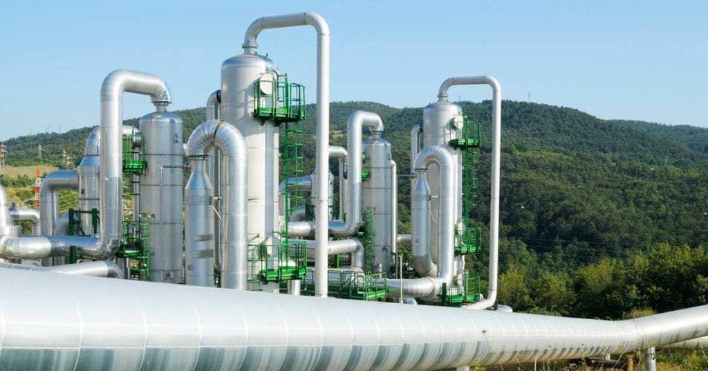


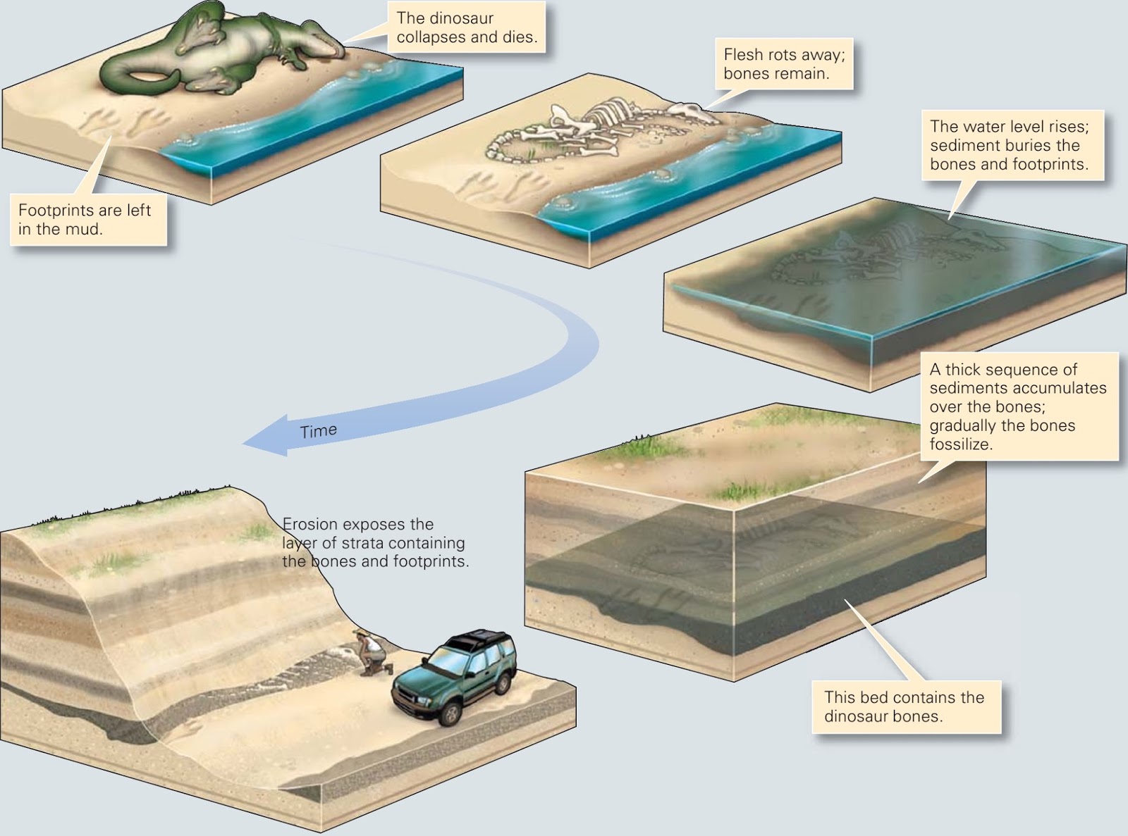
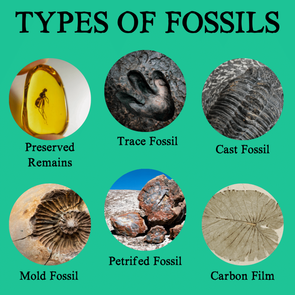

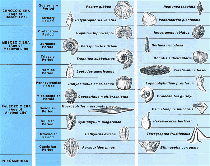

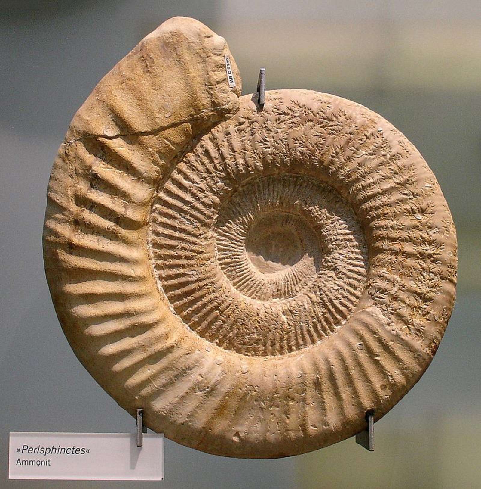


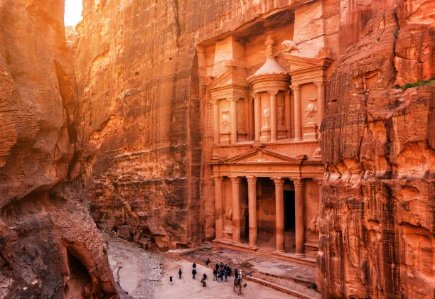


