Home Blog Page 41

Types of Volcanic Eruptions

Volcanic eruptions are fascinating and powerful geological events that have captured human interest throughout history. These events are a result of the Earth’s internal processes, involving the movement and interaction of molten rock, gases, and other materials beneath the Earth’s surface. The study of volcanic eruptions encompasses various scientific disciplines, including geology, seismology, volcanology, and atmospheric science.

A volcanic eruption is the release of magma, ash, gases, and other volcanic materials from the Earth’s crust through openings such as vents or fissures. This phenomenon occurs when pressure builds up within the Earth’s interior, causing molten rock (magma) to rise towards the surface. Once magma reaches the surface, it can lead to explosive or effusive eruptions, producing volcanic features such as lava flows, ash clouds, and volcanic cones.

Importance of Studying Volcanic Eruptions:

Hazard Assessment and Mitigation: Understanding volcanic eruptions is crucial for assessing and mitigating the associated hazards. Volcanic activity can pose significant threats to human settlements, agriculture, and infrastructure. By studying past eruptions and monitoring volcanic activity, scientists can better predict and plan for potential hazards, helping to minimize the impact on communities.

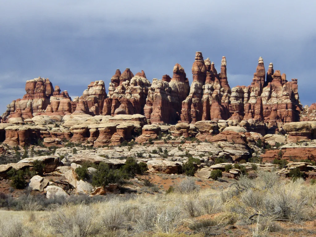
Geological Understanding: Volcanic eruptions provide valuable insights into the Earth’s internal processes. The study of volcanic rocks and formations helps scientists decipher the composition and structure of the Earth’s crust. This knowledge contributes to our understanding of plate tectonics, mantle dynamics, and the formation of geological features.

Climate Impact: Volcanic eruptions can influence global climate patterns. The release of large amounts of ash and gases, such as sulfur dioxide, into the atmosphere can lead to temporary cooling effects. Studying these interactions helps scientists model and understand the complex relationship between volcanic activity and climate change.

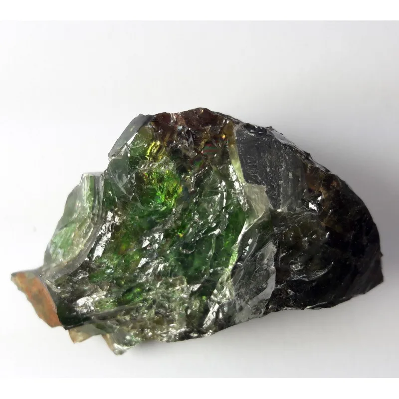
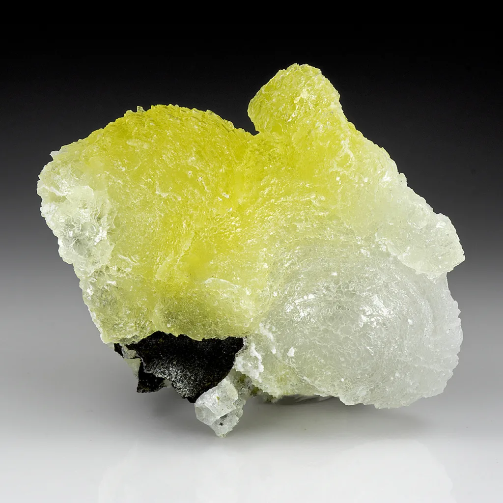
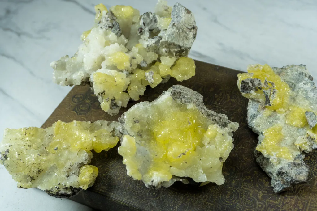
Natural Resource Exploration: Volcanic regions often host valuable mineral deposits, such as metals and geothermal resources. Studying volcanic processes aids in the exploration and extraction of these resources, contributing to economic development.

Ecosystem Dynamics: Volcanic eruptions can both destroy and create habitats. Studying the impact of eruptions on ecosystems helps scientists understand how life adapts and recovers in volcanic environments. Additionally, volcanic soils are often rich in nutrients, supporting unique ecosystems.

Technological Advancements: Monitoring and studying volcanic eruptions drive advancements in technology. Developments in seismology, satellite imaging, and remote sensing contribute to improved volcano monitoring systems, enhancing early warning capabilities.

In conclusion, the study of volcanic eruptions is essential for a holistic understanding of Earth’s dynamic processes and their impact on the environment. It not only helps protect human lives and property but also contributes to scientific knowledge and technological innovation.

Classification of Volcanic Eruptions

Explosive Eruptions:

1200px-Sarychev_Peak_Volcano_erupts_on_Matua_Island.jpg (1200×795) (wikimedia.org)

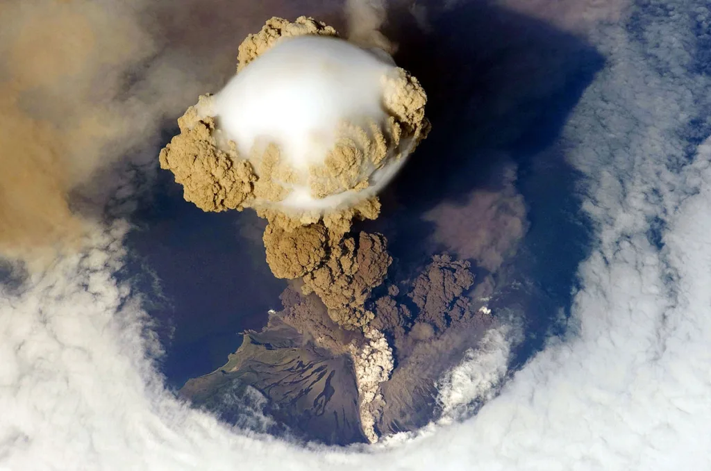
Explosive eruptions are characterized by the violent release of volcanic material, including ash, gases, and fragmented rocks, into the atmosphere. These eruptions are often associated with highly viscous magma that traps gas, leading to pressure buildup beneath the Earth’s surface. When the pressure is released, it results in a rapid and explosive expulsion of materials. The explosiveness of these eruptions can vary, and they are classified into different types based on their magnitude and style:

  1. Plinian Eruptions:
    • Named after the Roman historian Pliny the Elder.
    • Characterized by a massive column of ash and gas rising high into the stratosphere.
    • Produces pyroclastic flows, which are fast-moving currents of hot gas and volcanic debris.
  2. Vulcanian Eruptions:
    • Intermediate in explosiveness.
    • Involve the ejection of ash, rocks, and volcanic gases.
    • Typically result in the formation of volcanic domes.
  3. Strombolian Eruptions:
    • Characterized by intermittent, relatively mild explosions.
    • Emitting lava fragments and ash in regular bursts.
    • Named after the volcanic island of Stromboli.
  4. Phreatomagmatic Eruptions:
    • Result from the interaction between magma and water (either groundwater or surface water).
    • Produces steam-driven explosions, creating ash and volcaniclastic deposits.
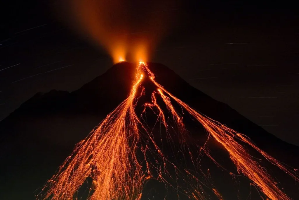
Effusive Eruptions:

Aa_channel_flow_from_Mauna_Loa.jpg (800×500) (wikimedia.org)

Effusive eruptions involve the relatively gentle release of low-viscosity magma onto the Earth’s surface. These eruptions are often associated with shield volcanoes and basaltic lava flows. The magma flows more easily due to its lower viscosity, allowing it to travel greater distances before solidifying. Effusive eruptions are generally less explosive than their counterparts, and they can exhibit different styles:

  1. Hawaiian Eruptions:
    • Characterized by the effusion of basaltic lava with low viscosity.
    • Produce fluid lava flows that can extend over long distances.
    • Often associated with shield volcanoes.
  2. Lava Fountains:
    • Occur when gas-rich magma reaches the surface and forms a fountain-like eruption.
    • Associated with the continuous release of lava, building volcanic cones.
  3. Fissure Eruptions:
    • Involve the eruption of magma along a linear crack or fissure in the Earth’s crust.
    • Commonly associated with flood basalts and can cover extensive areas with lava.

Understanding the classification of volcanic eruptions helps scientists and emergency responders assess the potential hazards and impacts associated with different volcanic activities. It also aids in the development of effective monitoring and mitigation strategies to protect communities living in volcanic regions.

Factors Influencing Eruption

PHOTOGRAPH BY BUDKOV DENIS (nationalgeographic.org)

Several factors influence the type of eruption a volcano experiences. These factors interact in complex ways, contributing to the diversity of volcanic activity observed around the world. Here are some key factors that influence eruption types:

  1. Composition of Magma:
    • The composition of magma plays a crucial role in determining eruption types. Magma can be classified based on its silica content, ranging from mafic (low silica) to intermediate and felsic (high silica).
    • Mafic magmas, which are low in silica and rich in iron and magnesium, tend to be less viscous. This low viscosity often leads to effusive eruptions, where lava can flow more easily.
    • Felsic magmas, high in silica, are more viscous and can trap gases more effectively, leading to more explosive eruptions.
  2. Gas Content:
    • The amount and type of gases dissolved in magma significantly influence eruption dynamics. Gases, such as water vapor, carbon dioxide, and sulfur dioxide, contribute to pressure buildup within the magma chamber.
    • High gas content in magma can lead to explosive eruptions, as the release of pressure can result in the rapid expansion of gas and the fragmentation of magma into ash and volcanic fragments.
  3. Tectonic Setting:
    • The tectonic setting of a volcano is a key factor in determining eruption types. Volcanoes are often associated with tectonic plate boundaries.
    • Subduction zone volcanoes, where one tectonic plate is forced beneath another, often experience explosive eruptions due to the water-rich nature of the subducting plate.
    • Mid-ocean ridges, where tectonic plates are moving apart, typically exhibit effusive eruptions with the extrusion of basaltic lava.
  4. Volcano Morphology:
    • The shape and structure of a volcano, referred to as its morphology, can influence eruption types. Different types of volcanoes, such as stratovolcanoes, shield volcanoes, and cinder cone volcanoes, exhibit distinct eruption characteristics.
    • Stratovolcanoes, with their alternating layers of lava and ash, are often associated with explosive eruptions.
    • Shield volcanoes, characterized by broad, gently sloping profiles, are typically associated with effusive eruptions.
  5. Depth of Magma Chamber:
    • The depth of the magma chamber beneath the Earth’s surface can influence eruption styles. Shallow magma chambers are more likely to produce explosive eruptions, as the pressure release is more sudden and violent.
    • Deeper magma chambers may lead to effusive eruptions, allowing magma to rise more slowly and release gas gradually.

Understanding these factors helps scientists predict and interpret volcanic activity, contributing to better volcanic hazard assessment and risk mitigation strategies for communities living near active volcanoes.

Notable Volcanic Eruptions and Types in History

Throughout history, there have been numerous notable volcanic eruptions that have left a lasting impact on the environment, climate, and human civilizations. Here are a few examples of historically significant volcanic eruptions, each representing different eruption types:

  1. Mount Vesuvius, Italy (79 AD) – Plinian Eruption:
    • One of the most famous volcanic eruptions in history.
    • The eruption buried the Roman cities of Pompeii and Herculaneum under a thick layer of ash and pumice.
    • This Plinian eruption, named after Pliny the Elder, involved the release of a massive column of ash and gas into the stratosphere.
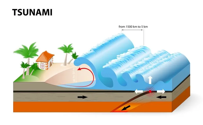
  2. Krakatoa, Indonesia (1883) – Explosive Eruption:
    • Krakatoa’s eruption is considered one of the most powerful in recorded history.
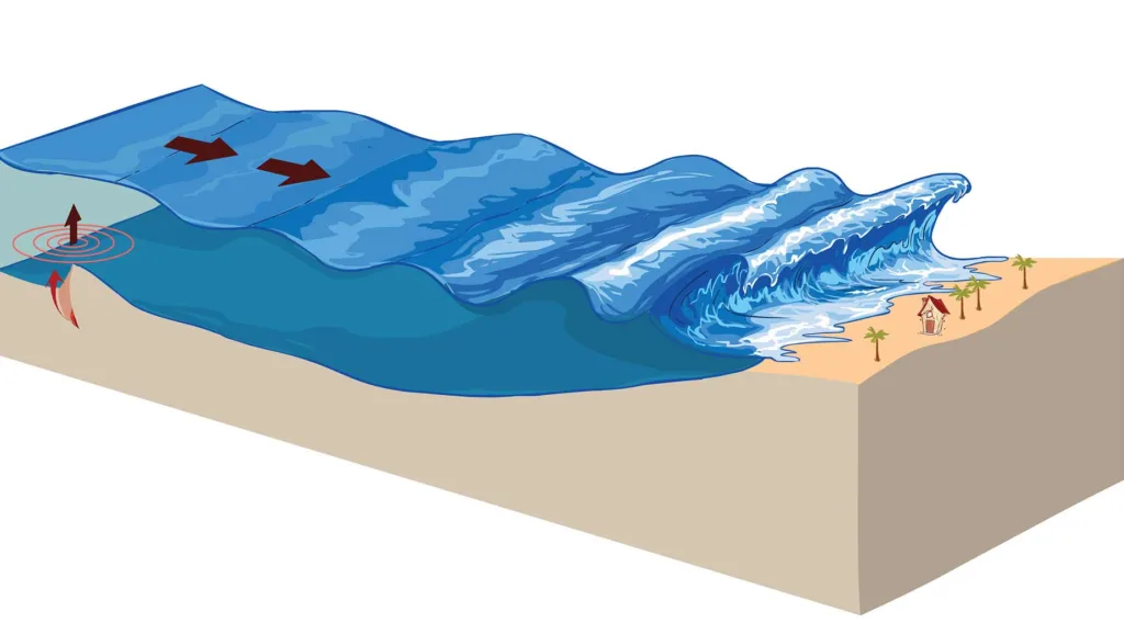
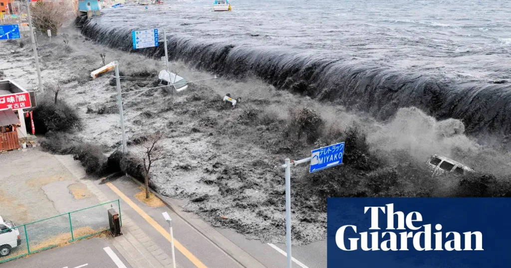
    • The explosion resulted in the collapse of the volcano, triggering tsunamis that affected coastal regions across the Indian Ocean.
    • The eruption caused global climate effects, leading to vivid sunsets and temperature changes due to the injection of ash and gases into the stratosphere.
  3. Mount St. Helens, USA (1980) – Vulcanian Eruption:
    • An explosive eruption in the state of Washington.
    • The eruption removed the upper portion of the volcano’s summit, causing widespread devastation and the deposition of ash over large areas.
    • Mount St. Helens is an example of a stratovolcano exhibiting Vulcanian eruption characteristics.
  4. Mount Pinatubo, Philippines (1991) – Plinian Eruption:
    • One of the most powerful volcanic eruptions of the 20th century.
    • The eruption had significant global climate effects, releasing large amounts of sulfur dioxide into the stratosphere, leading to a temporary cooling of the Earth’s surface.
    • Pinatubo is an example of a subduction zone volcano experiencing a Plinian eruption.
  5. Eyjafjallajökull, Iceland (2010) – Effusive Eruption:
    • This eruption gained international attention due to its impact on air travel over Europe.
    • Eyjafjallajökull is a stratovolcano, and the eruption involved both explosive and effusive phases.
    • The effusive phase included the extrusion of lava flows, contributing to the formation of a new volcanic cone.
  6. Mauna Loa, Hawaii (Various Eruptions) – Hawaiian Eruptions:
    • Mauna Loa, a shield volcano on the Big Island of Hawaii, has experienced multiple eruptions characterized by the effusion of low-viscosity basaltic lava.
    • These eruptions contribute to the gradual growth of the volcano over time, with lava flows extending over long distances.

These examples showcase the diversity of volcanic eruptions and their impacts on the environment. Studying these historical events helps scientists understand the different eruption types, their causes, and the potential hazards associated with volcanic activity.

Capitol Reef National Park, Utah, USA

Capitol Reef National Park is situated in south-central Utah, United States. The park encompasses an area of approximately 241,904 acres, making it one of the smaller national parks in Utah. It is part of the larger region known as the Waterpocket Fold, a nearly 100-mile long warp in the Earth’s crust that exposes various layers of sedimentary rock.

Unique Geological Features: Capitol Reef National Park is renowned for its striking geological formations, shaped over millions of years. The park’s uniqueness lies in its diverse and colorful rock layers, deep canyons, towering monoliths, and the Waterpocket Fold itself. Here are some key geological features that make Capitol Reef special:

  1. Waterpocket Fold: The Waterpocket Fold is the defining geological feature of Capitol Reef. It is a classic example of a monocline, where a rock layer is pushed up at an angle while the other side remains relatively flat. This fold is responsible for the steep cliffs and rugged terrain found throughout the park.
  2. Capitol Dome: The Capitol Dome, a prominent white sandstone formation, stands as a symbol of the park. It resembles the U.S. Capitol building, hence the name. This monolith is part of the Navajo Sandstone formation and is a popular subject for photographers.
  3. Cathedral Valley: Cathedral Valley is a remote area within the park characterized by towering monoliths and sandstone formations. The Temple of the Sun and the Temple of the Moon are two iconic structures found in this region.
  4. Slot Canyons: Capitol Reef is home to numerous slot canyons, narrow passages carved by water over millions of years. These canyons, such as Capitol Gorge and Sulphur Creek, provide opportunities for hikers to explore the park’s geology up close.
  5. Fruita Historic District: Beyond the geological formations, Capitol Reef has a human history represented by the Fruita Historic District. Settlers established orchards in the fertile Fruita valley, and remnants of their stone-walled orchards can still be seen today, adding a cultural dimension to the park.
  6. Colorful Rock Layers: The park features a kaleidoscope of colors in its rock layers, ranging from deep reds to pale yellows and whites. These layers represent different geological periods, and the unique hues result from varying mineral content and environmental conditions during their formation.

Capitol Reef National Park’s geology offers a captivating journey through time, showcasing the forces of nature that shaped this rugged and visually stunning landscape. Whether exploring the canyons, admiring the monoliths, or appreciating the history of Fruita, visitors to Capitol Reef are treated to a remarkable display of Earth’s geological wonders.

Formation of the Waterpocket Fold

The Waterpocket Fold, Capitol Reef National Park, Utah. Photos by Ron Niebrugge (wildnatureimages.com)

The Waterpocket Fold is a geologic feature that defines the landscape of Capitol Reef National Park, spanning nearly 100 miles in south-central Utah. This remarkable fold is a classic example of a monocline, a type of fold where one side of the rock strata is relatively flat, and the other side is steeply inclined. The formation of the Waterpocket Fold is a result of complex geological processes that unfolded over millions of years.

Geological Forces:

  1. Sedimentation: The story of the Waterpocket Fold begins with sedimentation during the Paleozoic Era, around 70 to 270 million years ago. At this time, the area that is now Capitol Reef was covered by a vast inland sea. Over millions of years, layers of sediment accumulated at the bottom of this sea, forming deposits of sand, silt, and other materials.
  2. Lithification: As more layers of sediment accumulated, the lower layers experienced compaction and cementation processes, transforming loose sediments into solid rock through a process known as lithification. Over time, these layers turned into different types of sedimentary rock, including sandstone, shale, and limestone.
  3. Uplift and Compression: Around 50 to 70 million years ago, tectonic forces caused the region to uplift. This uplift was not uniform; instead, it resulted in a regional flexure or warp in the Earth’s crust. The forces at play were likely a combination of compression and folding, with the Earth’s crust being pushed from different directions.
  4. Monocline Formation: The differential uplift and compression led to the formation of the Waterpocket Fold. The rocks on one side of the fold were lifted and tilted, creating a steeply inclined slope, while the rocks on the other side remained relatively horizontal. This asymmetric folding is what characterizes a monocline.
  5. Erosion: The uplift and tilting of the rock layers exposed them to the forces of erosion, primarily by water. Over millions of years, rivers and streams carved deep canyons, revealing the intricate layers of rock that make up the Waterpocket Fold. The erosive forces continue to shape the landscape today.
  6. Colorful Rock Layers: The different colors observed in the rock layers of the Waterpocket Fold are a result of varying mineral content and environmental conditions during the sedimentation process. Iron, manganese, and other minerals impart shades of red, yellow, white, and other hues to the rocks, creating a visually stunning and diverse geological tapestry.

The Waterpocket Fold, with its striking cliffs, canyons, and monoliths, stands as a testament to the dynamic geological forces that have shaped the Earth’s crust over geological time scales. Visitors to Capitol Reef National Park can witness the incredible results of these processes, gaining a deeper appreciation for the forces that have sculpted this unique and captivating landscape.

Navajo Sandstone and Entrada Sandstone in Capitol Reef National Park

1. Navajo Sandstone:

Navajo Sandstone | Utah | USA | Photos by Jess Lee (jessleephotos.com)

The Navajo Sandstone is one of the prominent rock formations found in Capitol Reef National Park, contributing to the park’s unique and captivating landscape. Key features and geological significance include:

  • Composition and Appearance: Navajo Sandstone is a thick layer of cross-bedded, fine to medium-grained sandstone that exhibits a striking reddish to light-orange color. The sandstone often appears as massive cliffs and domes, contributing to the iconic and colorful scenery of the park.
  • Formation and Age: The Navajo Sandstone was deposited during the Jurassic Period, approximately 180 to 190 million years ago. It represents an ancient desert environment where vast sand dunes were preserved and solidified over time, forming the distinctive rock layer seen in Capitol Reef.
  • Erosional Patterns: The Navajo Sandstone is highly resistant to erosion, creating towering cliffs and prominent features like the Capitol Dome within the park. The cross-bedding, a result of wind-blown sand dunes, adds to the unique patterns visible in the exposed rock faces.
  • Cultural Significance: Beyond its geological importance, the Navajo Sandstone holds cultural significance, as it serves as a canvas for the petroglyphs and rock art left by ancient inhabitants of the region. These markings provide insights into the lives and beliefs of the people who once called this area home.

2. Entrada Sandstone:

Southwestern Utah – Lonely Planet | Utah, USA, North America

Another significant rock formation in Capitol Reef National Park is the Entrada Sandstone, contributing to the diverse geological tapestry of the region. Key characteristics and geological significance include:

  • Composition and Appearance: The Entrada Sandstone is a multicolored rock layer that can display hues of red, orange, and white. It is often interspersed with layers of shale and siltstone. The sandstone appears in various formations, including domes, arches, and buttes.
  • Formation and Age: The Entrada Sandstone was deposited during the Jurassic Period, roughly 150 to 160 million years ago. The sediments that make up the Entrada Sandstone were deposited in an environment that alternated between shallow marine conditions and terrestrial settings.
  • Erosional Patterns: While not as resistant as the Navajo Sandstone, the Entrada Sandstone still contributes to the park’s rugged terrain. The softer layers erode more easily, creating arches and alcoves, adding to the scenic beauty of Capitol Reef.
  • Arches and Natural Bridges: Entrada Sandstone is known for contributing to the formation of natural arches and bridges within the park. These features, such as Hickman Bridge, are a result of erosional processes where softer rock layers underneath the sandstone are worn away, leaving behind the impressive formations.

Understanding the geological significance of the Navajo Sandstone and Entrada Sandstone provides insight into the ancient environments and processes that shaped Capitol Reef National Park. These rock layers not only contribute to the park’s stunning visual appeal but also serve as windows into the Earth’s distant past. Visitors can witness the interplay of colors, textures, and formations that tell the geological story of this remarkable landscape.

Cathedral Valley in Capitol Reef National Park

Cathedral Valley, Upper Cathedral Valley Viewpoint, Capitol Reef National Park, Utah, USA
-Danita Delimont- Stock Photo – Dissolve

Geological Formations:

Cathedral Valley is a remote and visually stunning area within Capitol Reef National Park, known for its towering monoliths, temples, and unique geological formations. Some of the key features within Cathedral Valley include:

  1. Temple of the Sun and Temple of the Moon:
    • Two massive monoliths that stand as iconic symbols of Cathedral Valley.
    • The Temple of the Sun is a tall, narrow structure, while the Temple of the Moon is broader and shorter.
    • These formations are composed of Entrada Sandstone and create a captivating silhouette against the desert sky.
  2. The Walls:
    • Steep cliffs and rock walls surround Cathedral Valley, creating a sense of isolation and grandeur.
    • The sheer size of the walls adds to the majestic and imposing atmosphere of the area.
  3. Glass Mountain:
    • A white, dome-shaped formation composed of gypsum, selenite, and other minerals.
    • The unique appearance of Glass Mountain adds diversity to the geological features of Cathedral Valley.
  4. Cathedral Valley Loop Road:
    • A scenic drive that allows visitors to explore the various formations and experience the vastness of Cathedral Valley.
    • The loop road offers panoramic views of the monoliths and temples, making it a popular route for photographers and nature enthusiasts.

Erosion Processes:

The striking monoliths and temples of Cathedral Valley were sculpted over millions of years by the relentless forces of erosion. Several erosion processes have played a significant role in shaping these geological wonders:

  1. Water Erosion:
    • Rainfall, although infrequent in the desert environment, has played a crucial role in shaping Cathedral Valley. Water, over time, has carved intricate patterns into the sandstone, creating channels and exposing the underlying rock layers.
  2. Wind Erosion:
    • Wind-blown sand and particles have acted as natural abrasives, slowly wearing away the surface of the rock formations. This process, known as aeolian erosion, has contributed to the smooth, sculpted appearance of the monoliths and cliffs.
  3. Freeze-Thaw Action:
    • Fluctuations in temperature, particularly during the freezing and thawing cycles, contribute to the breakdown of rock. Water seeps into cracks in the rock, freezes, and expands, exerting pressure that gradually fragments the rock over time.
  4. Chemical Weathering:
    • Chemical processes, such as the dissolution of minerals by water, contribute to the weathering of the rock. This is particularly evident in the presence of gypsum in formations like Glass Mountain, where soluble minerals can be dissolved and transported away.
  5. Biological Weathering:
    • The activities of plants and microorganisms also play a role in the weathering of rocks. Plant roots can penetrate cracks, exerting pressure and contributing to the breakdown of the rock.

The combination of these erosional forces, acting over geological time scales, has resulted in the unique and awe-inspiring formations found in Cathedral Valley. The interplay of water, wind, temperature variations, and biological activity has given rise to a landscape that showcases the dynamic processes shaping the Earth’s surface. Visitors to Cathedral Valley can witness the ongoing impact of these forces and appreciate the beauty that has emerged from the intricate dance of erosion and geological time.

Fruita and the Fremont River in Capitol Reef National Park

Capitol Reef National Park | Utah’s Hidden Gem, Hiking & Camping | Britannica

Fruita Area Overview:

Fruita is a historic district within Capitol Reef National Park, situated along the fertile floodplain of the Fremont River. Unlike many other areas in the park known for their towering cliffs and rugged canyons, Fruita offers a different perspective with its lush greenery and orchards. The geological features in the Fruita area include:

  1. Fremont River:
    • The Fremont River is a perennial stream that flows through Capitol Reef National Park, providing a crucial water source to the Fruita valley.
    • Fruita’s location along the river has made it historically significant, attracting early settlers who recognized the agricultural potential of the fertile valley.
  2. Fruit Orchards:
    • Fruita is famous for its historic fruit orchards, particularly apple and peach trees. The settlers planted these orchards, and today, visitors can still enjoy the fruit by participating in orchard tours or picking fruit during the harvest season.
  3. Historic Buildings:
    • The Fruita district features several historic buildings, including a one-room schoolhouse, the Gifford Homestead, and the Fruita Rural Historic District, providing insight into the lives of the early settlers.
  4. Scenic Beauty:
    • Fruita is surrounded by the towering red cliffs of Capitol Reef, creating a picturesque setting that combines the lush greenery of the valley with the dramatic desert landscape.

Influence of the Fremont River:

The Fremont River has played a significant role in shaping the landscape of Capitol Reef, particularly in the Fruita area. Its influence can be observed in several ways:

  1. Erosion and Sedimentation:
    • The Fremont River has been a powerful agent of erosion, cutting through the layers of sedimentary rock over millions of years. As the river flows, it carries sediment downstream, contributing to the formation of canyons and valleys.
  2. Alluvial Deposits:
    • The floodplain along the Fremont River is characterized by alluvial deposits, consisting of fertile soil carried by the river. This soil has been crucial for the success of agriculture in Fruita, providing nutrients for the growth of fruit trees and other crops.
  3. Canyon Formation:
    • The Fremont River has carved deep canyons, such as the scenic Capitol Gorge, showcasing the erosive power of water over time. These canyons offer opportunities for hiking and exploration, allowing visitors to witness the intricate layers of rock exposed by the river.
  4. Wildlife Habitat:
    • The riparian habitat along the Fremont River supports a diverse range of plant and animal life. Cottonwood trees, willows, and other vegetation thrive along the riverbanks, creating a haven for wildlife, including birds and small mammals.
  5. Cultural Significance:
    • The availability of water from the Fremont River made Fruita an attractive location for settlement. The early Mormon pioneers recognized the importance of the river for irrigation and established orchards and farmland, leaving behind a rich cultural legacy that visitors can explore today.

The interplay between the Fremont River and the landscape of Capitol Reef, especially in the Fruita area, highlights the dynamic relationship between water, erosion, and the formation of both natural and cultural features. The river has not only shaped the geology of the region but has also contributed to the agricultural history and scenic beauty of Fruita within Capitol Reef National Park.

Capitol Dome and Capitol Gorge

Capitol Dome:

Capitol Dome : Photos, Diagrams & Topos : SummitPost

Geological Formation:

The Capitol Dome is a prominent and iconic rock formation within Capitol Reef National Park. Here are key aspects of its geological formation:

  1. Composition and Appearance:
    • The Capitol Dome is primarily composed of Navajo Sandstone, a prominent rock layer within the park.
    • It stands as a massive, rounded monolith with a distinct white to light-orange color, creating a striking contrast against the red cliffs and canyons that characterize the surrounding landscape.
  2. Navajo Sandstone:
    • The Navajo Sandstone, which forms the Capitol Dome, was deposited during the Jurassic Period, approximately 180 to 190 million years ago.
    • This sandstone was originally part of an extensive desert environment, with vast sand dunes that eventually solidified into the rock layers visible today.
  3. Erosion Resistance:
    • The Capitol Dome is a testament to the differential erosion resistance of the Navajo Sandstone. Unlike surrounding rocks, the Navajo Sandstone is more resistant to weathering, allowing the dome to stand tall as a prominent feature in the park.
  4. Cross-Bedding Patterns:
    • The Navajo Sandstone often displays cross-bedding, a geological feature formed by the migration of ancient sand dunes. This creates distinctive patterns in the rock layers, contributing to the visual appeal of the Capitol Dome.
  5. Cultural Significance:
    • The Capitol Dome, resembling the U.S. Capitol building, has cultural significance and is often featured in photographs capturing the essence of Capitol Reef National Park.

Capitol Gorge:

Reddit

Capitol Gorge is a scenic canyon and one of the main attractions within Capitol Reef National Park. Here’s an exploration of its unique geological features:

  1. Canyon Formation:
    • Capitol Gorge was carved by the erosive forces of water, primarily the Fremont River, which cut through the sedimentary rock layers over millions of years.
    • The canyon is characterized by towering cliffs on either side, showcasing the intricate layers of rock that make up the Waterpocket Fold.
  2. Petroglyphs:
    • The smooth rock walls of Capitol Gorge bear witness to ancient human presence. Petroglyphs, rock engravings created by indigenous peoples, can be found along the canyon walls, providing a glimpse into the cultural history of the region.
  3. Narrows Section:
    • The canyon features a narrow section known as the Narrows, where the cliffs close in, creating a more confined and dramatic passage. Hiking through this section allows visitors to experience the geological and spatial uniqueness of Capitol Gorge.
  4. Pioneer Register:
    • Along the canyon walls, visitors can find inscriptions left by early pioneers who traveled through Capitol Gorge. This “Pioneer Register” serves as a historical record of the park’s exploration and settlement.
  5. Waterpocket Fold Exposures:
    • Capitol Gorge provides an excellent opportunity to see exposed layers of the Waterpocket Fold up close. The tilted rock layers showcase the geologic history of the region, revealing the effects of tectonic forces that created the fold.

The combination of the majestic Capitol Dome and the captivating Capitol Gorge offers visitors a diverse and enriching experience within Capitol Reef National Park. The geological formations and cultural history found in these areas contribute to the park’s unique charm and educational value.

Anatase

Anatase is one of the three primary mineral forms of titanium dioxide (TiO2), the other two being rutile and brookite. It is a tetragonal mineral and a polymorph of TiO2, meaning that it shares the same chemical composition with rutile but has a different crystal structure. Anatase is named after the Greek word “anatasis,” which means extension, in reference to its longer crystal axes compared to those of rutile.

Chemical Composition: The chemical composition of anatase is represented by the formula TiO2, indicating that it consists of one titanium (Ti) atom bonded to two oxygen (O) atoms. This composition is the same as rutile, but the arrangement of the atoms within the crystal lattice differs, leading to distinct physical properties.

Crystal Structure: Anatase has a tetragonal crystal structure, which means its unit cell has four sides and is taller than it is wide. The crystal lattice of anatase is characterized by a distorted octahedral coordination geometry around each titanium atom. In simple terms, the titanium atoms are surrounded by six oxygen atoms, forming an octahedral shape. The tetragonal structure of anatase is in contrast to the rutile polymorph, which has a more compact, orthorhombic crystal structure.

The crystal structure influences the properties of anatase, making it exhibit different behaviors compared to rutile in various applications. Anatase is known for its photocatalytic properties, which find applications in environmental and energy-related processes. It has a higher surface reactivity than rutile, making it useful in photocatalysis, solar cells, and other technologies.

In summary, anatase is a mineral form of titanium dioxide with a tetragonal crystal structure, distinct from the rutile and brookite polymorphs. Its unique properties make it valuable in various technological applications, particularly in areas related to photocatalysis and solar energy.

Properties of Anatase

Physical Properties

  1. Color: Anatase is typically dark blue, brown, or black, but it can also appear in shades of yellow, green, or red. The color may vary due to impurities present in the crystal lattice.
  2. Luster: The mineral has a submetallic to metallic luster, giving it a shiny appearance when light reflects off its surface.
  3. Streak: The streak of anatase is white to pale yellow, which is the color of the powdered mineral when it is scraped across a streak plate.
  4. Hardness: Anatase has a Mohs hardness of 5.5–6, making it a moderately hard mineral. It can scratch glass but is softer than minerals like quartz.
  5. Density: The density of anatase varies, but it is generally around 3.8 to 3.9 g/cm³.
  6. Cleavage: Anatase exhibits poor or indistinct cleavage, meaning it does not break along smooth planes when subjected to stress.
  7. Transparency: The mineral is typically opaque, meaning that light does not pass through it.
  8. Crystalline System: Anatase crystallizes in the tetragonal system, forming crystals with four sides, and often occurring as prisms or tabular crystals.

Chemical Properties:

  1. Chemical Formula: TiO2 – Anatase has the same chemical formula as rutile and brookite, all being different polymorphs of titanium dioxide.
  2. Reactivity: Anatase is known for its higher reactivity compared to rutile. It exhibits significant photocatalytic activity, making it useful in applications such as environmental remediation and solar energy conversion.
  3. Photocatalytic Properties: One of the notable chemical properties of anatase is its ability to undergo photocatalysis. When exposed to ultraviolet light, anatase can catalyze various chemical reactions, such as the degradation of organic pollutants in water.
  4. Transformation to Rutile: At elevated temperatures, anatase can undergo a phase transformation to rutile. This transformation is a reversible process and is influenced by factors such as temperature and pressure.
  5. Thermal Stability: Anatase is generally less thermally stable than rutile, and its stability is influenced by conditions such as pressure and the presence of impurities.

Understanding both the physical and chemical properties of anatase is crucial for its utilization in various industrial applications, including photocatalysis, pigments, and as a component in the production of titanium dioxide for paints, coatings, and other products.

Optical Properties of Anatase

  1. Transparency:
    • Anatase is typically opaque, meaning that light does not pass through it. This is in contrast to minerals that are transparent or translucent.
  2. Refraction:
    • The refractive index of anatase is relatively high, contributing to its characteristic luster. The refractive index is a measure of how much light is bent, or refracted, as it passes through the mineral.
  3. Birefringence:
    • Anatase exhibits birefringence, a property where light is split into two rays as it passes through the mineral. The extent of birefringence is influenced by the crystal structure and orientation.
  4. Dispersion:
    • Dispersion refers to the separation of different colors of light as it passes through a material. Anatase may show some dispersion, contributing to its play of colors, but it is not as pronounced as in some other minerals.
  5. Pleochroism:
    • Anatase can display pleochroism, meaning that it exhibits different colors when viewed from different angles. The presence of pleochroism is often related to the orientation of crystal axes.
  6. Optical Class:
    • Anatase belongs to the tetragonal crystal system, and its optical class is uniaxial positive. This means that it has one optic axis, and light traveling along this axis experiences positive birefringence.
  7. Luster:
    • The mineral has a submetallic to metallic luster, contributing to its shine when exposed to light.
  8. Fluorescence:
    • Anatase may exhibit fluorescence under ultraviolet (UV) light, with variations in color depending on the presence of specific impurities.

Understanding the optical properties of anatase is important for both geological and industrial purposes. These properties can be utilized in the identification of the mineral in geological samples and can also influence its applications in various industries, including pigments, coatings, and optical devices.

Occurrence and Formation

Occurrence:

Anatase is a mineral that occurs in a variety of geological settings. It is commonly found in association with other titanium minerals, particularly rutile and brookite. Some of the common occurrences include:

  1. Pegmatites: Anatase can be found in pegmatite veins, which are coarse-grained igneous rocks. Pegmatites often contain a variety of minerals due to their slow cooling and the presence of volatile components during their formation.
  2. Metamorphic Rocks: Anatase is sometimes found in metamorphic rocks, especially those that have undergone high-temperature and high-pressure conditions. Examples include schists and gneisses.
  3. Hydrothermal Veins: Hydrothermal veins, formed by the deposition of minerals from hot, mineral-rich fluids, can also host anatase. These veins are common in a range of geological environments.
  4. Placer Deposits: Anatase, along with other heavy minerals, may be concentrated in placer deposits through the process of erosion, transport, and sedimentation. These deposits are often associated with river systems.
  5. Sedimentary Rocks: Anatase can occur in sedimentary rocks, including sandstones and shales. It may be present as detrital grains or as part of the cementing material.

Formation:

The formation of anatase involves processes that lead to the crystallization of titanium dioxide under specific conditions. The exact mechanisms can vary depending on the geological environment, but common formation processes include:

  1. Magmatic Processes: Anatase can crystallize from magmatic fluids during the cooling of magma. As the magma cools, minerals such as anatase, rutile, and brookite may precipitate.
  2. Hydrothermal Processes: Hot, mineral-rich fluids circulating in the Earth’s crust can lead to the formation of anatase. These fluids may dissolve titanium from surrounding rocks and then deposit anatase as they cool.
  3. Metamorphism: Anatase can form during metamorphism, which involves the alteration of rocks due to high temperature and pressure. In metamorphic rocks, the precursor minerals may undergo changes to become anatase.
  4. Weathering and Erosion: Anatase may be liberated from its original source rocks through weathering processes. Once released, it can be transported by water and wind, eventually accumulating in sedimentary environments.

Understanding the occurrence and formation of anatase is crucial for both geological studies and industrial applications. The mineral’s presence in certain geological settings can provide insights into the Earth’s history and processes, while its properties make it valuable for various technological applications.

Applications and Uses of Anatase

Anatase, due to its unique physical and chemical properties, finds applications in various industrial and technological fields. Some of the notable uses of anatase include:

  1. Photocatalysis: Anatase is well-known for its photocatalytic activity. When exposed to ultraviolet (UV) light, it can catalyze chemical reactions, such as the decomposition of organic pollutants in air and water. This property is utilized in environmental applications, including water purification and air treatment.
  2. Solar Cells: The semiconductor properties of anatase make it suitable for use in solar cells. It can be employed as a photoanode material in dye-sensitized solar cells (DSSCs) and as part of the photoactive layer in other types of solar cell technologies. Its ability to absorb UV light aligns well with the solar spectrum.
  3. Pigments and Dyes: Anatase is used in the production of pigments and dyes for paints, coatings, and plastics. Its unique colors and optical properties make it valuable in creating a range of shades in various materials.
  4. Catalysis: Anatase is utilized as a catalyst in chemical reactions. Its surface reactivity is advantageous in promoting certain chemical transformations, and it finds applications in the synthesis of organic compounds and other industrial processes.
  5. Cosmetics: Anatase is used in cosmetic products, including sunscreens and skin care items. Its UV-absorbing properties make it effective in protecting the skin from harmful UV radiation.
  6. Ceramics: Anatase is incorporated into ceramics to enhance their properties. It can improve the mechanical strength and thermal stability of ceramic materials.
  7. Optical Devices: The optical properties of anatase, including its high refractive index and birefringence, make it suitable for use in optical devices such as lenses and prisms.
  8. Construction Materials: Anatase may be added to construction materials, such as concrete and coatings, to impart certain desirable properties. Its photocatalytic activity can contribute to the self-cleaning and air-purifying characteristics of these materials.
  9. Water Splitting: In research and development for renewable energy applications, anatase is investigated for its potential use in water splitting reactions. This process involves using solar energy to split water into hydrogen and oxygen, which can be used as a clean and sustainable source of fuel.

The diverse applications of anatase highlight its importance in various technological advancements, from environmental remediation to energy production and materials science. Ongoing research continues to explore new ways to harness the unique properties of anatase for emerging technologies.

Comparison with Other Titanium Dioxide Polymorphs

Titanium dioxide (TiO2) exists in several polymorphic forms, with the three primary ones being rutile, anatase, and brookite. Here’s a comparison between anatase and the other two major polymorphs:

Rutile: COLLECTION: Renaud Vochten

1. Anatase vs. Rutile:

  • Crystal Structure:
    • Anatase: Tetragonal crystal structure.
    • Rutile: Orthorhombic crystal structure.
  • Color:
    • Anatase: Varied colors, including blue, brown, black, yellow, green, and red.
    • Rutile: Reddish-brown to black.
  • Optical Properties:
    • Anatase: Higher refractive index, exhibits birefringence and pleochroism.
    • Rutile: Lower refractive index, non-birefringent.
  • Photocatalytic Activity:
    • Anatase: Higher photocatalytic activity, especially under UV light.
    • Rutile: Lower photocatalytic activity but more stable under visible light.
Brookite:
Kharan, Kharan District, Balochistan (Baluchistan), Pakistan

2. Anatase vs. Brookite:

  • Crystal Structure:
    • Anatase: Tetragonal crystal structure.
    • Brookite: Orthorhombic crystal structure.
  • Color:
    • Anatase: Varied colors.
    • Brookite: Brown to black, sometimes with a red tint.
  • Occurrence:
    • Anatase: More common and stable at lower temperatures.
    • Brookite: Less common and stable at higher temperatures.
  • Optical Properties:
    • Anatase: Exhibits birefringence and pleochroism.
    • Brookite: Exhibits birefringence.

General Comparisons:

  • Photocatalytic Activity:
    • Anatase: Known for high photocatalytic activity, especially in environmental applications.
    • Rutile and Brookite: Lower photocatalytic activity compared to anatase.
  • Stability:
    • Anatase: Less stable than rutile at high temperatures.
    • Rutile: More thermally stable.
    • Brookite: Less stable than anatase but more stable than anatase at high temperatures.
  • Applications:
    • Anatase: Widely used in photocatalysis, solar cells, pigments, and cosmetics.
    • Rutile: Used in pigments, coatings, plastics, and some optical applications.
    • Brookite: Less common in applications but has been studied for its unique properties.

In summary, anatase, rutile, and brookite are different polymorphs of titanium dioxide, each with its own crystal structure, color, stability, and properties. Anatase is particularly known for its photocatalytic activity, while rutile is valued for its stability and rutile’s better performance under visible light. Brookite, although less common, has unique properties that make it of interest in certain applications. The choice of polymorph depends on the specific requirements of the intended application.

Synthesis and Production

The synthesis and production of anatase titanium dioxide (TiO2) can be achieved through various methods, and the choice of method often depends on the desired application and the properties required. Here are some common methods for the synthesis of anatase TiO2:

  1. Hydrothermal Synthesis:
    • In hydrothermal synthesis, titanium precursor compounds react with water at elevated temperatures and pressures. This method can produce well-defined anatase nanoparticles with controlled size and morphology. The reaction conditions, such as temperature and pressure, can be adjusted to influence the crystal structure.
  2. Sol-Gel Method:
    • The sol-gel process involves the hydrolysis and polycondensation of metal alkoxides to form a sol, which is then subjected to gelation and drying. By controlling the reaction conditions, such as pH and temperature, anatase TiO2 nanoparticles can be synthesized. The sol-gel method allows for the preparation of thin films, coatings, and other materials.
  3. Solvothermal Synthesis:
    • Solvothermal synthesis is similar to hydrothermal synthesis but is conducted in organic solvents instead of water. This method allows for the synthesis of anatase nanoparticles with controlled size and shape. The choice of solvent and reaction conditions influences the properties of the resulting TiO2.
  4. Combustion Synthesis:
    • Combustion synthesis involves the exothermic reaction between metal precursors and a fuel source, leading to the formation of TiO2 nanoparticles. This method is relatively simple and cost-effective but may require careful control of combustion conditions to obtain the desired phase.
  5. Chemical Vapor Deposition (CVD):
    • CVD involves the chemical reaction of gaseous precursors to deposit a thin film of TiO2 on a substrate. By controlling the deposition parameters, such as temperature and precursor concentration, anatase TiO2 films can be produced. CVD is often used for large-scale production and in the semiconductor industry.
  6. Aerosol Methods:
    • Aerosol methods, such as spray pyrolysis or flame spray pyrolysis, involve the generation of TiO2 nanoparticles in the gas phase, which are then collected on a substrate. These methods are suitable for producing thin films and coatings.
  7. Template-Assisted Methods:
    • Template-assisted methods involve using templates, such as surfactant micelles or nanoparticles, to control the size and structure of the synthesized TiO2. After synthesis, the template is removed, leaving behind anatase TiO2 with a defined structure.
  8. Mechanical Methods:
    • Mechanical methods, such as ball milling or attrition milling, involve the mechanical grinding or milling of TiO2 precursors to obtain fine particles. These methods are relatively simple and can be used for large-scale production.

The choice of synthesis method depends on factors such as the desired particle size, morphology, and the intended application of the anatase TiO2. Each method has its advantages and limitations, and researchers and manufacturers often select the most suitable approach based on specific requirements.

Tsunami Warning Systems and Preparedness

Tsunamis, often triggered by undersea earthquakes or volcanic eruptions, can unleash devastating waves that pose a significant threat to coastal communities. The sheer force and speed of these waves make timely warnings crucial for minimizing the loss of life and property. Tsunami warning systems play a pivotal role in providing advance notice to vulnerable areas, enabling residents to evacuate and emergency responders to prepare for the potential impact.

A tsunami warning system comprises a network of sensors, communication channels, and monitoring centers designed to detect and disseminate information about potential tsunamigenic events. These systems aim to bridge the critical gap between the occurrence of an earthquake or other underwater disturbance and the arrival of tsunami waves at coastal locations.

This technological infrastructure involves a combination of seismographic and oceanographic sensors strategically positioned in earthquake-prone regions. Real-time data from these sensors are transmitted to central monitoring centers, where experts analyze the information to determine the potential for a tsunami. If a significant threat is identified, warnings are issued through various communication channels to authorities, the public, and relevant institutions.

Over the years, advancements in technology and international collaboration have enhanced the effectiveness of tsunami warning systems. Regional and global organizations, such as the Pacific Tsunami Warning Center (PTWC) and the Indian Ocean Tsunami Warning System (IOTWS), work together to provide comprehensive coverage and ensure seamless communication in the event of a tsunami threat.

This series of articles will delve into the components and functioning of tsunami warning systems, exploring the technologies involved, the importance of international cooperation, and the ongoing efforts to improve early warning capabilities. Understanding the intricacies of these systems is essential for coastal communities and emergency management agencies to enhance their preparedness and response to potential tsunami events.

Global Tsunami Warning Systems:

Global tsunami warning systems operate on an international scale, aiming to detect and alert regions worldwide about potential tsunami threats. These systems are collaborative efforts involving multiple countries and organizations, recognizing the transboundary nature of tsunamis. Two prominent examples of global tsunami warning systems are the Pacific Tsunami Warning Center (PTWC) and the Indian Ocean Tsunami Warning System (IOTWS).

Pacific Tsunami Warning Center (PTWC):

  1. Coverage: The PTWC is responsible for providing tsunami warnings to countries around the Pacific Ocean basin, including the United States, Canada, Japan, and various Pacific island nations.
  2. Technological Components:
    • Seismic Sensors: Monitor earthquake activity to identify potential tsunamigenic events.
    • Buoy Network: Ocean-based buoys detect changes in sea level, helping confirm tsunami generation and estimate wave height.
    • Communication Infrastructure: Utilizes satellite communication for real-time data transmission and dissemination of warnings.

Indian Ocean Tsunami Warning System (IOTWS):

  1. Background: Established after the devastating 2004 Indian Ocean tsunami, the IOTWS aims to provide timely warnings for the Indian Ocean region.
  2. Technological Components:
    • Seismic and Sea Level Sensors: Similar to the PTWC, the IOTWS employs a network of sensors to detect seismic activity and changes in sea level.
    • Communication Systems: Use satellite communication and ground-based systems to ensure rapid information exchange.

Local Tsunami Warning Systems:

Local tsunami warning systems focus on specific regions, providing detailed and timely alerts tailored to the needs of coastal communities. These systems are crucial for minimizing response times and facilitating targeted evacuations.

Japan’s Tsunami Warning System:

  1. Earthquake Early Warning (EEW): Japan’s system incorporates EEW to provide immediate alerts about seismic activity, allowing for rapid response before the arrival of tsunami waves.
  2. Sirens and Public Address Systems: Once a tsunami threat is confirmed, local authorities use sirens and public address systems to communicate evacuation orders to residents.

United States Tsunami Warning System:

  1. National Tsunami Warning Center (NTWC): Monitors and assesses tsunami threats for the United States and its territories.
  2. Integrated Public Alert and Warning System (IPAWS): Utilizes IPAWS to disseminate alerts through various communication channels, including Emergency Alert System (EAS), Wireless Emergency Alerts (WEA), and NOAA Weather Radio.

Technology Used in Detection:

Seismic Sensors:

  1. Seismometers and Seismic Networks: Detect underwater earthquakes and assess their potential to generate tsunamis.

Oceanographic Sensors:

  1. Buoy Systems: Measure changes in sea level and transmit data in real-time to confirm the occurrence of a tsunami.

Communication Infrastructure:

  1. Satellite Communication: Facilitates rapid transmission of data and warnings to relevant authorities and the public.
  2. Undersea Communication Cables: Ensure reliable communication between sensors, monitoring centers, and warning dissemination points.

Understanding the synergy between global and local systems, along with the technologies involved in detection, is crucial for developing resilient and effective tsunami warning systems that can protect coastal communities from the devastating impact of tsunamis.

Importance of Timely Warning

The importance of timely warning in the context of tsunamis cannot be overstated, as it directly correlates with the ability to save lives, minimize injuries, and reduce the economic impact of these natural disasters. Here are several key reasons highlighting the significance of timely tsunami warnings:

  1. Early Evacuation:
    • Timely warnings provide communities with the critical time needed to evacuate coastal areas and move to higher ground. Evacuation is a primary measure for ensuring the safety of residents and minimizing the risk of casualties.
  2. Reduced Loss of Life:
    • Tsunamis can strike with remarkable speed and force, leaving little time for people to react. Timely warnings offer the opportunity for individuals to escape the immediate danger zone, reducing the likelihood of loss of life due to drowning or other tsunami-related hazards.
  3. Protection of Infrastructure:
    • Early warnings not only save lives but also allow for the protection of infrastructure such as homes, businesses, and public facilities. Evacuating areas prone to flooding helps mitigate damage to buildings and infrastructure, contributing to community resilience.
  4. Emergency Preparedness:
    • Timely alerts enable emergency management agencies and local authorities to activate preparedness plans efficiently. This includes coordinating evacuation routes, deploying resources, and ensuring that emergency shelters are ready to accommodate evacuees.
  5. Community Awareness and Education:
    • Effective warning systems contribute to building a culture of preparedness within communities. Regular drills and educational campaigns enhance public awareness, ensuring that residents are familiar with evacuation procedures and understand the importance of heeding early warnings.
  6. International Cooperation:
    • Timely sharing of information among countries and regions is essential for global and regional tsunami warning systems. International cooperation allows for the swift dissemination of data, ensuring that neighboring nations are aware of potential threats and can take appropriate measures.
  7. Impact on Emergency Response:
    • Emergency responders rely on timely warnings to mobilize resources, provide assistance, and coordinate rescue operations. Early awareness enables these teams to be better equipped and positioned to respond effectively to the aftermath of a tsunami.
  8. Psychological Preparedness:
    • Timely warnings also contribute to psychological preparedness. Knowing that a reliable warning system is in place can help alleviate fear and anxiety within communities, as residents are more likely to trust and respond to official guidance.
  9. Economic Resilience:
    • By minimizing the impact of tsunamis through timely warnings, communities can reduce the economic burden associated with reconstruction, rehabilitation, and recovery. The cost of rebuilding is often significantly higher than the investment in early warning systems.

In summary, the timeliness of tsunami warnings is a critical factor in saving lives, protecting infrastructure, and fostering community resilience. Early detection and rapid dissemination of information empower individuals and authorities to take proactive measures, ultimately mitigating the devastating impact of tsunamis on coastal communities.

Preparedness Measures

Preparedness measures are essential for minimizing the impact of tsunamis and ensuring the safety and resilience of coastal communities. These measures involve a combination of planning, education, infrastructure development, and community engagement. Here are key preparedness measures for tsunami-prone areas:

  1. Early Warning Systems:
    • Invest in and maintain robust tsunami early warning systems that integrate seismic and oceanographic sensors.
    • Ensure efficient communication channels for timely dissemination of warnings to the public, emergency responders, and relevant authorities.
  2. Public Awareness and Education:
    • Conduct regular public awareness campaigns to educate residents about tsunami risks, warning signs, and evacuation procedures.
    • Provide educational materials in multiple languages to reach diverse populations within coastal communities.
  3. Evacuation Planning:
    • Develop and regularly update evacuation plans that include clearly marked evacuation routes, assembly points, and shelter locations.
    • Conduct evacuation drills and exercises to familiarize residents with evacuation procedures and improve response times.
  4. Community Engagement:
    • Establish community-based organizations and committees focused on disaster preparedness.
    • Encourage community members to actively participate in planning and preparedness activities, fostering a sense of shared responsibility.
  5. Land Use Planning:
    • Implement land use policies that restrict or guide development in high-risk coastal areas.
    • Designate safe zones and evacuation routes in urban planning to minimize vulnerability.
  6. Building Codes and Construction Standards:
    • Enforce and update building codes to ensure that structures in coastal zones are designed and constructed to withstand tsunami forces.
    • Retrofit older buildings to meet current safety standards.
  7. Emergency Supplies and Infrastructure:
    • Stockpile emergency supplies, including food, water, medical kits, and communication tools, in designated evacuation centers.
    • Ensure that critical infrastructure such as hospitals, schools, and emergency services are located in safe areas and are built to withstand tsunamis.
  8. Integration with Other Disaster Preparedness Efforts:
    • Integrate tsunami preparedness into broader disaster management plans to create a comprehensive and coordinated approach.
    • Coordinate efforts with local, regional, and national emergency management agencies to enhance overall disaster resilience.
  9. International Cooperation:
    • Collaborate with neighboring countries and international organizations to share data, experiences, and best practices.
    • Participate in regional and global tsunami warning systems to benefit from collective expertise and resources.
  10. Technological Innovations:
    • Invest in emerging technologies such as improved sensors, artificial intelligence, and data analytics to enhance the accuracy and speed of tsunami detection and warning systems.
  11. Regular Training and Capacity Building:
    • Conduct regular training for emergency responders, local officials, and community leaders to enhance their capacity to respond effectively to tsunami events.
    • Provide ongoing education and skill-building programs to keep communities informed and prepared.
  12. Post-Tsunami Recovery Planning:
    • Develop and implement post-tsunami recovery plans that address immediate needs, rebuilding efforts, and long-term resilience.

By implementing these preparedness measures, coastal communities can enhance their ability to respond to and recover from tsunamis, ultimately minimizing the impact on lives and infrastructure. Preparedness is a shared responsibility that involves individuals, communities, local governments, and international collaboration.

Golden or Yellow Labradorite

Golden Labradorite, also known as Yellow Labradorite or Golden Flash Labradorite, is a unique and captivating variety of labradorite, which is a feldspar mineral. It is renowned for its stunning play of colors, which typically includes vibrant flashes of gold, yellow, orange, and sometimes even blue or green. This iridescence is often referred to as labradorescence, a phenomenon caused by the interference of light within the layers of the stone.

Golden or Yellow Labradorite

Key characteristics of Golden Labradorite include its distinctive sheen, which sets it apart from other varieties of labradorite. The golden hues and flashes make it a sought-after gemstone for jewelry and ornamental purposes. The play of colors is most visible when the stone is viewed from certain angles or under specific lighting conditions.

Apart from its aesthetic appeal, Golden Labradorite is believed by some to possess metaphysical properties. Many people consider it a stone that enhances spiritual growth, intuition, and self-discovery. In various cultures, Labradorite is associated with mystical and protective qualities, making it a popular choice for those seeking a gemstone with both visual allure and potential energetic benefits.

In terms of geological origin, Golden Labradorite is often found in igneous rocks, particularly in regions where feldspar-rich magmas have cooled and solidified. Notable deposits are found in locations like Madagascar, Finland, Russia, and Canada.

Whether appreciated for its visual beauty, perceived metaphysical attributes, or both, Golden Labradorite continues to be a fascinating and cherished gemstone in the world of jewelry and crystal enthusiasts.

Geological formation and occurrence

Golden or Yellow Labradorite

Golden Labradorite, like other varieties of labradorite, is a feldspar mineral that forms as part of the plagioclase series. The geological formation of Golden Labradorite involves specific conditions that lead to the development of its distinctive play of colors, known as labradorescence. Here are the key factors involved in the geological formation and occurrence of Golden Labradorite:

  1. Magmatic Origin:
    • Golden Labradorite is primarily formed in igneous rocks, especially in environments where feldspar-rich magmas are present.
    • These magmas, which are molten rock materials beneath the Earth’s surface, cool and solidify over time. The cooling process is crucial for the development of the unique crystal structures within labradorite.
  2. Plagioclase Feldspar:
    • Labradorite belongs to the plagioclase feldspar group, which is a series of solid-solution minerals that range from albite to anorthite.
    • The specific composition and arrangement of elements within the plagioclase crystals contribute to the labradorescence observed in Golden Labradorite.
  3. Interstitial Perthitic Texture:
    • Golden Labradorite often exhibits an interstitial perthitic texture, characterized by the exsolution of lamellae or thin layers of different feldspar minerals within the crystal structure.
    • This internal arrangement creates the conditions for the interference of light, resulting in the play of colors for which labradorite is famous.
  4. Presence of Inclusions:
    • Inclusions of other minerals, such as magnetite or hematite, may contribute to the metallic sheen and golden hues observed in Golden Labradorite.
    • The interaction of these inclusions with light enhances the visual appeal of the stone.
  5. Global Occurrence:
    • Deposits of Golden Labradorite are found in various parts of the world. Notable locations include Madagascar, Finland, Russia, and Canada.
    • Labradorite is often associated with certain types of igneous rocks, including basalt and anorthosite.

In summary, Golden Labradorite owes its geological formation to the cooling and solidification of feldspar-rich magmas, with specific crystal structures and inclusions giving rise to its unique optical properties. The play of colors, which is a result of labradorescence, makes Golden Labradorite a highly prized and visually stunning gemstone.

Physical and Chemical Properties

Golden or Yellow Labradorite

Physical Properties of Golden Labradorite:

  1. Color:
    • The primary color is golden to yellow, often with iridescent flashes of blue, green, and orange due to labradorescence.
  2. Luster:
    • Labradorite typically exhibits a vitreous (glass-like) to pearly luster.
  3. Transparency:
    • Golden Labradorite is usually translucent to opaque.
  4. Crystal System:
    • Labradorite belongs to the triclinic crystal system.
  5. Cleavage:
    • Labradorite displays perfect cleavage in two directions, forming thin, flat sheets.
  6. Fracture:
    • It commonly exhibits a conchoidal fracture, producing smooth, curved surfaces.
  7. Hardness:
    • Labradorite has a hardness of 6 to 6.5 on the Mohs scale, making it moderately durable but still susceptible to scratching.
  8. Streak:
    • The streak of labradorite is typically white.
  9. Specific Gravity:
    • The specific gravity of Golden Labradorite ranges from approximately 2.68 to 2.72.

Chemical Properties of Golden Labradorite:

  1. Chemical Composition:
    • Golden Labradorite is a plagioclase feldspar with a specific composition along the albite-anorthite solid solution series.
    • Its general formula can be expressed as (Na, Ca)[Al(Al, Si)Si2O8].
  2. Mineral Group:
    • Belongs to the plagioclase feldspar group, which includes minerals with similar crystal structures but varying compositions.
  3. Inclusions:
    • Golden Labradorite may contain inclusions of other minerals, such as magnetite or hematite, contributing to its metallic sheen and color play.
  4. Optical Properties:
    • Exhibits labradorescence, an optical phenomenon caused by the interference of light between layers in the crystal structure.
  5. Twinning:
    • Labradorite often shows twinning, where multiple intergrown crystals share a common orientation.

Understanding the physical and chemical properties of Golden Labradorite is crucial for gemologists, mineralogists, and those involved in the jewelry industry. These properties not only contribute to the aesthetic appeal of the gemstone but also provide insights into its formation and behavior under various conditions.

Iridescence and Schiller Effect

Golden or Yellow Labradorite

Iridescence:

Iridescence refers to the phenomenon of displaying a spectrum of colors that change with the angle of observation or the angle of illumination. In the context of minerals and gemstones, including Golden Labradorite, iridescence is often caused by the interference, diffraction, or scattering of light. The play of colors observed in iridescent minerals is a result of the interaction of light waves with the microstructures or inclusions within the material.

In Golden Labradorite, iridescence is manifested as vibrant flashes of color, typically ranging from golden and yellow to blue, green, and orange. This optical effect is particularly pronounced in labradorite due to the presence of lamellae or thin layers of different feldspar minerals within the crystal structure. When light enters these layers, it undergoes interference, creating the spectral colors that make labradorite visually striking.

Schiller Effect:

The Schiller effect, also known as labradorescence in the case of labradorite, is a specific type of iridescence observed in certain minerals. It is characterized by a play of colors that seems to move or shimmer as the viewing angle changes. The Schiller effect is often associated with the presence of microscopic lamellae, inclusions, or structural features that diffract and interfere with light in a way that produces the captivating color display.

In Golden Labradorite, the Schiller effect is a key attribute contributing to its visual appeal. The internal structure of the labradorite crystal, including the interstitial perthitic texture and the presence of inclusions, gives rise to the Schiller effect. As light interacts with these features, the colors appear to shift and dance across the surface of the gemstone, creating a dynamic and mesmerizing effect.

Both iridescence and the Schiller effect enhance the aesthetic value of Golden Labradorite, making it a sought-after gemstone for jewelry and ornamental purposes. The dynamic play of colors adds a unique and captivating dimension to the gem, making it stand out among other minerals and gemstones.

Uses of Golden Labradorite

Golden or Yellow Labradorite

Golden Labradorite, prized for its stunning appearance and metaphysical associations, finds various uses in the realms of jewelry, lapidary arts, and holistic practices. Here are some common uses of Golden Labradorite:

  1. Jewelry:
    • Gemstone Settings: Golden Labradorite is often cut into cabochons or faceted stones and set into various types of jewelry, including rings, earrings, necklaces, and bracelets.
    • Statement Pieces: Due to its vibrant play of colors, Golden Labradorite is frequently used in statement jewelry, adding a touch of elegance and uniqueness to the wearer’s ensemble.
  2. Ornamental Objects:
    • Carvings and Sculptures: Skilled artisans may carve or sculpt Golden Labradorite into decorative objects, showcasing the gem’s iridescence and enhancing its aesthetic appeal.
    • Figurines and Statuettes: The gemstone’s captivating colors make it a popular choice for crafting figurines and statuettes, adding beauty to decorative pieces.
  3. Metaphysical and Spiritual Practices:
    • Crystal Healing: Golden Labradorite is believed by some to have metaphysical properties, including enhancing intuition, spiritual growth, and protection. It may be used in crystal healing practices by placing it on specific energy points on the body or incorporating it into energy grids.
    • Meditation: The stone is sometimes used in meditation practices to aid in connecting with higher consciousness and promoting a sense of inner peace.
  4. Home Decor:
    • Inlay Work: Golden Labradorite may be used in inlay work on furniture, decorative boxes, and other home decor items, providing a touch of natural beauty to living spaces.
    • Lapidary Craftsmanship: Craftsmen may incorporate Golden Labradorite into various lapidary projects, such as creating mosaic patterns, tiles, and other decorative elements.
  5. Collectibles:
    • Gemstone Collecting: Golden Labradorite, especially specimens with exceptional color play, is sought after by gemstone collectors who appreciate unique and rare specimens.
  6. Gifts and Souvenirs:
    • Unique Gifts: Jewelry or decorative items made from Golden Labradorite can be unique and thoughtful gifts, particularly for individuals who appreciate the beauty of gemstones.

While the aesthetic allure of Golden Labradorite makes it a popular choice for jewelry and decorative items, its use in metaphysical and spiritual practices adds an additional layer of significance for those who ascribe to such beliefs. Whether worn for its beauty or chosen for its perceived energetic properties, Golden Labradorite continues to be a versatile and captivating gemstone.

Locations where Golden Labradorite is mined

Golden or Yellow Labradorite

Golden Labradorite is found in various locations around the world, with certain regions being renowned for producing high-quality specimens. Some notable locations where Golden Labradorite is mined include:

  1. Madagascar:
    • Madagascar is a significant source of Golden Labradorite. The gemstones from this region are known for their intense golden and multicolored flashes.
  2. Finland:
    • Finland has been a traditional source of labradorite, including Golden Labradorite. The stone from this region is often associated with the term “spectrolite” and is known for its vibrant play of colors.
  3. Russia:
    • Russia is another country with deposits of Golden Labradorite. The gemstones from Russian mines may exhibit a range of colors, including golden, blue, and green flashes.
  4. Canada (Labrador):
    • Labradorite gets its name from the Labrador Peninsula in Canada, where it was first discovered. The region is known for producing labradorite with iridescence, and some specimens may display golden hues.
  5. United States:
    • Labradorite, including Golden Labradorite, is found in various locations in the United States. Deposits have been reported in states such as Oregon and New York.
  6. Other Locations:
    • Labradorite deposits can also be found in other countries, including Australia, Mexico, and Norway, although not all specimens from these locations may exhibit the characteristic golden flashes.

It’s important to note that the quality and appearance of Golden Labradorite can vary even within the same geographical region. The specific geological conditions, including the presence of inclusions and the crystal structure, contribute to the unique play of colors in each specimen. Gemstone enthusiasts and collectors often value specimens from particular locations based on the distinct characteristics and coloration associated with those sources.

Yellow Apatite

Apatit; X = 32 mm; Anemzi, Imilchil, Er Rachidia Provinz, Meknes-Tafialet Region; Marocco; https://www.mineralienatlas.de/lexikon/index.php/Bildanzeige?pict=1463695194

Yellow Apatite is a variety of the mineral apatite, which belongs to the phosphate group. Apatite itself is a group of phosphate minerals that are widely distributed in nature and can be found in various geological settings. The yellow color in Yellow Apatite is attributed to the presence of certain trace elements and impurities.

Apatit; X = 32 mm; Anemzi, Imilchil, Er Rachidia Provinz, Meknes-Tafialet Region; Marocco; https://www.mineralienatlas.de/lexikon/index.php/Bildanzeige?pict=1463695194

Yellow Apatite is a crystalline mineral with a yellowish hue, ranging from pale yellow to vibrant golden shades. It is composed of calcium phosphate, fluorine, and chlorine, with additional elements contributing to its distinctive coloration.

Metaphysical and Spiritual Practices (not scientific): Yellow Apatite is often associated with positive energy, personal power, and manifestation. In metaphysical and spiritual circles, it is believed to enhance creativity, motivation, and confidence. Some people use it for meditation and to stimulate the third chakra, promoting a sense of self-assurance and willpower.

Jewelry and Gemstone Industry: Due to its appealing yellow color, Yellow Apatite is sometimes used as a gemstone in jewelry. While not as commonly used as other gemstones, its unique hue can be an attractive choice for those seeking distinctive and less conventional jewelry pieces.

Crystal Healing and Alternative Medicine: In alternative healing practices, Yellow Apatite is thought to have various therapeutic properties. It is said to aid in digestion, boost metabolism, and promote overall well-being. Practitioners may use it in crystal therapy to balance energy and address issues related to the solar plexus chakra.

Geological and Scientific Research: Apatite minerals, including Yellow Apatite, are of interest to geologists and researchers. They can provide valuable information about the geological history of a region, as well as insights into mineralization processes. Scientists may study apatite crystals to understand the conditions under which they form and the compositions of the surrounding rocks.

Fertilizer Production: The phosphate content in apatite minerals, including Yellow Apatite, is a critical component in the production of fertilizers. Phosphorus is an essential nutrient for plant growth, and apatite deposits serve as a significant source of this important element in the agricultural industry.

Industrial Applications: Apatite minerals find applications in various industrial processes, such as the production of phosphoric acid used in the manufacturing of detergents, food additives, and other chemical products.

While Yellow Apatite may not be as well-known as some other gemstones or minerals, its unique color and metaphysical associations contribute to its significance in various fields, from spiritual practices to geological research and industrial applications.

Geological Background

Yellow Apatite

Formation Process: Yellow Apatite, like other apatite minerals, typically forms in geological environments where phosphate-rich fluids interact with rocks. The formation process involves a combination of factors such as the availability of phosphorous, fluorine, and chlorine, as well as specific geological conditions. The primary modes of formation include hydrothermal processes and magmatic activity.

  1. Hydrothermal Processes: Hydrothermal formation occurs when hot fluids, often associated with volcanic or tectonic activity, permeate through rocks. These fluids, enriched with phosphorous and other elements, react with the surrounding minerals to precipitate apatite crystals. Yellow Apatite may form in hydrothermal veins or in the fractures and cavities of rocks.
  2. Magmatic Activity: Apatite can also crystallize directly from molten rock (magma) during certain stages of igneous activity. In magmatic processes, apatite may form as part of the crystallization sequence, and the presence of specific elements imparts the yellow color to the crystals.

Locations Where Yellow Apatite is Commonly Found: Yellow Apatite is found in various locations around the world, often associated with specific geological settings. Common occurrences include:

  1. Brazil: Brazil is a notable source of Yellow Apatite, and the state of Minas Gerais, in particular, has produced specimens with vibrant yellow hues. The crystals are often found in pegmatite veins associated with granitic rocks.
  2. Mexico: Yellow Apatite deposits have been reported in Mexico, where it can be found in association with other phosphate minerals in geological formations.
  3. Madagascar: Madagascar is another region known for producing Yellow Apatite specimens. The crystals are often found in pegmatites within metamorphic rocks.
  4. United States: Certain locations in the United States, such as Maine, have also yielded Yellow Apatite. These occurrences are typically associated with pegmatite deposits.
  5. Other Locations: Yellow Apatite can also be found in various other countries, including Russia, Canada, and some African nations.

Geological Significance: Yellow Apatite holds geological significance for several reasons:

  1. Indicator of Geological Processes: The presence of Yellow Apatite in specific geological formations provides valuable clues about the geological processes that occurred in the region, including the temperature, pressure, and chemical conditions under which the mineral formed.
  2. Mineral Exploration: Apatite minerals, including Yellow Apatite, can be indicators of mineralized zones. Geologists may use the presence of apatite to guide mineral exploration, especially for phosphorus-rich deposits or other valuable minerals associated with certain geological environments.
  3. Understanding Earth’s History: Studying apatite minerals contributes to our understanding of Earth’s geological history. By analyzing the composition and characteristics of Yellow Apatite crystals, researchers can gain insights into the conditions prevailing during their formation, helping to reconstruct the geological evolution of the Earth.

In summary, Yellow Apatite’s geological significance lies in its role as both a product of specific geological processes and a valuable indicator of certain geological conditions. It contributes to our understanding of Earth’s history and plays a role in mineral exploration and resource assessment.

Physical Properties of Yellow Apatite

Yellow Apatite
  1. Color: Yellow Apatite, as the name suggests, exhibits various shades of yellow. The color can range from pale yellow to intense golden-yellow.
  2. Crystal System: It belongs to the hexagonal crystal system. Apatite crystals often form prismatic hexagonal columns.
  3. Hardness: Yellow Apatite has a hardness of 5 on the Mohs scale. This indicates that it is relatively soft compared to some other minerals.
  4. Luster: The mineral typically displays a vitreous (glassy) to resinous luster.
  5. Transparency: Yellow Apatite is commonly transparent to translucent, allowing light to pass through the crystals.
  6. Cleavage: Apatite exhibits poor cleavage in one direction. Cleavage refers to the tendency of a mineral to break along certain planes.
  7. Fracture: The mineral can display conchoidal to uneven fractures when broken.
  8. Specific Gravity: The specific gravity of Yellow Apatite ranges from approximately 3.16 to 3.24. Specific gravity is a measure of a mineral’s density compared to the density of water.
  9. Streak: The streak of Yellow Apatite is usually white.

Chemical Properties of Yellow Apatite

Yellow Apatite
  1. Chemical Formula: The general chemical formula for apatite minerals is often written as Ca5(PO4)3(F,Cl,OH), indicating the presence of calcium, phosphorus, fluorine, chlorine, and hydroxyl ions. The specific formula for Yellow Apatite may vary based on the specific composition.
  2. Composition: Yellow Apatite contains calcium (Ca), phosphorus (P), and additional elements like fluorine (F) or chlorine (Cl) that contribute to its coloration. The presence of trace elements influences the intensity of the yellow color.
  3. Phosphorus Content: Apatite is a significant source of phosphorus, an essential nutrient for plant growth. As a result, apatite minerals, including Yellow Apatite, have economic importance in the production of fertilizers.
  4. Fluorapatite vs. Hydroxylapatite: The apatite group includes minerals with varying amounts of fluorine and hydroxyl ions. Fluorapatite has a higher fluorine content, while hydroxylapatite has a higher hydroxyl content. Yellow Apatite may contain a combination of these ions.
  5. Solid Solution Series: Apatite minerals can form a solid solution series with other phosphate minerals. In the case of Yellow Apatite, it may exhibit variations in composition along with other members of the apatite group.

Understanding the physical and chemical properties of Yellow Apatite is crucial for identifying the mineral, studying its geological significance, and exploring its various applications, from gemology to industrial uses.

Uses and Applications

Yellow Apatite

Yellow Apatite, like other apatite minerals, has several uses and applications across different fields. Here are some of its notable uses:

  1. Gemstone and Jewelry:
    • Yellow Apatite’s attractive yellow color makes it a suitable choice for gemstone and jewelry applications.
    • It is sometimes cut into faceted gemstones for use in earrings, pendants, and rings.
  2. Metaphysical and Spiritual Practices:
    • In metaphysical and spiritual contexts, Yellow Apatite is believed to have properties that enhance creativity, motivation, and confidence.
    • Some people use it for meditation and to stimulate the third chakra, promoting a sense of self-assurance and willpower.
  3. Crystal Healing:
    • Yellow Apatite is used in crystal healing practices to address issues related to the solar plexus chakra.
    • It is believed to have therapeutic properties that can aid in digestion, boost metabolism, and promote overall well-being.
  4. Geological Research:
    • Apatite minerals, including Yellow Apatite, are of interest to geologists for understanding the geological history of a region.
    • The study of apatite crystals provides insights into the conditions under which they formed and the processes that shaped the Earth’s crust.
  5. Fertilizer Production:
    • Apatite minerals are a significant source of phosphorus, a crucial nutrient for plant growth.
    • Phosphoric acid derived from apatite is used in the production of fertilizers, supporting agriculture and enhancing crop yields.
  6. Industrial Applications:
    • Apatite is used in various industrial processes, such as the manufacture of phosphate-based chemicals and detergents.
    • It plays a role in the production of food additives and other chemical products.
  7. Mineral Exploration:
    • The presence of apatite minerals, including Yellow Apatite, can be an indicator of certain geological conditions.
    • Geologists use the occurrence of apatite to guide mineral exploration, especially for phosphate-rich deposits and other valuable minerals associated with specific geological environments.
  8. Research and Education:
    • Yellow Apatite, along with other apatite minerals, is studied in research and educational settings to enhance our understanding of mineralogy and crystallography.

It’s important to note that while Yellow Apatite has various applications, its use in some fields, such as gemstone and jewelry, is often limited compared to other gemstones. Additionally, its metaphysical and spiritual uses are based on belief systems and should be approached with a nuanced perspective.

Anatomy of a Tsunami

A tsunami, often referred to as a seismic sea wave, is a powerful and destructive natural phenomenon that can have devastating effects on coastal areas. The term “tsunami” originates from the Japanese words “tsu” (meaning harbor) and “nami” (meaning wave). Tsunamis are typically triggered by underwater seismic activity, such as earthquakes, volcanic eruptions, or underwater landslides. Unlike regular ocean waves, which are caused by the wind, tsunamis can travel across entire ocean basins, carrying immense energy and posing a significant threat to coastal communities.

This introduction will explore the anatomy of a tsunami, delving into the key factors that contribute to its formation, propagation, and impact. Understanding the mechanisms behind tsunamis is crucial for developing effective warning systems, preparedness measures, and mitigation strategies to minimize the loss of life and property in vulnerable regions.

Key Components of the Anatomy of a Tsunami:

  1. Seismic Triggers:
    • Earthquakes: The majority of tsunamis are triggered by underwater earthquakes, particularly those with a high magnitude and a vertical component of motion. Subduction zone earthquakes, where tectonic plates converge or collide, are common culprits.
    • Volcanic Eruptions: Explosive volcanic eruptions, especially those that involve the sudden displacement of water, can generate tsunamis.
    • Underwater Landslides: Submarine landslides, whether caused by geological processes or human activities, can displace water and set off tsunami waves.
  2. Wave Generation:
    • Vertical Displacement: The vertical movement of the seafloor during an underwater earthquake is a primary mechanism for generating tsunamis. The abrupt shift in the ocean floor displaces a massive volume of water, initiating the formation of waves.
    • Initial Wave Characteristics: Tsunamis typically have long wavelengths and travel at high speeds across open ocean, often reaching speeds of up to 500 to 600 miles per hour (800 to 1,000 kilometers per hour).
  3. Propagation Across Oceans:
    • Open Ocean Behavior: In deep ocean waters, tsunamis may have a relatively low wave height, making them challenging to detect. The energy they carry, however, is immense and capable of traveling vast distances without significant loss.
    • Shallow Coastal Areas: As tsunamis approach shallower coastal regions, their energy becomes compressed, leading to a significant increase in wave height. This is when tsunamis pose the greatest threat to coastal communities.
  4. Impact on Coastal Areas:
    • Inundation: The onshore movement of tsunami waves, known as inundation, can cause severe flooding in low-lying coastal areas. The force and volume of water carried by tsunamis can result in the destruction of buildings, infrastructure, and vegetation.
    • Backwash: Tsunamis often exhibit multiple waves, and the backwash (retreating water) can be as dangerous as the initial surge, causing additional damage.
  5. Early Warning Systems and Preparedness:
    • Seismic Monitoring: Detecting and analyzing seismic activity in real-time is crucial for issuing timely tsunami warnings. Seismometers and other monitoring devices help assess the potential for tsunami generation.
    • Warning Dissemination: Effective communication systems, including tsunami warning centers and alert networks, play a vital role in providing timely information to coastal communities, allowing for evacuation and preparedness.

By examining the anatomy of a tsunami, we can better comprehend the complex interplay of geological forces and ocean dynamics that contribute to the formation and impact of these formidable natural events. As advancements in monitoring technology and early warning systems continue to evolve, the goal is to enhance our ability to mitigate the devastating consequences of tsunamis and protect vulnerable coastal populations.

Formation of Tsunamis

The formation of tsunamis is closely tied to underwater seismic activity, such as earthquakes, volcanic eruptions, or underwater landslides. Here’s a detailed overview of the process:

  1. Underwater Earthquakes:
    • The majority of tsunamis are triggered by underwater earthquakes, especially those associated with subduction zones. Subduction zones occur where tectonic plates converge, and one plate is forced beneath another into the Earth’s mantle.
    • When an earthquake occurs in a subduction zone, it can lead to the sudden vertical displacement of the seafloor. This upward or downward movement disturbs the water column above and initiates the formation of tsunami waves.
  2. Volcanic Eruptions:
    • Volcanic eruptions that involve the displacement of water can also generate tsunamis. For example, if an explosive underwater volcanic eruption causes the overlying water to be displaced, it can create a series of waves with significant energy.
    • The eruption itself may result in the collapse of volcanic island flanks, triggering underwater landslides that further contribute to tsunami formation.
  3. Underwater Landslides:
    • Submarine landslides, whether caused by natural geological processes or human activities, have the potential to displace large volumes of water and generate tsunamis.
    • The sudden movement of sediment or rock under the ocean can create a disturbance in the water column, initiating the propagation of tsunami waves.
  4. Vertical Displacement and Wave Generation:
    • The key mechanism for tsunami generation is the vertical displacement of the seafloor. When the seafloor undergoes a sudden uplift or subsidence, it displaces a massive amount of water above it.
    • This displacement sets off a series of waves that radiate outward in all directions from the point of origin, forming the initial tsunami waves.
  5. Characteristics of Tsunami Waves:
    • Tsunami waves have distinct characteristics that differentiate them from regular ocean waves. They often have long wavelengths, which means the distance between successive wave crests is much greater. This results in a low wave frequency and high energy content.
    • In the open ocean, tsunamis may have relatively low wave amplitudes, making them challenging to detect without specialized equipment. However, their energy is distributed over a vast area.
  6. Propagation Across Oceans:
    • Tsunamis can travel across entire ocean basins, covering thousands of kilometers. Due to their long wavelengths and high speeds, tsunamis can cross the deep ocean at speeds of 500 to 600 miles per hour (800 to 1,000 kilometers per hour) with minimal energy loss.
    • While in the open ocean, the wave height may be only a meter or less, but as the tsunami approaches shallow coastal areas, the energy becomes compressed, leading to a significant increase in wave height.

Understanding the formation of tsunamis is crucial for early detection, warning systems, and preparedness measures. Advances in seismic monitoring and communication technologies have improved our ability to detect and mitigate the impact of tsunamis on coastal communities. Early warning systems play a vital role in providing timely alerts to at-risk areas, allowing for evacuation and minimizing the potential for loss of life and property.

Tsunami Characteristics

Tsunamis exhibit several distinctive characteristics that set them apart from regular ocean waves. Understanding these features is essential for accurately identifying and responding to tsunami threats. Here are some key characteristics of tsunamis:

  1. Wavelength:
    • Tsunamis have much longer wavelengths compared to typical ocean waves. The distance between successive wave crests can be hundreds of kilometers in the open ocean.
  2. Wave Speed:
    • Tsunamis travel at incredibly high speeds, often exceeding 500 miles per hour (800 kilometers per hour) in deep ocean waters. This rapid speed allows them to traverse entire ocean basins.
  3. Wave Period:
    • The period of a wave is the time it takes for one complete cycle to pass a single point. Tsunamis have long periods, ranging from 10 to 60 minutes or more, which contributes to their low frequency.
  4. Wave Amplitude:
    • While tsunamis have long wavelengths, their amplitudes (wave height) in the open ocean are relatively low, often less than one meter. This characteristic makes them challenging to detect without specialized equipment.
  5. Energy Content:
    • Tsunamis carry a significant amount of energy due to their long wavelengths and high speeds. This energy is proportional to the square of the wave height, meaning that even small increases in wave height result in substantial increases in energy.
  6. Propagation in Deep Ocean:
    • In deep ocean waters, tsunamis may go unnoticed because of their low wave height. However, their energy is spread over a wide area beneath the ocean surface, making them powerful and potentially destructive as they approach shallower coastal regions.
  7. Shoaling and Amplification:
    • As tsunamis approach shallow coastal areas, their speed decreases, but their energy becomes compressed, leading to a significant increase in wave height. This shoaling effect can result in towering waves that inundate coastal regions.
  8. Multiple Waves:
    • Tsunamis often consist of multiple waves separated by intervals of several minutes to over an hour. The initial wave is not always the largest, and subsequent waves can be equally or more destructive.
  9. Drawback and Backwash:
    • Before the arrival of the main tsunami waves, there is often a drawback, where the sea level recedes significantly. This can expose the seafloor and serve as a warning sign. The backwash, or retreating water, can be as dangerous as the initial surge, causing additional damage.
  10. Non-Periodicity:
    • Unlike regular ocean waves that are generated by wind and have a relatively constant frequency, tsunamis are non-periodic. The irregular intervals between waves make them more challenging to predict accurately.

Understanding these characteristics is crucial for the development of effective tsunami warning systems, preparedness measures, and mitigation strategies. Advances in technology, including seismometers, ocean buoys, and numerical modeling, contribute to our ability to monitor and respond to tsunami threats, thereby minimizing the potential for loss of life and property in vulnerable coastal areas.

Conclusion

In conclusion, tsunamis are formidable natural phenomena with distinctive characteristics that set them apart from regular ocean waves. Triggered by underwater seismic activity such as earthquakes, volcanic eruptions, or underwater landslides, tsunamis demonstrate unique behaviors that make them challenging to detect and predict accurately. Understanding the anatomy and characteristics of tsunamis is crucial for developing effective warning systems, preparedness measures, and mitigation strategies to protect coastal communities.

Tsunamis are characterized by their long wavelengths, high speeds, and significant energy content. In the open ocean, their wave height is relatively low, making detection challenging without specialized equipment. However, as tsunamis approach shallow coastal areas, they undergo shoaling, resulting in a substantial increase in wave height and destructive potential. The non-periodic nature of tsunamis, multiple-wave patterns, and the occurrence of drawbacks and backwash further complicate prediction and response efforts.

Advancements in technology, including seismic monitoring, ocean buoys, and numerical modeling, have significantly improved our ability to detect and monitor tsunami-generating events. Early warning systems play a crucial role in providing timely alerts to at-risk coastal areas, enabling evacuation and preparedness measures to mitigate the impact of tsunamis.

As we continue to enhance our understanding of tsunamis and improve monitoring capabilities, the goal is to minimize the devastating consequences of these events on human lives, infrastructure, and the environment. Through international collaboration, research, and the implementation of robust warning and response systems, we strive to create resilient coastal communities that can effectively prepare for and mitigate the impact of tsunamis, ultimately reducing the risk and severity of these natural disasters.

The Needles in Canyonlands National Park in Utah, USA

Canyonlands National Park, located in southeastern Utah, USA, is a stunning and expansive landscape characterized by deep canyons, towering mesas, and dramatic arches. Established in 1964, the park covers over 337,000 acres and is divided into four distinct districts: Island in the Sky, The Needles, The Maze, and the Colorado and Green Rivers. Each district offers unique geological formations, diverse ecosystems, and opportunities for outdoor recreation.

Canyonlands National Park in Utah, USA

Introduction to The Needles District:

The Needles district is one of the four main districts within Canyonlands National Park and is renowned for its colorful spires, rock formations, and a vast network of hiking trails. This district, situated in the southeastern part of the park, earned its name from the towering red and white rock pinnacles that resemble needles.

Significance and Unique Features:

  1. Colorful Rock Formations: The Needles district is celebrated for its striking and diverse rock formations, including red and white banded spires, arches, and natural bridges. The colors of the rocks are particularly vibrant during sunrise and sunset, creating a mesmerizing landscape.
  2. Hiking Trails: The Needles offers an extensive network of hiking trails, catering to both novice and experienced hikers. Popular trails include the Chesler Park Loop, Elephant Hill, and the Joint Trail. These trails showcase the unique geology of the area and provide breathtaking views of the surrounding canyons.
  3. Ancient Puebloan Ruins: The Needles district is home to remnants of ancient Puebloan culture, including well-preserved granaries, pictographs, and petroglyphs. These archaeological sites offer a glimpse into the lives of the indigenous people who once inhabited the region.
  4. Solitude and Wilderness: Compared to other districts in Canyonlands, The Needles is often considered less crowded, providing visitors with a sense of solitude and a more immersive experience in the rugged wilderness. The vast expanses of open space and the absence of large crowds contribute to the district’s serene atmosphere.
  5. Dark Skies: Canyonlands National Park, including The Needles, is designated as an International Dark Sky Park. This recognition highlights the exceptional quality of the park’s night skies, offering stargazers unparalleled opportunities to observe celestial wonders due to minimal light pollution.

In conclusion, The Needles district in Canyonlands National Park stands out for its breathtaking landscapes, unique geological features, ancient cultural history, and opportunities for outdoor adventure, making it a must-visit destination for nature enthusiasts and those seeking an unforgettable desert experience.

Geological Formation of The Needles

The Needles in Canyonlands National Park in Utah, USA

The Needles district in Canyonlands National Park is a testament to the complex and dynamic geological processes that have shaped the landscape over millions of years. The unique rock formations in this region are the result of a combination of sedimentation, erosion, and tectonic activity.

1. Sedimentation:

  • The geological history of The Needles dates back to the Late Permian and Early Triassic periods, around 300 to 200 million years ago. During this time, the area was covered by a vast inland sea.
  • Over millions of years, sediments such as sand, silt, and mud accumulated at the bottom of the sea, forming thick layers of sedimentary rock. The compression of these sediments eventually led to the creation of rock layers.

2. Tectonic Activity:

  • The uplifting of the Colorado Plateau, caused by tectonic forces, played a crucial role in shaping The Needles. Around 20 million years ago, tectonic uplift and the erosion of overlying rocks exposed the ancient sedimentary layers.

3. Erosion:

  • Erosion, primarily driven by the Colorado River and its tributaries, gradually carved through the exposed rock layers, creating the intricate canyons and spires seen in The Needles today.
  • The erosional processes are ongoing, continually sculpting the landscape and exposing new rock formations. Freeze-thaw cycles, wind erosion, and occasional flash floods contribute to the dynamic nature of the terrain.
The Needles in Canyonlands National Park in Utah, USA

Unique Rock Formations:

  1. Spires and Pinnacles: The most distinctive feature of The Needles is its towering rock spires and pinnacles, which are composed of the Cedar Mesa Sandstone. These formations often have a vertical, needle-like appearance, hence the name of the district.
  2. Cross-Bedding: The rock layers in The Needles exhibit remarkable cross-bedding, visible as diagonal layers within the sandstone. This feature reflects the ancient dune environments where the sand was deposited.
  3. Natural Arches and Bridges: Erosion has sculpted natural arches and bridges, creating iconic formations like Elephant Hill and the Joint Trail. These arches are formed as softer rock layers erode beneath a more resistant layer, eventually creating openings.
The Needles in Canyonlands National Park in Utah, USA

Geological History and Context:

  1. Ancient Environments: The sedimentary rocks in The Needles bear witness to ancient environments, from marine settings during the Permian and Triassic periods to the desert dune environments of the Jurassic period.
  2. Uplift and Erosion: The uplift of the Colorado Plateau and the subsequent erosion by the Colorado River and its tributaries have been instrumental in exposing the layered rock formations and shaping the intricate canyons.
  3. Tectonic Evolution: The geological history of The Needles is intricately tied to the tectonic evolution of the region, with uplift and subsidence influencing the deposition and exposure of rock layers.

In summary, The Needles’ geological formations are a result of a complex interplay of sedimentation, tectonic forces, and erosional processes over millions of years. The resulting landscape showcases the enduring forces of nature and provides a remarkable canvas for geological enthusiasts and visitors alike.

Cultural and Historical Significance

The Needles in Canyonlands National Park in Utah, USA

The Needles district in Canyonlands National Park holds cultural and historical significance, primarily due to the presence of ancient Puebloan archaeological sites and the area’s connection to indigenous cultures. The cultural and historical importance of The Needles can be understood through the following points:

  1. Ancient Puebloan Presence:
    • The Needles district is home to well-preserved archaeological sites left behind by the ancient Puebloan people, also known as Ancestral Puebloans or Anasazi.
    • Ruins of granaries, dwellings, and other structures can be found throughout the region, providing insight into the daily lives, social structures, and cultural practices of these indigenous people.
  2. Rock Art and Petroglyphs:
    • The canyon walls in The Needles feature numerous examples of rock art, including petroglyphs and pictographs. These intricate drawings and carvings depict various aspects of Puebloan life, such as hunting scenes, religious rituals, and symbolic imagery.
  3. Cultural Landscape:
    • The landscape of The Needles itself is a cultural artifact, shaped by the spiritual and practical needs of the ancient inhabitants. The strategic placement of dwellings and granaries reflects a deep understanding of the environment and a harmonious integration with nature.
  4. Ceremonial Sites:
    • Some areas within The Needles are believed to have served as ceremonial sites for the Puebloan people. These locations may have been used for religious rituals, gatherings, and other communal activities that were integral to the cultural identity of the ancient inhabitants.
  5. Historical Context of Trade and Migration:
    • The Needles region was part of an extensive network of trade routes and migration paths used by various indigenous cultures. The landscape facilitated the movement of people and goods, contributing to cultural exchange and interaction.
  6. Continued Cultural Connection:
    • The cultural significance of The Needles extends beyond its archaeological sites. Native American tribes with ancestral ties to the region maintain cultural connections to the land, considering it sacred and integral to their heritage.
  7. Conservation and Education:
    • Efforts to preserve and protect The Needles’ cultural resources involve a combination of conservation measures and educational initiatives. Park authorities work to raise awareness about the historical importance of the area and promote responsible visitation.
  8. Ethnographic Research:
    • Ongoing ethnographic research helps to deepen our understanding of the cultural practices and lifestyles of the ancestral inhabitants of The Needles. This research contributes to a broader appreciation of the cultural history of the region.

In summary, The Needles district is a landscape rich in cultural and historical significance, offering a glimpse into the lives of the ancient Puebloan people and their enduring impact on the region. The preservation of archaeological sites and the recognition of the area’s cultural importance contribute to its role as a place of cultural heritage and education within Canyonlands National Park.

Allanite

Allanite is a complex mineral belonging to the epidote group, which consists of silicate minerals. The mineral was first identified by mineralogist Thomas Allan in 1808, and it was named in his honor. Allanite is known for its variable composition, containing elements such as calcium, cerium, lanthanum, yttrium, iron, aluminum, silicon, and oxygen.

Allanite in Talc: Trimouns Talc Mine, Luzenac, Ariege, Midi-Pyrenees, France

Definition: Allanite is a mineral group within the epidote supergroup, characterized by its black to brownish-black color and often prismatic crystal habit. It has a general formula represented as (Ca,REE,Th)(Al,Fe)3(SiO4)3(OH), with REE indicating rare earth elements. The mineral can exhibit a considerable range of chemical variations due to the substitution of different elements in its crystal structure.

Geological Occurrences: Allanite is commonly found in metamorphic rocks, especially those that have undergone regional metamorphism. It is associated with minerals like garnet, biotite, and feldspar. This mineral can also occur in igneous rocks, such as granite and syenite, particularly in pegmatites where it may form large crystals.

Some notable occurrences of allanite include:

  1. Norway: Allanite has been found in various locations in Norway, including the Bamble Sector and other areas with significant metamorphic activity.
  2. USA: Certain regions in the United States, such as Colorado and New York, have reported occurrences of allanite in metamorphic rocks.
  3. Canada: Allanite has been identified in locations across Canada, including regions in Ontario and Quebec, often associated with granitic rocks.
  4. Russia: In Russia, allanite has been found in the Ural Mountains and other geological formations.

Distribution: Allanite is distributed worldwide, and its presence has been documented in various countries on nearly every continent. The mineral is part of the broader epidote group, which is known for its occurrence in diverse geological settings. The distribution of allanite is particularly notable in areas with metamorphic activity and granitic rocks.

In addition to its geological significance, allanite has economic importance due to its association with rare earth elements. These elements are crucial in the production of various high-tech products, including electronics and renewable energy technologies. Consequently, the study of allanite and its distribution contributes to both geological research and the understanding of critical mineral resources.

Mineralogical Properties of Allanite

  1. Chemical Composition: Allanite has a complex chemical composition, with a general formula (Ca,REE,Th)(Al,Fe)3(SiO4)3(OH). This formula indicates that allanite contains calcium (Ca), rare earth elements (REE), thorium (Th), aluminum (Al), iron (Fe), silicon (Si), and oxygen (O), along with hydroxyl (OH) groups. The specific elements present and their concentrations can vary, leading to a range of compositions within the mineral group.
  2. Crystal System: Allanite crystallizes in the monoclinic crystal system. Its crystals are typically prismatic, and they may show well-developed faces. The prismatic habit is often observed in metamorphic rocks and pegmatites.
  3. Color: Allanite commonly appears black to brownish-black. The dark color is characteristic and can help distinguish it from other minerals. However, variations in color may occur due to impurities or differences in chemical composition.
  4. Luster: The mineral exhibits a vitreous to resinous luster, giving it a shiny appearance. The luster can vary slightly depending on the specific composition of the allanite specimen.
  5. Hardness: Allanite has a hardness ranging from 5.5 to 6.5 on the Mohs scale. This places it in the mid-range of mineral hardness, making it relatively resistant to scratching.
  6. Cleavage: The cleavage of allanite is generally poor. It shows indistinct cleavage planes, which means that the mineral does not break along well-defined flat surfaces. Instead, it tends to fracture irregularly.
  7. Transparency: Allanite is typically translucent to opaque. The dark color and variable transparency are characteristic features, and thin sections of the mineral may reveal some degree of light transmission.
  8. Streak: The streak of allanite, the color left on a porcelain streak plate when the mineral is scratched against it, is brown. This is consistent with its dark coloration.
  9. Specific Gravity: The specific gravity of allanite ranges from approximately 3.3 to 4.3. This property helps in distinguishing it from other minerals with different densities.
  10. Associations: Allanite is often associated with other minerals in metamorphic and igneous rocks. Common companions include garnet, biotite, feldspar, quartz, and other minerals characteristic of the geological environments where allanite is found.

Understanding these mineralogical properties is essential for identifying and classifying allanite specimens in the field of mineralogy and geology.

Formation and Occurrence

Formation of Allanite:

Allanite forms primarily through metamorphic and igneous processes, and its occurrence is closely linked to specific geological environments. The following are the main formation mechanisms:

  1. Metamorphic Formation: Allanite is commonly associated with regional and contact metamorphism. During regional metamorphism, rocks undergo high temperatures and pressures over large areas, leading to mineral recrystallization and the formation of new minerals. Allanite can crystallize in these conditions, especially in the presence of fluids rich in the necessary elements.
  2. Igneous Formation: Allanite is also found in certain igneous rocks, particularly in pegmatites. Pegmatites are coarse-grained igneous rocks that form from slow cooling of magma, allowing for the growth of large crystals. Allanite can be one of the minerals that crystallize from these magmas.
  3. Hydrothermal Processes: Hydrothermal fluids, which are hot water-rich solutions, play a role in the formation of allanite. The circulation of these fluids through rocks can introduce the necessary elements, facilitating the growth of allanite crystals.

Occurrence and Distribution:

  1. Metamorphic Rocks: Allanite is commonly found in metamorphic rocks such as schist, gneiss, and amphibolite. These rocks result from the transformation of pre-existing rocks under high temperature and pressure conditions. Allanite often occurs alongside other minerals formed during metamorphic processes.
  2. Igneous Rocks: In igneous rocks, allanite is associated with granitic rocks and, more specifically, with pegmatites. Pegmatites provide a favorable environment for the growth of large crystals, and allanite can be one of the minerals found in these geologic formations.
  3. Mineral Veins: Allanite can occur in mineral veins, especially those formed by hydrothermal activity. In these settings, fluids circulating through fractures in rocks can deposit minerals like allanite as they cool and react with the surrounding rocks.
  4. Geographical Distribution: Allanite has been identified in various locations worldwide. Some notable occurrences include regions in Norway, the United States (such as Colorado and New York), Canada (including Ontario and Quebec), and Russia (particularly in the Ural Mountains). The mineral’s distribution is linked to geological processes and the types of rocks present in different regions.
  5. Association with Rare Earth Elements: Allanite is of interest for its association with rare earth elements (REE). These elements have economic importance due to their use in various high-tech applications, including electronics and renewable energy technologies. As a result, the study of allanite occurrences contributes to our understanding of critical mineral resources.

Overall, the formation and occurrence of allanite are intimately connected to geological processes such as metamorphism, igneous activity, and hydrothermal alteration. The mineral’s presence in specific geological settings contributes to its significance in both scientific research and industrial applications.

Rare Earth Elements (REEs)

The term “Rare Earth Elements” (REEs) refers to a group of 17 chemical elements in the periodic table. Despite their name, these elements are not necessarily rare in the Earth’s crust, but they are often found in low concentrations and are widely dispersed. The rare earth elements include:

  1. Lanthanides (Atomic Numbers 57-71):
    • Lanthanum (La)
    • Cerium (Ce)
    • Praseodymium (Pr)
    • Neodymium (Nd)
    • Promethium (Pm)
    • Samarium (Sm)
    • Europium (Eu)
    • Gadolinium (Gd)
    • Terbium (Tb)
    • Dysprosium (Dy)
    • Holmium (Ho)
    • Erbium (Er)
    • Thulium (Tm)
    • Ytterbium (Yb)
    • Lutetium (Lu)
  2. Scandium (Sc) and Yttrium (Y):
    • Scandium and yttrium are often included in discussions of REEs due to their similar chemical properties and occurrence in the same mineral deposits.

Significance of Rare Earth Elements:

Rare earth elements play a crucial role in various technological, industrial, and scientific applications. Their unique properties, such as magnetic and luminescent characteristics, make them essential in the following areas:

  1. Electronics:
    • REEs are used in the production of magnets for electric vehicle motors, wind turbines, and various electronic devices.
    • Neodymium and praseodymium, in particular, are critical for the development of high-strength magnets.
  2. Catalysis:
    • Some rare earth elements are used as catalysts in petroleum refining and chemical manufacturing processes.
  3. Luminescence:
    • Europium and terbium are essential for the production of phosphors used in LED lighting, fluorescent lamps, and display screens.
  4. Magnets:
    • REEs contribute to the manufacturing of powerful magnets used in speakers, headphones, computer hard drives, and other electronic devices.
  5. Glass and Ceramics:
    • Cerium is used in glass and ceramics for UV absorption, leading to the production of eyewear and windows that protect against ultraviolet radiation.
  6. Medical Imaging:
    • Gadolinium is used in contrast agents for magnetic resonance imaging (MRI) in medical diagnostics.
  7. Nuclear Energy:
    • Some rare earth elements have applications in nuclear energy, particularly in the development of fuel cells and nuclear reactors.

Role of Allanite as a Source of REEs:

Allanite is of significance in the context of rare earth elements as it is one of the minerals that can contain these elements. The mineral often includes cerium, lanthanum, neodymium, and other rare earth elements in its composition. The role of allanite as a source of REEs is noteworthy for the following reasons:

  1. REE Content:
    • Allanite can have a significant concentration of rare earth elements, making it a potential source for these critical minerals.
  2. Economic Importance:
    • Given the growing demand for rare earth elements in various industries, the economic importance of minerals like allanite lies in their potential to contribute to the global supply of REEs.
  3. Mining and Processing:
    • Extracting rare earth elements from minerals like allanite involves mining and subsequent processing methods. These processes are essential for separating and purifying the elements for industrial use.
  4. Research and Exploration:
    • The study of allanite and its occurrence contributes to ongoing research on new sources of rare earth elements. Geological exploration and mineralogical investigations help identify viable deposits that could be economically extracted.

In summary, allanite serves as a potential source of rare earth elements, contributing to the global supply chain for these critical materials. As the demand for REEs continues to rise, understanding the mineralogical properties and occurrences of minerals like allanite becomes crucial for both scientific research and industrial applications.

Allanite’s Uses and Applications

Allanite, due to its composition, which may include rare earth elements (REEs), has various uses and applications in different industries. While it is not as well-known as some other minerals, its unique properties make it valuable in specific contexts. Here are some of the key uses and applications of allanite:

  1. Source of Rare Earth Elements (REEs):
    • One of the primary applications of allanite is its role as a potential source of rare earth elements. REEs are essential in the production of high-tech products, including electronics, magnets, and renewable energy technologies.
  2. Magnetic Applications:
    • Allanite, when it contains specific rare earth elements like neodymium and praseodymium, can be used in the production of powerful magnets. These magnets are crucial for various applications, such as electric vehicle motors, wind turbines, and electronic devices.
  3. Ceramics and Glass Industry:
    • Cerium, one of the rare earth elements found in some allanite specimens, is used in the ceramics and glass industry. It is employed for UV absorption, leading to the production of eyewear and windows that protect against ultraviolet radiation.
  4. Nuclear Energy:
    • Some rare earth elements present in allanite have applications in nuclear energy, including the development of fuel cells and nuclear reactors. These elements contribute to the efficiency and performance of certain components in the nuclear industry.
  5. Luminescent Materials:
    • Allanite, particularly if it contains elements like europium and terbium, can be used in the production of luminescent materials. These materials are employed in the manufacture of LED lighting, fluorescent lamps, and display screens.
  6. Catalysis in Chemical Processes:
    • Certain rare earth elements, if present in allanite, can serve as catalysts in chemical processes, including petroleum refining and the manufacturing of various chemicals.
  7. Medical Imaging:
    • Gadolinium, a rare earth element that may be present in allanite, is used in contrast agents for magnetic resonance imaging (MRI) in medical diagnostics.
  8. Research and Mineral Collecting:
    • Allanite is of interest to mineral collectors and researchers in the field of mineralogy. Its complex crystal structure and variability in composition make it a subject of study for understanding geological processes and mineral formation.

It’s important to note that the economic viability of extracting rare earth elements from allanite depends on factors such as the concentration of REEs in the specific mineral deposit, the cost of extraction, and market demand for these elements.

While allanite may not be as widely recognized as some other minerals, its unique combination of properties and potential rare earth element content contribute to its importance in various industrial sectors and scientific fields.

Tsunami Mitigation and Engineering Solutions

A tsunami, also known as a seismic sea wave, is a series of ocean waves with extremely long wavelengths and high energy. These waves are typically caused by undersea earthquakes, volcanic eruptions, or landslides. Tsunamis can travel across entire ocean basins and, upon reaching coastal areas, can cause widespread destruction.

Definition and Characteristics of Tsunamis:

  1. Formation: Tsunamis are primarily generated by the displacement of water due to undersea earthquakes. When tectonic plates beneath the ocean floor move, they can create vertical displacement of water, setting off a series of waves.
  2. Speed and Wavelength: Tsunamis travel at incredible speeds across the open ocean, reaching speeds of up to 500 miles per hour (800 kilometers per hour). While at sea, the wavelength can be hundreds of kilometers and the wave height only a few centimeters.
  3. Amplification near Coasts: As tsunamis approach shallower coastal waters, their speed decreases, and their energy is compressed, causing a significant increase in wave height. This is what makes tsunamis so destructive when they reach shorelines.
  4. Multiple Waves: Tsunamis often consist of a series of waves that can continue for several hours, with the initial waves not necessarily being the largest.

Historical Tsunamis and Their Impacts:

  1. 2004 Indian Ocean Tsunami: One of the most devastating tsunamis in recorded history, triggered by a massive undersea earthquake off the coast of Sumatra, Indonesia. It caused widespread destruction and resulted in the loss of hundreds of thousands of lives across multiple countries.
  2. 2011 Tōhoku Earthquake and Tsunami: An earthquake off the coast of Japan generated a powerful tsunami that struck the northeastern part of the country. The tsunami caused significant damage, including the Fukushima Daiichi nuclear disaster.
  3. Lituya Bay Tsunami (1958): Caused by a landslide into Lituya Bay in Alaska, this tsunami generated the highest wave ever recorded at 1,720 feet (524 meters).

Importance of Tsunami Mitigation:

  1. Early Warning Systems: Establishing efficient early warning systems is crucial for giving coastal communities sufficient time to evacuate and prepare for an incoming tsunami. This involves monitoring seismic activity and ocean conditions in real-time.
  2. Land-Use Planning: Governments and communities in high-risk areas should implement land-use planning that restricts the construction of critical infrastructure and residential areas in vulnerable coastal zones.
  3. Public Education and Awareness: Educating communities about tsunamis, their warning signs, and evacuation procedures is essential. This includes regular drills and outreach programs to ensure that residents are well-prepared.
  4. Infrastructure Design: Building resilient infrastructure that can withstand the impact of tsunamis is vital. This includes designing buildings and coastal structures to minimize damage and protect human life.
  5. International Cooperation: Tsunamis can impact multiple countries, and international cooperation is crucial for sharing information, resources, and expertise in monitoring and mitigating the impact of tsunamis on a global scale.

In summary, understanding the characteristics of tsunamis, learning from historical events, and implementing effective mitigation measures are essential for minimizing the devastating impact of tsunamis on coastal communities.

Tsunami Warning Systems

Tsunami warning systems are crucial in providing timely alerts to coastal communities, helping them prepare for and mitigate the impact of potentially destructive tsunamis. These systems involve a combination of monitoring, detection, communication, and public education measures. Here are key components of tsunami warning systems:

  1. Seismic Monitoring:
    • Earthquake Detection: Earthquakes are often the primary cause of tsunamis. Seismic monitoring systems detect and locate earthquakes in real-time. Advanced seismic networks can estimate the earthquake’s magnitude and depth.
    • Automated Algorithms: Algorithms can quickly assess the seismic data to determine whether an earthquake has the potential to generate a tsunami. This information is crucial for issuing timely warnings.
  2. Oceanographic Monitoring:
    • Buoy Systems: Oceanographic buoys equipped with pressure sensors are deployed in strategic locations across the ocean. These buoys can detect the passage of tsunami waves and transmit real-time data to monitoring centers.
    • Tide Gauges: Tide gauges installed along coastlines measure changes in sea level. Unusual variations can indicate the presence of a tsunami. The combination of buoys and tide gauges provides a comprehensive picture of tsunami activity.
  3. Data Integration and Analysis:
    • Warning Centers: Regional tsunami warning centers, such as the Pacific Tsunami Warning Center (PTWC) and the Japan Meteorological Agency (JMA), receive and analyze seismic and oceanographic data. They assess the potential threat and issue warnings to at-risk areas.
    • International Collaboration: Since tsunamis can affect multiple countries, international collaboration is essential. Warning centers share data and coordinate efforts to issue timely and accurate warnings.
  4. Communication Systems:
    • Emergency Alert Systems: Once a tsunami warning is issued, various communication channels are used to disseminate information quickly. This includes emergency alert systems, radio broadcasts, TV alerts, text messages, and sirens in coastal areas.
    • Community Outreach: Public education programs help communities understand the importance of responding to tsunami warnings. This includes conducting drills, distributing informational materials, and promoting awareness of evacuation routes.
  5. Evacuation Planning:
    • Evacuation Routes: Communities in tsunami-prone areas develop and publicize evacuation routes. These routes lead residents to safe zones that are located above expected tsunami inundation levels.
    • Shelters: Designated evacuation shelters provide safe havens for residents during tsunamis. These shelters are strategically located and equipped to withstand the impact of tsunami waves.
  6. Continuous Monitoring and Research:
    • Technology Advancements: Ongoing research and technological advancements contribute to the improvement of warning systems. This includes the development of more accurate sensors, enhanced modeling capabilities, and better communication infrastructure.
  7. Community Preparedness:
    • Education and Training: Regular drills and educational programs ensure that communities are well-prepared to respond to tsunami warnings. This involves raising awareness about the signs of tsunamis and promoting a culture of preparedness.

A well-integrated and collaborative tsunami warning system is essential for minimizing the loss of life and property in the event of a tsunami. Timely and accurate warnings, coupled with effective community preparedness, are key elements in reducing the impact of these natural disasters.

Coastal Planning and Land Use

Coastal planning and land use management are critical components in reducing the vulnerability of coastal areas to natural hazards, including tsunamis, storms, and sea-level rise. Effective planning involves a combination of zoning regulations, sustainable development practices, and community engagement. Here are key aspects of coastal planning and land use:

  1. Zoning Regulations:
    • Setback Requirements: Zoning regulations often include setback requirements, specifying how far structures must be located from the shoreline. This helps reduce exposure to coastal hazards and allows for natural buffers.
    • Land Use Designations: Coastal zones may have different land use designations, such as residential, commercial, or conservation areas. Proper zoning helps manage development in a way that balances economic activities with environmental preservation.
    • Building Height Restrictions: Limits on building height can be imposed to prevent the construction of structures that may obstruct views, impede coastal access, or exacerbate vulnerability to storm surge and tsunamis.
  2. Coastal Erosion Management:
    • Beach Nourishment: Implementing beach nourishment projects involves adding sand or other sediments to eroded beaches to mitigate coastal erosion.
    • Dune Restoration: Protecting and restoring natural dune systems act as natural barriers against storm surge and flooding.
  3. Climate-Resilient Design:
    • Elevated Structures: In flood-prone coastal areas, buildings may be elevated on stilts or pilings to reduce vulnerability to storm surge and flooding.
    • Green Infrastructure: Incorporating green infrastructure, such as permeable surfaces and coastal vegetation, helps absorb water, reduce erosion, and enhance resilience.
  4. Community Engagement:
    • Public Input and Participation: Inclusive planning processes that involve local communities in decision-making help ensure that plans align with the needs and preferences of residents.
    • Education and Outreach: Public awareness campaigns and educational programs inform residents about coastal hazards, evacuation routes, and preparedness measures.

Zoning Regulations:

Zoning regulations play a crucial role in guiding land use and development in coastal areas. These regulations are designed to balance economic interests with environmental sustainability and public safety. Key components of coastal zoning include:

  1. Floodplain Zoning:
    • Flood Hazard Areas: Designating specific zones within the floodplain where development is restricted or subject to additional regulations.
    • Base Flood Elevation (BFE): Establishing elevation standards based on flood risk assessments to guide construction above potential flood levels.
  2. Setback Requirements:
    • Shoreline Setbacks: Establishing setback distances from the shoreline to prevent development too close to the coast, reducing vulnerability to erosion, storm surge, and tsunamis.
    • Vegetative Setbacks: Protecting natural vegetation along shorelines to serve as a buffer against coastal hazards.
  3. Land Use Designations:
    • Coastal Residential and Commercial Zones: Designating specific areas for residential, commercial, or mixed-use development based on considerations such as elevation, infrastructure capacity, and vulnerability to hazards.
    • Conservation Areas: Preserving ecologically sensitive areas and critical habitats through zoning designations.
  4. Building Codes and Standards:
    • Elevated Structures: Establishing requirements for elevated building designs to minimize vulnerability to storm surge and flooding.
    • Structural Resilience: Implementing building codes that consider the impact of coastal hazards, including wind, wave action, and erosion.

Coastal Infrastructure Design:

Infrastructure design in coastal areas must account for the unique challenges posed by the proximity to the ocean. This includes designing structures that can withstand the forces of waves, storm surges, and potential tsunamis. Key considerations in coastal infrastructure design include:

  1. Resilient Coastal Structures:
    • Seawalls and Bulkheads: Constructing seawalls and bulkheads to protect against erosion and storm surge. Design considerations should include materials that resist corrosion and withstand wave impact.
    • Breakwaters and Jetties: Installing breakwaters and jetties to dissipate wave energy, reduce erosion, and protect coastal developments.
  2. Elevation and Foundation Design:
    • Elevated Foundations: Elevating infrastructure, including roads and buildings, to reduce vulnerability to storm surge and potential flooding.
    • Pilings and Piers: Using pilings or piers to elevate structures above potential flood levels while allowing water to flow freely beneath.
  3. Infrastructure Redundancy:
    • Critical Infrastructure Planning: Identifying and prioritizing critical infrastructure such as hospitals, emergency shelters, and utilities for enhanced resilience and redundancy.
    • Backup Systems: Implementing redundant systems and backup infrastructure to ensure continuity of essential services during and after coastal events.
  4. Adaptive Infrastructure:
    • Flexible Design: Incorporating adaptive design principles to allow infrastructure to flexibly respond to changing environmental conditions and future sea-level rise.
    • Monitoring and Maintenance: Regular monitoring and maintenance of coastal infrastructure to address wear and tear, corrosion, and other factors that may compromise resilience.
  5. Incorporating Natural Solutions:
    • Living Shorelines: Using natural features such as marshes, mangroves, and dunes to provide natural buffers against storm surge and erosion.
    • Beach Restoration: Implementing projects to restore and nourish beaches to enhance their ability to absorb wave energy.

Effective coastal planning, land use management, and infrastructure design require a comprehensive and integrated approach that considers the dynamic nature of coastal environments. By incorporating resilience measures and sustainable practices, communities can better adapt to the challenges posed by natural hazards and ensure the long-term viability of coastal development.

Structural and Engineering Solutions

Structural and engineering solutions play a crucial role in mitigating the impact of coastal hazards, including tsunamis. These solutions involve the design and construction of barriers, buildings, and infrastructure that can withstand the forces associated with tsunamis and protect coastal communities. Here are some key aspects of these solutions:

Japon Seawalls and Barriers
  1. Seawalls and Barriers:
    • Seawalls: These are vertical structures built along the shoreline to prevent erosion and protect coastal areas from storm surge and wave action. Seawalls are typically constructed using concrete, steel, or other durable materials.
    • Revetments: Sloping structures made of concrete, rock, or other materials, placed along the shoreline to dissipate wave energy and reduce erosion.
    • Breakwaters: Offshore barriers designed to break the force of incoming waves, protecting coastal areas by creating calmer water conditions.
  2. Tsunami-Resistant Buildings:
    • Elevated Structures: Designing buildings on elevated platforms or pilings to reduce vulnerability to tsunami inundation. This allows waves to pass beneath the structure without causing significant damage.
    • Tsunami-Resistant Foundations: Implementing specialized foundation designs that can absorb and disperse the energy of tsunami waves, reducing the impact on the structure.
    • Reinforced Structures: Constructing buildings with reinforced materials and structural elements to withstand the dynamic forces exerted by tsunami waves.
  3. Natural and Hybrid Solutions:
    • Living Shorelines: Utilizing natural features like mangroves, salt marshes, and coastal vegetation to provide natural buffers against storm surge and wave action. These living shorelines can absorb wave energy, reduce erosion, and enhance habitat.
    • Dunes and Sandbanks: Building and maintaining natural or artificial sand dunes along coastlines to act as a barrier against storm surge and tsunami waves. These structures can absorb and dissipate wave energy.
    • Mangrove Restoration: Planting and restoring mangrove forests along coastal areas can provide protection by absorbing wave energy and reducing the velocity of incoming waves.
  4. Hydraulic Structures:
    • Tidal Gates and Barrages: Installing structures such as tidal gates or barrages to control the flow of water in estuaries and tidal basins, helping to reduce the impact of storm surge.
    • Canals and Drainage Systems: Developing efficient drainage systems and canals to manage water flow during heavy rainfall and storm events, reducing the risk of flooding in coastal areas.
  5. Hybrid Approaches:
    • Combined Seawalls and Green Infrastructure: Integrating traditional seawalls with green infrastructure elements, such as vegetated slopes and permeable surfaces, to enhance resilience and ecological benefits.
    • Smart Infrastructure: Implementing smart technologies, such as sensors and monitoring systems, to provide real-time data on sea conditions, allowing for adaptive responses to changing coastal dynamics.
  6. Community Planning and Evacuation Structures:
    • Vertical Evacuation Buildings: Designing multi-story buildings that serve as vertical evacuation structures. These buildings are strategically located in tsunami-prone areas and provide safe refuge for residents during tsunami events.
    • Evacuation Routes: Planning and designating safe evacuation routes that lead inland and to higher ground, ensuring that residents can quickly move to secure locations in the event of a tsunami warning.
  7. Education and Awareness:
    • Community Outreach Programs: Educating communities about the importance of tsunami-resistant buildings and infrastructure, as well as providing guidance on evacuation procedures and preparedness measures.
    • Building Codes and Standards: Implementing and enforcing building codes and standards that incorporate tsunami-resistant design principles to enhance the overall resilience of coastal structures.

It’s important to note that a combination of these structural and engineering solutions, along with effective land-use planning and early warning systems, contributes to comprehensive tsunami mitigation strategies. The integration of both traditional and nature-based approaches can enhance the overall resilience of coastal areas and reduce the impact of tsunamis on communities and infrastructure.

Tsunami Modeling and Risk Assessment

Tsunami modeling and risk assessment are essential components of efforts to understand and mitigate the potential impact of tsunamis on coastal areas. These processes involve the use of mathematical models, computer simulations, and data analysis to predict the behavior of tsunamis and assess the vulnerability of coastal regions. Here are the key aspects of tsunami modeling and risk assessment:

Tsunami Modeling:

  1. Seismic Source Modeling:
    • Earthquake Characteristics: Modeling the characteristics of the seismic source, such as the location, magnitude, depth, and type of earthquake, to understand the energy released and the potential for tsunami generation.
  2. Generation and Propagation Modeling:
    • Numerical Simulations: Using numerical models to simulate the generation and propagation of tsunami waves from the source region to coastal areas. These models take into account the bathymetry (ocean floor topography) and other geological features.
  3. Wave Height and Arrival Time Predictions:
    • Wave Height Simulation: Predicting the height and amplitude of tsunami waves at different locations along the coast by considering the energy transferred from the seismic source to the ocean.
    • Arrival Time Estimation: Calculating the time it takes for tsunami waves to reach specific coastal points, aiding in the development of timely warning systems.
  4. Run-up and Inundation Modeling:
    • Run-up Simulations: Modeling the maximum height that tsunami waves could reach onshore (run-up) to understand the potential inundation of coastal areas.
    • Inundation Mapping: Creating maps that depict the extent of flooding and potential damage in coastal regions based on simulated tsunami scenarios.

Tsunami Risk Assessment:

  1. Vulnerability Assessment:
    • Infrastructure and Building Vulnerability: Evaluating the susceptibility of infrastructure, buildings, and critical facilities to tsunami impact. This includes assessing the structural integrity of buildings and the resilience of coastal infrastructure.
    • Population Vulnerability: Analyzing the vulnerability of the population, considering factors such as population density, demographics, and socio-economic factors.
  2. Exposure and Sensitivity Analysis:
    • Land Use and Development Patterns: Assessing the exposure of coastal areas to potential tsunamis by analyzing land use and development patterns. This includes identifying critical facilities, residential areas, and economic assets.
    • Ecosystem Sensitivity: Understanding the sensitivity of coastal ecosystems to tsunami events and their role in buffering the impact on communities.
  3. Hazard Probability Assessment:
    • Historical Event Analysis: Studying historical tsunami events to assess the recurrence intervals, magnitudes, and locations of past tsunamis. This information helps estimate the probability of future events.
    • Seismic Risk Assessment: Integrating seismic hazard assessments with tsunami modeling to understand the likelihood of large earthquakes generating tsunamis in specific regions.
  4. Risk Quantification and Mapping:
    • Risk Maps: Developing risk maps that integrate information on hazard probability, vulnerability, and exposure to provide a spatial representation of tsunami risk.
    • Quantitative Risk Assessment (QRA): Using mathematical models to quantify the potential losses (human, economic, and environmental) associated with tsunami events.
  5. Scenario-based Analysis:
    • Scenario Development: Creating plausible tsunami scenarios based on different seismic events to assess the range of potential impacts on coastal areas.
    • Emergency Response Planning: Using scenario-based analysis to inform emergency response plans, evacuation strategies, and resource allocation.
  6. Adaptive Management and Preparedness:
    • Risk Reduction Strategies: Recommending risk reduction strategies and mitigation measures based on the findings of risk assessments.
    • Adaptive Management: Continuously updating risk assessments and management strategies based on new data, research, and changes in coastal conditions.

Tsunami modeling and risk assessment provide valuable insights for policymakers, emergency managers, and communities to make informed decisions regarding land-use planning, infrastructure development, and disaster preparedness. These tools contribute to the overall goal of reducing the impact of tsunamis and enhancing the resilience of coastal regions.

Successful Tsunami Mitigation Projects

  1. Tsunami Warning Systems:
    • Pacific Tsunami Warning System (PTWS): Established in the Pacific Ocean region, PTWS is a collaboration of countries aimed at detecting and providing timely warnings for tsunamis. It involves a network of seismographic and sea level monitoring stations, providing crucial information to member countries to mitigate the impact of tsunamis.
  2. Community Evacuation Planning:
    • Japan’s Tsunami Evacuation Towers: In Japan, particularly in tsunami-prone areas like the city of Natori, evacuation towers have been constructed. These multi-story structures provide vertical evacuation options for residents during tsunamis, reducing the risk of casualties.
  3. Building Codes and Retrofitting:
    • Chile’s Earthquake-Resilient Buildings: After experiencing a devastating earthquake and tsunami in 2010, Chile implemented stringent building codes and retrofitting measures. This includes strengthening structures to withstand seismic forces and ensuring that new constructions adhere to higher resilience standards.
  4. Natural Infrastructure and Land Use Planning:
    • Mangrove Conservation in Indonesia: Indonesia has implemented projects focused on preserving and restoring mangrove ecosystems along its coastlines. Mangroves act as natural barriers, helping to reduce the impact of storm surges and tsunamis. Conservation efforts contribute to the overall resilience of coastal areas.
  5. Public Education and Awareness Programs:
    • TsunamiReady in the United States: The TsunamiReady program, implemented by the National Weather Service in the United States, certifies communities that have demonstrated preparedness through effective planning, education, and warning communication. This initiative aims to enhance public awareness and preparedness for tsunamis.

Lessons Learned from Past Events:

  1. Importance of Early Warning Systems:
    • Lesson: The 2004 Indian Ocean Tsunami highlighted the critical need for a robust early warning system. Countries in the region subsequently established systems like the Indian Ocean Tsunami Warning System, emphasizing the importance of timely alerts for coastal communities.
  2. Vertical Evacuation Structures:
    • Lesson: Japan’s experience with tsunamis demonstrated the effectiveness of vertical evacuation structures. Constructing elevated buildings or towers provides a practical solution for communities to seek refuge during tsunami events.
  3. Community Engagement and Education:
    • Lesson: Effective community engagement and education are crucial. Ensuring that residents are aware of the risks, understand evacuation procedures, and actively participate in drills significantly improves the overall readiness of communities.
  4. Integration of Natural Solutions:
    • Lesson: Incorporating natural infrastructure, such as mangroves and dunes, into coastal planning is a sustainable approach. These natural features act as protective barriers and contribute to the overall ecological health of coastal ecosystems.
  5. Adaptive Management and Continuous Improvement:
    • Lesson: The dynamic nature of coastal hazards requires an adaptive approach. Regularly updating and improving warning systems, infrastructure, and preparedness plans based on new data, research, and lessons learned from past events is crucial.
  6. International Collaboration:
    • Lesson: Tsunamis can affect multiple countries, emphasizing the importance of international collaboration. Sharing information, resources, and expertise contributes to a more effective response to tsunami threats.
  7. Incorporating Indigenous Knowledge:
    • Lesson: In some regions, indigenous knowledge about natural hazards and traditional practices for evacuation and shelter can be valuable. Integrating this knowledge into modern mitigation strategies enhances the resilience of communities.
  8. Urban Planning and Land Use Management:
    • Lesson: Proper land use planning and zoning regulations, including setback requirements and restrictions on construction in high-risk areas, are essential for reducing vulnerability to tsunamis and other coastal hazards.
  9. Public-Private Partnerships:
    • Lesson: Collaboration between government agencies, private sectors, and non-governmental organizations is crucial for implementing comprehensive mitigation projects. Public-private partnerships can bring together diverse resources and expertise.

Learning from past events and successful mitigation projects is crucial for continually improving strategies to reduce the impact of tsunamis. It underscores the importance of a multi-faceted approach that combines technological advancements, community involvement, and sustainable solutions for long-term resilience.

Kornerupine

Kornerupine is a mineral that belongs to the cyclosilicate group. It is composed of aluminum, boron, and magnesium, with the chemical formula (Mg,Fe)3Al6(Si,Al,B)5O21(OH). The mineral typically occurs in shades of green, but it can also be found in brown, yellow, and blue varieties. Kornerupine is known for its pleochroism, meaning it can display different colors when viewed from different angles.

Kornerupine

History and Discovery: Kornerupine was first discovered in 1884 in Greenland by the Danish geologist Andreas Nikolaus Kornerup, after whom the mineral is named. Initially, it was misidentified as a variety of another mineral called diaspore. It wasn’t until later that kornerupine was recognized as a distinct mineral species. Over time, kornerupine has been found in various locations worldwide, including Madagascar, Sri Lanka, Brazil, Myanmar, and Tanzania.

Significance in the Gemstone World:

  1. Gemstone Use: Kornerupine is appreciated for its attractive colors and is sometimes used as a gemstone in jewelry. Green kornerupine, in particular, is popular for its vivid hues. However, its use in jewelry is relatively limited compared to more well-known gemstones.
  2. Durability: Kornerupine has good hardness and durability, making it suitable for various jewelry applications. It ranks around 6.5 to 7 on the Mohs scale of hardness, making it comparable to many other popular gemstones like peridot and tanzanite.
  3. Collectibility: While not as well-known or widely used as some other gemstones, kornerupine has gained a niche following among gemstone enthusiasts and collectors due to its unique properties and relative rarity.
  4. Pleochroism: One of the distinctive features of kornerupine is its pleochroism, where it can exhibit different colors when viewed from different angles. This optical property adds to its appeal, especially for those who appreciate gems with dynamic and changing colors.

It’s worth noting that kornerupine may not be as widely recognized as other gemstones, but its unique characteristics make it a fascinating mineral for those with an interest in gemology and mineralogy.

Geological Formation

Kornerupine

Kornerupine typically forms in metamorphic rocks under high-pressure and high-temperature conditions. The geological processes leading to the formation of kornerupine involve the metamorphism of rocks rich in aluminum, boron, and magnesium. Here is an overview of the geological formation of kornerupine:

  1. Parent Rocks: The precursor rocks that give rise to kornerupine are often aluminum-rich rocks, such as aluminous gneisses, schists, and sometimes carbonate-rich rocks. These rocks undergo metamorphism due to tectonic forces or other geological processes.
  2. Metamorphic Conditions: Kornerupine is typically associated with high-pressure, high-temperature metamorphic environments. These conditions are often found in regions where tectonic plates collide or where rocks are subjected to intense heat and pressure deep within the Earth’s crust.
  3. Aluminum and Boron Enrichment: During metamorphism, minerals within the parent rocks undergo chemical changes. Aluminum and boron become enriched, and these elements play a crucial role in the formation of kornerupine. The presence of magnesium is also important for the formation of this mineral.
  4. Crystallization: As the metamorphic conditions reach the appropriate range, minerals start to crystallize, and kornerupine forms as elongated prismatic crystals. The crystal structure of kornerupine is classified as a cyclosilicate, where the basic building blocks are rings of silicate tetrahedra.
  5. Pegmatite Occurrence: In some cases, kornerupine may also be found in pegmatites, which are coarse-grained igneous rocks with larger crystals. Pegmatites can act as host rocks for various minerals, including kornerupine.
  6. Secondary Alterations: Kornerupine may undergo secondary alterations over time due to geological processes, leading to the formation of other minerals. These alterations can influence the color and overall appearance of kornerupine.

The geological formation of kornerupine is closely tied to the complex processes of metamorphism, which can occur over millions of years. The mineral’s occurrence in specific geological settings contributes to its relative rarity and makes it an intriguing subject of study for geologists and mineralogists.

Physical Properties of Kornerupine

Kornerupine
  1. Color: Kornerupine occurs in a range of colors, including green (most common), brown, yellow, and blue. The green variety is often the most sought after for gemstone use.
  2. Luster: The luster of kornerupine is vitreous, giving it a glassy and reflective appearance when polished.
  3. Transparency: Kornerupine is typically transparent to translucent, allowing light to pass through, which is desirable for gemstone use.
  4. Crystal System: It crystallizes in the orthorhombic crystal system, forming prismatic crystals.
  5. Hardness: Kornerupine has a hardness ranging from 6 to 7 on the Mohs scale. This level of hardness makes it suitable for various jewelry applications.
  6. Cleavage: Kornerupine exhibits imperfect cleavage in two directions that are nearly at right angles. Cleavage refers to the way a mineral may break along certain planes.
  7. Fracture: The mineral displays a subconchoidal to uneven fracture, meaning it breaks with curved surfaces or irregular fragments.
  8. Density: The density of kornerupine typically ranges from 3.27 to 3.34 g/cm³, and it can vary depending on the composition and impurities present.
  9. Pleochroism: One of the distinctive optical properties of kornerupine is pleochroism. It shows different colors when viewed from different angles, a phenomenon that adds to its visual appeal.
  10. Optical Properties: Kornerupine has biaxial negative optical character and moderate relief. It also exhibits strong dispersion, meaning it can separate light into its component colors.
  11. Fluorescence: Some kornerupine specimens may exhibit fluorescence under ultraviolet light, appearing in various colors.

Understanding these physical properties is crucial for gemologists and those working with gemstones to identify and appreciate kornerupine. These properties also contribute to its use in jewelry and its value in the gemstone market.

Chemical Composition

Kornerupine

The chemical composition of kornerupine is a complex arrangement of elements, and it falls within the cyclosilicate group of minerals. The general chemical formula for kornerupine is:

(Mg,Fe)3 ​ Al6 ​ (Si,Al,B)5 ​ O21 (OH)

Breaking down the components:

  • (Mg,Fe): Indicates a variable composition of magnesium (Mg) and iron (Fe).
  • Al: Aluminum is a significant component.
  • (Si,Al,B): Represents a combination of silicon (Si), aluminum (Al), and boron (B).
  • O: Oxygen is a fundamental part of the mineral’s composition.
  • OH: Hydroxide (OH) is also present in the formula.

This formula reflects the combination of different elements in various proportions, showcasing the variability in the mineral’s composition. The presence of boron is noteworthy, as it is one of the defining characteristics of kornerupine. The variable composition of magnesium and iron contributes to the range of colors observed in kornerupine specimens.

It’s important to note that the actual composition of kornerupine samples can vary, and the mineral may contain trace elements and impurities, influencing its color and overall characteristics. The chemical composition is a key factor in understanding the mineral’s formation and its properties as a gemstone.

Uses and Applications of Kornerupine

Kornerupine
  1. Gemstone Jewelry:
    • Ornamental Use: Kornerupine, particularly in its green variety, is used as a gemstone in jewelry. It is often faceted to enhance its brilliance and can be set into various types of jewelry, including rings, earrings, and pendants.
    • Collector’s Items: Gemstone enthusiasts and collectors appreciate kornerupine for its unique properties, including pleochroism, making it a sought-after item for those interested in rare and distinctive gemstones.
  2. Metaphysical and Healing Properties:
    • Metaphysical Beliefs: Some individuals believe that certain gemstones, including kornerupine, possess metaphysical properties that can influence energy and well-being. Such beliefs vary among different cultures and are not scientifically supported.
  3. Lapidary Arts:
    • Cabochons and Carvings: Besides faceting, kornerupine may be shaped into cabochons or used for carvings and artistic creations in the field of lapidary arts.
  4. Mineral Specimen Collections:
    • Educational and Scientific Collections: Kornerupine, being a relatively rare mineral, is also valued for educational and scientific purposes. Mineral collectors and geologists may include kornerupine specimens in their collections for study and display.
  5. Decorative Stone:
    • Inlays and Decorative Items: The unique colors and optical properties of kornerupine make it suitable for decorative inlays in various items. It may be used in artistic or ornamental pieces.
  6. Research and Geological Studies:
    • Mineralogical Research: Kornerupine’s presence and properties in specific geological settings provide valuable information to geologists and mineralogists studying metamorphic processes and rock formations.
  7. Limited Industrial Applications:
    • Limited Use in Industry: While not a common industrial material, kornerupine has been explored for potential uses in certain specialized applications due to its hardness and resistance to wear.

It’s important to note that kornerupine, although appreciated for its unique qualities, is not as widely used in the jewelry market as more mainstream gemstones. Its application is often niche, catering to those who seek distinctive and less common gemstone options.

Occurrence and Mining Locations

Kornerupine

Kornerupine is a relatively rare mineral, and its occurrences are scattered across various locations globally. The mineral is often associated with certain geological settings, particularly those involving high-pressure and high-temperature metamorphic processes. Here are some notable occurrences and mining locations for kornerupine:

  1. Greenland:
    • Discovery Location: Kornerupine was first discovered in 1884 in Greenland by the Danish geologist Andreas Nikolaus Kornerup, after whom the mineral is named.
    • Occurrences: Greenland remains one of the historical and notable sources of kornerupine.
  2. Madagascar:
    • Occurrences: Madagascar is a significant source of kornerupine, and the mineral is found in various regions on the island. The green variety from Madagascar is particularly valued in the gemstone market.
  3. Sri Lanka:
    • Occurrences: Sri Lanka has been known to produce kornerupine, and the gem-quality material from this location may exhibit various colors.
  4. Myanmar (Burma):
    • Occurrences: Myanmar is another country where kornerupine can be found. The mineral occurs in certain gem-bearing regions of the country.
  5. Brazil:
    • Occurrences: Brazil has been recognized as a source of kornerupine, contributing to the global availability of the mineral.
  6. Tanzania:
    • Occurrences: Tanzania is known to produce kornerupine, and the mineral has been found in specific regions within the country.
  7. Kenya:
    • Occurrences: Kornerupine has also been reported in Kenya, contributing to the mineral’s global distribution.

It’s important to note that while kornerupine occurs in these locations, the quantity and quality of the material may vary. Gem-quality kornerupine suitable for use in jewelry is often obtained through mining operations that focus on extracting and processing gemstones. Additionally, the mineral may also be found in pegmatites, contributing to its presence in certain geological formations.

Brucite

Brucite is a mineral that is composed of magnesium hydroxide (Mg(OH)2). It belongs to the class of minerals known as hydroxides, which are compounds containing a metal cation and one or more hydroxide anions. Brucite specifically consists of magnesium ions (Mg2+) and hydroxide ions (OH-) in a 1:2 ratio.

Chemical Composition:

  • Chemical Formula: Mg(OH)2
  • Molecular Weight: 58.3197 g/mol
  • Crystal System: Trigonal

Brucite is characterized by its hexagonal crystal structure, which gives rise to its trigonal symmetry. The mineral is often found in the form of platy or tabular crystals, but it can also occur in massive or fibrous habits.

Occurrence in Nature: Brucite is a relatively rare mineral, but it can be found in several geological environments. It is commonly associated with serpentinite deposits, which form through the alteration of ultramafic rocks rich in magnesium. The mineral can also be found in metamorphic rocks and occasionally in hydrothermal veins.

Some notable occurrences of brucite include regions like the Ural Mountains in Russia, the United States (particularly in California), Italy, and Greece. The mineral is typically white, gray, green, or blue-green in color, and its luster is often described as pearly or vitreous.

In addition to its natural occurrences, brucite can also be produced synthetically for various industrial applications. It has uses in the production of magnesium compounds, flame retardants, and as a neutralizing agent in acidic soils.

Geology and Formation

Brucite is typically formed through the alteration of magnesium-rich minerals in specific geological settings. Here is an overview of the geology and formation of brucite:

1. Serpentinite Alteration:

  • One of the primary geological settings for the formation of brucite is in serpentinite deposits. Serpentinite is a metamorphic rock derived from the alteration of ultramafic rocks (such as peridotite) in the presence of water and high temperatures.
  • The alteration of minerals like olivine in ultramafic rocks results in the release of magnesium ions (Mg2+), which combine with hydroxide ions (OH-) from water to form brucite (Mg(OH)2).

2. Metamorphic Processes:

  • Brucite can also be found in metamorphic rocks as a result of metamorphic processes involving magnesium-rich precursor minerals.
  • During metamorphism, minerals containing magnesium undergo changes in mineral composition and structure, leading to the formation of brucite.

3. Hydrothermal Veins:

  • In some cases, brucite may be found in hydrothermal veins. Hydrothermal processes involve the circulation of hot fluids through rocks, leading to mineral alteration and the deposition of new minerals.
  • Brucite can precipitate from hydrothermal fluids rich in magnesium and hydroxide ions under suitable temperature and pressure conditions.

4. Weathering and Soil Formation:

  • Brucite can also form as a result of weathering processes, especially in areas with magnesium-rich rocks. The dissolution of magnesium-containing minerals by water can lead to the release of magnesium ions, which then react with hydroxide ions to form brucite.
  • In soils, brucite may be present as a secondary mineral, contributing to the overall mineral composition of the soil.

5. Synthetic Production:

  • Brucite can be produced synthetically for various industrial applications. This is often done by precipitating magnesium hydroxide from solutions containing magnesium salts, such as magnesium chloride or magnesium sulfate.

Understanding the geological processes and conditions under which brucite forms is crucial for both geological research and industrial applications. The mineral’s presence can provide insights into the geological history and conditions of a particular region.

Physical and Chemical Properties

Physical Properties of Brucite:

  1. Color: Typically white, gray, green, or blue-green.
  2. Luster: Pearly or vitreous.
  3. Transparency: Transparent to translucent.
  4. Crystal System: Trigonal.
  5. Crystal Habits: Often in the form of platy or tabular crystals, but can also occur in massive or fibrous habits.
  6. Hardness: Relatively soft with a Mohs hardness of about 2.5 to 3.
  7. Cleavage: Perfect basal cleavage, meaning it breaks easily along planes parallel to its basal structure.
  8. Fracture: Uneven to subconchoidal.
  9. Density: Relatively low density, typically around 2.38 g/cm³.

Chemical Properties of Brucite:

  1. Chemical Formula: Mg(OH)2.
  2. Composition: Composed of magnesium ions (Mg2+) and hydroxide ions (OH-) in a 1:2 ratio.
  3. Solubility: Insoluble in water, and it does not easily dissolve in acids.
  4. Stability: Stable under normal atmospheric conditions but can slowly weather and alter over time, particularly in the presence of acidic conditions.
  5. Flame Retardant Properties: Due to its ability to release water when heated, brucite is used as a flame retardant in certain applications.

Understanding these physical and chemical properties is essential for identifying and characterizing brucite in geological samples and industrial processes. The mineral’s unique properties, such as its flame-retardant capabilities, make it valuable in various applications.

Occurrence and Distribution of Brucite

  1. Serpentinite Deposits:
    • Brucite is commonly associated with serpentinite deposits, which form through the alteration of ultramafic rocks like peridotite. The alteration process involves the release of magnesium ions, which combine with hydroxide ions to form brucite.
  2. Metamorphic Rocks:
    • Brucite can be found in metamorphic rocks, particularly in areas where magnesium-rich minerals undergo metamorphic processes, leading to the formation of brucite as a secondary mineral.
  3. Hydrothermal Veins:
    • In some instances, brucite may occur in hydrothermal veins. Hydrothermal fluids rich in magnesium and hydroxide ions can lead to the precipitation of brucite under suitable temperature and pressure conditions.
  4. Weathering and Soil Formation:
    • Brucite can form as a result of weathering processes in areas with magnesium-rich rocks. The dissolution of magnesium-containing minerals by water can result in the release of magnesium ions, contributing to the formation of brucite.
  5. Specific Geological Locations:
    • Notable occurrences of brucite include regions in the Ural Mountains in Russia, the United States (particularly in California), Italy, and Greece. These locations often have geological conditions conducive to the formation of brucite.
  6. Industrial Production:
    • Brucite can also be produced synthetically for industrial purposes. The synthetic production often involves the precipitation of magnesium hydroxide from solutions containing magnesium salts, such as magnesium chloride or magnesium sulfate.
  7. Association with Carbonate Deposits:
    • Brucite may also be found associated with carbonate deposits, as it can precipitate from solutions rich in magnesium and hydroxide ions in carbonate-rich environments.

Understanding the geological context and conditions under which brucite forms is crucial for identifying potential deposits and extracting it for various applications. The mineral’s occurrence in diverse geological settings makes it valuable in both geological research and industrial processes.

Uses and Applications

Brucite has several uses and applications, ranging from industrial processes to environmental and technological applications. Here are some of the key uses of brucite:

  1. Flame Retardants:
    • Brucite is used as a flame retardant in various materials, including plastics, textiles, and coatings. When heated, brucite releases water vapor, which helps suppress combustion and reduce the spread of flames.
  2. Magnesium Compound Production:
    • Brucite is a source of magnesium, and it can be processed to produce various magnesium compounds. These compounds find applications in industries such as pharmaceuticals, agriculture, and construction.
  3. Neutralizing Agent in Soil:
    • Due to its alkaline nature, brucite is used as a soil amendment to neutralize acidic soils. It helps regulate soil pH and improve conditions for plant growth.
  4. Water Treatment:
    • Brucite can be employed in water treatment processes. It reacts with acidic components in water, contributing to the removal of impurities and the adjustment of pH levels.
  5. Catalyst Support:
    • Brucite is used as a support material for catalysts in certain chemical processes. Its properties make it suitable for providing a stable and inert environment for catalysts to function effectively.
  6. Health and Beauty Products:
    • Brucite is used in certain health and beauty products, such as antacids and cosmetics, due to its alkaline and absorbent properties.
  7. Environmental Applications:
    • The ability of brucite to sequester carbon dioxide makes it of interest in carbon capture and storage (CCS) applications. It can react with carbon dioxide to form magnesium carbonate, contributing to greenhouse gas mitigation efforts.
  8. Synthetic Rubber Production:
    • Brucite can be used as a filler in the production of synthetic rubber. It enhances the physical properties of rubber compounds and improves their performance.
  9. Construction Materials:
    • In construction materials, brucite can be used as a filler or as a component in products like mortar and concrete. Its incorporation can influence the properties of these materials.
  10. Research and Development:
    • Brucite is also studied in various scientific and geological research projects to understand its formation, properties, and potential applications in emerging technologies.

The diverse applications of brucite highlight its versatility and importance in various industries, ranging from fire safety to agriculture and environmental sustainability.

Chrysoberyl