")


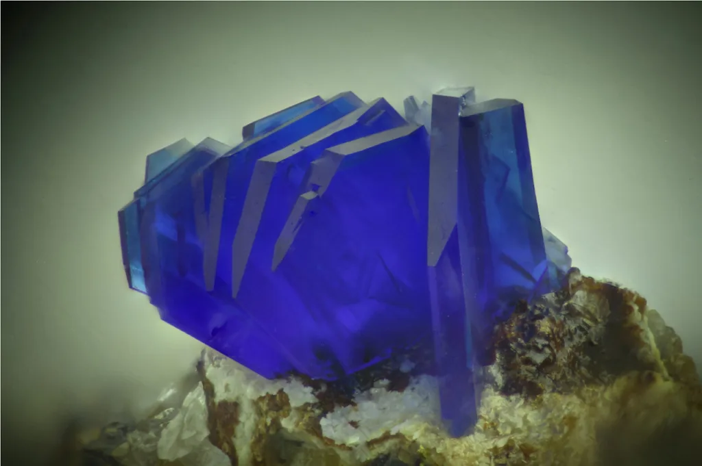
Shattuckite

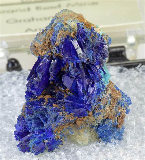
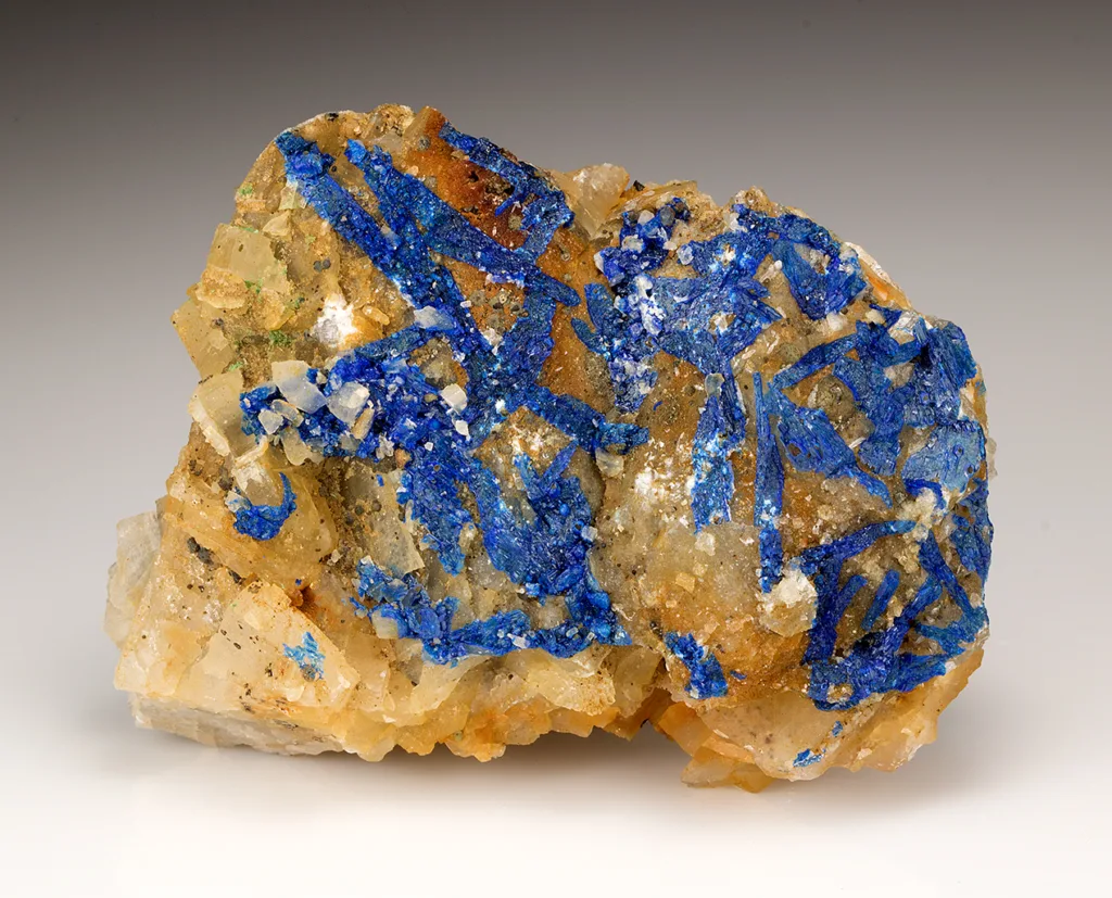
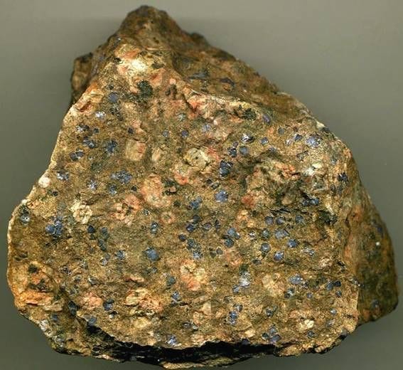
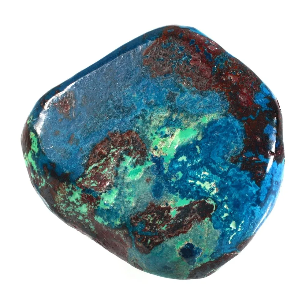
Shattuckite is a rare and visually striking mineral that is prized by mineral collectors and enthusiasts for its vibrant blue and green-blue color. It is a copper silicate mineral and is often found in association with other copper minerals like azurite, malachite, and chrysocolla. Shattuckite’s name is derived from the Shattuck Mine in Bisbee, Arizona, USA, where it was first discovered in 1915.
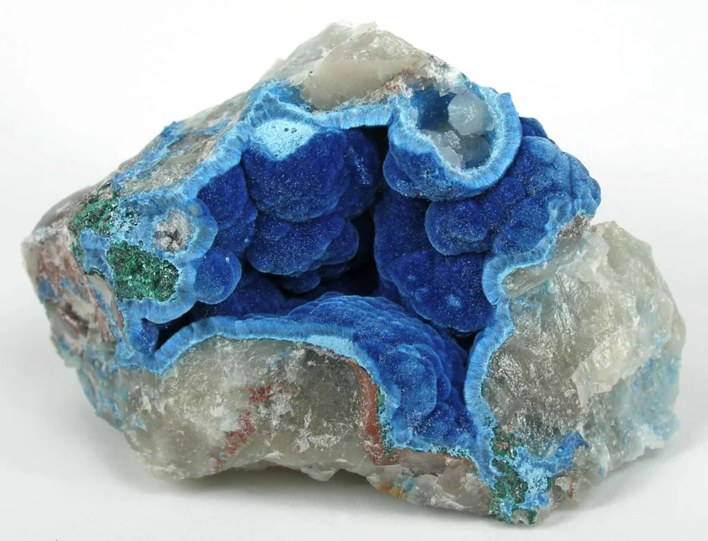
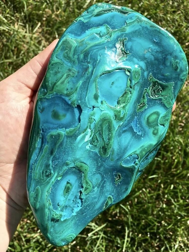
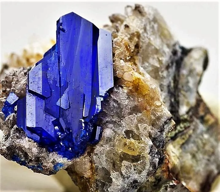
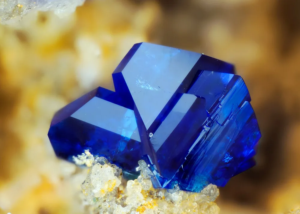
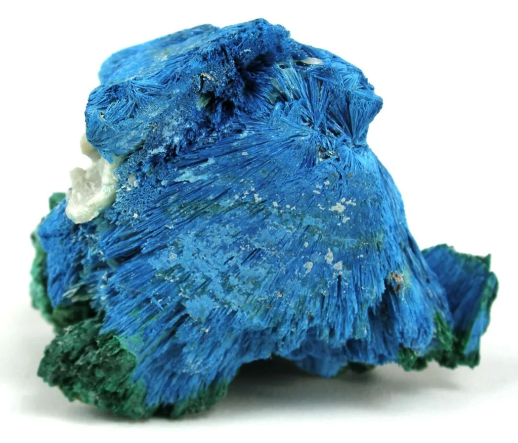
Definition: Shattuckite has a chemical composition of Cu5(SiO3)4(OH)2. It crystallizes in the orthorhombic crystal system and typically forms as radiating aggregates or fibrous structures, which contribute to its distinctive appearance. Its color can range from a deep, saturated blue to green-blue, and it often exhibits a pleasing, velvety luster.
Historical Significance: Shattuckite holds historical significance in the field of mineralogy and geology because of its initial discovery at the Shattuck Mine in Bisbee, Arizona. Bisbee was a prominent mining district in the late 19th and early 20th centuries, known for its rich deposits of various copper minerals. Shattuckite, when first found, became a notable addition to the list of minerals coming from the region.
Mineral collectors and geologists recognize Shattuckite for its stunning coloration and unique crystal formations. It is considered a secondary mineral, meaning it forms as a result of the alteration of primary copper ores. Shattuckite is often found in the oxidized zones of copper deposits, where the primary copper minerals undergo weathering and react with surrounding rocks and minerals. This makes it a valuable mineral for studying geological processes and the mineralization of copper deposits.
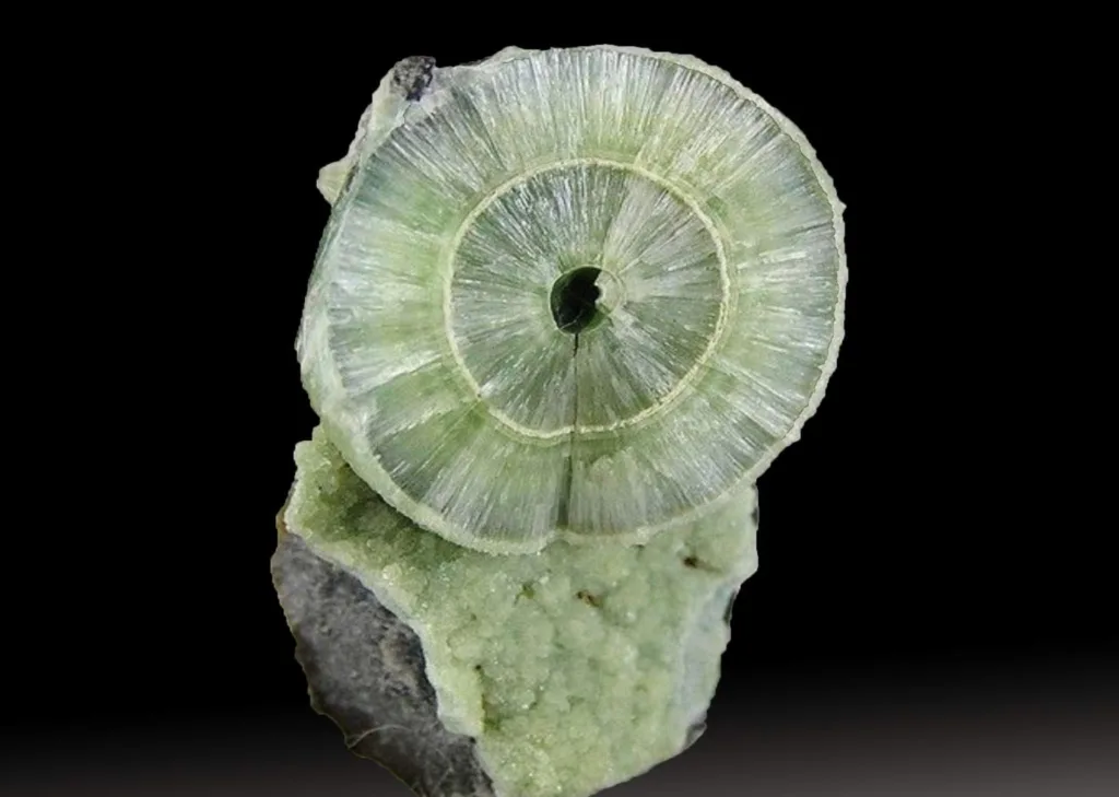
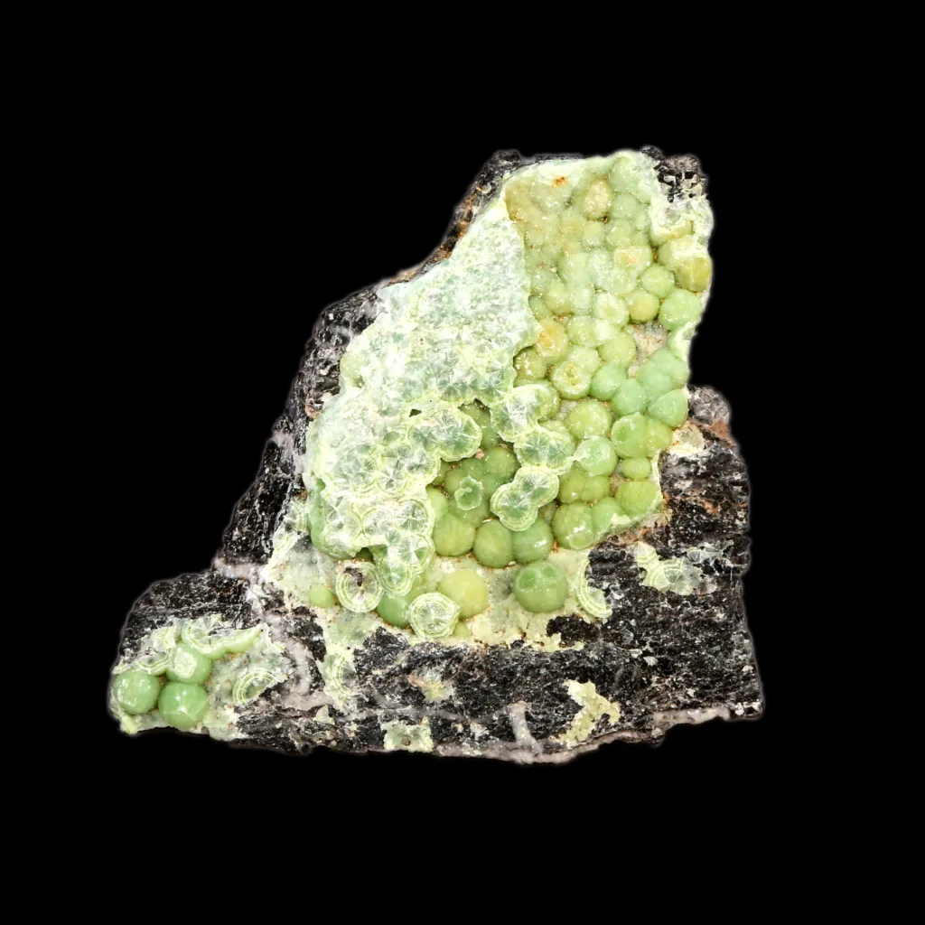
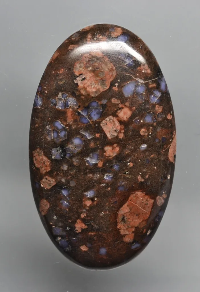
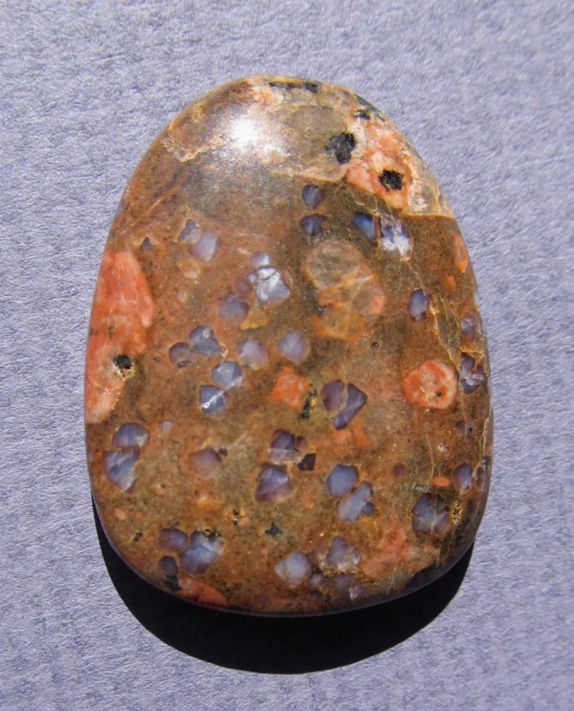
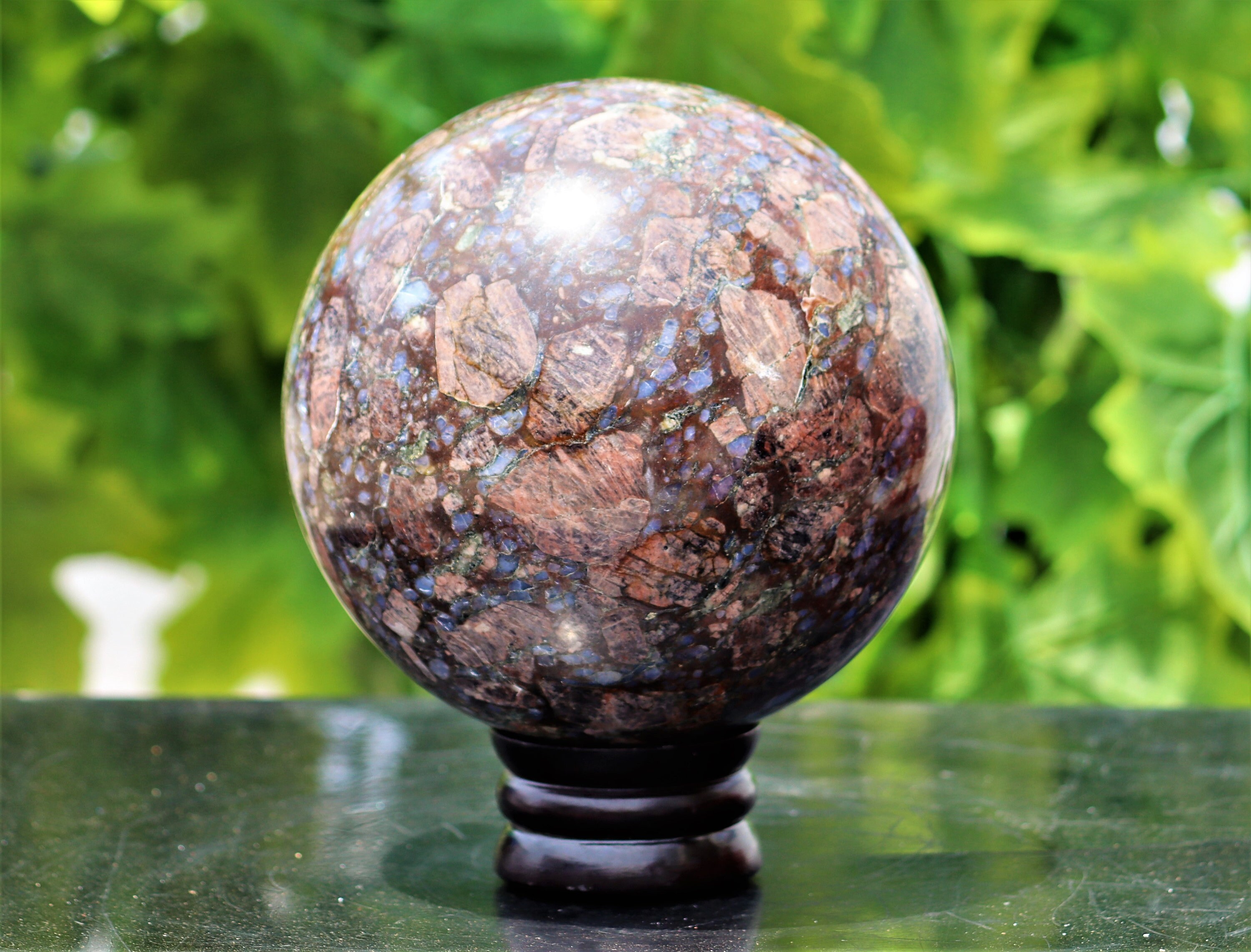
Shattuckite is also valued for its aesthetic appeal, and specimens are highly sought after in the world of mineral collecting. Its beautiful, rich blue and green-blue colors, along with its fibrous and botryoidal textures, make it a prized addition to mineral collections.
In summary, Shattuckite is a remarkable mineral known for its stunning color and unique crystal formations. Its historical significance lies in its discovery in the mining district of Bisbee, Arizona, and it continues to captivate the interest of mineral enthusiasts and collectors for its aesthetic and geological importance.
Geology and Formation of Shattuckite
The geology and formation of Shattuckite are closely tied to the presence of copper-rich mineral deposits and the alteration processes that occur within these deposits. Here is an overview of how Shattuckite is formed and the geological context in which it is typically found:
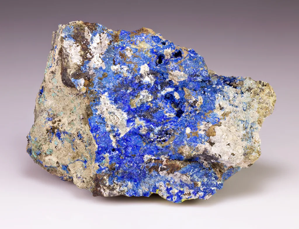
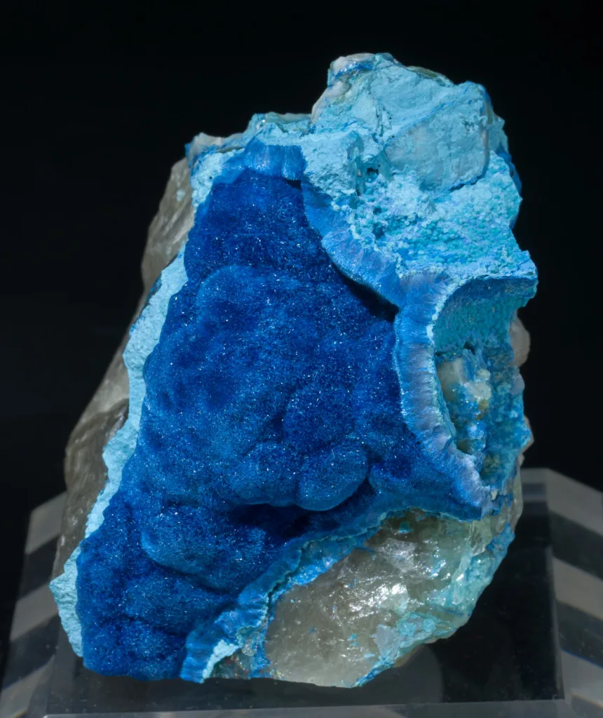
1. Geological Context: Shattuckite is most commonly found in the oxidized zones of copper deposits, often associated with other secondary copper minerals like malachite, azurite, chrysocolla, and turquoise. These deposits are typically hosted in sedimentary rocks, particularly in arid or semi-arid regions where copper-bearing solutions percolate through the ground.
2. Formation Process: The formation of Shattuckite involves several key geological and chemical processes:
a. Primary Copper Mineralization: Initially, copper minerals, known as primary minerals, are deposited in the rock. These primary minerals can include chalcopyrite, bornite, or other copper sulfides.
b. Weathering and Oxidation: Over time, exposure to oxygen, water, and other weathering agents leads to the oxidation of these primary copper minerals. This process transforms them into secondary copper minerals. This weathering occurs primarily in the near-surface environment.
c. Secondary Mineral Formation: During the weathering and alteration process, copper ions are released from the primary minerals and combine with other elements. In the case of Shattuckite, these copper ions react with silica (SiO2), oxygen (O2), and hydroxide ions (OH-) to form the mineral Cu5(SiO3)4(OH)2, which is Shattuckite. This process is influenced by the local geology and the specific conditions of the deposit.
d. Mineral Aggregation: Shattuckite typically forms as radiating aggregates, fibrous or botryoidal structures, or even as crusts on the walls of cavities within the host rock. These unique structures contribute to its aesthetic appeal.
3. Environmental Factors: The formation of Shattuckite is closely related to specific environmental conditions, including the presence of copper-rich solutions, a source of silica, and suitable pH levels. These conditions are often found in arid regions where copper deposits are subjected to leaching and weathering due to the interaction of copper-rich fluids with the surrounding rocks and minerals.
In summary, Shattuckite is a secondary copper mineral that forms as a result of the alteration and weathering of primary copper minerals in copper deposits. Its formation is intricately tied to geological processes, including the leaching of copper, the oxidation of primary minerals, and the subsequent combination of copper ions with silica and other elements. The mineral’s unique crystal structures and vibrant blue or green-blue color make it a fascinating and aesthetically pleasing addition to the world of mineralogy.
Physical, Chemical and Optical Properties of Shattuckite
Shattuckite possesses several distinctive physical, chemical, and optical properties that make it a notable and attractive mineral for both collectors and researchers. Here are some of its key properties:
Physical Properties:
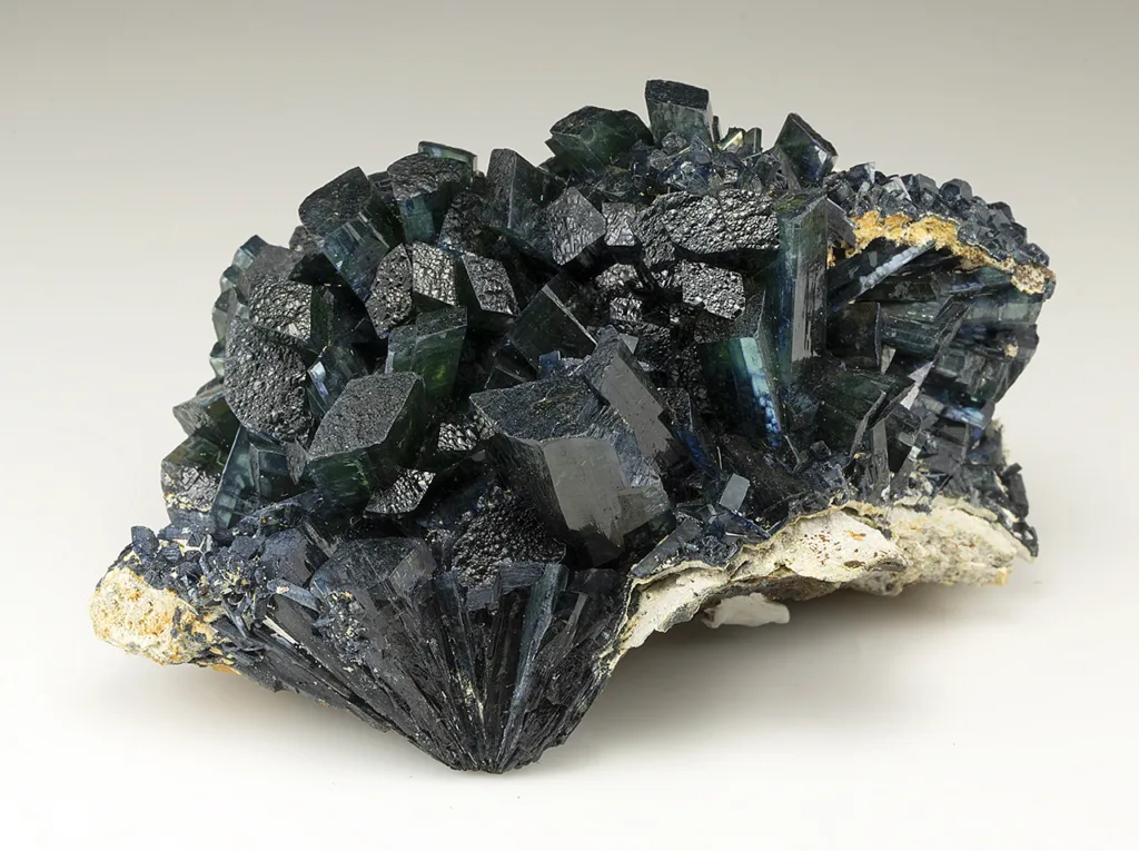
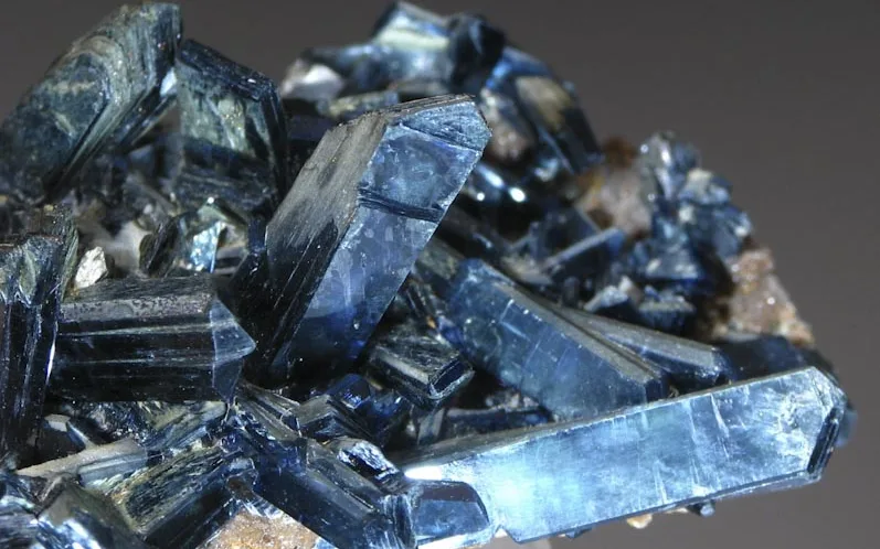
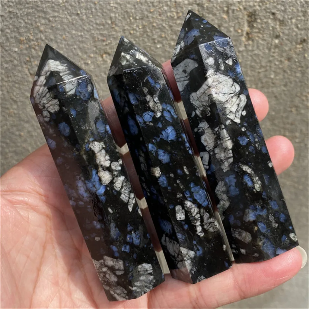
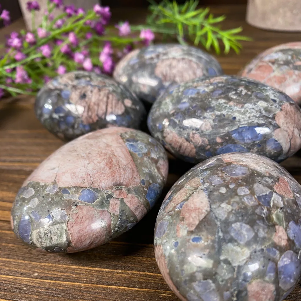
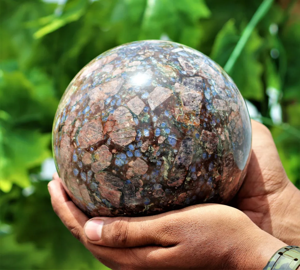
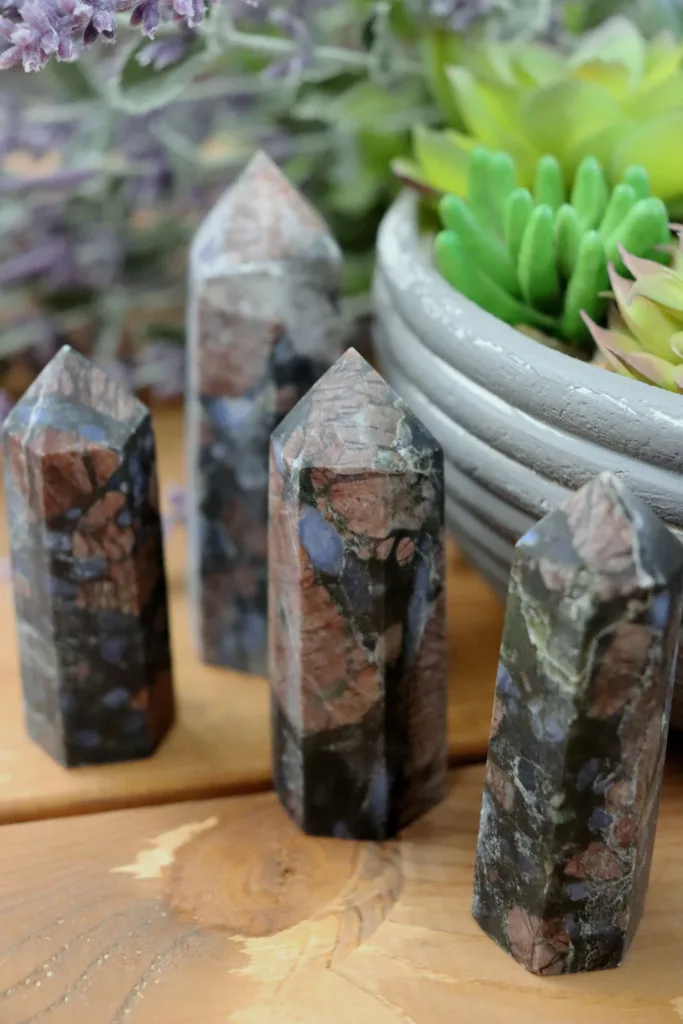
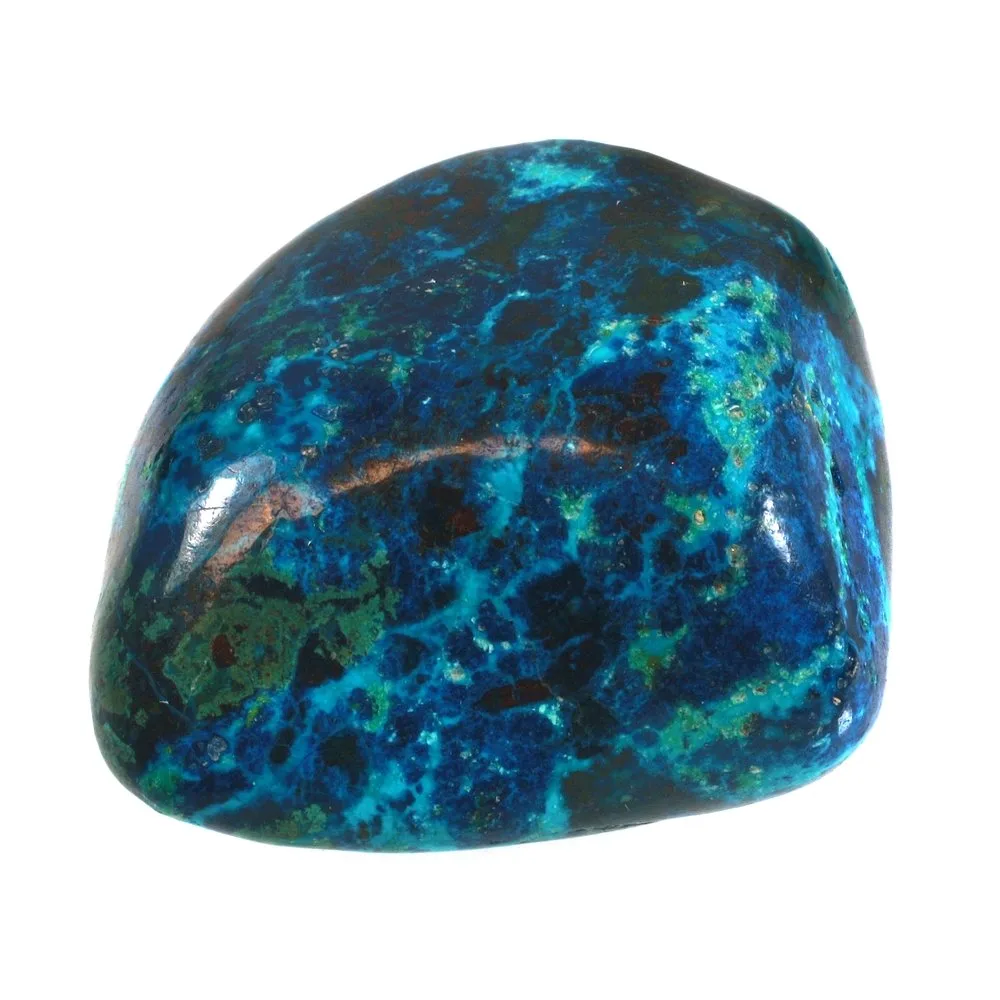
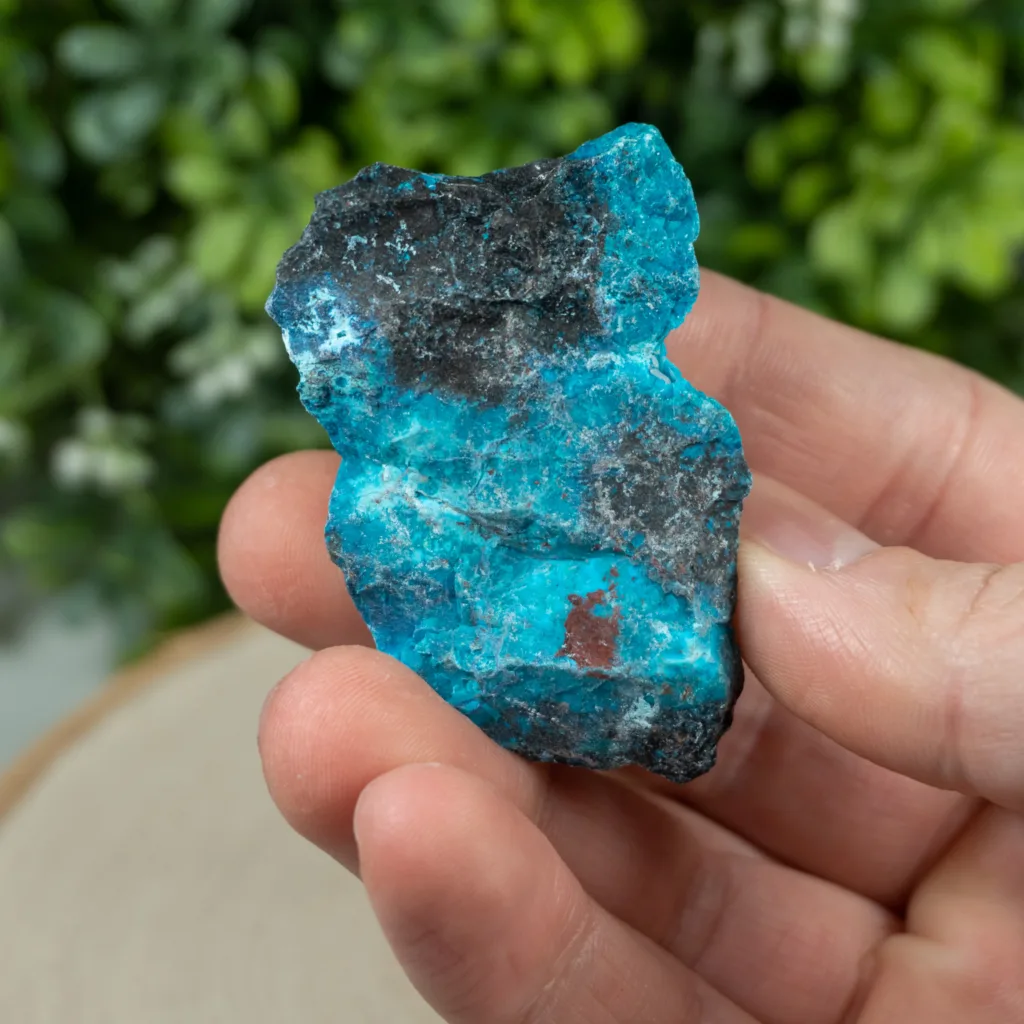
- Color: Shattuckite is renowned for its striking blue and green-blue color, which can range from deep azure to a more turquoise hue. This vibrant color is one of its most prominent features.
- Luster: It typically exhibits a vitreous to silky luster, which can give the mineral a soft, almost velvety appearance.
- Crystal Habit: Shattuckite often forms in radiating fibrous aggregates, botryoidal (grape-like) masses, and crusts. It rarely forms distinct crystals but can have a pseudohexagonal or tabular appearance.
- Hardness: Shattuckite falls in the range of 3.5 to 4 on the Mohs scale of mineral hardness. This makes it relatively soft compared to many other minerals, making it susceptible to scratching.
- Cleavage: It lacks distinct cleavage, meaning it doesn’t break along specific planes like some other minerals.
- Fracture: Shattuckite exhibits a conchoidal fracture, which means it breaks with smooth, curved surfaces similar to the way glass or obsidian fractures.
- Specific Gravity: Its specific gravity falls between 3.6 and 4.1, depending on its exact composition.
Chemical Properties:
- Chemical Composition: Shattuckite has the chemical formula Cu5(SiO3)4(OH)2. It is a copper silicate mineral and contains copper (Cu), silicon (Si), oxygen (O), and hydroxide ions (OH).
- Copper Content: Given its copper-rich nature, Shattuckite often contains a significant amount of copper, which contributes to its brilliant blue and green-blue colors.
Optical Properties:
- Transparency: Shattuckite is typically translucent to opaque, meaning light does not pass through it easily.
- Refractive Index: Its refractive index varies, but it is generally on the lower side for minerals, indicating that light is bent or refracted less when passing through Shattuckite.
- Birefringence: Shattuckite is usually non-birefringent, which means it does not split light into two distinct rays as some anisotropic minerals do.
- Pleochroism: Shattuckite may exhibit weak pleochroism, meaning it can show different colors or intensities of color when viewed from different angles.
- Fluorescence: In some cases, Shattuckite can exhibit weak to moderate blue or green fluorescence under ultraviolet (UV) light.
In summary, Shattuckite is known for its beautiful blue and green-blue color, silky to vitreous luster, unique crystal habits, and relatively low hardness. Its chemical composition primarily consists of copper, silicon, oxygen, and hydroxide ions. The optical properties of Shattuckite include translucency to opacity, a range of refractive indices, and occasionally weak pleochroism and fluorescence. These distinctive properties contribute to its appeal as a collector’s gem and its relevance in geological studies.
Uses and Applications

Shattuckite is primarily valued for its aesthetic qualities and is often sought after by mineral collectors and lapidary enthusiasts for its stunning blue and green-blue color and unique crystal formations. However, it is not widely used for industrial or commercial purposes due to its rarity and relatively small availability. Its main applications and uses are as follows:
- Mineral Collecting: Shattuckite is highly prized in the world of mineral collecting and is considered a desirable addition to mineral collections. Collectors appreciate its vibrant colors and distinctive crystal structures.
- Lapidary: Some lapidary artists and jewelers use Shattuckite to create cabochons, beads, and other ornamental items. Its beautiful blue and green-blue hues can be cut and polished to make attractive gemstones for use in jewelry.
- Metaphysical and Spiritual: Shattuckite is believed by some to possess metaphysical properties, including promoting truth, inner peace, and psychic development. It is used in crystal healing and spiritual practices, often as a meditation stone or for enhancing one’s intuition.
- Geological and Mineralogical Research: Shattuckite has significance in the field of geology and mineralogy. Its formation and association with other copper minerals contribute to the understanding of mineralization processes in copper deposits. It is also studied for its crystallography and mineralogical characteristics.
- Art and Decorative Items: Shattuckite specimens can be used in art and decorative items, such as sculptures and ornamental pieces, to add a splash of color and intrigue. Its striking appearance can be a focal point in various artistic creations.
It’s important to note that Shattuckite is a relatively rare mineral, and substantial quantities are not readily available. This rarity, combined with its specific color and structure, makes it more of a collector’s mineral and less of an industrial or commercial resource. As such, its applications are mainly limited to the fields of aesthetics, mineralogy, and metaphysical practices.
Rarity and Value
Shattuckite is considered a relatively rare mineral, and its rarity contributes to its value in the world of mineral collecting and lapidary arts. Several factors contribute to its rarity and the value associated with it:
Limited Occurrence: Shattuckite is not a common mineral, and it is found in only a few select locations around the world. Its primary occurrences are often associated with copper deposits, particularly in arid or semi-arid regions.
Small Deposits: Even within these copper deposits, Shattuckite is typically found in relatively small quantities. It often forms as thin veins, crusts, or pockets within the host rock, rather than large, extensive ore bodies.
Distinctive Appearance: The mineral’s striking blue and green-blue colors, along with its unique fibrous and botryoidal crystal habits, make it visually appealing and highly sought after by mineral collectors, jewelers, and lapidary artists.
Mineral Collecting: Shattuckite’s rarity and its aesthetic qualities make it a desirable addition to mineral collections, and collectors are often willing to pay a premium for quality specimens.
Limited Commercial Use: Shattuckite’s primary value lies in its use as a collector’s item and as a gemstone in jewelry, rather than in industrial applications. As a result, it is not widely processed or utilized in large-scale commercial industries, further preserving its rarity.
The value of Shattuckite can vary significantly based on factors such as its color, quality, size, and the location from which it is sourced. High-quality Shattuckite specimens with vivid, well-defined crystal structures and intense blue or green-blue hues can command relatively high prices in the mineral market. Rare or exceptional pieces may be particularly valuable to collectors and investors.
It’s important to note that, like with any mineral or gemstone, the value of Shattuckite can fluctuate based on market trends, supply and demand, and the preferences of collectors and buyers. Rarity, aesthetic appeal, and the mineral’s unique properties all contribute to its desirability and value within the world of minerals and gemstones.
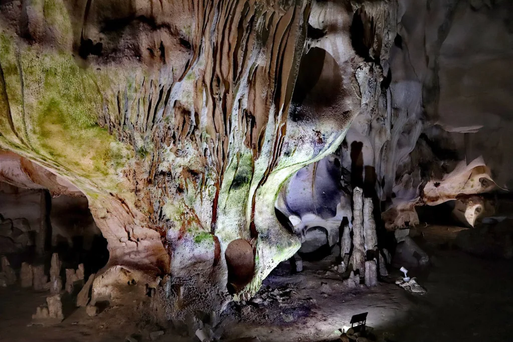
Occurrence and Mining Localities of Shattuckite
Shattuckite is a relatively rare mineral, and it is found in a limited number of locations around the world. It is often associated with copper deposits and typically occurs in the oxidized zones of these deposits, where primary copper minerals have undergone alteration due to weathering and other geological processes. Some of the notable mining localities for Shattuckite include:
- Bisbee, Arizona, USA: The Shattuckite mineral is named after the Shattuck Mine in Bisbee, Arizona, where it was first discovered. The Bisbee mining district, known for its rich copper deposits, has been a historically significant source of Shattuckite. This locality is renowned for producing some of the finest Shattuckite specimens.
- Democratic Republic of the Congo: The Katanga Copper Crescent in the DRC is a well-known source of Shattuckite. This region is famous for its vast copper deposits and is rich in a variety of copper minerals, including Shattuckite.
- Namibia: The Tsumeb Mine in Namibia has also yielded Shattuckite specimens. This mine is famous for its diverse mineral deposits and has produced many world-class mineral specimens.
- Southwestern Africa: Shattuckite has been found in other southwestern African countries, including Botswana and the Republic of South Africa. These countries are known for their mineral-rich geology and are often explored by mineral collectors and researchers.
- Other Occurrences: Shattuckite has also been reported from several other localities around the world, albeit in smaller quantities. These include countries like Australia, Mexico, and parts of Europe.
It’s important to note that even in the most significant Shattuckite-producing localities, this mineral is not typically extracted on a large scale for commercial purposes. Instead, it is primarily collected and appreciated for its aesthetic qualities and geological significance. As such, its availability can be limited, and high-quality specimens are highly sought after by mineral collectors and lapidary enthusiasts.