")


Cenotes, Mexico

Cenotes are natural sinkholes or deep natural pits, characteristic of the Yucatán Peninsula in Mexico and some other areas with similar geological features. The word “cenote” comes from the Yucatec Maya language, with the original term “dzonot” referring to any location with accessible groundwater. Over time, this term evolved into “cenote” as the Spanish language adopted it.

Geological Formation of Cenotes
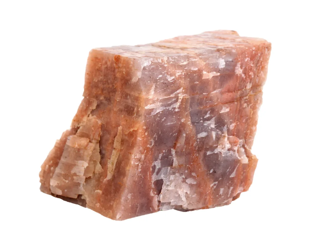
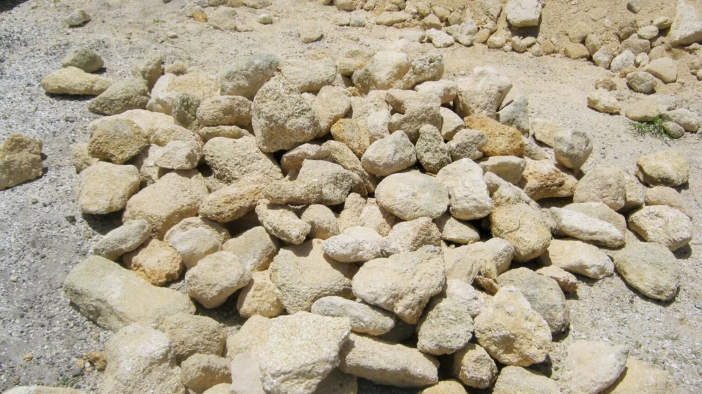
Cenotes are primarily formed through a geological process called karstification, which involves the dissolution of soluble bedrock, such as limestone or dolomite. The Yucatán Peninsula is largely made up of limestone, a porous and soluble rock. Rainwater, slightly acidic due to dissolved carbon dioxide, seeps into the ground and slowly dissolves the limestone, creating underground voids and passages.
As these voids enlarge over time, the overlying rock may collapse, exposing the groundwater below and forming a cenote. Some cenotes are also created through the collapse of cave ceilings. The Yucatán Peninsula has a vast network of underground rivers and caves, contributing to the formation of cenotes.
Types of Cenotes:
- Open Cenotes:
- These are surface-level cenotes, often resembling large ponds or lakes.
- Characterized by a visible water surface and may have vegetation around the edges.
- Open cenotes are popular for swimming, snorkeling, and diving.
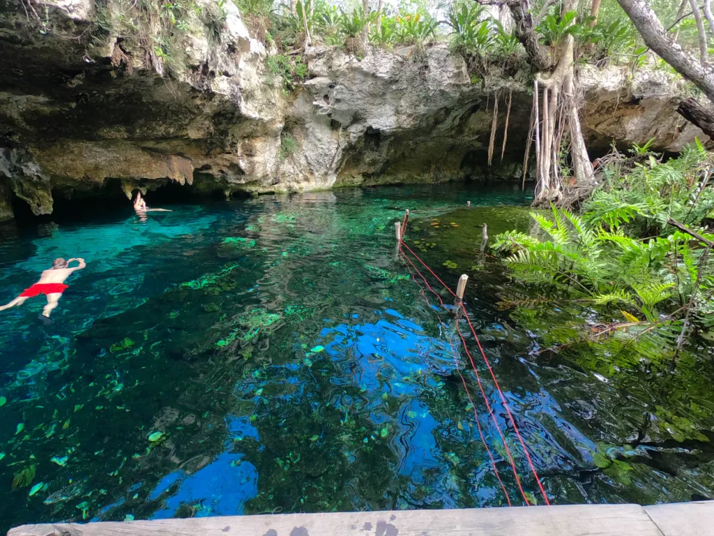
- Semi-Open Cenotes:
- Partially covered by a cave, overhang, or rock formation.
- They offer a combination of sunlight and shade, providing a unique atmosphere.
- Semi-open cenotes may have both surface and submerged cave systems.
- Cave Cenotes:
- Located entirely within caves or caverns, accessible through underwater passages.
- Cave cenotes often require specialized cave diving skills to explore.
- These cenotes can be particularly fascinating for experienced divers due to their intricate underwater formations.
Cenotes are not only geological wonders but also hold cultural and ecological significance for the Mayan people. In ancient times, cenotes were considered sacred, serving as a source of freshwater for communities and as sites for ceremonial activities. Today, they are popular destinations for tourists seeking a unique natural experience, with many cenotes providing opportunities for swimming, snorkeling, and cave diving. The Yucatán Peninsula, in particular, is renowned for its stunning cenotes, attracting visitors from around the world.
Geography and Distribution
Cenotes are primarily found in Mexico, particularly in the Yucatán Peninsula, where they are numerous and play a crucial role in the local hydrology. The distribution of cenotes extends beyond the Yucatán Peninsula to other parts of Mexico with similar geological characteristics, such as parts of the states of Quintana Roo, Campeche, and Tabasco.
Concentration in the Yucatán Peninsula:
The Yucatán Peninsula, which includes the states of Yucatán, Quintana Roo, and Campeche, is renowned for having a high concentration of cenotes. This region is characterized by its karst topography, where the porous limestone bedrock allows for the formation of these unique sinkholes. The Yucatán Peninsula is essentially a limestone platform, and the dissolution of this rock over time has created a vast network of underground rivers, caves, and cenotes.
Notable Cenote Locations:
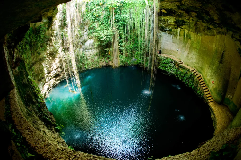
Ik Kil:
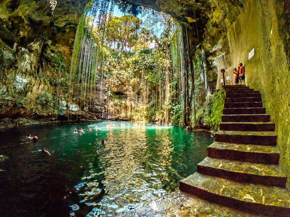
Located near the archaeological site of Chichen Itzá in Yucatán.
One of the most famous and visually stunning cenotes, with vines hanging down from the opening to the water below.
Popular for swimming and often included as a stop on tours to Chichen Itzá.
Gran Cenote:
Situated near the town of Tulum in Quintana Roo.
Known for its crystal-clear waters and impressive rock formations.
Offers opportunities for snorkeling and cave diving.
Dos Ojos:

Translating to “Two Eyes,” Dos Ojos is a complex of underwater cave systems and cenotes near Tulum.
One of the longest underwater cave systems in the world.
Known for its extensive network of passages and stunning underwater formations, making it a popular destination for cave divers.
Sacred Cenote of Chichen Itzá:

Located at the archaeological site of Chichen Itzá in Yucatán.
Historically significant for the ancient Maya, believed to be a sacred site for rituals and ceremonies.
Archaeological findings in the cenote include various artifacts and human remains.
Cenote Azul:

Found near Playa del Carmen in Quintana Roo.
Known for its deep blue color and clear waters.
Offers opportunities for swimming, snorkeling, and cliff diving.
These are just a few examples, and there are countless cenotes throughout the Yucatán Peninsula, each with its own unique characteristics and attractions. The popularity of these natural wonders has made cenotes a significant part of the tourism experience in the region, attracting visitors interested in exploring their geological formations, cultural history, and recreational activities.
Cultural and Historical Significance

Role of Cenotes in Ancient Mayan Culture: Cenotes held immense cultural and religious significance for the ancient Maya. They were considered portals to the underworld and were often associated with the gods of rain, water, and fertility. Cenotes were believed to be sacred places where the spiritual and earthly realms intersected, making them ideal locations for rituals and ceremonies.
Use of Cenotes for Rituals and Ceremonies: Ancient Maya communities used cenotes for various rituals and ceremonies, including offerings to appease gods or seek their favor. The Sacred Cenote of Chichen Itzá, for example, was a site where valuable objects, as well as human sacrifices, were made. These offerings were believed to ensure the well-being of the community and maintain a harmonious relationship with the divine.
Archaeological Findings in Cenotes: Cenotes have served as natural repositories for archaeological artifacts and human remains. The anoxic (low-oxygen) conditions in some cenotes have preserved organic materials exceptionally well. Archaeologists have discovered a wealth of artifacts, including pottery, tools, and jewelry, as well as the remains of sacrificial victims. These findings provide valuable insights into the rituals, customs, and daily life of the ancient Maya.
Ecological Importance:

Unique Ecosystems Within Cenotes: Cenotes are not only cultural treasures but also support unique ecosystems. The water in cenotes is often clear and mineral-rich, creating a distinct habitat for various species. Some cenotes have a layer of hydrogen sulfide or halocline, creating different environmental zones within the same cenote.
Flora and Fauna Adapted to the Cenote Environment: The flora and fauna in cenotes have adapted to the specific conditions of these environments. Blind cavefish and other specially adapted aquatic species inhabit the dark recesses of underwater cave systems. Plant life around the edges of open and semi-open cenotes is adapted to fluctuating water levels and often includes unique species not found in other ecosystems.
Conservation Efforts and Challenges: Cenotes face challenges related to pollution, over-extraction of water, and habitat degradation. Conservation efforts aim to preserve the ecological balance of these systems. Initiatives include promoting responsible tourism practices, implementing water management strategies, and raising awareness about the importance of cenotes in maintaining biodiversity.
Tourism and Recreation: The cultural and natural appeal of cenotes has turned them into popular tourist destinations. Visitors can explore the geological wonders of cenotes, swim in their crystal-clear waters, snorkel, dive, or simply enjoy the unique atmosphere. Tourism, while providing economic benefits to local communities, also poses challenges to the delicate ecosystems. Sustainable tourism practices and regulations are crucial to balance the preservation of cenotes with the enjoyment they bring to visitors.
In summary, cenotes are not only geological marvels but also hold a rich cultural history and contribute to unique ecosystems. Balancing tourism, conservation, and cultural preservation is essential to ensure the continued significance of cenotes for future generations.