")


Mount Ararat, Turkey: Story of Noah’s Ark

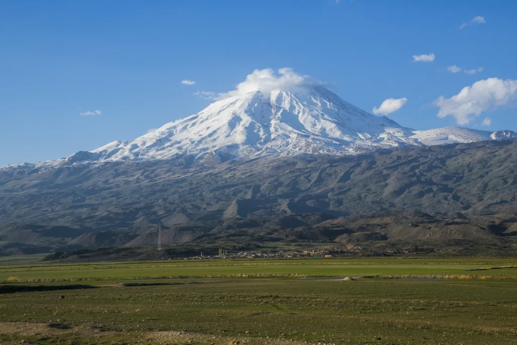
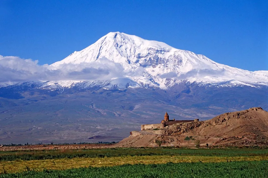
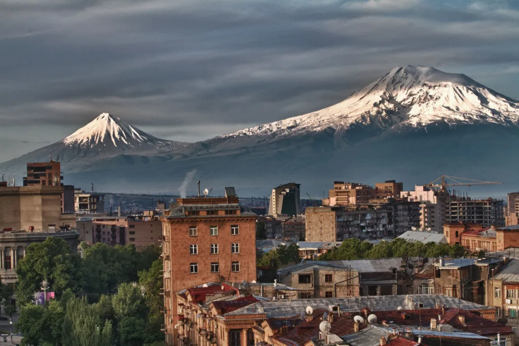
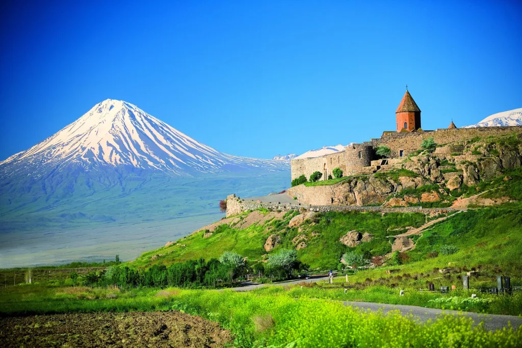
Mount Ararat, known as “Ağrı Dağı” in Turkish, is the highest mountain in Turkey, reaching an elevation of 5,137 meters (16,854 feet) above sea level. Located in eastern Turkey, near the borders with Iran and Armenia, Mount Ararat is a dormant stratovolcano with a prominent and distinctive twin-peaked profile.
Culturally and historically, Mount Ararat is renowned for its association with the biblical story of Noah’s Ark. According to religious traditions, it is believed to be the place where Noah’s Ark came to rest after the Great Flood, symbolizing hope and renewal. This association has made the mountain an iconic symbol in Judeo-Christian and Islamic faiths.
The region surrounding Mount Ararat has also become a popular destination for tourists, mountaineers, and outdoor enthusiasts. Climbers are drawn to the challenge of reaching its summit, making it a notable peak for adventurers. However, the mountain and its surrounding area have also been subject to geopolitical disputes between Turkey, Armenia, and neighboring countries.
Efforts are underway to protect the natural environment and preserve the cultural and historical significance of Mount Ararat while managing the influx of tourists and addressing geopolitical complexities. It remains a symbol of both natural beauty and cultural heritage in eastern Turkey.
Location: Mount Ararat is situated in the far eastern part of Turkey, near the border with Iran and Armenia. It is part of the Eastern Anatolia region, specifically within the Iğdır Province.
Biblical Significance: Mount Ararat holds significant religious and cultural importance, particularly in Abrahamic traditions. According to the Bible, it is believed to be the place where Noah’s Ark came to rest after the Great Flood, as described in the Book of Genesis. This connection has made Mount Ararat an iconic symbol in Judeo-Christian and Islamic traditions.
Tallest Peak in Turkey: Mount Ararat is the highest mountain in Turkey, with its highest peak, Mount Ararat, reaching an elevation of 5,137 meters (16,854 feet) above sea level. This makes it a challenging and popular destination for mountaineers and hikers from around the world.
Geopolitical Context: Mount Ararat has been at the center of geopolitical disputes and historical conflicts due to its location at the crossroads of Eastern Europe, Western Asia, and the Caucasus. The region has witnessed territorial disputes between Turkey, Armenia, and other neighboring countries, contributing to the mountain’s complex historical context.
In summary, Mount Ararat is a prominent and symbolically significant mountain in eastern Turkey, known for its biblical connection, status as Turkey’s highest peak, rich history, and the geopolitical context of its region. It continues to be a point of fascination and cultural significance for people around the world.
Geography and Geology
Geography and geology play essential roles in understanding Mount Ararat. Here’s a more detailed look at these aspects:
Geography:
- Location: Mount Ararat is located in eastern Turkey, near the border with Iran and Armenia. It lies within the Iğdır Province and is part of the Eastern Anatolia region.
- Physical Features: The mountain is characterized by its twin peaks, Greater Ararat and Lesser Ararat. Greater Ararat is the taller of the two, reaching an elevation of 5,137 meters (16,854 feet) above sea level. Lesser Ararat stands at 3,896 meters (12,782 feet). The region around Mount Ararat features rugged terrain, including glaciers, deep valleys, and a volcanic landscape.
- Climate: The climate around Mount Ararat varies with elevation. At higher altitudes, it experiences cold and harsh alpine conditions with snow and ice, while lower elevations have a more temperate climate. Precipitation is relatively low, making the mountain’s slopes arid in some areas.
Geology:
- Volcanic Origin: Mount Ararat is a dormant stratovolcano, which means it is composed of layers of solidified volcanic rock, ash, and lava. The mountain’s formation is related to the tectonic activity in the region, primarily the convergence of the Arabian Plate and the Eurasian Plate.
- Volcanic History: The volcanic activity that formed Mount Ararat dates back millions of years. It is believed to have been active during the late Pleistocene and Holocene epochs, but it is currently considered dormant, with no recorded eruptions in modern history.
- Glaciers: Mount Ararat is known for its glaciers, which are remnants of the colder periods in Earth’s history. These glaciers, such as the Eastern and Western Plateau Glaciers, are primarily found on the upper slopes and contribute to the region’s stunning alpine scenery.
- Tectonic Activity: The region around Mount Ararat is seismically active due to the ongoing convergence of tectonic plates. Earthquakes are relatively common in the area, posing challenges to the stability of the mountain’s slopes.
In summary, Mount Ararat’s geography is characterized by its location in eastern Turkey, distinctive twin peaks, and varying climate conditions, while its geology is rooted in its volcanic origins, with a history of geological activity and the presence of glaciers. These factors contribute to the mountain’s unique natural beauty and geological significance.
Cultural and Historical Significance
Mount Ararat holds significant cultural and historical importance, particularly in the context of various civilizations and religious traditions. Here are some key aspects of its cultural and historical significance:
- Biblical and Religious Significance: Mount Ararat is most famous for its association with the biblical story of Noah’s Ark. According to the Book of Genesis in the Bible, it is believed to be the place where Noah’s Ark came to rest after the Great Flood, providing a symbol of hope and renewal for humanity. This story is shared by Judaism, Christianity, and Islam, making the mountain a revered site in these religions.
- Cultural Symbolism: Mount Ararat has been a subject of fascination and inspiration for poets, writers, and artists throughout history. Its towering presence and distinctive twin peaks have been depicted in numerous artworks, literature, and cultural expressions, serving as a symbol of both beauty and resilience.
- Historical Civilizations: The region surrounding Mount Ararat has been inhabited by various civilizations, including the Urartians, Armenians, and others. The mountain has been at the crossroads of different cultures and has witnessed the rise and fall of ancient empires and kingdoms, leaving behind a rich historical legacy.
- Territorial Disputes: The historical significance of Mount Ararat extends to modern times, as the mountain and its surrounding region have been at the center of territorial disputes and conflicts between Turkey, Armenia, and neighboring countries. These disputes have political and historical dimensions, making the mountain a symbol of regional tensions.
- Mountaineering and Exploration: Mount Ararat’s challenging terrain and status as the highest peak in Turkey have made it a popular destination for mountaineers and adventurers. Climbing the mountain has become a significant cultural and sporting activity, drawing people from around the world to conquer its peaks.
- Tourism: Despite its historical and cultural significance, Mount Ararat has also become a tourist attraction. Visitors come to explore the region’s natural beauty, engage in trekking and hiking, and learn about the mountain’s rich history and folklore.
In summary, Mount Ararat’s cultural and historical significance is deeply rooted in its biblical connections, its role as a symbol of hope and renewal, its influence on art and literature, and its historical context as a region inhabited by various civilizations. Additionally, the mountain’s role in contemporary territorial disputes and its popularity among mountaineers and tourists contribute to its multifaceted cultural and historical importance.
Mount Ararat in Modern Times
In modern times, Mount Ararat continues to hold significance and play various roles, both culturally and practically:
- Tourism and Recreation: Mount Ararat has become a popular destination for tourists and outdoor enthusiasts. The region attracts trekkers, hikers, and mountaineers who seek to conquer its peaks. The opportunity to witness the stunning natural beauty of the mountain and its surroundings draws visitors from around the world.
- Climbing Expeditions: Mount Ararat is one of the Seven Summits, a list of the highest peaks on each of the seven continents. This status makes it particularly attractive to climbers aiming to complete this prestigious mountaineering challenge. Climbing expeditions, both guided and independent, are organized regularly.
- Cultural and Religious Pilgrimages: For people of various religious backgrounds, especially those from Abrahamic faiths (Judaism, Christianity, and Islam), visiting Mount Ararat remains a significant pilgrimage. Some individuals and groups make the journey to connect with the biblical story of Noah’s Ark or to simply pay their respects to the mountain’s cultural and religious heritage.
- Research and Scientific Studies: The mountain and its surrounding region attract scientists and researchers interested in geology, glaciology, ecology, and archaeology. Mount Ararat’s unique geological history, glaciers, and the remnants of past civilizations provide valuable research opportunities.
- Cultural Heritage: The historical and cultural significance of Mount Ararat is preserved through museums, archaeological sites, and cultural events in the surrounding areas. Efforts are made to protect and promote the mountain’s heritage.
- Geopolitical Context: Mount Ararat and its vicinity continue to be of geopolitical importance. Ongoing disputes and diplomatic efforts between Turkey, Armenia, and neighboring countries affect the region and influence the accessibility and use of the mountain.
- Conservation and Environmental Concerns: The impact of tourism and climate change on Mount Ararat’s environment and glaciers has raised concerns. Conservation efforts are underway to protect the natural beauty and ecological balance of the region.
- Infrastructure Development: Infrastructure development, including roads and facilities for tourists and climbers, has been an ongoing focus in the region to support tourism and outdoor activities while ensuring safety and accessibility.
In summary, Mount Ararat remains a dynamic and multifaceted symbol of cultural, religious, and natural significance in modern times. It continues to attract visitors, climbers, researchers, and diplomats, while also facing the challenges of conservation and geopolitical complexities.