













Essential Structural Geology Guides
Core concepts, structures and geological mapping.



Structural Geology Articles
Research and detailed reference articles. · View all →
Structural Geology: The Scientific Guide
Geometry, deformation, field methods and applied investigations.
What Is Structural Geology?
Structural geology investigates the three-dimensional form of geological bodies, their deformation history and the processes responsible for their present configuration. Its scales range from microscopic crystal fabrics to continental fault systems. Structural observations distinguish original geological features from those produced during later deformation.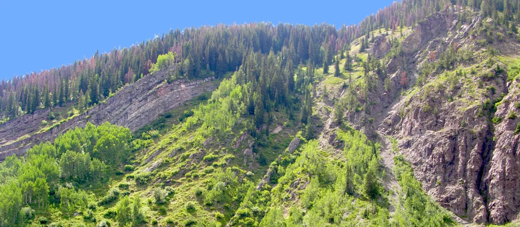
Structural analysis distinguishes geometry (observed form), kinematics (motion and finite deformation) and mechanics (forces and material behavior). Mapping, petrography, orientation data and regional relationships provide independent constraints.
Stress, Strain and Rock Deformation
Stress is force per unit area, expressed in pascals. Normal stress acts perpendicular to a surface and shear stress acts parallel to it. Three mutually perpendicular principal stresses describe a local stress state; with compression positive they are commonly ordered σ₁ ≥ σ₂ ≥ σ₃. Strain describes a change in shape or size relative to a reference configuration.
| Behavior | Response | Examples |
|---|---|---|
| Elastic | Recoverable deformation after unloading | Elastic deformation around a locked fault |
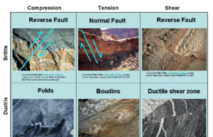
| Brittle | Fracture and displacement along discontinuities | Joints, faults, cataclasite |
| Ductile | Permanent distributed deformation | Folds, mylonitic fabrics, crystal-plastic deformation |
Worked Example: Shortening and Stress
Engineering linear strain is ε = (L − L₀)/L₀. A marker bed originally 5.0 m long, shortened to 4.0 m, has ε = (4.0 − 5.0)/5.0 = −0.20, or 20% shortening with extension positive. A force of 100 kN distributed normally over 0.01 m² gives an average normal stress of 10 MPa. These are simplified one-dimensional examples, not full stress or strain tensors.
Confining pressure, temperature, strain rate, fluid pressure, mineralogy and pre-existing weaknesses influence deformation. Brittle and ductile behavior can coexist in layered rocks; folding does not necessarily exclude fracture or slip between beds.
Folds: Geometry and Classification
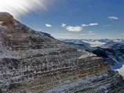
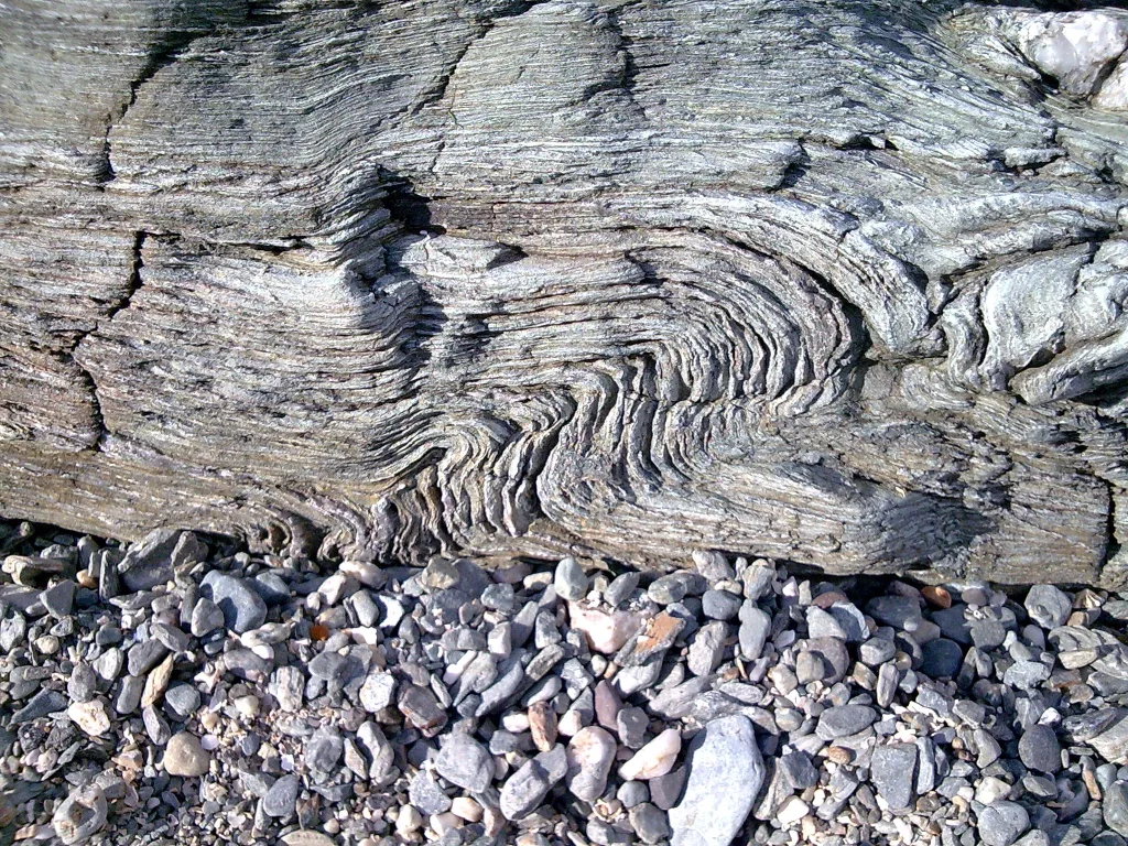
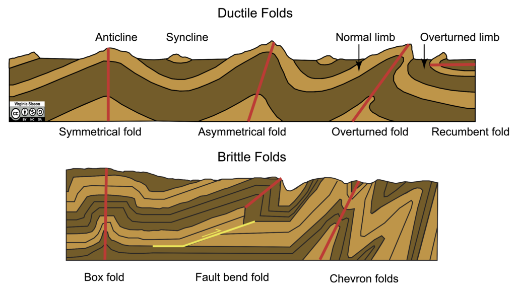
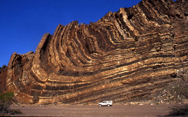
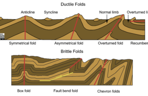
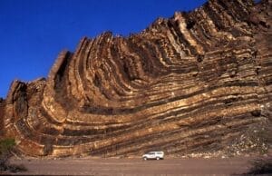
A fold is a bent geological surface. Its geometry includes limbs, hinges, hinge lines, axial surfaces and interlimb angles. An axial surface connects hinges of folded layers; a hinge line may be described by trend and plunge.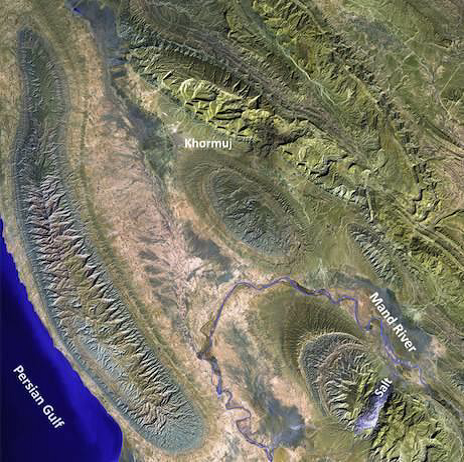
| Term | Diagnostic feature |
|---|---|
| Antiform | Convex-up geometry in a suitable section |
| Synform | Concave-up geometry in a suitable section |
| Anticline | Older strata in the core |
| Syncline | Younger strata in the core |
| Monocline | Step-like bending of layers |
| Dome / basin | Outward / inward dip in ideal non-overturned strata |
Anticline and syncline are age-based names, not simply shape descriptions. Overturning complicates identification. Other descriptors include upright, inclined, recumbent, open, tight and isoclinal. Establish stratigraphic facing, trace marker beds and measure limb orientations before interpreting a fold.
Faults: Displacement Along Geological Surfaces
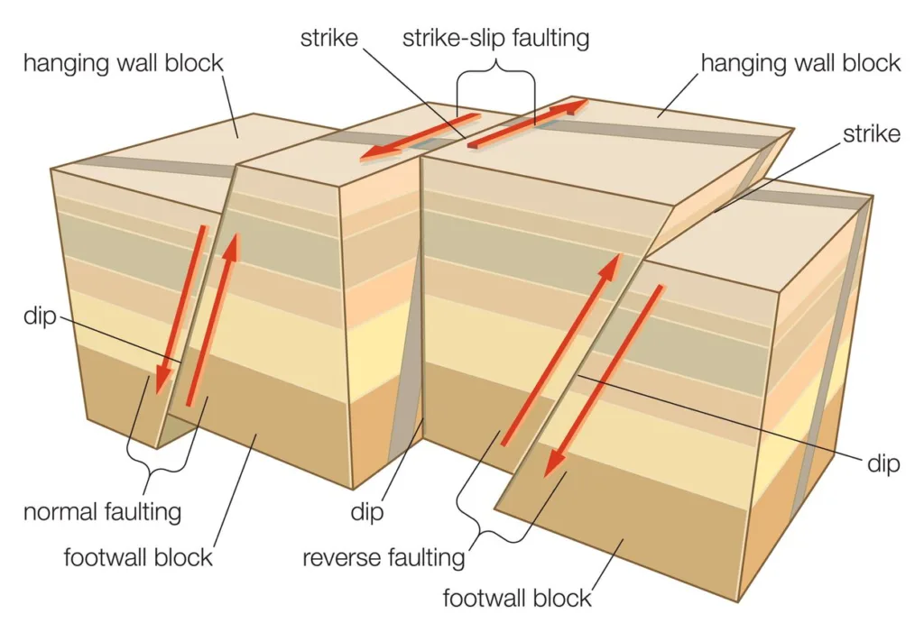
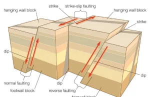
A fault is a discontinuity across which rock bodies have undergone relative displacement. The hanging wall lies above a dipping fault and the footwall below. Net slip is not necessarily the apparent separation of a marker in a map or cross-section.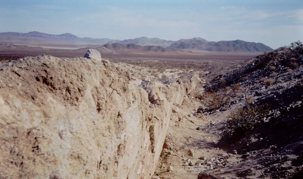
| Fault type | Relative motion | Typical setting |
|---|---|---|
| Normal | Hanging wall moves down | Extension and rifting |
| Reverse | Hanging wall moves up | Shortening |
| Thrust | Low-angle reverse fault | Fold-and-thrust belts |
| Strike-slip | Predominantly horizontal motion along strike | Transform boundaries and shear zones |
| Oblique-slip | Combined dip-slip and strike-slip | Oblique convergence or extension |
Fault Zones and Displacement
Fault zones may contain a principal slip surface, gouge-rich core, fractured damage zones, veins and subsidiary faults. Slickenside lineations may indicate slip direction; displaced markers or reliable asymmetric structures are needed to determine sense of motion.
For a pure dip-slip fault dipping 60° with 10 m net slip, the vertical displacement component is 10 sin 60° ≈ 8.66 m; the horizontal down-dip component is 10 cos 60° = 5.0 m. Apparent map offsets may differ from both components.
Fractures, Joints, Veins and Shear Zones
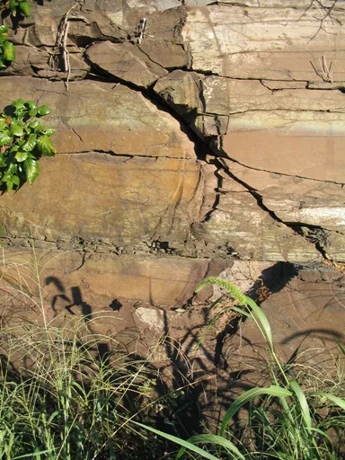
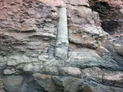
A fracture is a break in rock. A joint generally has negligible shear displacement at the observation scale. Veins are mineral-filled openings, commonly recording fluid circulation and precipitation. Shear zones concentrate deformation and can be brittle, ductile or transitional.
Foliation and Lineation
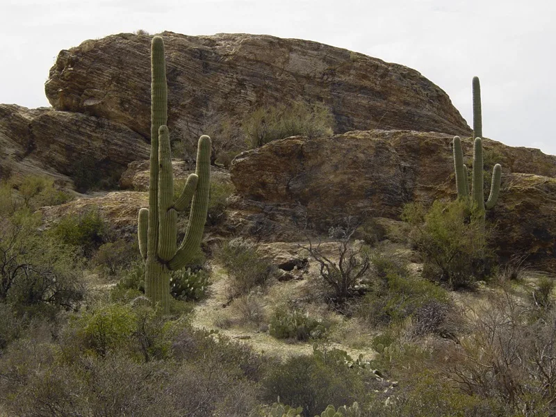
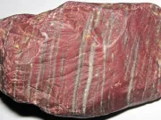
Foliation is a planar fabric formed by mineral alignment, deformation or compositional segregation. Lineation is a linear fabric such as aligned elongate grains or stretching lineations. Bedding-cleavage relationships help interpret folding, but one fabric alone does not establish a unique stress direction. See Metamorphic Textures & Fabrics.
Tectonic Regimes and Structural Styles
| Regime | Common structures | Setting |
|---|---|---|
| Shortening | Thrusts, folds, reverse faults | Continental collision |
| Extension | Normal faults, tilted blocks, grabens | Rifts and extensional basins |
| Strike-slip | Strike-slip faults and en echelon structures | Transform boundaries |
| Transpression / transtension | Combined strike-slip and shortening / extension | Oblique plate boundaries |
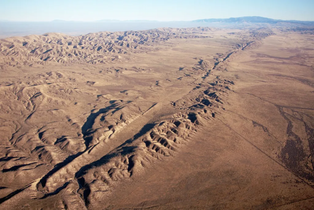
Local strain partitioning, inherited weaknesses and changing plate motions produce multiple generations of structures. Cross-cutting and overprinting relationships constrain relative timing; numerical ages require suitable dating methods.
Strike, Dip, Trend and Plunge
Strike and dip describe the orientation of a plane. Strike is the azimuth of a horizontal line in the plane, true dip is its steepest downward inclination and dip direction is the downhill bearing. Trend and plunge describe the direction and inclination of a line.
| Measurement | Definition | Range |
|---|---|---|
| Strike | Horizontal bearing of a plane | 0–360°; opposite bearings define the same strike line |
| Dip | Maximum inclination below horizontal | 0–90° |
| Dip direction | Down-dip azimuth | 0–360° |
| Trend | Bearing of the plunging end of a line | 0–360° |
| Plunge | Inclination of a line below horizontal | 0–90° |
Worked Example: Recording a Bedding Plane
A bed strikes 040° and dips 35° southeast. Dip-direction/dip notation is 130/35. The right-hand-rule strike/dip notation is 040/35 because dip is 90° clockwise from strike. State the convention when exchanging data.
Use a representative surface, level the geological compass for strike and measure true dip with a clinometer. Record the dip direction, feature type, location and quality of the measurement. Apply magnetic declination corrections if true north is required.
Stereonets and Structural Data
A stereonet represents three-dimensional orientations in two dimensions. Planes can be plotted as great circles or poles, and linear features as points. Lower-hemisphere equal-area projections are commonly used to compare orientation sets. Joint-plane intersections may help screen potential wedge failures; friction, persistence, water conditions and actual slope geometry must also be considered.
Geological Maps and Cross-Sections
A geological map records the surface distribution of geological units, contacts and structures. A cross-section interprets their geometry along a vertical plane. Topography, apparent dip, layer thickness and fault separation must be considered together. A section perpendicular to strike represents true dip for a planar feature; an oblique section usually displays a shallower apparent dip.
For true dip δ and horizontal section angle θ measured from strike, tan(apparent dip) = tan(δ) × sin(θ). For δ = 45° and θ = 30°, apparent dip is approximately 26.6°. A single section cannot establish complete three-dimensional geometry.
| Evidence | Interpretation | Limitation |
|---|---|---|
| Strike/dip symbols | Orientation of a planar feature | Local observations may not represent the entire unit |
| Map contacts and contours | Surface intersection of geological boundaries | Topography affects the map pattern |
| Displaced markers | Fault separation | True slip requires additional constraints |
| Boreholes and geophysics | Subsurface geometry | Interpretation and sampling uncertainty |
Related guides: Geological Maps · Types of Maps.
Structural Geology and Earthquakes
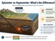
Earthquakes can occur during rapid slip on faults, releasing stored elastic strain. Some faults move aseismically and not every mapped fault is active. Source models integrate seismic data, fault geometry, geodetic measurements and paleoseismic evidence. A mapped fault alone cannot establish the timing of a future earthquake. See Earthquakes.
Engineering, Resources and Environmental Applications
| Application | Structural information | Practical relevance |
|---|---|---|
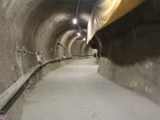
| Slope and tunnel investigation | Discontinuity orientation, spacing, persistence and condition | Preliminary analysis of planar sliding, wedges and toppling |
| Groundwater investigation | Faults and fracture networks | Potential flow paths or barriers |
| Mineral exploration | Veins, faults, folds, shear zones | Controls on ore-body geometry |
| Reservoir studies | Fault displacement, folds and fractures | Traps, compartmentalization and flow |
| Tectonic reconstruction | Cross-cutting relations and deformation fabrics | Sequence of events |
Intact rock strength and rock mass behavior are distinct. Strong intact rock can form an unstable rock mass when discontinuities have unfavorable orientations. Structural mapping supports site investigation but does not replace project-specific engineering assessment.
Further reading: Engineering Geology · Hydrogeology · Mining Geology.
Frequently Asked Questions About Structural Geology
What is the difference between a fault and a joint?
A fault shows relative displacement. A joint normally lacks appreciable shear displacement at the observation scale.
What is the difference between stress and strain?
Stress describes force per unit area; strain describes deformation relative to a reference configuration.
How do you distinguish an anticline from a syncline?
Establish the relative ages of folded strata. Anticlines contain older strata at their cores, synclines younger strata.
What is the difference between strike and dip?
Strike is the horizontal orientation of a plane, dip is its steepest downward inclination.
Can rock deform without breaking?
Yes. Crystal-plastic and other ductile deformation mechanisms can operate without macroscopic fracture.
Why does structural geology matter in construction?
Discontinuity geometry and rock fabrics may control stability, groundwater movement and excavation conditions.
Scientific References and Further Reading
- Steven Earle, Physical Geology, 2nd edition — Geological Structures
- Physical Geology — Stress and Strain
- Physical Geology — Measuring Geological Structures
- USGS — Earthquake Hazards Program
- Fossen, H. (2016). Structural Geology, 2nd edition. Cambridge University Press.