







Salt creates some of Earth’s most unusual geological landscapes, from vast white desert plains to intricately shaped crystals, underground caves and mountains of flowing rock salt. These landforms originate through a combination of evaporation, mineral precipitation, dissolution, tectonic deformation and groundwater movement. Although most are dominated by halite (sodium chloride, NaCl), associated minerals and local geological conditions can produce dramatically different structures.
The ten examples below illustrate three principal ways in which salt shapes the landscape: accumulation in closed basins, chemical interaction with geothermal fluids, and the deformation and dissolution of ancient buried evaporites.
How salt creates geological landforms
Evaporites form when water containing dissolved ions becomes sufficiently concentrated for minerals to precipitate. Mineral saturation depends on fluid composition, temperature and the activities of dissolved ions; it is not determined by a single universal salinity threshold. In suitable basins, continued evaporation produces mineral layers or surface crusts. Later burial can turn these deposits into rock salt. Under geological stress, buried salt may flow upward as diapirs, while contact with dilute water can dissolve it into caves and collapse structures.
1. Salar de Uyuni, Bolivia
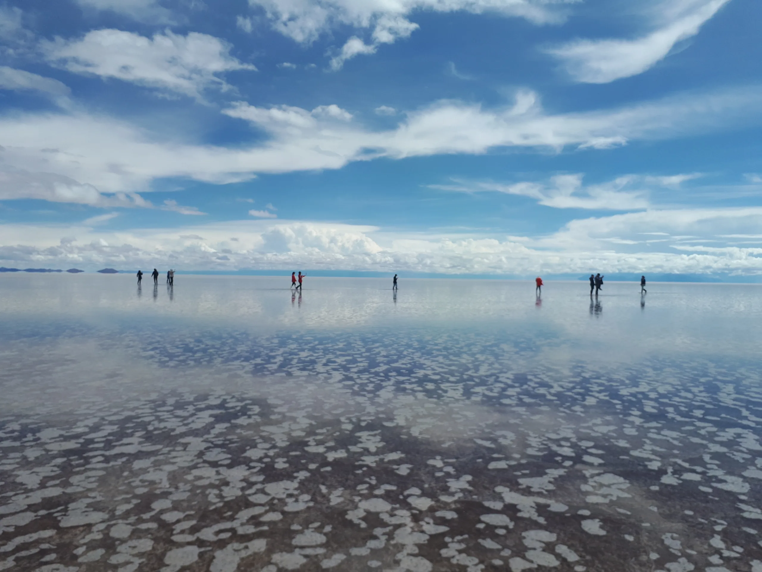
Salar de Uyuni occupies an enclosed basin of the Andean Altiplano. Its brilliant white surface is the modern expression of successive lake stages that left dissolved salts behind as water levels fell. Today, precipitation, runoff and groundwater transport soluble ions into the basin, while evaporation removes water and concentrates the remaining brine. Halite crystallizes when the solution becomes sufficiently concentrated, producing an extensive, nearly level crust.
During dry periods, the crust commonly displays polygonal patterns. Cracking, brine movement and crystal growth can all influence these patterns; they should not be interpreted simply as ordinary mud cracks. After rain, a shallow water layer produces the famous mirror effect. The basin also contains lithium-bearing brines beneath its surface, but the white solid crust is predominantly salt rather than lithium metal. See our Salar de Uyuni geological profile and NASA Earth Observatory.
2. Devil’s Golf Course, California, USA
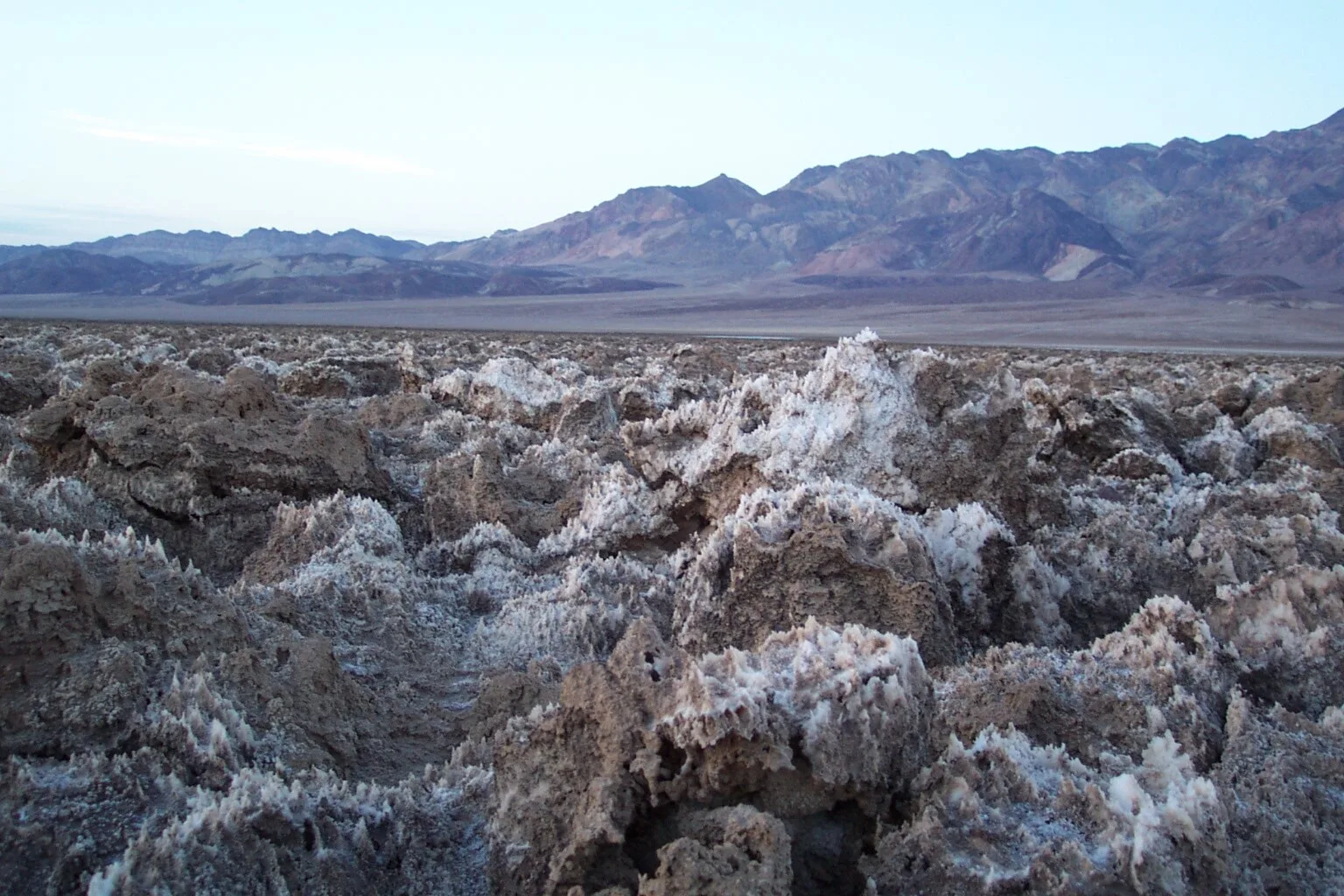
Unlike the smooth surface of many salars, Devil’s Golf Course in Death Valley is a rugged field of sharp salt projections. It lies within the Badwater Basin, where dissolved minerals accumulate in a desert depression lacking an effective drainage outlet. Saline water rises toward the ground surface through porous sediment, evaporates and deposits crystals. Irregular crystal growth and repeated wetting and drying gradually create a rough, cemented salt-and-mud crust.
Wind and rain modify the projecting structures, while renewed evaporation can add fresh crystals. The result is a surface with cavities, ridges and exceptionally sharp edges. This is a useful reminder that a salt flat need not be flat on the scale of centimeters or meters. The landscape is also a fragile geologic feature: trampling breaks crystals and the irregular surface presents a fall hazard. The National Park Service describes the site’s distinctive salt formations. Read more about Devil’s Golf Course.
3. Bonneville Salt Flats, Utah, USA
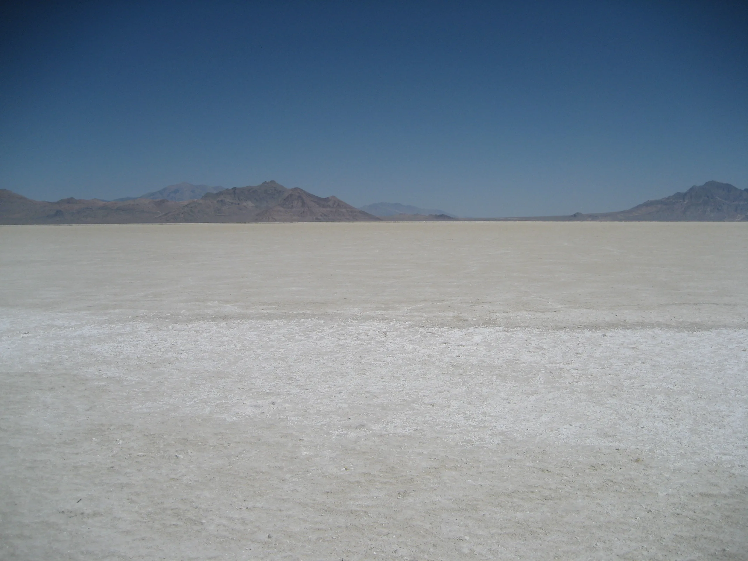
Bonneville Salt Flats preserves salts in a basin associated with the much larger Pleistocene Lake Bonneville. When that lake shrank, its dissolved mineral inventory was redistributed among residual water bodies, sediments and groundwater. Modern seasonal flooding, evaporation and shallow brine circulation continue to reshape the salt crust. According to the Bureau of Land Management, the salt is largely sodium chloride.
A relatively smooth crust develops where water and sediment dynamics allow widespread precipitation across a low-gradient basin floor. Nevertheless, the thickness and condition vary across the flats and through time. Surface appearance alone cannot reveal the total subsurface salt inventory. Groundwater movement, weather, human activity and mineral extraction can all complicate the salt balance. Bonneville is therefore both a striking evaporite landform and an example of why modern salt flats must be understood as changing hydrogeological systems. See the Bureau of Land Management site profile.
4. Dead Sea, Jordan and Israel
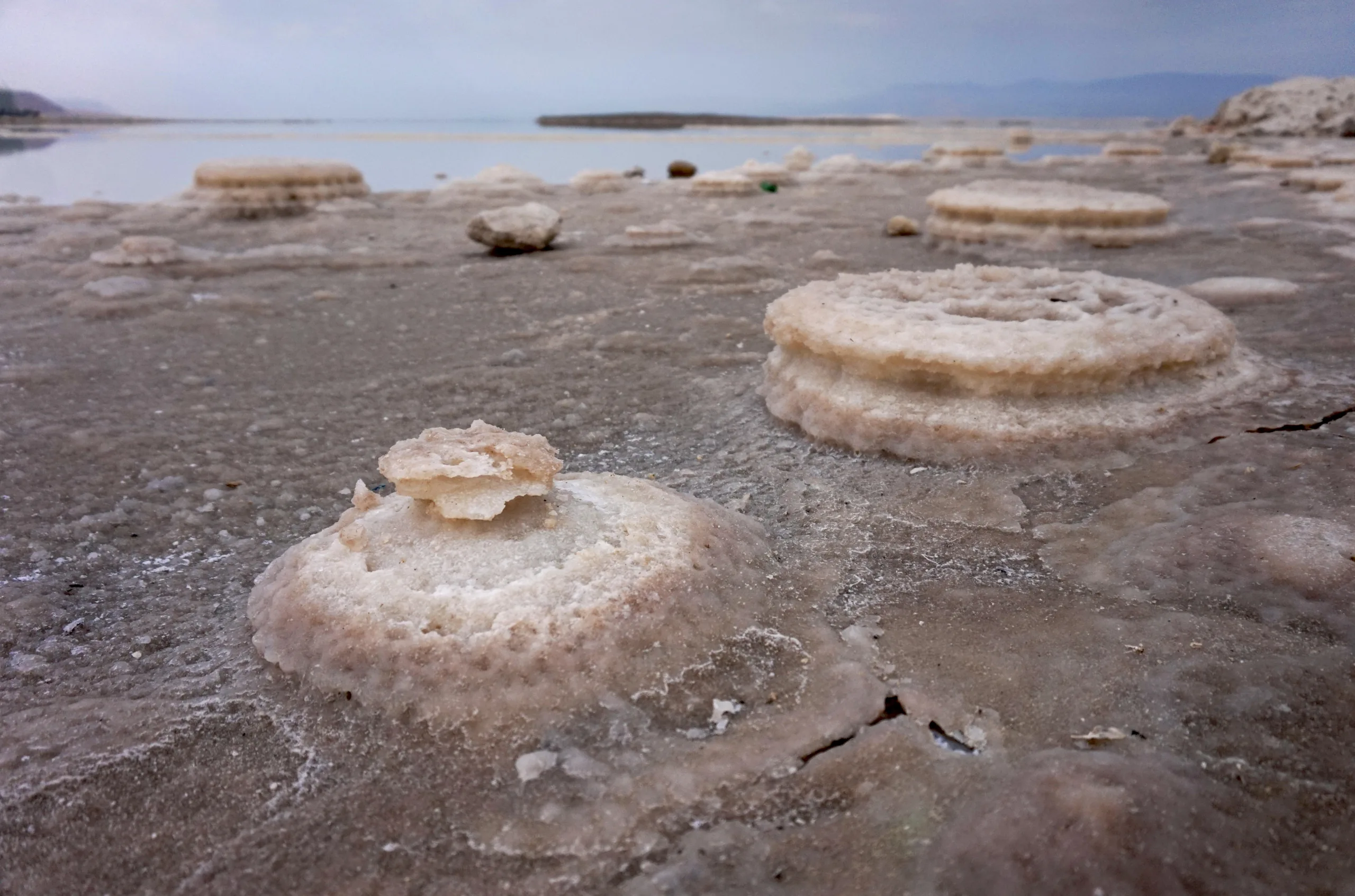
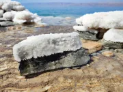
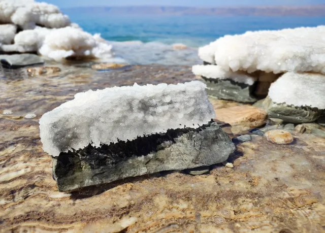
The Dead Sea occupies a tectonic depression along the Dead Sea Transform. It is a terminal lake: water arrives from its drainage basin but has no surface outlet to the ocean. Evaporation concentrates sodium, chloride, magnesium and other dissolved ions. Halite can precipitate from sufficiently concentrated brine, forming crystalline coatings, protruding clusters and sediment on the lake bed. The gleaming white deposits along parts of its shore are an accessible expression of this chemistry.
The modern lake’s falling level has exposed previously submerged deposits and altered shoreline conditions. Salt deposition is not controlled by evaporation alone; water temperature, mixing and freshwater inputs also affect saturation and crystal growth. A second geological process occurs where relatively fresh groundwater encounters buried halite: dissolution removes material and can promote sinkhole collapse. These sinkholes are a serious hazard, not tourist features to approach. The distinction between precipitation at the shore and dissolution underground is central to understanding the changing Dead Sea. Further information: Dead Sea geology and Sedimentology research.
5. Lake Assal, Djibouti
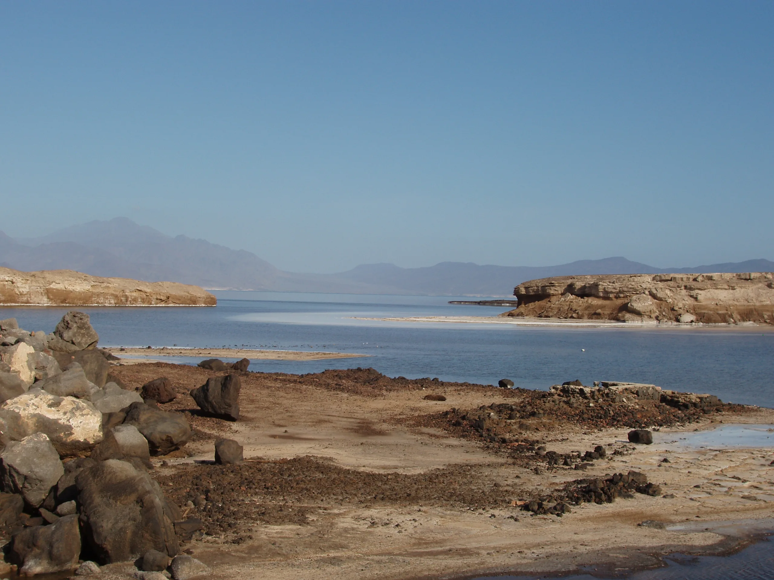
Lake Assal lies in the tectonically active Afar region, approximately 155 meters below sea level. The basin is separated from the nearby marine environment by volcanic and tectonically fractured terrain. Subsurface circulation allows seawater-derived fluids to contribute to the lake, while intense evaporation concentrates the dissolved constituents. Broad white salt deposits develop where hypersaline water reaches saturation and crystallizes.
The juxtaposition of dark volcanic rocks, pale salt crust and blue brine reflects two separate geological systems working together: continental rifting shapes the basin, whereas water circulation and evaporation generate the evaporite deposits. A closed surface drainage pattern does not necessarily imply that a basin is hydrogeologically isolated. Lake Assal illustrates the importance of fractured bedrock and groundwater pathways in supplying dissolved minerals. See published research on the Lake Assal basin.
6. Dallol, Ethiopia
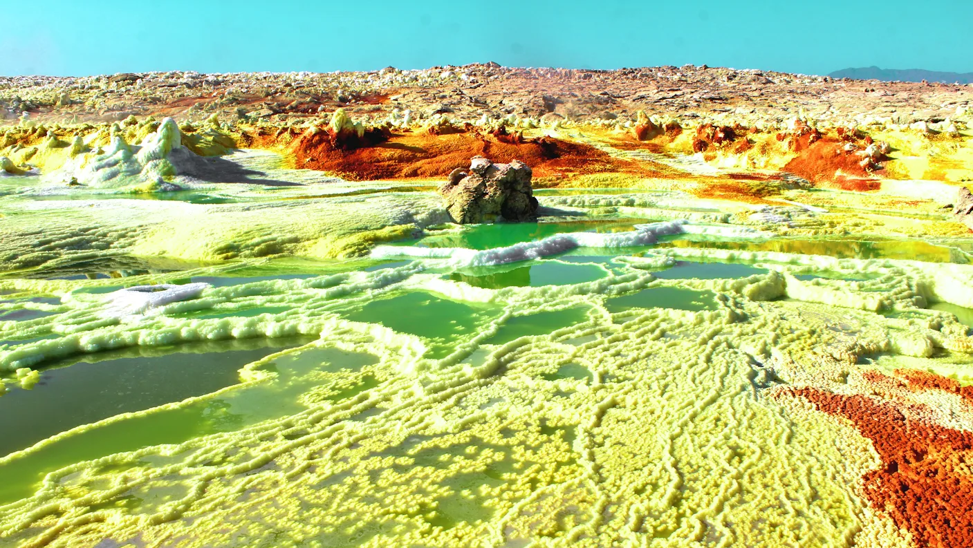
Dallol lies in the Danakil Depression, where thick evaporite sequences interact with geothermal fluids. Its vivid mineral landscape is built by multiple chemical reactions rather than by ordinary seawater evaporation alone. Hot, highly saline and in places strongly acidic fluids circulate through salt-rich material, transport dissolved constituents and precipitate minerals as they cool, evaporate or react with the atmosphere. Salt terraces, crusts and chimney-like structures can form around discharge zones.
White deposits commonly include halite; yellow, orange, red and brown colors may reflect iron-bearing minerals, sulfur-bearing phases and other chemical products. Color is not enough to identify a mineral species unambiguously. Conditions vary sharply over short distances, and some pools are both corrosive and extremely hot. Dallol is important precisely because it combines evaporite geology with hydrothermal geochemistry. It must not be confused with a conventional salt pan or treated as a safe landscape for casual sampling. Read our Danakil Depression profile and research on Dallol’s hydrothermal mineral chemistry.
7. Namakdan Salt Cave, Qeshm Island, Iran
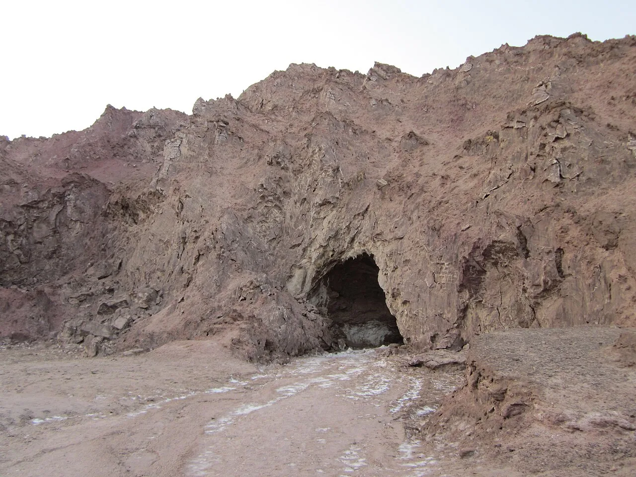
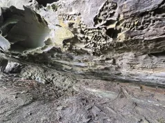
Namakdan exemplifies salt karst: a cave system developed in soluble rock salt rather than in limestone. The cave occurs within a salt dome on Qeshm Island, where ancient evaporites have risen toward the surface. Rainwater and other relatively dilute waters dissolve halite along fractures and bedding-related weaknesses. Continued dissolution enlarges openings and creates underground passages, while water carrying dissolved salt can precipitate new crystals when it evaporates.
Salt caves can contain delicate stalactite-like and flowstone-like deposits, although their mineral chemistry differs from the calcite speleothems typical of limestone caves. Because halite is readily soluble, passage geometry can change relatively quickly during water infiltration and flood events. The International Union of Geological Sciences identifies Namakdan as an exceptional salt-dome and salt-cave geosite, with mapped passages extending approximately 6.6 kilometers. See the IUGS geosite profile and our Qeshm Island geology article.
8. Jashak Salt Dome, Iran
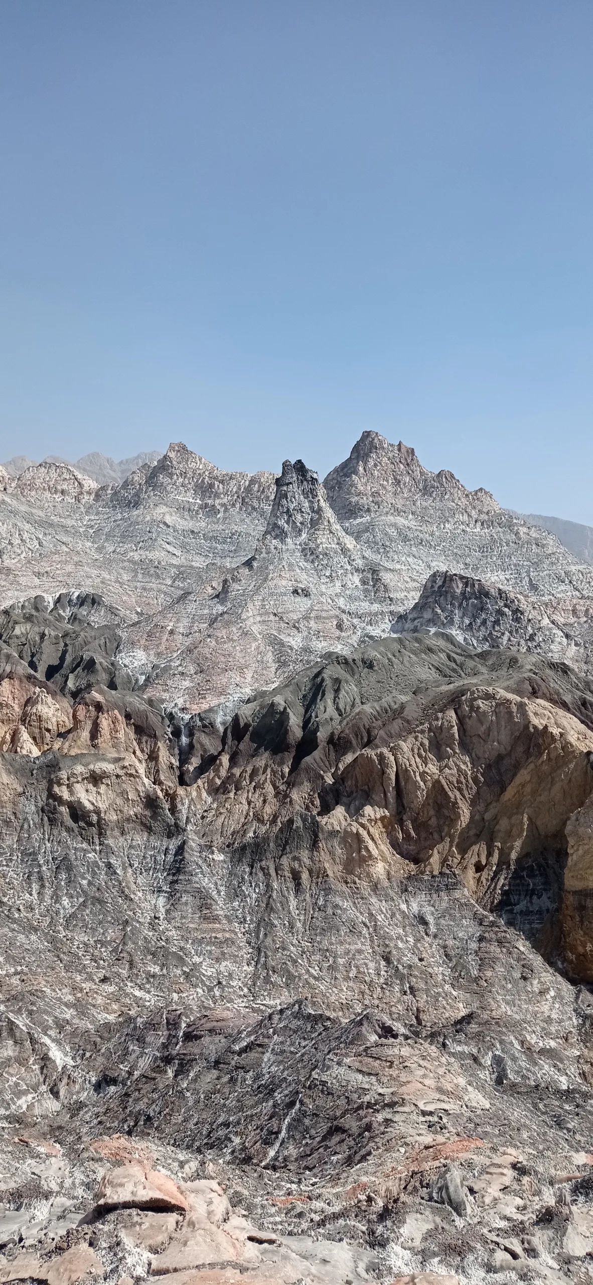
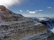
Jashak is an exposed salt diapir in the Zagros fold-and-thrust belt. Salt originally accumulated in sedimentary basins and was buried beneath younger strata. Under geological pressures and over long periods, rock salt can deform by ductile flow. Differences in density, differential loading and regional tectonic deformation can promote its upward migration through overlying rocks. Where a diapir reaches the surface, exposed salt may spread downslope under its own weight.
These gravity-driven salt flows are sometimes described as salt glaciers, although they consist of deforming rock salt rather than ice. Rainwater simultaneously dissolves the exposed halite, carving gullies and leaving less soluble material behind. Consequently, the surface may contain colored impurities, sedimentary inclusions and caprock as well as salt. Jashak demonstrates that evaporites are not merely sedimentary deposits: under appropriate conditions they become mobile structural elements of the crust. See IUGS documentation of Zagros salt domes and glaciers.
9. Lake Tuz, Türkiye
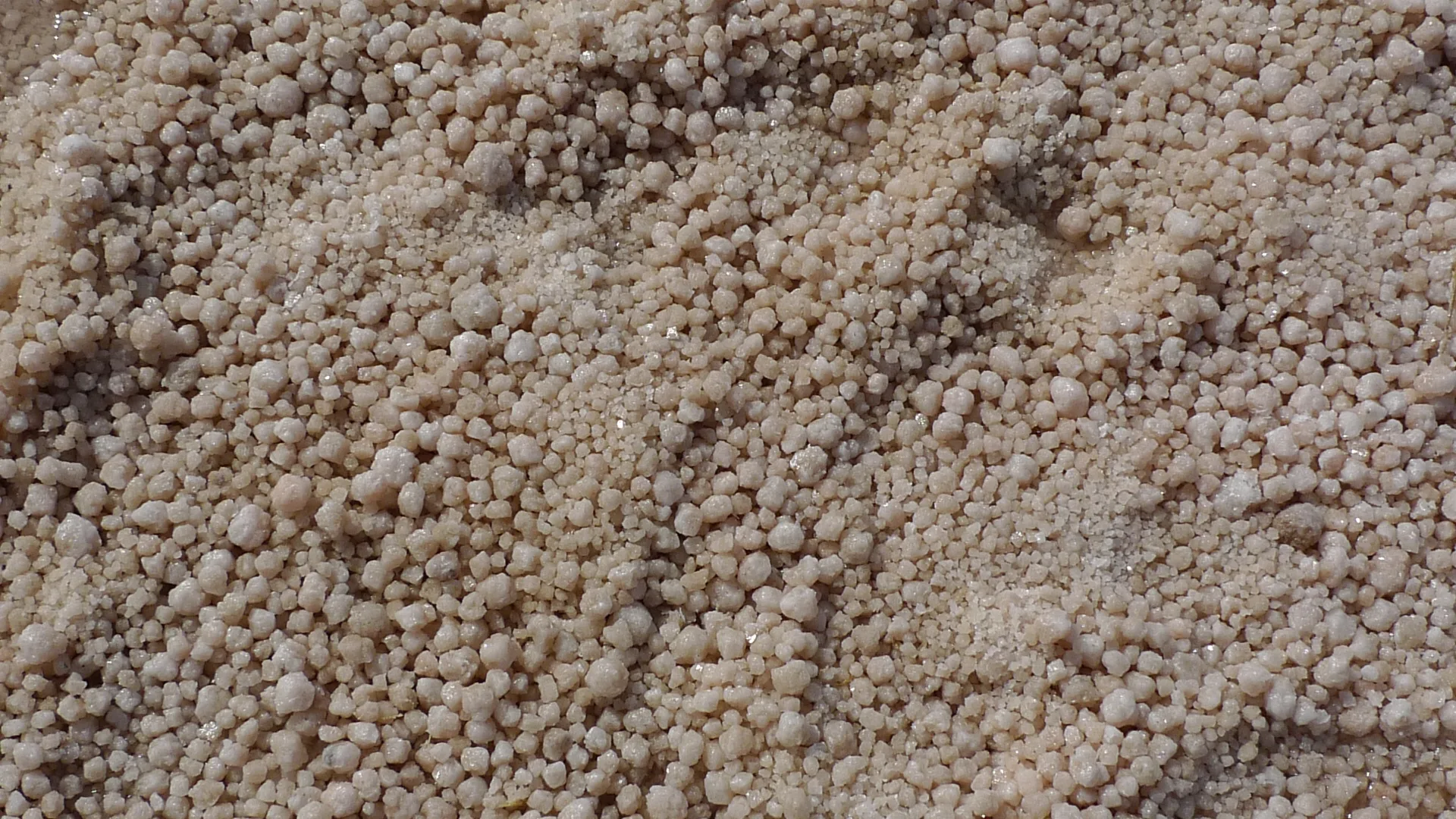
Lake Tuz occupies a shallow, endorheic basin in Central Anatolia. Water delivered by precipitation, streams and groundwater accumulates within the depression and becomes concentrated through evaporation. During periods of low water, substantial areas of the lake floor are exposed and salt crystallizes across the surface, producing a nearly continuous white landscape. Flooding and subsequent drying can dissolve and rebuild parts of the crust.
The lake is a dynamic wetland as well as an evaporite environment. Its exposed area and brine concentration vary with seasonal weather, longer-term climate variability and water use in the surrounding basin. These changes have consequences for salt deposition and for organisms dependent on shallow saline habitats. Satellite observations help distinguish seasonal fluctuations from sustained changes in water coverage; a single photograph cannot establish the lake’s long-term condition. See NASA’s satellite-based assessment of Lake Tuz and USGS Tuz Gölü site information.
10. Salar de Atacama, Chile
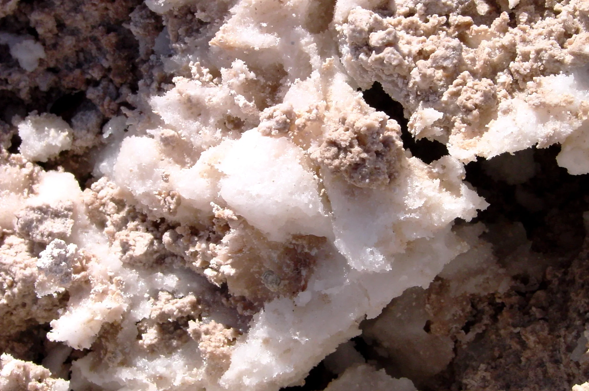
Salar de Atacama is a major evaporite basin in the exceptionally dry northern Chilean Andes. Water carrying dissolved minerals enters the basin through surface and subsurface pathways, including groundwater from surrounding mountain regions. With little effective surface outflow, evaporation concentrates the brines and promotes the deposition of halite and other evaporite minerals. Broad areas display rough, porous salt crusts rather than a perfectly smooth reflective surface.
The basin is also known for lithium-rich subsurface brines. During the evolution of a concentrated solution, some minerals precipitate preferentially while certain dissolved elements remain in the liquid, enabling chemical enrichment. Natural salt polygons, rough halite surfaces and saline lagoons must be distinguished from the geometric artificial evaporation ponds used in mineral production. Laguna Chaxa and its surrounding natural deposits illustrate the connection between evaporite geology and sensitive saline wetland ecosystems. See USGS Earthshots: Salar de Atacama.
Comparing the main salt-forming processes
| Process | Representative examples | Geological evidence |
|---|---|---|
| Evaporation and precipitation | Uyuni, Bonneville, Lake Tuz, Lake Assal, Salar de Atacama | Salt crusts, saline brines and basin-floor evaporites |
| Shoreline crystallization and dissolution | Dead Sea, Devil’s Golf Course | Crystal coatings, rough crusts and locally dissolution-related hazards |
| Hydrothermal fluid chemistry | Dallol | Mineral terraces, hydrothermal deposits and chemically variable colors |
| Salt tectonics and karst | Jashak, Namakdan | Diapirs, gravity-driven salt flow and solution passages |
Frequently Asked Questions
What mineral makes most salt flats white?
Halite is the principal white mineral in many salt flats, although gypsum, carbonates and other evaporite minerals may also be present. An exact identification requires mineralogical evidence.
Can salt form mountains?
Yes. Buried rock salt can deform and migrate under geological stress, rising as diapirs. Exposed salt may spread downslope and be sculpted by dissolution and erosion.
Are all salt landscapes formed by evaporation?
No. Evaporation commonly produces the original mineral deposit, but caves form primarily through dissolution, salt domes through deformation, and some unusual deposits through hydrothermal fluid reactions.
Why are some salt deposits colorful?
Mineral impurities, iron-bearing compounds, microorganisms and fluid chemistry can contribute color. The cause differs between locations and cannot be determined from a photograph alone.
Conclusion
Salt landscapes are records of interactions between climate, water chemistry, sedimentation and tectonics. Studying them reveals how minerals accumulate at the surface, how ancient evaporite layers deform within the crust and how water dissolves or reprecipitates soluble rocks. Their distinctive forms provide natural laboratories for understanding geological processes that operate over timescales ranging from a seasonal cycle to millions of years.
Featured photograph: White halite crystals encrusting a stone on the Jordanian Dead Sea shore. Photo: Petar Milošević, Wikimedia Commons, CC BY-SA 4.0. (WebP conversion.)