



















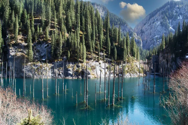
Lake Kaindy, in southeastern Kazakhstan’s Kolsai Lakes region, is famous for an extraordinary sight: the bare trunks of a drowned spruce forest rising out of clear, cold mountain water. The landscape looks surreal, but its origin is geological. A massive slope failure blocked a valley, creating a natural dam and flooding trees that had been growing on the valley floor.
Where Is Lake Kaindy?
The lake lies in the northern Tian Shan mountain system, where high relief, fractured bedrock, steep slopes and active earthquake faults create favorable conditions for landslides. The narrow valley acts as a natural reservoir once a sufficiently large slide blocks the drainage. The dramatic tree trunks are the remnants of Schrenk’s spruce (Picea schrenkiana), an important mountain conifer in Central Asia.
How Was the Sunken Forest Formed?
The process is a classic example of a landslide-dammed lake. First, strong shaking or slope instability causes rock and soil to descend into a valley. The debris forms a barrier across a stream. Water then accumulates upstream, raises the local water level and inundates vegetation. At Kaindy, the still-visible trunks preserve the position of the former forest, turning the lake into a natural marker of rapid landscape change.
A natural dam is not necessarily permanent. Such lakes may persist for decades, but erosion, overtopping or dam failure can change their level. The relative stability of the Kaindy basin is part of its continuing geological story.
Did the 1911 Earthquake Create Lake Kaindy?
Many descriptions associate Lake Kaindy with the devastating 1911 Kemin earthquake. A 2022 tree-ring study supported a connection to that event. However, a later dendrochronological investigation, published in 2025, proposed that the relevant landslide may instead date to the 1889 Chilik earthquake. The date should therefore not be presented as conclusively settled: researchers agree on a landslide-dam origin, while the exact earthquake association remains under discussion.
This is an instructive example of how science revises familiar origin stories. Tree rings can constrain when trees died or were disturbed, while landslide deposits, historical shaking records and landscape evidence help test competing explanations.
Why Do the Trees Remain Visible?
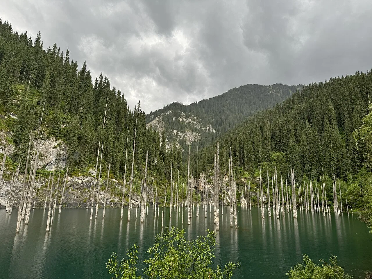
The emergent trees are not living trees growing in water. Their roots and lower trunks were drowned as the water rose. Cold water, relatively slow decomposition under submerged conditions and the tough wood help explain why recognizable trunks survive. Their pale, stripped branches contrast with the turquoise water. Light scattering, lakebed sediment and conditions in the water influence the color seen in photographs, which may vary with weather and viewpoint.
What Can Geologists Learn from the Lake?
Lake Kaindy offers a compact demonstration of linked hazards: tectonic movement, unstable slopes, landslide damming and altered river systems. Field mapping can distinguish displaced rock and soil from intact valley walls; sediment studies can reconstruct flooding and subsequent lake conditions; dendrochronology can help date the event. Similar processes can produce dangerous short-lived lakes in mountain regions around the world.
For comparison, explore our erosion and weathering guide and our feature on Salar de Uyuni, a very different lake-related landscape.
How Geologists Study the Landslide Dam
The valley blockage, displaced blocks, sediment grain sizes and erosional channels can reveal how rapidly the landslide moved and how water accumulated behind it. Lake sediments may also preserve a record of later floods and slope failures. A lake enclosed by landslide debris is not automatically stable: geologists evaluate seepage, overflow erosion and downstream hazards.
Dating the Submerged Trees
Tree-ring evidence can constrain when the drowned trees stopped growing. Research comparing 1889 and 1911 earthquake interpretations illustrates why a familiar origin story can change when new samples and chronological methods become available. The date of tree death, the onset of flooding and the trigger of the valley blockage must be examined separately.
Frequently Asked Questions
Is Lake Kaindy a volcanic crater lake?
No. It is a landslide-dammed mountain lake, not a volcanic crater.
Are the trees still alive?
No. The exposed trunks are remains of a forest submerged during the lake’s formation.
Was the lake definitely formed in 1911?
No. The 1911 Kemin earthquake is a longstanding explanation, but newer tree-ring research proposes an association with the 1889 Chilik earthquake.
Scientific Sources
- Akkemik et al. (2022), Turkish Journal of Earth Sciences
- Miramont et al. (2025), tree-ring evidence for the 1889 Chilik earthquake